What are the most spectacular roads in Italy?
Located in the southern part of Europe, Italy is a dream for drivers as it hosts the mountain passes (the Alps), coastal drives (Adriatic, Ionian, Tyrrhenian, and Ligurian), and some of the most famous scenic routes in the world.
Choosing only a few roads to drive in the country is nearly impossible, as there are about 600 spectacular routes. Stelvio Pass is Europe's most famous road. At an elevation of 2,757m (9,045ft) above sea level, the pass is located in the northern part of the country. It's one of the highest roads in Europe. Featuring 48 hairpin turns, the road through the summit is a marvel of engineering.
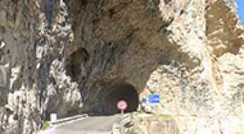
If you prefer coastal drives, you must experience the breathtaking Amalfi Coast Road. The road follows the shoreline from Sorrento south to Salerno. The road has been featured in films since cameras started rolling at 24 frames per second. If you want to feel like James Bond, don’t skip Strada della Forra. A small car with a functioning horn is recommended. For skilled drivers only. The drive is known by motorcyclists from all over Europe, as it is impressive and not without danger in a few narrow and steep spots. If you prefer roads with a story, don’t miss the Strada delle 52 Gallerie, a WWI military mule road. Built on the massif of Pasubio, it was constructed in this position to stay away from Austro-Hungarian artillery fire.
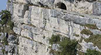
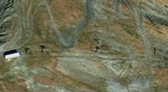
Monte Cengio Mule Track: A Journey Through Italy's Great War Legacy
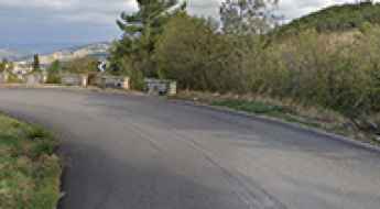
The Mulattiera di Arroccamento al Monte Cengio is a spectacular Italian military track dating back to the Great War. Dominating the Val d'Astico in the Veneto region, this masterpiece of mountain engineering was built on vertical cliffs to supply men and materials to the bastion of Monte Cengio, the last line of defense for the Po Valley.
Road trip guide: Conquering Monte Chersogno
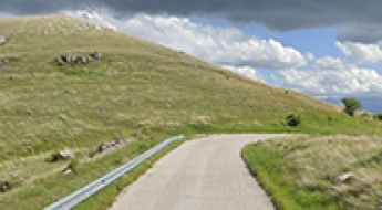
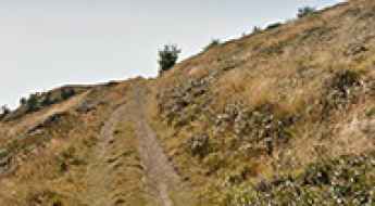
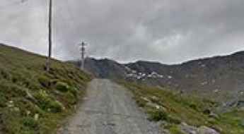
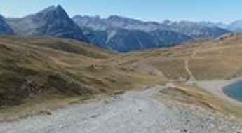
Monte Chersogno is a high mountain pass at an elevation of 2.411m (7,910ft) above the sea level, located in the province of Cuneo, in Piedmont, Italy.
Pas du Paradis: Driving the D1006/SS25 Border Road in the Alps
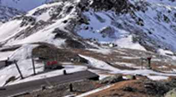
Located on the border between France and Italy, Pas du Paradis is a mountain pass at an elevation of 1,731m (5,679ft) above sea level. This paved road connects the Savoie department in France with the Piedmont region in Italy.
How to Get to the Iconic Blockhaus in the Apennine?
Blockhaus is a high mountain peak at an elevation of 2,072m (6,797ft) above sea level, located in the Abruzzo region of Italy.
Strada Provinciale 96 in Basilicata is the road of the 56 tornanti
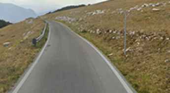
Strada Provinciale 96 (SP96) is an exceptionally challenging drive situated in the province of Potenza, within the Southern Italian region of Basilicata.
Gole del Saggitario is a scenic canyon road dug into the cliffs of the Apennines
Sagittarius Gorges is a scenic gorge located in the Abruzzo region of Italy. The road through the gorges is extremely challenging yet scenic, with great views of the Apennines.
The wild and steep road to Laghetto di Campaccio
Laghetto di Campaccio is a high mountain lake at an elevation of 2.314m (7,591ft) above the sea level, located in the Province of Sondrio, in the Lombardy region of Italy.
Giro d'Italia Roads: The history and legends behind the iconic Italian passes
The Giro d'Italia is a demanding 21-day race that traverses the beautiful and often challenging Italian geography. Since its birth at the beginning of the 20th century, it has transformed ordinary mountain roads into legendary driving routes. Join us to discover the most fascinating stories and the roads that have marked the legend of this competition.
Is Strada Provinciale 97 di Racollo the best road in Italy?
Imagine a fully paved mountain road, with twisting turns, open straights, and almost no traffic. Sounds like a dream? In Italy, the Strada Provinciale 97 di Racollo is a hidden gem, a true paradise for both two- and four-wheel drivers.
Travel guide to the top of Monte Grane in the Cottian Alps
Monte Grané is a high mountain peak at an elevation of 2,306 m (7,565 ft) above sea level, located in the Province of Cuneo, in Italy.
Driving the SP64 to Cima Mammarosa: The gateway to the Majella massif
Located in the heart of the Parco Nazionale della Majella, in the Abruzzo region of Italy, the drive to Cima Mammarosa is a high-altitude transit that tests both driver focus and vehicle stamina. Reaching 1,658m (5,439ft) above sea level, this mountain pass sits on the rugged boundary between the Pescara and Chieti provinces. It is a route defined by the raw verticality of the Apennines, where the asphalt is constantly battling the elements and the mechanical stress on your car is constant.
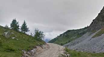
A brutally steep unpaved road to Col de Varda
Col de Varda is a high mountain pass at an elevation of 2,115m (6,938ft) above sea level, located in the Province of Belluno, Italy.

Discover Italy’s Essence with Every Hertz Car Hire
Disclosure: This article is sponsored by Hertz. The content below is promotional in nature. We aim to ensure transparency while sharing useful travel insights.
Italy is one place which is not just seen - it is supposed to be felt. As a traveller, the first thing that you may have heard about Italy is how the food smells, how the views capture your attention or how the artworks make you spell-bound. So, what is it that sets Italy apart from many other countries?
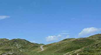
How to drive the Great Dolomite Road in Italy?
The Great Dolomite Road (Grande Strada delle Dolomiti) is a high-altitude alpine drive in northern Italy. Spanning approximately 110 kilometers, the route is a technical sequence of three different roads: the SS241 from Cardano to Vigo di Fassa, the SS48 through the Val di Fassa, and the SR48 in the Belluno province, ending in Cortina d'Ampezzo.
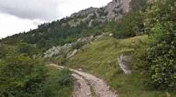
How to drive the steep gravel sector of Monte Sante Marie?
Monte Sante Marie is a notorious unpaved sector located in the Province of Siena, Tuscany, linking the towns of Asciano and Castelnuovo Berardenga. Known technically as a "sterrato" road, it is a key logistical segment of the Strade Bianche. The route is characterized by a surface of fine white clay and loose gravel, which presents significant traction challenges for motor vehicles, especially during the steep ascent and descent phases where the friction coefficient is extremely low.
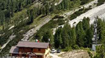
How to get to Cesare Branca Refuge in Lombardy?
Rifugio Cesare Branca al Lago delle Rosole is a high mountain refuge at an elevation of 2,483m (8,146ft) above sea level, located in the Lombardy region of Italy.
The Italian Road That Stops Just Short of the Ultimate Danger Zone (Mount Vesuvius, Italy)
Mount Vesuvius is located in the Campania region of Southern Italy, overlooking the Bay of Naples. It lies within the Province of Naples (now the Metropolitan City of Naples) and is the central feature of the Vesuvius National Park.
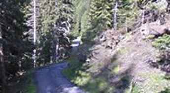
Driving the high-altitude military road from Monte Saccarello to Colle del Garezzo
The high-altitude track running from Monte Saccarello to Colle del Garezzo is one of the most technical and spectacular military routes in the Ligurian Alps, in the Province of Imperia. This 6.8 km (4.2 miles) unpaved ridge road stays almost entirely above 2,000 meters, crossing several high mountain passes including Sella della Valletta, Passo di Garlenda, Punta di Santa Maria, and Passo Frontè. It is a route that tests the limits of any off-road vehicle and the nerves of the driver.
How to drive the steep chairlift track to Testa Bassa?
Testa Bassa is a high mountain peak at an elevation of 2,454m (8,051ft) above sea level, located in the Aosta Valley region of the Italian Alps. The route to the summit is a rugged service road primarily used for chairlift maintenance.
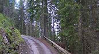
Driving the mountain road to Forcella Luson in the Dolomites
Forcella Luson is a high mountain pass at an elevation of 2.383m (7,818ft) above sea level, located in the Province of Bolzano, in the Trentino-South Tyrol region of Italy.
Monte Dubasso Ridge Road: Driving the Crest Track to Colle San Bartolomeo
The high-mountain ridge road linking Monte della Guardia, Monte Dubasso, and Colle San Bartolomeo di Ormea is a single-lane mountain track located in the Ligurian Alps, running along the border zone between Piedmont and Liguria, in Italy. This 11.4 km (7.1 miles) drive connects two different sections of the SP216 road.
How to drive the steep road to Rifugio Pizzini in Lombardy
Rifugio Pizzini-Frattola is a high mountain hut at an elevation of 2,706m (8,877ft) above sea level, located in the Lombardy region of Italy. It is one of the highest roads in Italy.
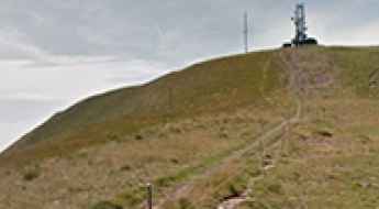
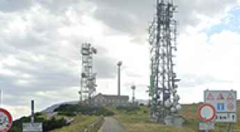
How to drive the steep 4x4 track to Colma di Marucolo?
Colma di Marucolo is a high mountain peak at an elevation of 1,857m (6,092ft) above sea level, located in the province of Brescia, Lombardy (Italy). Situated in the Prealps, the summit is occupied by a large communication tower. Logistically, the road to the peak is a technical continuation of the route starting from Colle San Zeno. The track is strictly unpaved and serves as an essential service road for telecommunications maintenance.
How to drive the rugged track to Col dei Pass in Belluno
Col dei Pass is a high mountain peak at an elevation of 1,818m (5,964ft) above sea level in the Province of Belluno, Italy.
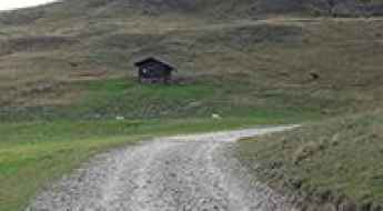
How to drive the steep 18% road to Malga Clef in Trentino
Malga Clef is a mountain dairy at an elevation of 1,720 meters (5,643 ft) above sea level in the Province of Trentino, Italy. The main challenge of this route is managing a 10.7-kilometer narrow road where several ramps hit a maximum gradient of 18%.
Driving the alpine military track to Col de Saurel
Col de Saurel is a high mountain pass at an elevation of 2,392 meters (7,847 ft) above sea level, located on the border between France and Italy.
How to drive the narrow and steep road to Rifugio Rinfreddo?
Rifugio Rinfreddo is a high-mountain shelter at an elevation of 1,892 meters (6,207ft) above sea level, located in the heart of the Comelico region, in Italy.
Can I drive the unpaved road to Fleckner Hut in the Stubai Alps?
Flecknerhütte (Fleckner Hut) is a high mountain refuge at an elevation of 2,056m (6,745ft) above sea level located in the South Tyrol province of Italy.
How to drive the challenging road to Forcella Chiandolada in Belluno?
Forcella Chiandolada is a high mountain pass at an elevation of 1.582m (5,190ft) above sea level, located in the Province of Belluno in the Italian region Veneto.
How to drive the unpaved road to Chaz-Dura?
Chaz-Dura is a high mountain peak at an elevation of 2.560m (8,398ft) above sea level, located in the autonomous region of Aosta Valley, in Italy. It's one of the highest roads in the country.
How to drive the brutal 29% ramps of Muro di Campeggio?
Muro di Campeggio, officially named Via Sumbilla, is one of the steepest paved roads in Italy. The route is a vertical asphalt wall that climbs the hills north of Pergoloso, hitting a maximum gradient of 29%.