What are the most spectacular roads in Italy?
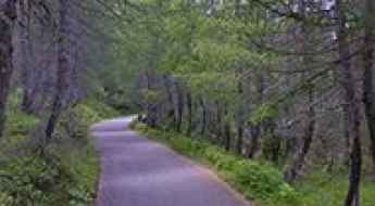
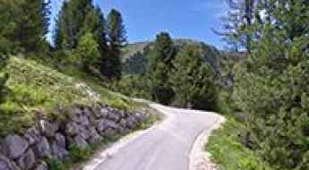
Located in the southern part of Europe, Italy is a dream for drivers as it hosts the mountain passes (the Alps), coastal drives (Adriatic, Ionian, Tyrrhenian, and Ligurian), and some of the most famous scenic routes in the world.
Choosing only a few roads to drive in the country is nearly impossible, as there are about 600 spectacular routes. Stelvio Pass is Europe's most famous road. At an elevation of 2,757m (9,045ft) above sea level, the pass is located in the northern part of the country. It's one of the highest roads in Europe. Featuring 48 hairpin turns, the road through the summit is a marvel of engineering.
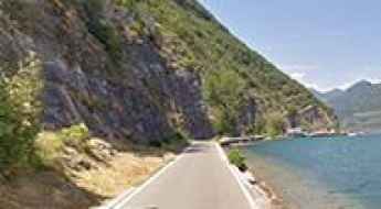
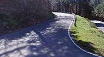
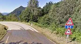
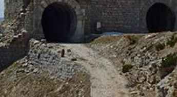
If you prefer coastal drives, you must experience the breathtaking Amalfi Coast Road. The road follows the shoreline from Sorrento south to Salerno. The road has been featured in films since cameras started rolling at 24 frames per second. If you want to feel like James Bond, don’t skip Strada della Forra. A small car with a functioning horn is recommended. For skilled drivers only. The drive is known by motorcyclists from all over Europe, as it is impressive and not without danger in a few narrow and steep spots. If you prefer roads with a story, don’t miss the Strada delle 52 Gallerie, a WWI military mule road. Built on the massif of Pasubio, it was constructed in this position to stay away from Austro-Hungarian artillery fire.
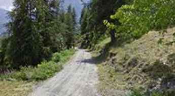
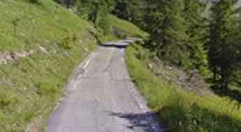
The rough and bumpy road to Colle Bourget
Colle Bourget is a high mountain pass at an elevation of 2.299m (7,542ft) above the sea level, located in the Province of Turin, Italy. The peak offers a magnificent view of both sides of the ridge.
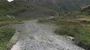
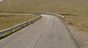
A military road to Colle della Vecchia
Colle della Vecchia is a high mountain pass at an elevation of 2.605m (8,546ft) above the sea level, located in the Province of Turin in the Italian region Piedmont. It's one of the highest Italian roads.
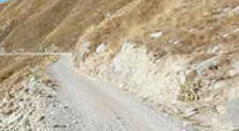
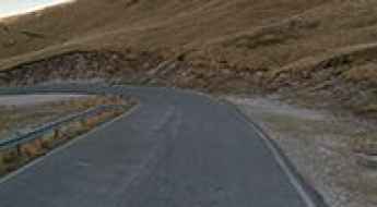
An epic enthralling road to Col di Caneva Pass
Passo di Col di Caneva is a high mountain pass at an elevation of 1.835m (6,020ft) above the sea level, located in the Province of Belluno in the Italian region Veneto.
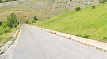
The road to Monte Faudo in Imperia is not for the sissies
Monte Faudo is a mountain peak at an elevation of 1.149m (3,769ft) above the sea level, located in the Province of Imperia in the Italian region Liguria.
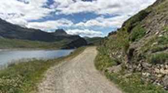
Driving the lake-level road of Monte Isola: Carzano to Peschiera Maraglio
Located on Monte Isola, the largest lake island in Italy, the road linking the villages of Carzano and Peschiera Maraglio is a high-precision drive on the shores of Lake Iseo. Reaching just a few centimeters above the water level, this 2.3 km (1.4 miles) asphalt track in the province of Brescia is a logistical anomaly. It is a journey where the lack of safety infrastructure and the immediate proximity to the deep waters of the lake leave zero margin for driver error.
The road to Prato Piazza Pass isn’t an easy one
Passo Prato Piazza (also called Plätzwiesensattel) is a high mountain pass at an elevation of 1.993m (6,538ft) above the sea level, located in the province of South Tyrol in northern Italy.
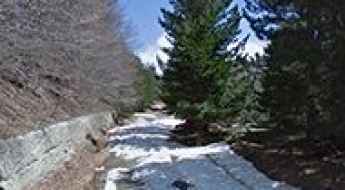
The Wild Road to Cadino Pass
Passo di Cadino is a high mountain pass at an elevation of 1.937m (6,354ft) above the sea level, located in the province of Brescia, in Lombardy, Italy.
A memorable road trip to Lago di Place Moulin
Lago di Place Moulin is a high mountain reservoir at an elevation of 1.968m (6,456ft) above the sea level, located in the Aosta Valley region of northwest Italy.
Driving the road to Picco Pass is not a piece of cake
Passo di Picco is a high mountain pass at an elevation of 1.870m (6,135ft) above the sea level, located in the province of Brescia, Lombardy, northern Italy.
A memorable road trip to Pampeago Pass
Passo di Pampeago (Reiterjoch) is a high mountain pass at an elevation of 2.003m (6,571ft) above the sea level, located on the border between the provinces of Trento and Bolzano, in northeastern Italy.
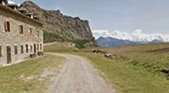
Baita del Pastore
Baita del Pastore is a high mountain refuge at an elevation of 2.173m (7,129ft) above the sea level, located in the Province of Sondrio, Lombardy region of the Alps in northern Italy.
Sella di Russis: A Narrow Alpine Journey through the Dolomites
Sella di Russis is a high mountain pass at an elevation of 1,729m (5,672ft) above sea level, located in South Tyrol, Italy. Known for its technical driving and stunning Alpine vistas, it is a hidden gem in the heart of the Dolomites.
Driving the SP256 to Passo di Montescuro: The heart of the Sila mountains
Located in the heart of the Sila National Park in Calabria, the drive through the Passo di Montescuro is a high-altitude mission through one of Southern Italy's most rugged forest plateaus. Reaching an elevation of 1,618m (5,308ft) above sea level, the road known as Strada Provinciale 256 (SP256) is a winding artery that connects Fago del Soldato with Spezzano della Sila. It is a journey where the lush scenery of the "Gran Bosco d'Italia" hides a technical road surface that demands constant vigilance from every driver.
Strada Foresta Girgini
The Strada Foresta Girgini is a very challenging drive in the Province of Nuoro in Italian island of Sardinia. The route demands 100% concentration. This road has humbled many egos. Open to all motorized vehicles, however, strongly recommended for high clearance, 4-wheel drive vehicles. The road is very rough--only try driving it in a 2wd car, if you're planning to buy a new car.
Monte Ologno: Driving the steep 13% Giro d’Italia climb in Piedmont
Located in the Province of Verbano-Cusio-Ossola, in the Italian region of Piedmont, Monte Ologno is a high mountain pass reaching an elevation of 1,168m (3,832ft) above sea level. This climb has gained legendary status in recent years, especially after being featured in the Giro d’Italia, becoming a bucket-list destination for those seeking extreme gradients and technical paved roads.
Monte Gran Costa: A historic military peak along the Assietta Road
Monte Gran Costa is a high mountain peak reaching an elevation of 2,615m (8,579ft) above sea level, located in the Cottian Alps of northern Italy. It is one of the most significant historical points along the famous Assietta ridge, offering panoramic views and a deep dive into the military past of the region. It's one of the highest roads in the country.

A paved road to Coe Pass in the Venetian Prealps
Passo Coe is a high mountain pass at an elevation of 1.610 m (5,282 ft) above sea level, located in the Autonomous Province of Trento, in Italy.
Road trip guide: Conquering Monte Campomolon
Monte Campomolon is a high mountain peak at an elevation of 1.848m (6,062ft) above the sea level, located in Veneto, a northeastern Italian region.
A curvy paved road to Lago di Morasco
Lago di Morasco is a high mountain lake at an elevation of 1.794m (5,885ft) above the sea level, located in Alta Val Formazza, in Piedmont, Italy.
A memorable road trip to Dondena Refuge
Rifugio Dondena is a high mountain refuge at an elevation of 2.192m (7,191ft) above the sea level, located in the Alps in Aosta Valley, Italy.
Monte Motta: The Ultimate Road Trip Guide
Monte Motta is a high mountain peak at an elevation of 2.776m (9,107ft) above the sea level, located in Piedmont, Italy.
Col di Val Bighera: The Ultimate Road Trip Guide
Col di Val Bighera is a high mountain pass at an elevation of 2.120m (6,955ft) above the sea level, located in the Alps in Italy.
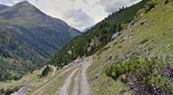
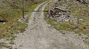
Colle delle Selle Vecchie: Driving the Alta Via del Sale Border Track
Colle delle Selle Vecchie (known in France as Col de la Celle Vieille) is a high mountain pass at an elevation of 2,099 meters (6,886 ft) above sea level, located on the border between France and Italy. Situated within the Ligurian Alps, the unpaved track through the pass forms part of the famous Alta Via del Sale, a former military route connecting the Province of Cuneo in Piedmont with the Alpes-Maritimes department.
Is the road to Monte Amiata in Tuscany difficult to drive?
Reaching the summit of Monte Amiata is a climb through the dense forests of an ancient, extinct volcano. At 1,720m (5,643ft) above sea level, this peak in the Province of Siena is the highest point in southern Tuscany. The Strada Provinciale Vetta dell'Amiata, which leads to the top, is a demanding route where the steepness of the terrain and the condition of the asphalt require constant attention from the driver.
Colle della Cavallina: a narrow paved road to the summit
Colle della Cavallina is a high mountain pass at an elevation of 1.934m (6,345ft) above the sea level, located in the Province of Cuneo in the Italian region of Piedmont.
A funny drive to Colletto di Canosio
Colletto di Canosio is a high mountain pass at an elevation of 1.650m (5,413ft) above the sea level, located in the Val Maira, a valley in south-west of Piedmont in the Province of Cuneo, Italy.
Elisabetta Refuge
Rifugio Elisabetta Soldini Montanaro is a high mountain refuge at an elevation of 2.195m (7,201ft) above the sea level, located in northern Italy, in the autonomous region of Aosta Valley.
A memorable road trip to Guardia Pass
Passo della Guardia is a high mountain pass at an elevation of 1.508m (4,947ft) above the sea level, located in the Maritime Alps on the border between Italy and France. The pass is traversed by the spectacular Via del Sale.
How to drive the iconic road to Godi Pass in the Abruzzo
Passo Godi is a high mountain pass at an elevation of 1,588 m (5,209 ft) above sea level, located in the province of L'Aquila, in Italy.
Driving the SP335 to Colle Bettone: A steep Piedmont challenge
Located in the rugged Province of Cuneo, in the Italian region of Piedmont, the drive to Colle Bettone is a hidden technical test for any mountain driver. Reaching an elevation of 1,834m (6,017ft) above sea level, the road—known as the Strada Provinciale 335 (SP335)—is a winding path that cuts through the base of Monte Bettone. It is a route where the peace of the Alps is constantly interrupted by the reality of a narrow, crumbling pavement and ramps that push standard engines to their limit.
Valico di Monte Cristo
Valico di Monte Cristo is a high mountain pass at an elevation of 1.767m (5,797ft) above the sea level, located in the Abruzzo region of Italy.
Sella di Leonessa
Sella di Leonessa is a high mountain pass at an elevation of 1.890m (6,200ft) above the sea level, located in the Central Apennines, in Italy.
Monte Botte Donato
Monte Botte Donato is a high mountain pass at an elevation of 1.928m (6,325ft) above the sea level, located in the Calabria region of Southern Italy.
How to drive the Sentiero Riale to Passo di San Giacomo?
The Passo di San Giacomo is an international high mountain pass at an elevation of 2,313m (7,589ft) above sea level, situated on the border between Italy (Piedmont) and Switzerland (Ticino). Located in the Lepontine Alps, the Italian side is accessed via a high-altitude track known as Sentiero Riale - Passo S. Giacomo. While the Italian sector is motorable with the correct equipment, the Swiss side is strictly a walking path, making the summit a logistical dead-end for vehicles.
Cime Bianche
Cime Bianche is a high mountain pass at an elevation of 2.899m (9,511ft) above the sea level, located in the Aosta Valley region of north-western Italy.
How To Travel To Barmasse Refuge
Rifugio Barmasse is a high mountain refuge at an elevation of 2.169m (7,116ft) above the sea level, located in the Alps, in Aosta Valley, Italy.