What are the most spectacular roads in Italy?
Located in the southern part of Europe, Italy is a dream for drivers as it hosts the mountain passes (the Alps), coastal drives (Adriatic, Ionian, Tyrrhenian, and Ligurian), and some of the most famous scenic routes in the world.
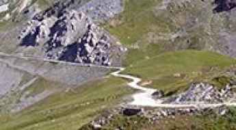
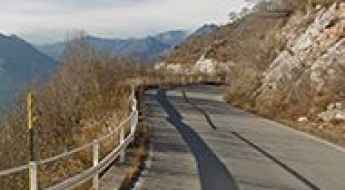
Choosing only a few roads to drive in the country is nearly impossible, as there are about 600 spectacular routes. Stelvio Pass is Europe's most famous road. At an elevation of 2,757m (9,045ft) above sea level, the pass is located in the northern part of the country. It's one of the highest roads in Europe. Featuring 48 hairpin turns, the road through the summit is a marvel of engineering.
If you prefer coastal drives, you must experience the breathtaking Amalfi Coast Road. The road follows the shoreline from Sorrento south to Salerno. The road has been featured in films since cameras started rolling at 24 frames per second. If you want to feel like James Bond, don’t skip Strada della Forra. A small car with a functioning horn is recommended. For skilled drivers only. The drive is known by motorcyclists from all over Europe, as it is impressive and not without danger in a few narrow and steep spots. If you prefer roads with a story, don’t miss the Strada delle 52 Gallerie, a WWI military mule road. Built on the massif of Pasubio, it was constructed in this position to stay away from Austro-Hungarian artillery fire.
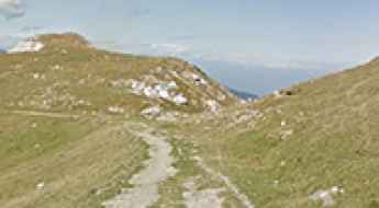
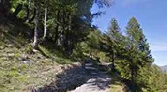
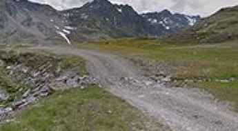
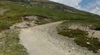
Driving the Unpaved Mountain Road to Rodella Pass in the Dolomites
Passo Rodella is a high mountain pass at an elevation of 1,866m (6,122ft) above sea level, located in the Autonomous Province of Bolzano, in Italy.
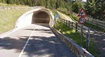
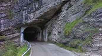
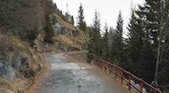
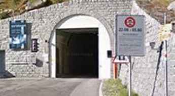
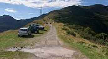
Passo Castrin: The Alpine pass hidden inside a tunnel
Passo Castrin (also known as Hofmahdjoch) is a high-mountain pass reaching an elevation of 1,781m (5,843ft) above sea level in the Autonomous Province of Bolzano, South Tyrol, Italy. Located in the Ortler Alps, this pass is unique because its highest point is actually situated at the south entrance of a tunnel built in 1998.
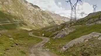
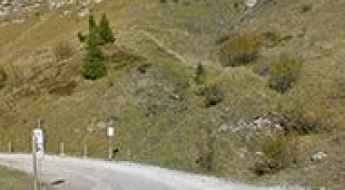
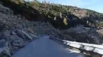
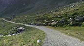
The breathtaking unpaved road to Salati Pass
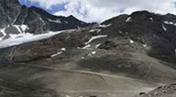
Passo dei Salati is a high mountain pass at an elevation of 2,988m (9,803ft) above sea level, located in Italy. It’s one of the highest roads in Europe.
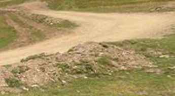
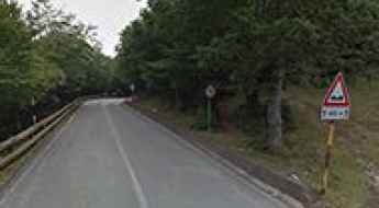
How to drive the unused road from Cancelli to Fossato di Vico?
Strada Cancelli-Fossato di Vico is a short mountain road straddling the Umbria and Marche regions, in the central part of Italy.
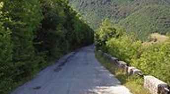
How to drive the scenic road from Sospirolo to Gosaldo in Belluno?
Located in the province of Belluno, in the Italian region of Veneto, the road from Sospirolo to Gosaldo offers a stunning drive with amazing views.
The Ultimate Guide to Traveling to Becco Rosso Pass
Cima Becco Rosso is an international high mountain pass at an elevation of 2,261 m (7,417 ft) above sea level, located on the border of France and Italy.
How to get to Lago Miserin, the largest natural lake in Aosta?
Lago Miserin is a remote alpine lake at an elevation of 2,580m (8,464ft) above sea level, located in the Autonomous Region of Aosta Valley, in Italy. It's one of the highest roads in Italy.
An Old Military Road to Colle di Costa Piana
Colle di Costa Piana is a high mountain pass situated at an elevation of 2313m (7588ft) above sea level, found within the Metropolitan City of Turin, in Italy.
A winding paved road to Portella Femmina Morta
Portella Femmina Morta is a high mountain pass at an elevation of 1,535m (5,036ft) above sea level, located in the Italian region of Sicily.
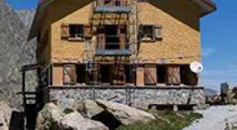
How to get by car to Barbara Lowrie Refuge in Piedmont?
Rifugio Barbara Lowrie is a high mountain refuge at an elevation of 1,753m (5,751ft) above sea level, located in the Metropolitan City of Turin, in Italy.
How to get by car to Lago di Malga Bissina in Trento?
Lago di Malga Bissina is a high mountain reservoir at an elevation of 1,815m (5,954ft) above sea level, located in the Autonomous Province of Trento, in Italy.
A memorable road trip to Costazza Pass in the Alps
Passo della Costazza is a high mountain pass at an elevation of 2,181 m (7,155 ft) above sea level, located in the Autonomous Province of Trento in Italy.
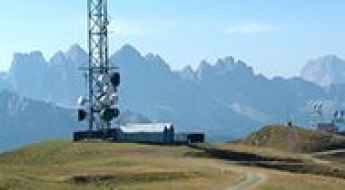
A steep gravel road to Monte Telegrafo-Plose in the Dolomites
Monte Telegrafo-Plose is a high mountain peak at an elevation of 2,483m (8,146ft) above sea level, located in the Trentino-South Tyrol region of Italy. The summit offers a view of more than 100 mountain peaks.
How to get by car to Lago di Lei?
Lago di Lei is an artificial high mountain lake at an elevation of 2,000m (6,500ft) above sea level, located on the border of Switzerland and Italy.
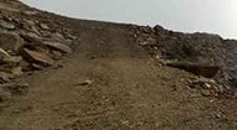
How to drive the unpaved road to Monte Sobretta in Sondrio
Monte Sobretta is a high mountain peak located in the Province of Sondrio, in Italy. East of the summit, a minor unpaved road climbs up to 2,901m (9,517ft) above sea level. It's one of the highest roads in Europe.
How to get to Genova-Figari Refuge in Cuneo
Rifugio Genova-Figari is a high mountain refuge at an elevation of 2.015m (6,610ft) above sea level, located in the Province of Cuneo, in Italy.
An old military road to Cima di Morissolo
Cima di Morissolo is a mountain peak at an elevation of 1,311m (4,301ft) above sea level, located in the Italian region of Piedmont. The summit hosts an old fortification built during the First World War.
Passo di Fraele: Driving the historic gravel road near the Swiss border
Located in the Lombardy region of northern Italy, Passo di Fraele is a high mountain pass reaching an elevation of 1,955m (6,414ft) above sea level. Situated near the international border between Switzerland and Italy, this pass is a historical gateway in the Alps, offering a stunning landscape dominated by turquoise lakes and ancient defensive structures.
Forcella Pass, The Road That Has it All!
Passo della Forcella is a high mountain pass at an elevation of 1.824m (5,984ft) above the sea level, located in the Province of Udine in the Italian region Friuli-Venezia Giulia. The average steepness is 15.08%.
Driving the steep road to Bruncu Spina: the roof of Sardinia
Bruncu Spina is a high mountain pass at an elevation of 1,828m (5,997ft) above sea level, located in the Gennargentu Range of Sardinia, Italy. It is the second-highest peak on the island and offers one of the most rugged and isolated driving experiences in the Mediterranean, ending at a derelict weather station with panoramic views.
A wild road to Mont Fallere in the Pennine Alps
Mont Fallère is a high mountain peak at an elevation of 2,377 m (7,798 ft) above sea level, located in the Valle d’Aosta region, in Italy.
Driving to the international San Jorio Pass
Passo San Jorio (Passo di San Iório) is an international high mountain pass at an elevation of 2.012m (6,601ft) above the sea level located on the border of Switzerland and Italy.
Driving the forgotten military road to Monte Toraro: A Cold War relic
Located in the Venetian Prealps, in the Province of Vicenza, the road to the summit of Monte Toraro is a ghost track that whispers of Cold War tensions and military secrecy. Reaching an elevation of 1,890m (6,200ft) above sea level, this route was once a vital artery for the Italian Air Force and NATO. Today, it is a decaying strip of asphalt that is slowly being reclaimed by the mountain, offering a high-stakes journey through one of the most strategic sectors of the Triveneto Alps.
An old military road to Colle Cologna
Colle Cologna is a high mountain pass at an elevation of 2.394m (7,854ft) above sea level, located in the Province of Cuneo, in Italy.
How to drive the paved road to Panarotta Refuge in the Dolomites?
Rifugio Panarotta is a high mountain refuge at an elevation of 1,780m (5,839ft) above sea level, located in the autonomous province of Trentino, in Italy. The ascent is very popular with amateur cyclists.
A memorable road trip to Pradarena Pass
Passo di Pradarena is a high mountain pass at an elevation of 1.579m (5,180ft) above the sea level, located on the border of Emilia Romagna and Tuscany regions, in northern Italy.
A wild road to Refuge Grand Tournalin
Refuge Grand Tournalin is a high mountain refuge at an elevation of 2.535m (8,316ft) above the sea level, located in the Alps in Aosta Valley, Italy. It's one of the highest mountain roads of Italy.
How to drive the defiant road to Alpe di Poti
Alpe di Poti is a mountain pass at an elevation of 827m (2,713ft) above sea level, located in the Province of Arezzo, in Italy.
A paved road to Agueglio Pass
Passo Agueglio is a mountain pass at an elevation of 1.143m (3,750ft) above the sea level, located in the Italian region of Lombardy.
Monte Ornito: Driving the WWII battlefield road in Latina
Monte Ornito is a mountain peak at an elevation of 764m (2,506ft) above sea level, located in the province of Latina, in the Lazio region of central Italy. Part of the Aurunci Mountains, the peak was the scenario of fierce combats during World War II. The road to the summit is a narrow and technical climb that scales the steep slopes above the Gulf of Gaeta, connecting historical sites with a memorial dedicated to the fallen soldiers of the 1944 battles.
Carosello 3000
Carosello 3000 is a high mountain peak at an elevation of 2.783m (9,130ft) above the sea level, located in the Province of Sondrio, Lombardy region of the Alps in northern Italy, near the Swiss border.
Im Hinteren Eis
Im Hinteren Eis is a high mountain peak at an elevation of 3.030m (9,940ft) above the sea level, located in South Tyrol in northern Italy. It’s one of the highest roads of Europe.
Travel Guide to Rifugio Prarayer
Prarayer Hut is a high mountain refuge at an elevation of 2.005m (6,578ft) above the sea level, located in Aosta Valley, in northern Italy.
Can I drive the road to Rifugio La Baita in Val di Rezzalo?
Rifugio La Baita is a high mountain refuge at an elevation of 1,860m (6,102ft) above sea level, located in the Italian province of Sondrio.
The road to Monte Festa is not for the faint of heart
Monte Festa is a mountain pass at an elevation of 1.065m (3,494ft) above the sea level, located in the Province of Udine in the Italian region of Friuli-Venezia Giulia.
Venini Refuge
Located in the Province of Como in the Italian region Lombardy, Rifugio Venini is a high mountain refuge at an elevation of 1.576m (5,170ft) above the sea level.