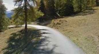
What are the most spectacular roads in Italy?
Located in the southern part of Europe, Italy is a dream for drivers as it hosts the mountain passes (the Alps), coastal drives (Adriatic, Ionian, Tyrrhenian, and Ligurian), and some of the most famous scenic routes in the world.
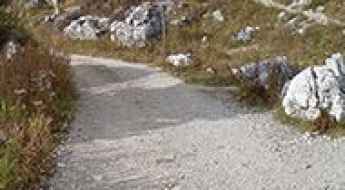
Choosing only a few roads to drive in the country is nearly impossible, as there are about 600 spectacular routes. Stelvio Pass is Europe's most famous road. At an elevation of 2,757m (9,045ft) above sea level, the pass is located in the northern part of the country. It's one of the highest roads in Europe. Featuring 48 hairpin turns, the road through the summit is a marvel of engineering.
If you prefer coastal drives, you must experience the breathtaking Amalfi Coast Road. The road follows the shoreline from Sorrento south to Salerno. The road has been featured in films since cameras started rolling at 24 frames per second. If you want to feel like James Bond, don’t skip Strada della Forra. A small car with a functioning horn is recommended. For skilled drivers only. The drive is known by motorcyclists from all over Europe, as it is impressive and not without danger in a few narrow and steep spots. If you prefer roads with a story, don’t miss the Strada delle 52 Gallerie, a WWI military mule road. Built on the massif of Pasubio, it was constructed in this position to stay away from Austro-Hungarian artillery fire.
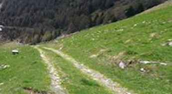
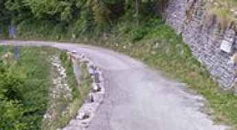
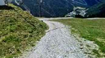
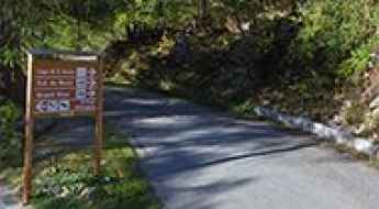
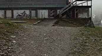
How to drive the steep road to Genova-Schlüterhütte Refuge?
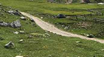
Rifugio Genova-Schlüterhütte is a high mountain hut at an elevation of 2.304m (7,559ft) above sea level, located in South Tyrol, in Italy.
Mutegg
Mutegg is a high mountain peak at an elevation of 2.624m (8,608ft) above the sea level, located in Italy’s South Tyrol region. It’s one of the highest roads of the country.
Vallone di Chavannes
Vallone di Chavannes is a high mountain peak at an elevation of 2.184m (7,165ft) above the sea level, located in the Valle d’Aosta region, in northwestern Italy.
Malga di Pinalto
Malga di Pinalto (Penaud Alm) is a high mountain peak at an elevation of 2.328m (7,637ft) above the sea level, located in South Tyrol, northern Italy.
Croce di Poverzone
Croce di Poverzone is a high mountain pass at an elevation of 1.908m (6,256ft) above the sea level, located in the heart of the Valtellina, in Italy.
Corna Pass: A high-clearance 4x4 challenge on the roads of the Mediterranean Alps
Corna Pass (also known as Passo della Corna or Pas de la Corne) is an international high mountain pass at an elevation of 1,046m (3,431ft) above sea level, situated on the border between Italy and France. This route is strictly for experienced 4x4 drivers looking for a technical challenge in the Ligurian Alps.
Fronza alle Coronelle Refuge
Rifugio Fronza alle Coronelle - Kölner Hütte is a high mountain refuge at an elevation of 2.341m (7,680ft) above the sea level, located in the province of South Tyrol in northeastern Italy.
Passo Vezzena
Passo Vezzena is a mountain pass at an elevation of 1.402m (4,599ft) above the sea level, located in Trentino in the northern Italian region Trentino-Alto Adige/Südtirol.
Champillon
Champillon is a high mountain plateau at an elevation of 2.092m (6,863ft) above the sea level, located in the Aosta Valley region of north-western Italy.
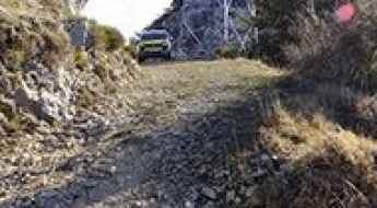
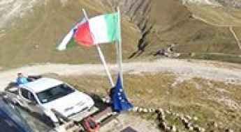
How to drive the military track to Barbacana Pass?
Passo di Barbacana is an international mountain pass at an elevation of 2,180 meters (7,152 ft) above sea level, located on the border between Italy (Piedmont) and France. The track is a dead-end for motor vehicles: the Italian side from San Bernolfo is an unpaved military road, while the French slope is a walking path.
Chalet de l'Épée Refuge
Rifugio Chalet de l'Épée is a high mountain refuge at an elevation of 2.383m (7,818ft) above the sea level, located in the Aosta Valley region of north-western Italy.
Averau Refuge
Rifugio Averau is a high mountain refuge at an elevation of 2.418m (7,933ft) above the sea level, located in the province of Belluno in Italy.
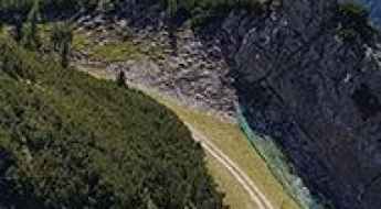
Strada degli Alpini
Strada degli Alpini is the name of the sharply winding and precipitous ascent in a steep and narrow zig-zag road located in the Province of Treviso, in the Italian region Veneto.
Col Rodella
Col Rodella is a high mountain peak at an elevation of 2.462m (8,077ft) above the sea level, located in Val di Fassa, in South Tyrol in northern Italy.
How to drive the unpaved road to Pomedes Refuge?
Rifugio Pomedes is a high mountain refuge at an elevation of 2.303m (7,555ft) above sea level, located in the province of Belluno, in Italy.
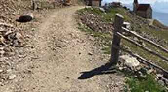
How to drive the unpaved road to Doss dei Cembri?
Doss dei Cembri is a high mountain peak at an elevation of 2394m (7,854ft) above sea level, located in the Autonomous Province of Trento, in Italy.
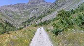
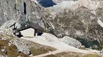
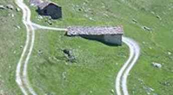
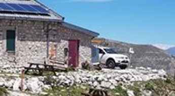
Rifugio Pulpito: A brutal climb in the heart of the Ortler Range
Rifugio Pulpito (also known as Kanzel-Hütte in German) is a high mountain refuge at an elevation of 2,354m (7,723ft) above sea level, located in the South Tyrol province of northern Italy. Situated within the breathtaking Stelvio National Park, the climb to the refuge offers some of the most dramatic views of the Ortler massif.
Monte Fana-Pfannspitze
Monte Fana is a high mountain peak at an elevation of 2.502m (8,208ft) above the sea level, located in the Trentino-South Tyrol region of Italy.
Capanna Tondi Refuge
Rifugio Capanna Tondi is a high mountain refuge at an elevation of 2.347m (7,700ft) above the sea level, located in the Veneto region of Northern Italy.
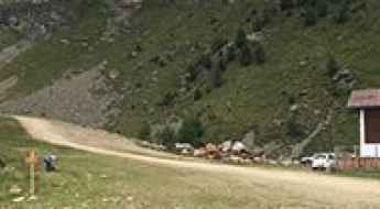
Cimetta Rossa: Driving the High Mountain Trail in Valle d'Aosta
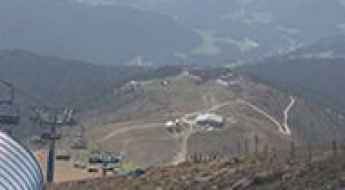
Cimetta Rossa is a mountain peak at an elevation of 2,499m (8,198ft) above sea level, located in the Valle d’Aosta region of northwestern Italy. The route to the summit is primarily used as a service road for local ski infrastructure.
Everything you need to know about the road to Col du Mont in the Aosta Valley
Col du Mont is a high mountain pass at an elevation of 2.169 m (7,116 ft) above sea level, located in the Aosta Valley region, in Italy.
How to drive the unpaved road to Col di Tsomioy?
Col di Tsomioy is a high mountain pass at an elevation of 2.464m (8,083ft) above sea level, located in the Valle d’Aosta region, in Italy.
The epic unpaved road to Col dei Rossi in the Dolomites
Col dei Rossi is a high mountain peak at an elevation of 2.371m (7,778ft) above the sea level, located in Trentino in the region Trentino-Alto Adige/Südtirol, in Italy.
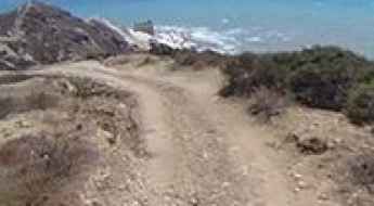
Driving the road to Punta Bianca is not a piece of cake
Punta Bianca is a secluded white beach located in Sicily, Italy, with a horrible road where you can easily damage your car.
Lavarella Refuge
Rifugio Lavarella-Berghütte Lavarella is a high mountain refuge at an elevation of 2.045m (6,709ft) above the sea level, located in South Tyrol in northern Italy.
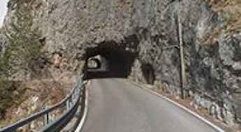
Driving the scenic Strada del Lumiei, the Italian road of the tunnels
Strada del Lumiei is the name of a very challenging road with stunning views located in the Province of Udine in the Italian region Friuli-Venezia Giulia.
How to drive the unpaved road to Croce di Lazfons?
Croce di Lazfons is a high mountain peak at an elevation of 2.316m (7,598ft) above sea level, located in the Autonomous Province of Bolzano – South Tyrol of Italy.

The best ski resorts for kids in Italy
When it comes to planning a family ski vacation in Italy, there are plenty of fantastic options to choose from. The country is renowned for its stunning Alpine landscapes and world-class ski resorts, making it an ideal destination for families looking to hit the slopes. If you're traveling with children, you'll want to ensure that your chosen destination offers the perfect mix of skiing opportunities and kid-friendly amenities. In this article we'll explore the best ski resorts in Italy equipped for children and families who want to spend an unforgettable ski vacation.
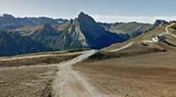
Road to Monte Tavolino: Driving the 19.73% Gradient in South Tyrol
Monte Tavolino, also known as Sefiarspitze, is a high mountain peak at an elevation of 2,505 meters (8,218 ft) above sea level, located in South Tyrol, northern Italy. Situated within the Texel Group of the Ötztal Alps, the route leading to the summit is a raw, unpaved single-lane service track built for ski infrastructure maintenance.
Travel guide to Kesselberghütte
Kesselberghütte is a mountain cabin at an elevation of 2.299m (7,542ft) above the sea level, located in Italy’s South Tyrol region.
Colle della Lace
Colle della Lace is a high mountain peak at an elevation of 2.047m (6,715ft) above the sea level, located on the border of Aosta and Piedmont regions, in northern Italy.
Driving the unpaved track to Rifugio Sebastiani at Colletto di Pezza
Colletto di Pezza is a high mountain peak reaching an elevation of 2,102m (6,896ft) above sea level, located in the province of L'Aquila, Italy. Situated within the Abruzzo Apennines, the road to the summit and the Rifugio Vincenzo Sebastiani is a technical high-altitude track inside the Riserva Naturale Orientata Monte Velino.
Parafulmine Refuge
Rifugio Parafulmine is a high mountain hut at an elevation of 1.543m (5,062ft) above the sea level, located in the Province of Bergamo in the Italian region of Lombardy.
Scoiattoli Refuge
Rifugio Scoiattoli is a high mountain hut at an elevation of 2.257m (7,404ft) above the sea level, located in Veneto, a region in Northern Italy.
Monte Cuzzo
Monte Cuzzo is a high mountain peak at an elevation of 2.503m (8,211ft) above the sea level, located in South Tyrol in northern Italy.
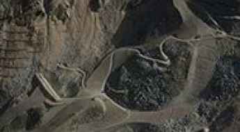
How to drive the gravel road to Col de Muraton?
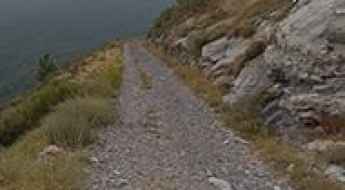
Col de Muraton, also known as Passo del Muratone, is an international mountain pass at an elevation of 1,163 meters (3,815 ft) above sea level, located on the border between France (Alpes-Maritimes) and Italy (Liguria). The 16.4 km mountain route links the Italian town of Pigna with the French border crest. Originally a rough mule track, the current road is entirely unpaved, forming a narrow gravel ledge carved directly into the steep slopes of the Ligurian Alps.