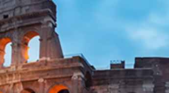
What are the most spectacular roads in Italy?
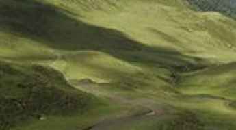
Located in the southern part of Europe, Italy is a dream for drivers as it hosts the mountain passes (the Alps), coastal drives (Adriatic, Ionian, Tyrrhenian, and Ligurian), and some of the most famous scenic routes in the world.
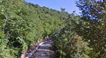
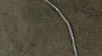
Choosing only a few roads to drive in the country is nearly impossible, as there are about 600 spectacular routes. Stelvio Pass is Europe's most famous road. At an elevation of 2,757m (9,045ft) above sea level, the pass is located in the northern part of the country. It's one of the highest roads in Europe. Featuring 48 hairpin turns, the road through the summit is a marvel of engineering.
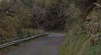
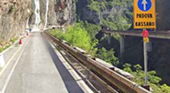
If you prefer coastal drives, you must experience the breathtaking Amalfi Coast Road. The road follows the shoreline from Sorrento south to Salerno. The road has been featured in films since cameras started rolling at 24 frames per second. If you want to feel like James Bond, don’t skip Strada della Forra. A small car with a functioning horn is recommended. For skilled drivers only. The drive is known by motorcyclists from all over Europe, as it is impressive and not without danger in a few narrow and steep spots. If you prefer roads with a story, don’t miss the Strada delle 52 Gallerie, a WWI military mule road. Built on the massif of Pasubio, it was constructed in this position to stay away from Austro-Hungarian artillery fire.
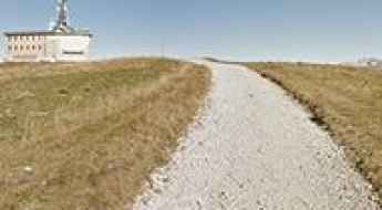
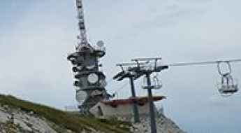
Porta Vescovo
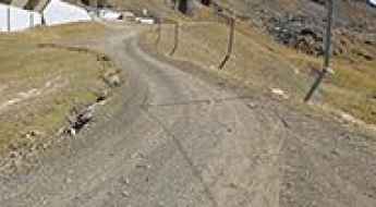
Porta Vescovo is a high mountain peak at an elevation of 2.518m (8,261ft) above the sea level, located on the border of Trentino South Tyrol and Veneto, in northern Italy.
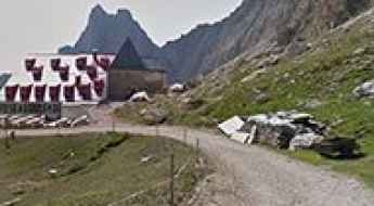
Can I drive to Capanna 2000 Refuge in Bergamo?
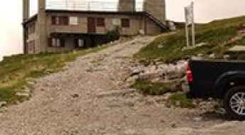
Rifugio Capanna 2000 is a high mountain hut at an elevation of 1,972m (6,469ft) above sea level, located on the slopes of Monte Alben in the Province of Bergamo, Lombardy, Italy.
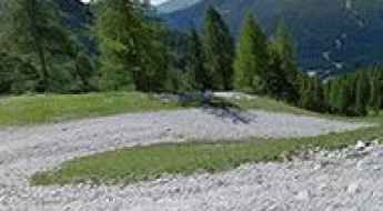
Driving the wild unpaved road to Punta di Verzel
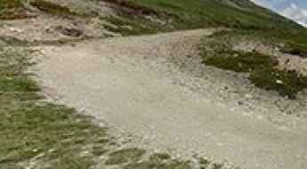
Punta di Verzel is a high mountain peak at an elevation of 1.871m (6,138ft) above the sea level, located in the Italian region Piedmont.
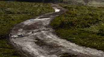
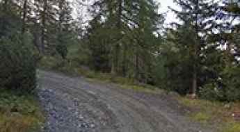
Driving the unpaved road to Passo dei Campelli in the Italian Alps
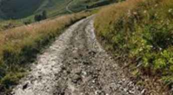
Passo dei Campelli is a high mountain pass at an elevation of 1.896m (6,220ft) above the sea level, located in the Province of Bergamo in the Italian region of Lombardy.
Travel guide to Kuhleitenhütte
Kuhleitenhütte is a mountain cabin at an elevation of 2.360m (7,742ft) above the sea level, located in Italy’s South Tyrol region.
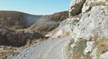
How to drive the unpaved road to Passo di San Colombano?
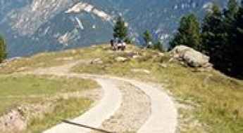
Passo di San Colombano is a high mountain pass at an elevation of 2,247m (7,372ft) above sea level, located in the Province of Sondrio, in the Lombardy region of northern Italy. Situated in the heart of the Valtellina, this route offers a perfect blend of alpine challenge and medieval history.
Alpe Soglia
Alpe Soglia is a high mountain peak at an elevation of 1.841m (6,040ft) above the sea level, located in Piedmont in northern Italy.
Sella Brunech
Sella Brunech is a high mountain peak at an elevation of 2.443m (8,015ft) above the sea level, located in Trentino in the northern Italian region Trentino-Alto Adige/Südtirol.
Col Toront
Col Toront is a high mountain peak at an elevation of 1.615m (5,298ft) above the sea level, located in the Veneto region of northern Italy. The elevation gain is 1.321 meters. The average gradient is 7.33%, with sections up to 16%.
Alpe di Tires
Alpe di Tires (Tierser-Alpl) is a high mountain peak at an elevation of 2.456m (8,057ft) above the sea level, located in the Dolomites mountain range, in the South Tyrol province of north Italy.
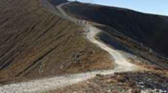
Is the road to Rifugio Colverde in the Dolomites too steep for cars?
Rifugio Colverde is a high-mountain hut at an elevation of 1,970m (6,463ft) above sea level, located in the Pale di San Martino group of the Dolomites, Trentino, in Italy. The track to the refuge is a brutal ski resort service route built for the maintenance of the gondola pillars.
How to drive the unpaved road to Pian della Nana in Trentino?
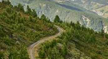
Pian della Nana is a large karst amphitheatre at an elevation of 2.094m (6,870ft) above sea level, located in Trentino, in Italy.
What are the Essential Logistics for Driving the Most Iconic Roads in Italy?
Italy is home to some of the most technologically challenging and historically significant transit corridors in Europe. From the high-altitude engineering of the Alps to the vertical logistics of the Amalfi Coast, navigating the roads of Italy requires more than just a standard license; it demands a technical understanding of terrain, vehicle dynamics, and local transit regulations. Whether you are auditing the asphalt of the northern passes or the winding coastal arteries, a successful mission depends on precise planning. This guide analyzes the essential protocols for mastering the Italian landscape with professional discipline.
Discover the road to Monte Sambucaro, Italy's WWII battlefield landmark
Monte Sambucaro is a mountain peak situated on the boundary between the Campania and Lazio regions of Italy. A narrow mountain road ascends to a height of 692m (2,270ft) above the sea level on the mountain's western slopes.
Malga Campobon is well worth the drive
Malga Campobon is a high mountain pass at an elevation of 2.035m (6,676ft) above sea level, located in the Province of Belluno in the Italian region of Veneto, near the Austrian border.
Travel guide to the top of Chaschauna Pass
Pass Chaschauna-Passo di Cassana is a high mountain pass at an elevation of 2.698m (8,851ft) above sea level, located on the border of Italy and Switzerland. It's one of the highest roads of the country.
The challenging and panoramic unpaved road to Pointe Leysser
Pointe Leysser is a high mountain peak at an elevation of 2,429m (7,969ft) above sea level. It is located in the Valle d’Aosta region, in northwestern Italy, towering over the central valley near Saint-Pierre.
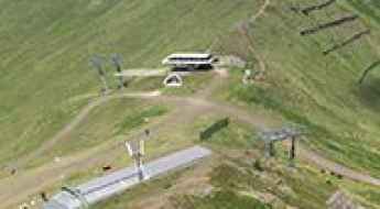
Driving the brutal service road to Rifugio Paion: The Alpe Cermis wall
Located at the highest point of the Alpe Cermis ski resort in Trentino, the ascent to Rifugio Paion is one of the most punishing climbs in the Val di Fiemme. Reaching an elevation of 2,223m (7,293ft) above sea level, this service road is a vertical monster designed for heavy machinery and chairlift maintenance. It is a journey where the rules of standard driving don't apply, and where the mechanical strain on your vehicle is constant from the first meter to the summit ridge.
Driving to Cima Uomo: The brutal 20% ski-station track in the Dolomites
Located in the Trentino-Alto Adige/Südtirol region of northern Italy, the ascent to Cima Uomo is a relentless test of traction and torque. Reaching an elevation of 2,480m (8,136ft) above sea level, this is not a conventional mountain pass, but a raw, unpaved service road designed for ski-station maintenance and chairlift access. It is a journey of extreme verticality where the loose Dolomite stone threatens to stop even the most capable 4x4 vehicles.
Colle del Pis
Colle del Pis is a high mountain peak at an elevation of 2.524m (8,280ft) above the sea level, located in the Metropolitan City of Turin, in Italy.
Colle della Portula
Colle della Portula is a high mountain peak at an elevation of 2.449m (8,034ft) above the sea level, located in the Aosta Valley region of north-west Italy.
How to get by car to Col de Valvacin in the Dolomites?
Col de Valvacin is a high mountain peak at an elevation of 2,360m (7,742ft) above sea level, located in the Province of Trento, in Italy.
Lago di Mucrone
Lago di Mucrone is a high mountain lake at an elevation of 1.901m (6236ft) above the sea level, located in the northern Italian region of Piedmont.
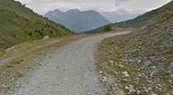
How difficult is the 4x4 road to Lago Gabiet in the Aosta Valley?
Lago Gabiet is a high mountain reservoir reaching an elevation of 2,384m (7,821ft) above sea level in the Gressoney Valley, part of the Aosta Valley region in Northern Italy. Tucked into the foothills of the Monte Rosa massif, the road to this alpine lake is a demanding unpaved track that serves the local ski infrastructure. This is a journey through a high-altitude landscape where the steepness of the ramps and the loose rocky surface require a capable 4x4 vehicle and a driver comfortable with narrow, unprotected mountain ledges.
Road SP269c: Driving the Narrow Coastal Ascent in Campania
Located in the Salerno province of the Campania region in southwestern Italy, Strada Provinciale 269c (SP269c) is a technical mountain road. The route serves as a secondary link between the coastal area of Marina di Campagna and the town of Mandia, traversing the steep ridges overlooking the Tyrrhenian Sea.
Strada dei Crozi: An Old Road Carved into the Rock in Trento
Strada dei Crozi is a dangerous and narrow mountain road located in the Trentino–Alto Adige region of northern Italy. In 1972, the road was closed to vehicles but reopened again for a brief period (2020-2022).
Driving to Monte Giogo: Abandoned NATO Antennas and Cold War Relics in the Tuscan Mountains
Monte Giogo is a high mountain peak at an elevation of 1,510m (4,954ft) above sea level, located in the province of Massa-Carrara in the Tuscany region of Italy.
Driving the steep 4x4 road to the Palasinaz Lakes in Aosta
The Palasinaz Lakes, also known as the "7 Lakes" (including Literan, Battaglia, Verde, Potcha, Chaudière, Lungo, and Bringuets), are a spectacular group of alpine basins at an elevation of 2,445 meters (8,021 ft) above sea level. Located in the Aosta Valley region of north-western Italy, the track to reach them is a raw, high-altitude mountain road that demands absolute mechanical respect. This isn't a route for standard cars; it is a sustained, unpaved climb that snakes up from the Val d'Ayas, offering a technical driving experience where the thin air and the loose surface will test the limits of your 4WD system.
Road trip guide: Conquering Cima Palon
Cima Palon is a high mountain peak at an elevation of 2.067m (6,781ft) above the sea level, located in Trentino-Alto Adige/Südtirol in Italy.
How to drive the military track to Colle Plane?
Colle Plane is a high-altitude mountain pass at an elevation of 2,222m (7,290ft) above sea level, situated on the international border between Italy (Piedmont) and France (Alpes-Maritimes). Located in the Ligurian Alps, the road to the summit is a critical segment of the historical Via Marenca and is technically integrated into the wider logistical network of the Via del Sale. This narrow, unpaved military track requires a high-clearance 4x4 vehicle due to extreme surface degradation and deep erosion gullies.
Laghi di Champlong
Laghi di Champlong is a high mountain lake at an elevation of 2.353m (7,719ft) above the sea level, located in the Aosta Valley region of north-west Italy.
The inhumane climb to Monte Lussari with 22% ramps
Monte Lussari is a high mountain peak at an elevation of 1.745m (5,725ft) above the sea level, located in the province of Udine, in the autonomous region Friuli-Venezia Giulia of Italy.
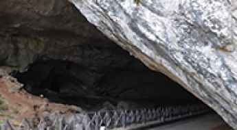
Grotte di San Giovanni: The Cave with a Road Inside
Located in Domusnovas, Sardinia, Grotta San Giovanni is a cave with a road running through it. It was the only cave in Italy that allowed vehicle passage before being closed to traffic. Now, visitors can walk along the road inside the cave. It’s one of the few roads in the world that runs through a cave.
A scenic unpaved road to Monte Bellino in the Cottian Alps
Monte Bellino is a high mountain peak at an elevation of 2.172m (7,125ft) above the sea level, located in Cuneo province, in the southwest of the Piedmont region of Italy.
A race on the Italian Strada Provinciale 349
The Strada Provinciale 349 (SP349) is a challenging mountain road located in the Vicenza Pre-Alps, in the province of Vicenza, in the Veneto region of Italy.
A military road to Monte Specie in the Dolomites
Monte Specie is a high mountain peak at an elevation of 2,308m (7,572ft) above sea level, located in the Autonomous Province of Bolzano, in South Tyrol, Italy. Along the way, you can see ruins reminiscent of the First World War.