What are the most spectacular roads in Peru?
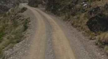
Located in the heart of the Andes, in the western part of South America, Peru is very challenging for drivers due to its geography that comprises the coast, the Andes Mountains, and the Amazon Rainforest. With such topography, it has more than 230 roads listed as the most spectacular in the world.
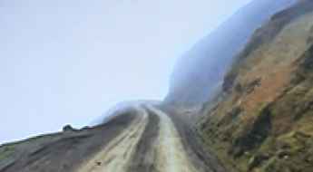
When traveling to the country, you can’t miss Curvas de Huanchaca, a series of 24 hairpin turns located on the boundary between Cusco and Apurimac. It’s one of the most hairpinned roads in the world, offering travelers a spectacular, vertigo-inducing drive. Or the harrowing paved road to Anticona Pass in the Andes, at an elevation of 4,824m (15,826ft) above sea level. The pass is often incorrectly said to be the highest paved road in South America.
If you want to try scary drives, don’t forget the Pasamayo Serpentine, a lethal coastal road known for fatal traffic accidents. The road has no safety fences, and one mishap, and you plunge off the cliff and into the sea. Or Pato Canyon Road, a path hewn out of sheer rock, located in the Ancash Region. And if you’re up for paved mountain roads, don’t miss the awe-inspiring drive to Punta Olímpica in the Andes, climbing up to 4,732m (15,525ft) above sea level. It's one of the highest paved roads in the country.
Driving the defiant 4x4 road to Chila in the Andes
Chila is a high mountain peak at an elevation of 5,260m (17,257ft) above sea level, located in Chachas District, in the Castilla Province of Peru. It’s one of the highest roads in the country.
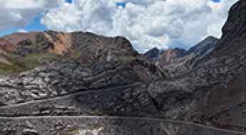
Cerro Llacsacocha: Driving to the 4,980m mine peak in the Peruvian Andes
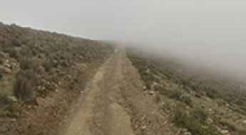
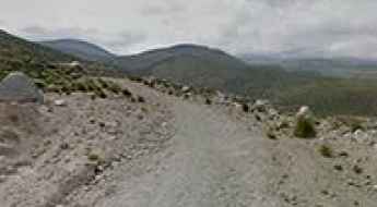
If you want to feel what it’s like to drive on the roof of the world, Cerro Llacsacocha is the place. At 4,980m (16,338ft) above sea level, this isn't a mountain for tourists; it’s an active mining peak in the Yauli Province of central Peru. The air is so thin that both you and your engine will struggle to breathe. It’s a landscape of grey rock, massive excavation pits, and some of the highest dirt tracks you’ll ever find in the Junín Region.
A Remote and Rugged Route: Abra Caballuni Pass in Puno Province
Abra Caballuni is a high mountain pass at an elevation of 4,960m (16,272ft) above sea level, located in the Puno Province of Peru.
Driving the scary unpaved road to Abra Chucuito in the Andes
Abra Chucuito is a high mountain pass at an elevation of 4,471m (14,668ft) above sea level, located in the department of Cusco in Peru.
Laguna Capalococha: The ultimate 4x4 challenge in the Cordillera Blanca
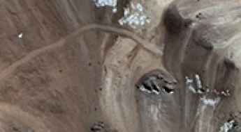
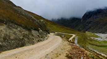
Laguna Capalococha is a remote high-mountain lagoon situated at an elevation of 4,623m (15,167ft) above sea level in the Huaylas Province of Peru. Nestled deep within the Ancash Region, the road to this glacial lake is one of the most secluded and demanding tracks in the Cordillera Blanca range.
Driving a Wild Curvy Road to Abra Ucchuchacua in the Andes
Abra Ucchuchacua is a high mountain pass at an elevation of 4,740 m (15,551 ft) above sea level, located on the boundary between the Yanahuanca and Oyón districts of Peru.
A wild unpaved 4x4 road to Chuanuma in the Andes
Chuañuma is a high mountain peak at an elevation of 5,283m (17,332ft) above sea level, located in Chachas District, in the Castilla Province of Peru. It’s one of the highest roads in the country.
How to drive the unpaved road to Laguna Canchiscocha in Peru?
The road to Laguna Canchiscocha, Laguna Fudococha, and Laguna Tayacocha is a high-altitude mountain track in the Yungay Province of Peru. Reaching an elevation of 4,561m (14,963ft), this route crosses the rugged Cordillera Negra range through one of the most isolated sectors of the Ancash Region.
How to drive the unpaved Carretera 106 in Pasco?
Carretera 106 is a high mountain road located in the Pasco Province of central Peru. Spanning 100 km from Ninacaca, this route links high Andean passes and narrow river canyons before ending abruptly in the eastern mountains.
How to drive the Carretera 5N from Oxapampa to Nuevo Trujillo?
Located in central Peru, Carretera 5N is a high-risk mountain road connecting the Pasco and Huánuco regions. The route runs for 202 km (125 miles), starting in Oxapampa—a town known for its unique German-Austrian architecture—and ending in Nuevo Trujillo. The road follows deep canyons and crosses extreme terrain on the eastern slopes of the Andes.
How to drive the challenging Carretera 104 from Jauja to San Ramon?
Located in the Junín Region of Peru, Carretera 104 is a high-mountain road. Set on the eastern slopes of the Andean Cordillera Oriental, the route connects the city of Jauja with San Ramón. It is a hazardous link between the high Andes and the Chanchamayo Province.
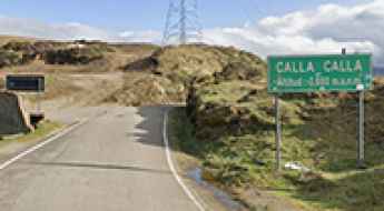
How to drive the narrow 8B road through Calla Calla Pass?
The Calla Calla Pass is a high mountain crossing in the northern Peruvian Andes. At 3,600m (11,811ft), the 8B road connects Leimebamba and Balsas over an 88 km stretch. Driving here means dealing with a paved surface that is extremely narrow and in poor condition. The route moves from high-altitude peaks down to the humid forest, which means the road grip and visibility can change from one turn to the next.
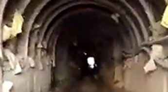
Tunel Iscaycruz: Driving through one of the highest tunnels in the world
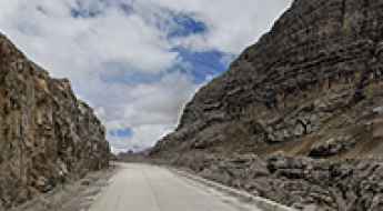
Tunel Iscaycruz is an extreme high-altitude mountain passage at an elevation of 4,905 meters (16,092 ft) above sea level, located in the Oyón province of the Lima region in Peru. Set deep within the high cordillera of central Peru, this 229.86-meter-long tunnel is a critical logistical asset for the Los Quenuales lead and zinc mines. Due to its staggering altitude, it surpasses the Punta Olímpica Tunnel, making it potentially the highest in South America and certainly one of the highest vehicular tunnels in the world.
Jatunchacua: Driving the high Paso Retrochero in the Peruvian Andes
Located on the high-altitude boundary between the Lima and Pasco regions in Peru, the Jatunchacua Pass (locally known as Paso Jatunchacua) is a formidable mountain crossing. Reaching a staggering elevation of 4,833m (15,856ft) above sea level, it stands as one of the highest driveable points in the area, situated just south of the imposing Nevado Retrochero.
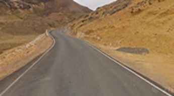
Driving the high altitude HV-116 road to Abra Apacheta
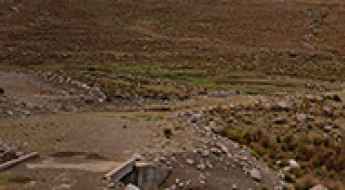
Abra Apacheta is a massive mountain pass that sits at 4,704 meters above sea level in the Huancavelica region of central Peru. Sitting on the HV-116 route, this is one of the highest paved roads in the country, but don't let the asphalt fool you. This is a high-altitude grind where the air is thin, the weather is unpredictable, and the road clings to the Andean ridges for 66 kilometers. Driving here means pushing your vehicle through a desolate, mineral landscape where oxygen is a luxury and the technical nature of the curves requires constant focus.
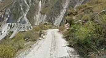
Can you drive the challenging mountain road from Yungay Pampa to Mirasanta in Ancash?
Located in the Huaylas Province, within the Ancash Region of Peru, the unpaved road from Yungay Pampa to Mirasanta is a challenging adventure for skilled drivers only.
How to drive the unpaved road to Hatun K'irawniyuq in Arequipa?
Hatun K'irawniyuq is a high mountain pass at an elevation of 4,407m (14,458ft) above sea level, located in the Arequipa Region of Peru. The road to the summit is the AR-105, an unpaved road that crosses the Andean range through a volcanic and arid landscape.