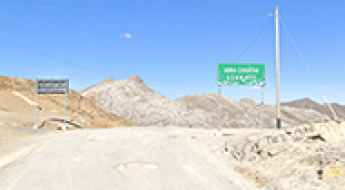
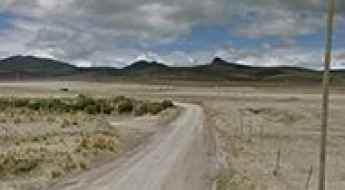
What are the most spectacular roads in Peru?
Located in the heart of the Andes, in the western part of South America, Peru is very challenging for drivers due to its geography that comprises the coast, the Andes Mountains, and the Amazon Rainforest. With such topography, it has more than 230 roads listed as the most spectacular in the world.
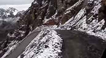
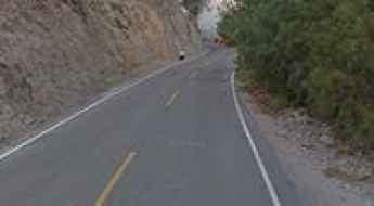
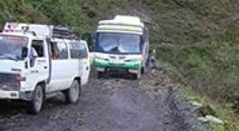
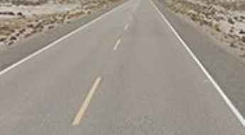
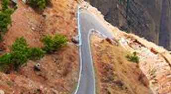
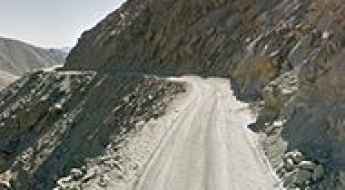
When traveling to the country, you can’t miss Curvas de Huanchaca, a series of 24 hairpin turns located on the boundary between Cusco and Apurimac. It’s one of the most hairpinned roads in the world, offering travelers a spectacular, vertigo-inducing drive. Or the harrowing paved road to Anticona Pass in the Andes, at an elevation of 4,824m (15,826ft) above sea level. The pass is often incorrectly said to be the highest paved road in South America.
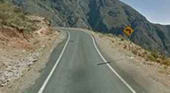
If you want to try scary drives, don’t forget the Pasamayo Serpentine, a lethal coastal road known for fatal traffic accidents. The road has no safety fences, and one mishap, and you plunge off the cliff and into the sea. Or Pato Canyon Road, a path hewn out of sheer rock, located in the Ancash Region. And if you’re up for paved mountain roads, don’t miss the awe-inspiring drive to Punta Olímpica in the Andes, climbing up to 4,732m (15,525ft) above sea level. It's one of the highest paved roads in the country.
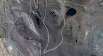
How to drive the unpaved mining road to Abra Rapaz?
Abra Rapaz is a high mountain pass at an elevation of 4.937m (16,197ft) above sea level, located in the highlands of Lima, in the high cordillera of central Peru. The road is bordered by a drop of hundreds of meters (many hundreds of feet) unprotected by guardrails.
Abra de Toroya, a winding road only for experienced drivers
Abra de Toroya is a high mountain pass at an elevation of 4.750m (15,583ft) above the sea level, located in the Puno department, in southeastern Peru.
Is the road from Puquina to Salinas Moche in Peru difficult to drive?
Driving from Puquina to Salinas Moche is a journey into the thin, freezing air of the high Andes. At its peak, this track reaches a staggering 4,601m (15,095ft) above sea level, making it one of the most demanding routes in the Moquegua region. This isn't a place for a casual drive; it’s a high-altitude grind through a landscape of grey rock and clouds where both your lungs and your engine will be begging for air.
Driving the Camino a Pacaraos: A terrifying cliff road in Peru
Pacaraos is a remote high-mountain town sitting at an elevation of 3,331m (10,928ft) above sea level in the Huaral Province of Peru. The road to reach this settlement, known as Camino a Pacaraos, is famous for its extreme narrowness and the vertiginous drops that flank the route.

Singa-Yunguilla Road is definitely not a “Sunday drive”
Located in central Peru, Carretera Singa-Yunguilla is one of the most dangerous routes in the world. In many places this high mountain road is bordered by a drop of hundreds of meters (many hundreds of feet) unprotected by guardrails. It’s definitely not a “Sunday drive”.
TA-104 Road: Driving the narrow lakeside cliffs of Laguna Aricota
Located in the Tacna Region of southern Peru, the TA-104 is a challenging regional road that offers a high-stakes driving experience. Stretching through a barren, volcanic landscape, this route is a vital link in the high desert, but its technical nature and extreme exposure make it a journey reserved for those with nerves of steel and a reliable vehicle.
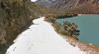
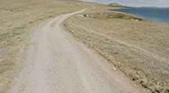
Laguna de Suches
Laguna de Suches is a high mountain lake at an elevation of 4.491m (14,734ft) above the sea level, located in Candarave Province, in Peru.
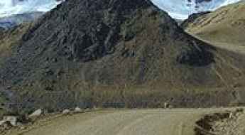
Driving the Challenging AN 104 Road to Chicarhuapunta
Chicarhuapunta is a high mountain pass at an elevation of 4,289m (14,071ft) above sea level, located in the Huaylas Province of Peru.
Laguna Orcococha
Laguna Orcococha is a high mountain lake at an elevation of 4.625m (15,173ft) above the sea level, located in the province of Castrovirreyna in Peru.
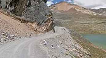
Road 34H: Conquering Abra Sandia and Laguna Saytococha in Peru
Deep in the Sandia Province of the Puno Region, Road 34H stands as one of the most formidable and dizzying routes in the Peruvian Andes. Stretching for 61 km (38 miles) from Quiscupunco to the town of Sandia, this high-mountain corridor crosses the legendary Abra Sandia pass and skirts the shores of Laguna Saytococha, offering a journey that tests the nerves of even the most seasoned expedition drivers.
Llanganuco Orconcocha
Llanganuco Orconcocha is a high mountain crystal blue lake located in the Cordillera Blanca in the Andes of Peru at an elevation of 3.850m (12,631ft) above the sea level.
Journey Through the Depths: Exploring Peru's Challenging Cotahuasi Canyon Road
Take a journey through the depths of Peru's challenging Cotahuasi Canyon Road. Located about 200 kilometers (124 miles) from Arequipa in the heart of the Southern Andes, Cotahuasi. Canyon is known for being one of the deepest canyons in the world.
How to get by car to Gruta Huagapo: A scenic drive through the Peruvian Andes
The road to Gruta Huagapo, officially known as JU-105, is a spectacular mountain route located in the Tarma Province of Peru. Connecting the towns of Acobamba and San Pedro de Cajas, this road serves as the main access to one of South America's deepest and most fascinating natural wonders.
Driving the potholed road to Abra Chaucha in the central highlands
Abra Chaucha is a high mountain pass at an elevation of 4,728m (15,511ft) above sea level, located in Peru.
Laguna Canchis
Laguna Canchis is a high mountain lake at an elevation of 4.475m (14,681ft) above the sea level, located in the Andes of Peru, in the province Huarochirí.
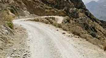
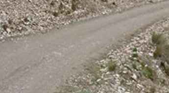
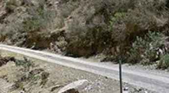
What are the driving hazards on the single-lane road from Sacaycacha to Pallasca?
The Carretera Sacaycacha-Pallasca, located in the Pallasca Province of the Ancash region in Peru, is one of the most high-risk routes in the Andes. Spanning 17.8 km (11 miles), this road is defined by its extreme verticality, lack of protections, and a technically challenging mixed-surface composition of asphalt and dirt sections. For any driver, this single-lane corridor is a definitive test of technical skill and psychological endurance, as it traverses terrain with unprotected drops exceeding 600 meters (2,000ft).
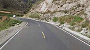
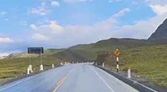
Driving the high 3N road to Mojon Pass in the Peruvian Andes
Mojon Pass, or Paso de Mojón, is a high-altitude mountain pass at an elevation of 4,291 meters (14,078 ft) above sea level, located in the Ancash Department of central Peru. Traversed by the Carretera 3N, this pass is a vital link between Conococha and Huallanca. While the road is fully asphalted and relatively wide, the physical reality of driving at nearly 4,300 meters involves managing extreme weather volatility and a landscape where the mountainside literally crumbles onto the driving line, requiring constant mechanical vigilance and precise steering.
How to drive the paved road to Laguna Viscacha?
Laguna Viscacha is a high mountain lagoon at an elevation of 4.614m (15,137ft) above sea level, located in Mariscal Nieto Province, in Peru.
Driving the high altitude 20A road to Abra de la Viuda
Abra de la Viuda is a staggering high mountain pass reaching an elevation of 4,711 meters in the Junín Province of central Peru. Sitting high in the Cordillera de la Viuda range, near the boundary with Lima, this pass is a brutal test of both human and mechanical endurance. The road, known as 20A, provides a vital link across the Andes, cutting through a landscape of dark lagoons and jagged peaks where the thin air and the presence of massive mining operations define the driving experience.
The wild road to Huayunca doesn’t drop below 4.900m for 25km
Huayunca is a high mountain pass at an elevation of 5.115m (16,781ft) above the sea level, located located in Peru in Departamento de Apurimac, on the boundary of Cusco and Apurimac regions. It’s one of the highest roads of the country.
Abra Jahuaycate: The Ultimate Road Trip Guide
Abra Jahuaycate is a high mountain pass at an elevation of 5.065m (11,003ft) above the sea level, located in Pitumarca District of the province Canchis in Peru. It’s one of the highest roads of the country.
How to drive the paved road to Abra Acopunco?
Abra Acopunco is a high mountain pass at an elevation of 4.042m (13,261ft) above sea level, located in Peru.
Laguna Alcacocha
Laguna Alcacocha is a high mountain lake at an elevation of 4.350m (14,271ft) above the sea level located at the top of the Andean mountains in the Pasco region of Peru.
Abra de Viscos
Abra de Viscos is a high mountain pass at an elevation of 4.695m (15,403ft) above the sea level, located in the Departament of Arequipa, in Peru.
Abra Tres Cruces
Abra Tres Cruces is a high mountain pass at an elevation of 3.738m (12,263ft) above the sea level, located in the province of Yauyos in Peru.

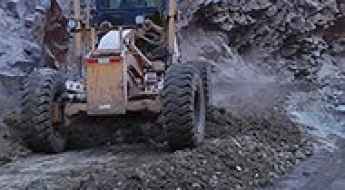
Is the road to Punta Caudalosa Chica in Peru difficult?
Punta Caudalosa Chica is a high-altitude mountain pass located in the Huancavelica region of Peru. Situated in the Angaraes province, this unpaved mining track climbs through the Andes range to reach a maximum elevation of 4,990 meters (16,371 ft) above sea level.
Abra Mio
Abra Mio is a high mountain pass at an elevation of 4.764m (15,629ft) above the sea level, located in the Huaral Province, Peru.
Punta Fierro Cruz
Punta Fierro Cruz is a high mountain pass at an elevation of 4.823m (15,823ft) above the sea level, located in the Yauli province, in Peru.
Driving the unpaved PE-34E road to Abra Canchenita
Abra Canchenita is a high-altitude mountain pass located in the Carhuaz Province within the Ancash Region of Peru. The unpaved pass sits on the Carretera Regional PE-34E, climbing the rugged Andean mountain walls to reach a maximum elevation of 4,827 meters (15,836 ft) above sea level.
Dare to drive the dangerous Punta Chanca
Punta Chanca is a high mountain pass at an elevation of 4.852m (15,918ft) above the sea level, located in the Department of Lima, in Central Peru.
Road to the Junín Lakes: Driving to Alcacocha, Tarusmachay, and Oshgomachay
Located in the heart of the Central Andes of Peru, the journey through the glacial lakes of the Junín region is a high-altitude experience that tests both driver and machine. This remote track connects three stunning Andean mirrors: Laguna Alcacocha, Laguna Tarusmachay, and Laguna Oshgomachay, offering a unique traverse through the desolate beauty of the Meseta de Bombón.
Road 1SC
Carretera 1SC is one of the most extreme roads on Earth. Located in southern Peru, your wheels will be astounded at the wonderful views of the mountains spread out before you! They are terrible for drivers who are prone to vertigo.
Queropalca
Queropalca is a high mountain town at an elevation of 3.971m (13,028ft) above the sea level, located in the Andes of Peru, in the Lauricocha Province, Cauri District.
Volcan Ticsani
Ticsani Volcano is a volcano in the Andes of Peru, at an elevation of 4.875m (15,994ft) above the sea level, located in the Moquegua Region, Mariscal Nieto Province, in the districts of Cuchumbaya and San Cristóbal, in Peru.
Punta Yahuarcocha
Punta Yahuarcocha is a high mountain pass at an elevation of 4.980m (16,338ft) above the sea level, located in the Angaraes province, in the region of Huancavelica, Peru
Abra Turpo
Abra Turpo is a high mountain pass at an elevation of 4.798m (15,741ft) above the sea level, located in the Huancavelica Province, Peru.