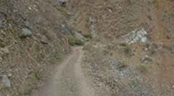
What are the most spectacular roads in Peru?
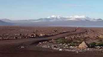
Located in the heart of the Andes, in the western part of South America, Peru is very challenging for drivers due to its geography that comprises the coast, the Andes Mountains, and the Amazon Rainforest. With such topography, it has more than 230 roads listed as the most spectacular in the world.
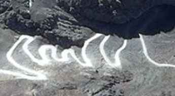
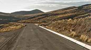
When traveling to the country, you can’t miss Curvas de Huanchaca, a series of 24 hairpin turns located on the boundary between Cusco and Apurimac. It’s one of the most hairpinned roads in the world, offering travelers a spectacular, vertigo-inducing drive. Or the harrowing paved road to Anticona Pass in the Andes, at an elevation of 4,824m (15,826ft) above sea level. The pass is often incorrectly said to be the highest paved road in South America.
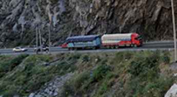
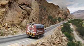
If you want to try scary drives, don’t forget the Pasamayo Serpentine, a lethal coastal road known for fatal traffic accidents. The road has no safety fences, and one mishap, and you plunge off the cliff and into the sea. Or Pato Canyon Road, a path hewn out of sheer rock, located in the Ancash Region. And if you’re up for paved mountain roads, don’t miss the awe-inspiring drive to Punta Olímpica in the Andes, climbing up to 4,732m (15,525ft) above sea level. It's one of the highest paved roads in the country.
Wamp'una
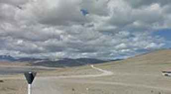
Wamp'una is a high mountain pass at an elevation of 4.843m (15,889ft) above the sea level, located in Lima Province in Peru.
Sumbilca-Pacaybamba Road
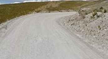
Located in the province Huaral in Peru, Carretera Sumbilca-Pacaybamba is one of the most extreme roads of the country. Drivers must remain cautious as the journey has been known to claim the lives of careless drivers. Drive with care as this is a mountain road with hairpin curves and dangerous dropoffs.
Wiswillani Pass
Paso Wiswillani is a high mountain pass at an elevation of 4.807m (15,771ft) above the sea level, located in the Arequipa Region of Peru.
How to drive the paved road to Abra Tucuccasa?
Abra Tucuccasa is a high mountain pass at an elevation of 4.496m (14,750ft) above sea level, located in the region Ayacucho of Peru.
How dangerous is the Carretera Cincha–Huanca to Abra de Rumualdo?
Abra de Rumualdo is a high mountain pass reaching an elevation of 3,434 meters (11,266 ft) above sea level in the Caylloma Province of Peru. The journey over the summit runs along the Carretera Cincha–Huanca, a remote route where the road surface disintegrates completely as you climb higher, turning from a basic road into a narrow mountain ledge.
Driving the endless curves of Abra Sotacocha in the Peruvian Andes
Abra Sotacocha is a high-altitude test of concentration in the south-central Andes of Peru. Reaching an elevation of 4,261m (13,979ft) above sea level, this mountain pass in the Ayacucho region is defined by its unrelenting geometry. On this road, the concept of a "straight line" doesn't exist; the entire 67km journey is a continuous sequence of turns that demands constant work on the steering wheel and absolute focus on the shifting mountain conditions.
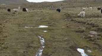
Laguna Pumacocha: this road is not for timid drivers
Laguna Pumacocha is a high mountain lagoon at an elevation of 4.370m (14,337ft) above the sea level, located in the Yauyos Province, in the Lima Region of Peru.
Carretera PA-100: Driving the High Andean Track to Cerro de Pasco
The Carretera PA-100 is a high-altitude mountain highway located in the Pasco Province of central Peru. The unpaved route runs through the high Andean plateau, connecting the regional hub of Cerro de Pasco at the Route 3N junction with Route 18 near the western valleys.
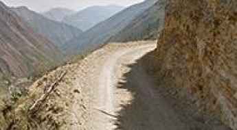
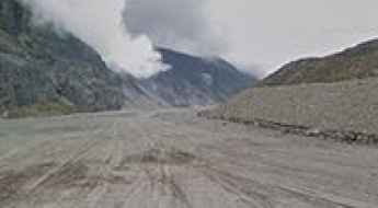
Infiernillo Canyon is by no means an easy road
Located in the Huarochirí Province of the Department of Lima in Peru, the Infiernillo Canyon is an impressive geological formation carved by the turbulent waters of Rímac river.
Abra Huaytire is an absolute must for road lovers
Abra Huaytire is a high mountain pass at an elevation of 4.768m (15643ft) above sea level, located in Peru.
Road LM-119
Carretera LM-119 is one of the scariest roads in the world. It’s located in Santo Domingo de los Olleros District, province Huarochirí in Peru.
Abra Tiabaya
Abra Tiabaya is a high mountain pass at an elevation of 2.747m (9,012ft) above the sea level, located in Peru’s Arequipa Region.
How to drive the unpaved road to Laguna Jochauma in Arequipa?
Laguna Jochauma is a high mountain lagoon at an elevation of 4.947m (16,230ft) above sea level, located in the Arequipa Region of Peru.
Abra Livini-Tarata
Abra Livini-Tarata is a high mountain pass at an elevation of 4.803m (15,757ft) above the sea level, located in the Tacna Region in southern Peru.
Cerro Choquecota
Cerro Choquecota is a high mountain peak at an elevation of 5.001m (16,407ft) above the sea level, located in the Puno Region, in southern Peru.
An epic road to Abra Progreso in the Andes
Abra Progreso is a high mountain pass at an elevation of 4.432m (14,540ft) above sea level, located in Progreso District, in Peru.
A curvy yet scenic road through Pampas Galeras National Reserve
Pampa Galeras-Barbara D'Achille is a national reserve located in the department of Ayacucho, Peru. Its main purpose is to protect the habitat of the vicuña.
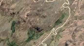
Road from San Francisco de Mosca to Antapirca: Driving the 23 Hairpins in Pasco
The mountain road connecting San Francisco de Mosca and Antapirca is a high-altitude unpaved route located in the Pasco region of central Peru. Traversing the rugged Andean topography, the road represents a critical link between the Huánuco and Pasco departments, maintaining an elevation consistently above 2,000 meters.
Laguna Ashcajocha
Laguna Ashcajocha is a high mountain lagoon at an elevation of 4.383m (14,379ft) above the sea level, located in the region Ayacucho of Peru.
How to drive the unpaved road to Laguna Chiuri
Laguna Chiuri is a high mountain lagoon, at an elevation of 4.828m (15,839ft) above sea level, located in the Department of Lima, in Peru.
How to drive the mining road to Cerro Iglisane?
Cerro Iglisane is a high mountain peak at an elevation of 5.052m (16,574ft) above the sea level, located in the General Sánchez Cerro Province in Peru.
How to drive the 4,956m Cerro Yaritani in the Peruvian Andes?
Cerro Yaritani is a high mountain pass at an elevation of 4,956m (16,259ft) above sea level, located in the Cusco Region of southeastern Peru.
Road LM-110
Located in the province of Huaral in Peru, Carretera LM-110 is one of the scariest roads of the country.
Laguna Saquicocha
Laguna Saquicocha is a high mountain lagoon at an elevation of 4.397m (14,425ft) above the sea level, located in the Ancash Region of Peru.
How to drive the unpaved road to Yantahuain in Ancash?
Yantahuain is a high mountain pass at an elevation of 4.223m (13,854ft) above sea level, located in the Ancash Region of Peru.
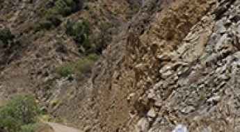
Driving the defiant Puchka cliff canyon road
Cañon del Rio Puchka is the name of a very challenging drive located in the Ancash region of Peru.
How to drive to Perdidos Canyon in the Peruvian desert?
El Cañón de los Perdidos is a very scenic canyon located in the Ica province of Peru. The road to the canyon is challenging to find, as some sections are missing or unmarked, requiring you to navigate through the open desert. The canyon extends 5 km and was discovered in 2011. Formed by the erosion of the Río Seco, it features a lagoon and is frequented by vultures.
Driving a road to the brutally high Abra Huayta in Arequipa
Abra Huayta is a high mountain pass at an elevation of 5,323m (17,463ft) above sea level, located in the province of Castilla in Peru. It’s one of the highest roads in the country.
Driving the unpaved road to Laguna Jalcuy in the Peruvian Andes
Laguna Jalcuy (also known as Laguna Jalcoy) is a high-altitude mountain lagoon reaching an elevation of 4,925m (16,158ft) above sea level, situated on the border of the Lima and Pasco regions in Peru. Located deep within the Andes, the access road is a remote gravel track demanding specialized vehicle preparation.
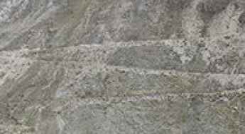
How to drive the 32 hairpin turns to the summit of Pampa Huilacollo
Pampa Huilacollo is a high mountain plateau at an elevation of 4.625m (15,173ft) above sea level, located in the province Mariscal in Peru. The average gradient is 11.46%.
The Road to Abra Tsactsapunta in the Cordillera Blanca Is Not for Timid Drivers
Abra Tsactsapunta is a high-mountain pass at an elevation of 4,472m (14,671ft) above sea level, located on the boundary of the Yungay and Huaylas provinces, Ancash Department, in Peru. The route crosses the northern sector of the Cordillera Blanca range.
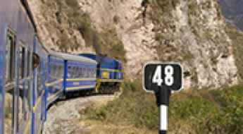
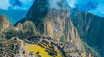
How To Plan Your Trip to Machu Picchu by Train
Planning a train journey to Peru’s iconic Machu Picchu, a UNESCO World Heritage Site, combines adventure, history, and stunning landscapes. But without a clear strategy, the logistics can feel overwhelming. Let’s break down the process step-by-step to ensure your journey is seamless and unforgettable.
How to drive the challenging 4x4 road to Quiscapampa in the Andes?
Quiscapampa is a high mountain peak at an elevation of 5,351m (17,555ft) above sea level, located in Chachas District, in the Castilla Province of Peru. It’s one of the highest roads in the country.
The Inca Trail: South America's Most Exclusive High-Altitude Trek
A 42-kilometer pilgrimage through cloud forests, ancient stonework, and thin air, reserved for those who earn every step.
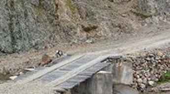
How dangerous is the wooden bridge on the road to Huanaccmarca in Peru?
The bridge on the road to Huanaccmarca is a primitive and terrifying river crossing located in the Coronel Castañeda District of the Parinacochas Province, in southern Peru. Perched at an extreme elevation of 4,393m (14,412ft) above sea level, this structure is one of the most precarious crossings in the most spectacular bridges in the world list. It is a makeshift construction of wooden planks laid over a stone and concrete base, designed to save time on a remote mining route where the lack of maintenance and the weight of heavy machinery make every crossing a gamble.
Road to Laguna Yanco: 100 Hairpin Turns in the Ancash Region
Located in the Aija Province of the Ancash Region in Peru, the road to Laguna Yanco is a high-altitude mountain track reaching an elevation of 4,444m (14,580ft) above sea level. This unpaved route is one of the most technically demanding corridors in the Peruvian Andes due to its extreme vertical gain and complex geometry.