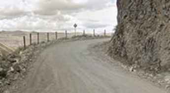
What are the most spectacular roads in Peru?
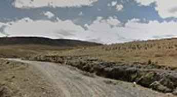
Located in the heart of the Andes, in the western part of South America, Peru is very challenging for drivers due to its geography that comprises the coast, the Andes Mountains, and the Amazon Rainforest. With such topography, it has more than 230 roads listed as the most spectacular in the world.
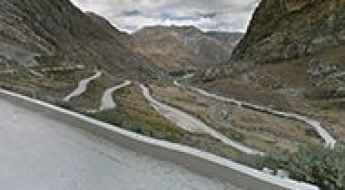
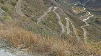
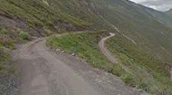
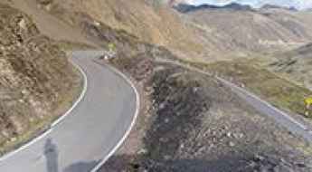
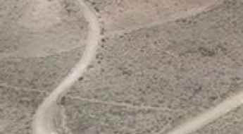
When traveling to the country, you can’t miss Curvas de Huanchaca, a series of 24 hairpin turns located on the boundary between Cusco and Apurimac. It’s one of the most hairpinned roads in the world, offering travelers a spectacular, vertigo-inducing drive. Or the harrowing paved road to Anticona Pass in the Andes, at an elevation of 4,824m (15,826ft) above sea level. The pass is often incorrectly said to be the highest paved road in South America.
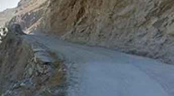
If you want to try scary drives, don’t forget the Pasamayo Serpentine, a lethal coastal road known for fatal traffic accidents. The road has no safety fences, and one mishap, and you plunge off the cliff and into the sea. Or Pato Canyon Road, a path hewn out of sheer rock, located in the Ancash Region. And if you’re up for paved mountain roads, don’t miss the awe-inspiring drive to Punta Olímpica in the Andes, climbing up to 4,732m (15,525ft) above sea level. It's one of the highest paved roads in the country.
Abra Tolconi
Abra Tolconi is a high mountain pass at an elevation of 4.860m (15,945ft) above the sea level, located in the Andes of Peru, in the Arequipa Region.
Laguna Chichis
Laguna Chichis is a high mountain lake at an elevation of 4.539m (14,891ft) above the sea level, located in the Andes of Peru, in the province Huarochirí.
Toromocho
Toromocho is a high mountain peak at an elevation of 4.996m (16,391ft) above the sea level, located in the Morococha District in the Yauli Province of the Junín Region in Peru.
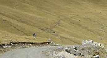
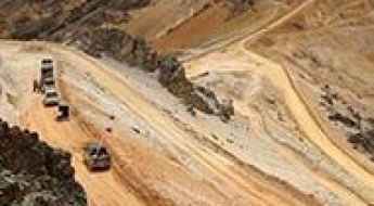
Driving the high altitude Esperanza Pass in Puno
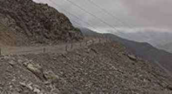
Esperanza Pass, or Paso Esperanza, is a staggering high-altitude crossing that reaches 4,782 meters in the Puno region of southern Peru. This is a hardcore mining route where the air is thin and the scenery is dominated by raw earth and heavy machinery. The road is a vital link for mine trucks, meaning the surface is constantly battered by massive tires and heavy loads. Driving here is a slow, gritty experience where you are not just fighting the incline, but also the dust and the sheer scale of the industrial traffic that rules these Andean heights.
Driving the high altitude road 670 to Abra Achallaque
Abra Achallaque is a high-altitude mountain pass located on the regional boundary between Cusco and Arequipa in southern Peru. Situated in the high puna plateau, this unpaved mountain sector of the Carretera 670 climbs the bare Andean ridges to reach a maximum elevation of 4,962 meters (16,279 ft) above sea level.
How dangerous is the 29-hairpin road passing Qullqi in Peru?
The road passing Qullqi (also known as Colqui) is a high-altitude mountain track located in the Huarochirí Province, Lima Region, Peru. The route climbs the western slopes of the massif, reaching a maximum road elevation of 4,765m (15,633ft) above sea level.
Laguna Rajucolta
Laguna Rajucolta is a high mountain glacial lake at an elevation of 4.280m (14,041ft) above the sea level, located in the Huaraz Province, in the Ancash Region of Peru.
A wild road to Laguna Uchucchacua in the Andes
Laguna Uchucchacua is a high mountain lagoon at an elevation of 4.390m (14,402ft) above the sea level located in the province of Oyón in the Department of Lima, in Central Peru.
How to drive the unpaved road to Laguna Quequerane in Puno
Laguna Quequerane is a high-mountain lake at an elevation of 4,034 meters (13,234 ft) above sea level, located in the Lampa Province of Peru.
Laguna Ampatune
Laguna Ampatune is a high mountain lake at an elevation of 4.280m (14,041ft) above the sea level, located in the Andes of Peru, in the Quispicanchi Province.
The Ultimate Guide to Traveling the Chimboya Pass
Abra Chimboya is a high mountain pass at an elevation of 5.114m (16,778ft) above the sea level, located on the boundary between the regions of Cusco and Puno, in Peru. It’s one of the highest roads of the country.
Alto Lagonilla
Alto Lagonilla is a high mountain pass at an elevation of 4.410m (14,468ft) above the sea level, located in the province of Lampa in Peru.
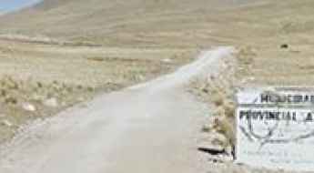
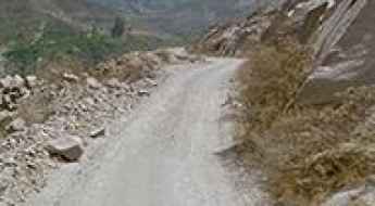
Mollepata-Pallasca Road
Located on the border of La Libertad and Ancash regions in northwestern Peru, the Mollepata-Pallasca road is a very exciting journey in the heart of the Andes mountain range.
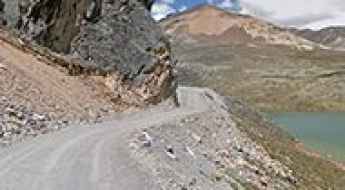
Driving the LM-116: The treacherous cliff road from Barba Blanca to Autisha
The LM-116 (Carretera Barba Blanca-Autisha), located in the Huarochirí Province of the Lima Region, is widely regarded as one of the most nerve-wracking drives in the Peruvian Andes. This road follows the deep canyon of the Santa Eulalia River, offering a high-altitude transit that is as spectacular as it is terrifying.
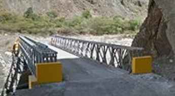
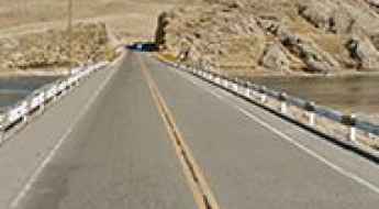
Crossing the Chucusvalle Bridge
Puente Chucusvalle is a metallic modular bridge located on the boundary between the regions of La Libertad and Ancash in northwestern Peru, crossing the Tablachaca River. It’s one of the most spectacular bridges in the world.
Tuco
Tuco is a high mountain town at an elevation of 4.725m (15,501ft) above the sea level, located in the Andes, in the Cordillera Blanca in northwestern central Peru.
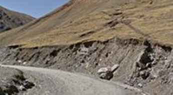
How to drive the unpaved road to Bolognesi in Ancash?
Bolognesi is a high mountain town located in the Pallasca Province of Ancash, in Peru. The road to the town is difficult: gravel surface, huge drops and very narrow.
Abra Cuncush
The Cuncush Pass is a high mountain pass at an elevation of 4.601m (15,095ft) above the sea level, located in the in the Ancash Region of Peru.
Chagual-El Pallar Road
Located in La Libertad Region, Carretera Chagual-El Pallar is a very dangerous high mountain road.
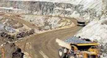
Caylloma Mine
Mina Caylloma is an open-pit mine at an elevation of 4.947m (16,230ft) above the sea level, located in the Arequipa Region of southern Peru.
Road LI-117
Located in the Lima Region of Peru, Carretera LI-117 is a high mountain road with hairpin turns and dangerous dropoffs.
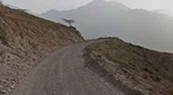
Abra Llamaorgo: Driving one of the highest mountain passes in Peru
Abra Llamaorgo is an extreme mountain pass reaching an elevation of 4,700m (15,419ft) above sea level, located in the Department of Huancavelica, Peru. This high-altitude route is a true test for any driver, offering raw Andean scenery and challenging gradients in one of the most remote regions of the country.
An epic road to Abra Ares in the Andes
Abra Ares is a high mountain pass at an elevation of 5.018m (16,463ft) above the sea level, located in the region of Arequipa, in Southern Peru. It’s one of the highest roads of the country.
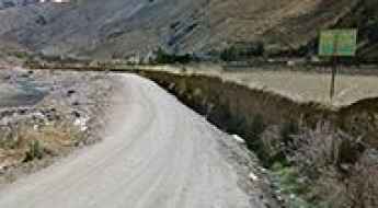
Cocachacra-Santiago de Tuna Road
Located in the province Huarochirí in Peru, Carretera Cocachacra-Santiago de Tuna road is one of the most demanding roads of the country. Drivers must remain cautious as the road has been known to claim the lives of careless drivers. Drive with care as this is a mountain road with hairpin curves and dangerous dropoffs.
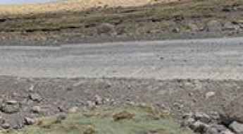
How to drive the unpaved AN-844 to Laguna Aguascocha?
Laguna Aguascocha is a high-altitude Andean lagoon situated at an elevation of 4,370m (14,337ft) above sea level in the Cordillera Blanca of northwestern central Peru. Located within the Huascarán National Park, the access route is via the AN-844 (also referenced as AN-1295 in sections), a 18.7 km unpaved corridor. This road serves as a vital logistical link between the paved Highway 3-N and the Mina Tuco mining site, crossing extreme terrain and passing secondary water bodies such as Laguna Yanacocha.
Take the Scenic Route and Discover Abra de Lares in Cusco
Abra de Lares is a high mountain pass at an elevation of 4.443m (14,576ft) above the sea level, located in Calca Province of Cusco Region of Peru.
Abra Huamina
Abra Huamina is a high mountain pass at an elevation of 4.284m (14,055ft) above the sea level, located in Ayacucho region, in south-central Peru.
Driving the paved 20A road to Laguna Huascachoca
Laguna Huascachoca is a high-altitude glacial lake at an elevation of 4,485 meters (14,714 ft) above sea level, located on the border between the Pasco and Junín regions in central Peru. The lake sits along Route 20A, a paved mountain highway crossing the central Andean plateau.
Paso Cacanapunta
The Cacanapunta Pass is a high mountain pass at an elevation of 4.162m (13,654ft) above the sea level, located in the in the Ancash Region of Peru.
Pacoorcco Pass
Paso Pacoorcco is a high mountain pass at an elevation of 4.758m (15,610ft) above the sea level, located in the Andes of Peru, in the Moquegua Region, General Sánchez Cerro Province, Ubinas District.
Alto de Tapacocha: Driving the 18% mining ramps in Recuay
Alto de Tapacocha is a high mountain peak at an elevation of 4,732 meters (15,524 ft) above sea level, located in the Recuay Province of Peru. Situated within the Ancash region of the Andes, the route is heavily used by mining trucks.
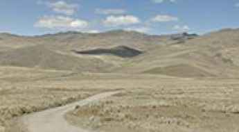
Is the unpaved road to Abra Mañazo in Peru difficult to drive?
Abra Mañazo is a high mountain pass at an elevation of 4,518m (14,822ft) above sea level, located in the Puno Province of southern Peru. This remote Andean route offers a high-altitude adventure through one of the most desolate landscapes in the region.
Corihuarmi Mine
Mina Corihuarmi is an open-pit gold mine at an elevation of 4.883m (16,020ft) above the sea level, located in Junín, a region in the central highlands and westernmost Peruvian Amazon.
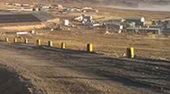
How to drive the unpaved road from Atacocha to Cerro de Pasco?
The Carretera Atacocha - Cerro de Pasco is a high-altitude mountain road located in the Pasco Province of central Peru. The unpaved route connects the mining settlement of Atacocha with the regional capital of Cerro de Pasco through the high ridges of the Andes.
Nevado Huayracancha: Driving to 5,045m through the Peruvian mining heartland
Nevado Huayracancha (also spelled Wayrakancha) is a high mountain pass in the Peruvian Andes at an elevation of 5,045m (16,551ft) above sea level. Located on the regional border between Lima and Junin, this route is one of the highest roads in the country.
How to drive the challenging PE-14C Road to Abra Huachucocha
Abra Huachucocha is a high mountain pass at an elevation of 4.341m (14242ft) above sea level, located in the province of Carlos Fermín Fitzcarrald, in Peru.