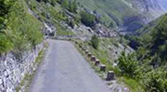
What are the most spectacular roads in France?
France is a true paradise for those wishing to experience the most spectacular roads, and it provides endless experiences for each driver. From stunning balcony roads, mountain passes, and coastal drives, to roads disappearing with the tides, it hosts more than 750 roads listed as the most spectacular in the world.
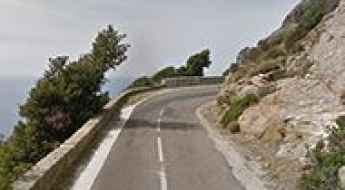
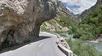
Located in the western part of Europe, France covers an area of 551,695 square kilometers and shares borders with 7 countries: Belgium, Luxembourg, Germany, Switzerland, Italy, Spain, and Andorra. With high mountains in the Alps and the Pyrenees, the roads of the country are famous worldwide because of the Tour de France, the most important cycling race. When traveling to the country, be sure to experience a drive through the best balcony roads. Dramatically carved out of rock on the side of mountains, the balcony roads are a unique experience for any rider.
The country also hosts iconic roads, known worldwide, including Col du Chaussy, a mountain pass at 1,533m (5,029ft) above sea level, famous for the “Lacets de Montvernier,” a special 3 km stretch with 17 hairpins as the road virtually climbs a cliff, or Col de Turini, a treacherous Alpine road with a legendary driving history, as one of the most dangerous and challenging stages of the Monte Carlo Rally and one of the most scenic drives in the world. For those preferring another kind of experience, don’t forget to drive Passage du Gois, the tide-covered road. It’s a natural passage flooded twice a day by the high tide leading to the island of Noirmoutier.
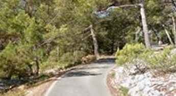
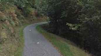
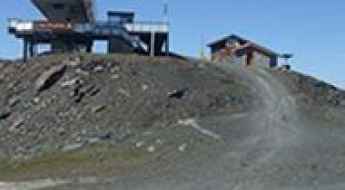
How to get by car to Mont Faron in Toulon?
Mont Faron is a mountain peak at an elevation of 584 m (1,916 ft) above sea level, located on southern France’s Mediterranean coast, overlooking the city and roadstead of Toulon. It features sweeping views and a WWII memorial.
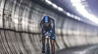
Chris Froome has become the first man to cycle non-stop the Eurotunnel
Completed in 1993, the Channel Tunnel is the longest undersea tunnel in the world and connects the southern part of England with northern France.
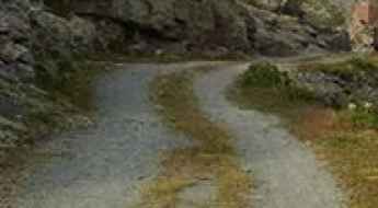
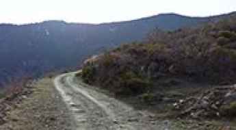
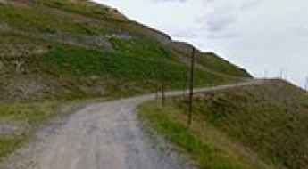
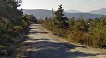
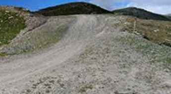
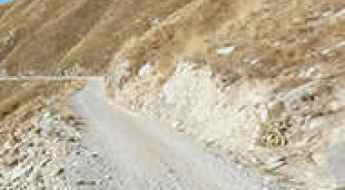
The unpaved road to Col de la Bathie in Savoie
Col de la Bâthie is a high mountain pass at an elevation of 1,884m (6,181ft) above sea level, located in the Savoie department of France.
The military road to Fort de la Redoute in Savoie
Fort de la Redoute is a high mountain fort at an elevation of 2,346 m (7,696 ft) above sea level, located in the Savoie department of France.
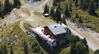
How to get to Refuge du Plan du Lac in the Alps?
Refuge du Plan du Lac is a high mountain refuge in the Alps at an elevation of 2.370m (7,775ft) above sea level, located in the Savoie department of France.

Driving the D86: Tour de Madeloc's Hairpin Turns
The Tour de Madeloc or Route Madeloc is a very small, narrow road located near the Spanish border and Cap Cerbere, in southern France. The route is part of the scenic Route des Cols and connects the coastal towns of Banyuls-Sur-Mer and Colliure.
A sensational paved road to Col de la Llose in the French Pyrenees
Col de la Llose is a high mountain pass at an elevation of 1,866 m (6,122 ft) above sea level, located in the Occitanie region of France.
How to drive the paved D89 Road in the Pyrenees?
D89 is a very scenic paved mountain road located in the Pyrénées-Orientales department of France, on the way to Puigmal (also called Puigmal d'Err).
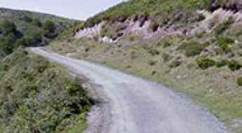
A classic road trip to Col de Soudet in the Pyrenees
Col de Soudet is a high mountain pass at an elevation of 1.540m (5,052ft) above sea level, located in the Pyrénées-Atlantiques department of France.
Road trip guide: Conquering Mur de Peguere in the Occitanie
Mur de Péguère is a mountain pass at an elevation of 1,375m (4,511ft) above sea level, located in the Occitanie region of France. It’s a killer climb: on paper, it only averages 7.9%, but that’s thanks to some relatively gentle lower slopes.
D33 is a winding paved road in Corsica
Located in the Haute-Corse department of France, on the north-east of the island of Corsica, D33 is a very scenic coastal road. Drive slowly because there is no room for mistakes.
Col de Pierre Plate: The Road That Has It All!
Col de Pierre Plate is a mountain pass at an elevation of 1,027m (3,369ft) above sea level, located in the Lozère department of France.
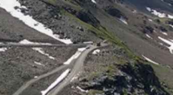
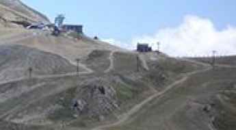
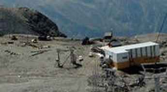
How to get to Glacier du Varet in Savoie?
Glacier du Varet is a high mountain glacier at an elevation of 2,883 m (9,458 ft) above sea level, located in the Savoie department of France. It's one of the highest roads in the country.
How to drive to the summit of Col d’Eylac in Cantal
Col d’Eylac is a high mountain pass at an elevation of 1,442 m (4,730 ft) above sea level, located in the Auvergne-Rhône-Alpes region of France.
Travel guide to the top of Coll de Sansa in the Pyrenees
Coll de Sansa is a high mountain pass at an elevation of 1,770m (5,807ft) above sea level, located in the Pyrénées-Orientales department of France.
How to get by car to Madone de Fenestre in the Alpes-Maritimes?
Madone de Fenestre is a high mountain chapel at an elevation of 1,904m (6,246ft) above sea level, located in the Alpes-Maritimes department of France.
How to get by car to Girotte Lake in Savoie?
Lac de la Girotte is a high mountain reservoir at an elevation of 1.753m (5,751ft) above sea level, located in the Savoie department of France.
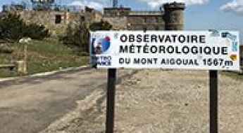
Water, snow and fog at the top of Mont-Aigoual
Mont-Aigoual is a high mountain pass at an elevation of 1.567m (5,141ft) above the sea level, located on the border of the Lozère and Gard departments in southern France. At the peak you have unlimited views and the highest manned weather station in France.

Col du Mollard: an iconic road in the French Alps
Col du Mollard is a high mountain pass at an elevation of 1.638m (5,374ft) above the sea level, located in the Savoie department in the Rhône-Alpes region in south-eastern France.
The narrow D102 is a dangerous balcony road
D102 is a short mountain road located in the Alpes-de-Haute-Provence department, in the region of Provence-Alpes-Côte d'Azur in southeastern France. It’s one of the most scenic French balcony roads.
Le Mauvais Pass, a narrow road to the summit
Le Mauvais Pass is a high mountain pass at an elevation of 1.779m (5,836ft) above the sea level located in the department of Hautes-Alpes in France, close to the Italian border.
Col de Thorens
Col de Thorens is a high mountain peak at an elevation of 3.118m (10,229ft) above the sea level, located in the Savoie department in the Auvergne-Rhône-Alpes region in southeastern France. It’s one of the highest roads of Europe.
Mont de la Chambre
Mont de la Chambre is a high mountain pass at an elevation of 2.844m (9,330ft) above the sea level located in the Savoie department in the Auvergne-Rhône-Alpes region in south-eastern France.
A memorable road trip to Col des Voltes
Col des Voltes is a high mountain pass at an elevation of 1.823m (5,980ft) above the sea level, located in the Pyrénées-Orientales department in southern France.
A memorable road trip to Col de Riou in the Pyrenees
Col de Riou is a high mountain peak at an elevation of 1.949m (6,394ft) above the sea level, located in the Hautes-Pyrénées department in the Occitan region of south-western France.
A lonely paved road to Col de Bostmendieta
Col de Bostmendieta is a mountain pass at an elevation of 1.054m (3,458ft) above the sea level, located in the Pyrénées-Atlantiques département, in France.
A curvy paved road to Col de Perty
Col de Perty is a mountain pass at an elevation of 1.302m (4,271ft) above the sea level, located in the Drôme department in the Auvergne-Rhône-Alpes region in southeastern France.
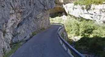
Clue du Peroure is a French balcony road
Clue du Pérouré is a canyon with dramatic views located in the Alpes-de-Haute-Provence department in the Provence-Alpes-Côte d'Azur region of France. It’s one of the most scenic French balcony roads.
Travel guide to the top of Col des Annes
Col des Annes is a high mountain pass at an elevation of 1.721m (5,646ft) above the sea level, located in the Haute-Savoie department in the Rhône-Alpes region in south-eastern France.
The iconic climb to Luz Ardiden
Luz Ardiden is a ski resort at an elevation of 1.720m (5,643ft) located in the Hautes-Pyrénées department in the Occitan region of south-western France. It has featured several times as a summit finish in the Tour de France and Vuelta a España races.
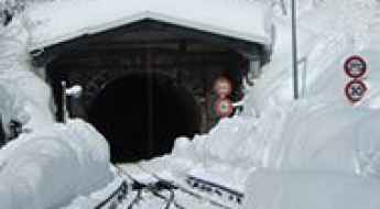
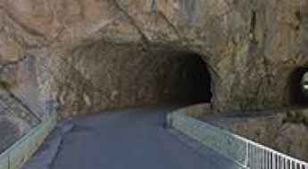
Tunnel des Montets
Located in the Haute-Savoie department of France, Tunnel des Montets is a mountain tunnel used by trains which also allows road traffic to avoid theCol des Montets mountain pass when there is heavy snowfall or avalanche danger.
The road to Lac du Barrage d'Ossoue isn't an easy one
Lac du Barrage d'Ossoue is a high mountain lake at an elevation of 1.842m (6,043ft) above the sea level, located in the Hautes-Pyrénées, a department in southwestern France.
The road to Mont Vial is said to be the scary of scaries
Mont Vial is a high mountain peak at an elevation of 1.527m (5,009ft) above the sea level, located in the Alpes-Maritimes department in southeastern France. It’s one of the few peaks of the backcountry behind Nice that is recognisable from the sea.
The military road to Colle delle Chaberton
Colle delle Chaberton is a high mountain pass at an elevation of 2.674m (8,772ft) above the sea level, located in the French Alps, in the département of Hautes-Alpes.
Fort de la Platte
Fort de la Platte is a military fortress at an elevation of 2.009m (6,591ft) above the sea level, located in the Savoie department in the Rhône-Alpes region in south-eastern France.
An awe-inspiring drive to Col d'Ornon
Col d'Ornon is a mountain pass at an elevation of 1.360m (4,462ft) above the sea level, located in the Dauphiné Alps, in the department of Isère in France.
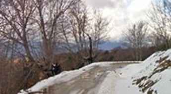
How to drive the narrow road to Col des Veaux?
The Col des Veaux is an international mountain pass at an elevation of 540m (1,771ft) above sea level, situated on the border between France (Pyrénées-Atlantiques) and Spain (Navarre). The road spans 19.9 km, linking Louhossoa in the north with Amaiur-Maya in the Baztan valley to the south. Although the surface is fully paved, the route is technically challenging due to its extreme narrowness and steep gradients that characterize the western Pyrenees.
Roche de Mio
Roche de Mio is a high mountain peak at an elevation of 2.716m (8,910ft) above sea level, located in the Graian Alps, in the Savoie department in the Auvergne-Rhône-Alpes region in south-eastern France.
Col de Fresse
Col de Fresse is a high mountain pass at an elevation of 2.777m (9,110ft) above the sea level, located in the Savoie department, in the Auvergne-Rhône-Alpes region of the French Alps. I
A curvy scenic road to Col de la Vaccia
Col de la Vaccia is a mountain pass at an elevation of 1.193m (3,914ft) above the sea level, located in the Corse-du-Sud department of France on the island of Corsica.
Pointe de la Masse
Pointe de la Masse is a high mountain peak at an elevation of 2.790m (9,153ft) above the sea level, located in the Savoie department in the Auvergne-Rhône-Alpes region of the French Alps.
Clue de Chasteuil is a balcony road in France
Clue de Chasteuil is a very scenic drive located in the Alpes-de-Haute-Provence department in southeastern France. It’s one of the famous French balcony roads. Driving on this narrow road between walls of cliffs and gorges is a delight.
Adventure along Pas de Colle Ardente
Passo di Collardente-Pas de Colle Ardente, is a high mountain pass at an elevation of 1.617m (5,305 ft) above the sea level, located in the Maritime Alps on the border between Italy and France. The pass is traversed by the spectacular Via del Sale.
The wild road to Col de la Fréte o de la Chiaupe
Col de la Fréte o de la Chiaupe is a high mountain pass at an elevation of 2.494m (8,182ft) above the sea level, located in the Graian Alps, in the Savoie department in the Auvergne-Rhône-Alpes region in south-eastern France.
A very bumpy, grueling road to Grand Col
Grand Col is a high mountain peak at an elevation of 2.939m (9,642ft) above the sea level, located in the Savoie department in the Auvergne-Rhône-Alpes region in south-eastern France. It’s one of the highest roads of Europe.