What are the most spectacular roads in Turkey?
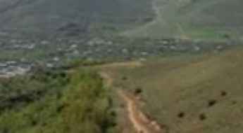
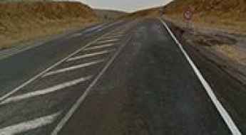
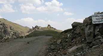
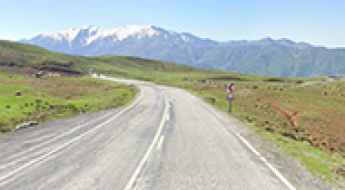
Straddling Europe and Asia, Turkey is one of the most exciting countries in the world to drive, and a must on any driver’s list. First on the list must be the challenging D915 (Bayburt-Of) Road. It stands as one of the world's most challenging roads, nestled between the Black Sea and the Northeast Anatolia regions. This road is for experts only.
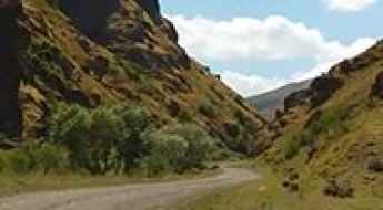
Covering an area of 783,356 square kilometers and sharing borders with eight countries, Turkey is home to about 200 roads listed as the most spectacular in the world. For the bravest drivers, the dangerous Kemaliye Stone Road above the Euphrates River is one of the most extreme roads in the world. This handmade road is for drivers with strong nerves only, with drops of hundreds of meters, unprotected by guardrails, and 38 unlit tunnels. The construction of the road started in 1870 and was finished in 2002. The road to Kus Yuvasi Pass will take your breath away. At 1,388m (4,553ft) above sea level, the pass is located in the Mediterranean Region of the country.
The Karabet Geçidi, at 2,994m (9,822ft) above sea level in Van Province, is one of Europe's highest paved roads, offering panoramic views. If the previous roads are not enough, the country is home to Gök Dağ, one of the highest roads in Europe, climbing up to 3,417m (11,210ft) above sea level. There are many construction companies established in Turkey that worked for building the new, better roads that attract many tourists each year.
Mount Artos: The brutal 3,225m volcanic climb in Van
Mount Artos, also known as Çadır Dağı, is a dormant volcano reaching an elevation of 3,225 meters (10,580 ft) above sea level in the Van Province of eastern Turkey. The raw, unpaved track climbing to the summit is one of the highest mountain roads of Turkey.
The road to Honaz Dağı is a chillout in high mountains
Honaz Dağı is a high mountain peak at an elevation of 2,519 m (8,264 ft) above sea level, located in the Denizli Province of Turkey. It’s one of the highest paved roads in the country.
A very bumpy, grueling road to Gulizar Tepe
Gülizar Tepe is a high mountain pass at an elevation of 2.928m (9,606ft) above sea level, located in Turkey. It’s one of the highest roads in the country.
Road trip guide: Conquering Karagol Lake in the Black Sea
Karagöl Dağı is a high mountain crater lake at an elevation of 2.620m (8,595ft) above sea level, located in the Giresun Province of Turkey.

Driving the high altitude track to Gül Tepe in eastern Turkey
Gül Tepe is a massive mountain pass that sits at 3,304 meters above sea level, deep in the Ağrı Province of eastern Turkey. This is a high-altitude grind that follows the border with Van, where the terrain is raw and the road is nothing more than a narrow ribbon of dirt and rock. Driving here means staying above the 2,000-meter mark for the entire journey, a reality that puts your engine under constant stress as the oxygen levels drop. It is a slow, technical climb where the mountain, not the driver, dictates the pace.
Mount Nemrut is a Fabulous Road if You Don’t Mind Heights
Nemrut Dagi is a high mountain pass at an elevation of 2,134m (7,001ft) above sea level, located in the Anatolia Region of Turkey. The drive to the top is fabulous if you don’t mind heights and steep roads!
A hairy high mountain unpaved road to Baltas Tepesi
Baltaş Tepesi is a high mountain pass at an elevation of 3,047 m (9,996 ft) above sea level, located in the Rize Province of Turkey. It’s one of the highest roads in the country.
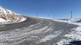
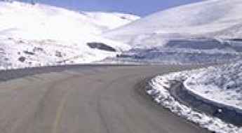
Driving the Stunning Paved Road to Erciyes Ski Resort in Kayseri Province
Erciyes Ski Center is a ski resort at an elevation of 2,220m (7,283ft) above sea level, located in Kayseri Province of Turkey.
Travel Guide to the Top of Marsis Mountain
Marsis Dağı is a high mountain pass with an elevation of 2,888m (9,475ft) above sea level, located in the Black Sea region of Turkey.
A paved road to the summit of Kolsuz Pass
Kolsuz Geçidi is a high mountain pass at an elevation of 1,514m (4,967ft) above sea level, located in Niğde Province, in Turkey.
How to get by car to Uzungol Plateau in the Black Sea region?
Uzungöl is a high mountain plateau at an elevation of 3,087m (10,127ft) above sea level, located in the Black Sea region of Turkey. It’s one of the highest roads in the country.
The wild 4x4 road to Ziyaret Dagi is not for timid drivers
Ziyaret Dağı is a high mountain pass at an elevation of 3,002m (9,849ft) above sea level, located in the Black Sea region of Turkey. It’s one of the highest roads in the country.
How to get by car to Karakaya Hill in Eastern Anatolia?
Karakaya Hill is a high mountain peak at an elevation of 3,148m (10,328ft) above sea level, located in Erzurum Province, Turkey. It’s one of the highest roads in the country.
Road trip guide: Conquering Mount Kosedag
Mount Kösedağ (Köse Dağı) is a high mountain peak at an elevation of 2,681m (8,795ft) above sea level, located in the Ağrı Province of Turkey.
Driving the high altitude Danakıran Road in Ağrı
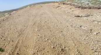
Danakıran Road is a brutal high-mountain track that cuts through the remote landscape of the Ağrı Province in eastern Turkey. Reaching an elevation of 2,961 meters, this is one of the highest roads in the country and a true test of a vehicle’s drivetrain. The path is entirely unpaved, consisting of a mix of loose volcanic soil and jagged rocks that can easily ruin a set of tires if you don't pick your line with extreme care. This is a journey through a barren, high-altitude desert where the mountain doesn't forgive mechanical failure.

An adventure road to Girdev Lake
Girdev Gölü is a seasonal lake situated at an elevation of 1,880m (6,167ft) above sea level, straddling the provinces of Muğla and Antalya in Turkey.
Driving the road to Ardici Tepe is not a piece of cake
Ardıçı Tepe is a high mountain peak at an elevation of 2.633m (8,638ft) above sea level, located in Erzurum Province, in the Eastern Anatolia Region of Turkey.
Karagöl Gölü: A High-Altitude 4x4 Road to the Bolkar Mountains
Karagöl Gölü is a stunning glacial lake situated at an elevation of 2,661m (8,730ft) above sea level in the Niğde Province of Turkey. Tucked away in the rugged Bolkar Mountains (part of the Central Taurus range), the journey to this lake is a legendary test for 4x4 enthusiasts.
Driving the wild unpaved road to Soğanlı Dagi Geçidi
Soğanlı Dagi Geçidi is a high mountain pass at an elevation of 2,763m (9,064ft) above sea level, located on the border of Trabzon and Bayburt provinces of Turkey. It’s one of the highest roads in the country.
How to Get by Car to Eastern Anatolia Observatory in Erzurum?
Doğu Anadolu Gözlemevi (Eastern Anatolia Observatory) is a ground-based astronomical observatory at an elevation of 3,139m (10,298ft) above sea level, located in Erzurum Province of Turkey. It’s one of the highest roads in the country.
A Road with Dangerous Drop-Offs to Sekersu Yaylasi
Şekersu Yaylası is a high mountain pass at an elevation of 2,497m (8,192ft) above sea level, located in Trabzon Province, Turkey.
What are the highest paved roads in Turkey?
Turkey is located at the crossroads of Europe and Asia, with land spanning both continents. Its diverse geography includes extensive mountain ranges, high plateaus, and rugged terrain. A look at a topographical map of the country shows that mountains dominate much of the landscape, especially in the eastern and southern regions. These elevations have led to the construction of several high-altitude roads, some of which are fully paved and accessible to vehicles. As a result, Turkey is home to some of the highest paved roads in the region, connecting remote villages, mountain passes, and strategic areas across the country.
The road to Kiskili Koyu isn’t an easy one
Kiskili Koyu is a high mountain peak at an elevation of 2,587m (8,487ft) above sea level, located in Bitlis Province, in eastern Turkey.
Driving the wild road to Apivanak Yaylasi
Apivanak Yaylası is a high mountain plateau at an elevation of 2,523m (8,277ft) above sea level, located in Rize Province of Turkey.
Road trip guide: Conquering Uzungol Yaylalari
Uzungöl Yaylaları is a high mountain pass at an elevation of 2,674 m (8,772 ft) above sea level, located in Trabzon Province, in Turkey.
How to Get by Car to Guzeldere Gecidi in Van Province?
Güzeldere Geçidi is a high mountain pass at an elevation of 2,763m (9,064ft) above sea level, located in Van Province, in Turkey.
The difficult road to Vercenik Yaylasi is for experienced drivers only
Verçenik Yaylası is a high mountain plateau at an elevation of 2,622m (8,602ft) above sea level, located on the eastern Black Sea coast of Turkey.
What You Need to Know About Driving the Road to Kazmadagi Pass in the Eastern Anatolia Region
Kazmadağı Pass is a high mountain pass at an elevation of 1,975m (6,479ft) above sea level, located in Muş Province in the Eastern Anatolia Region of Turkey.
Koycegiz Gecidi in Erzurum is an absolute must for road lovers
Köyceğiz Geçidi is a high mountain pass at an elevation of 2,301m (7,549ft) above sea level, located in Erzurum Province of Turkey.
Driving the rugged gravel road to Kaz Dağı (Mount Ida)
Kaz Dağı, historically known as Mount Ida, is a massive peak standing at 1,746 meters above sea level in the Balıkesir province of northwestern Turkey. Located within the Ida Mountain National Park, the road to the summit is a grueling 30.9-kilometer journey through dense forests and exposed rocky ridges. This is not a standard mountain drive; it is a raw gravel track where the elevation gain is relentless and the surface is often tortured by erosion and heavy winter snow. Driving here requires a vehicle with enough torque to handle the long climb and a cooling system that can cope with the sustained load of the ascent.
Conquering the defiant Durnalu Yaylasi in the Black Sea region
Durnalu Yaylası is a high mountain pass at an elevation of 2.625m (8,612ft) above sea level, located in the Black Sea region of Turkey.
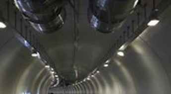
Avrasya Tuneli, built underneath the seabed of Bosphorus
The Eurasia Tunnel (Avrasya Tüneli) is a major double-deck undersea highway tunnel located in Istanbul, Turkey. The toll route runs beneath the seabed of the Bosphorus Strait, establishing a direct vehicular link between Kazlıçeşme on the European side and Göztepe on the Asian side of the city.
Driving the mountain road from Hayrangol to Cetinsu is not a piece of cake
Hayrangöl-Çetinsu Yolu is a high mountain road located in the Ağrı Province of Turkey.
Nemrut Caldera Road: How Extreme is This Eastern Turkey Mountain Drive?
Nemrut Caldera is a high mountain road reaching an elevation of 2,779 m (9,117 ft) above sea level. Located in Bitlis Province in eastern Turkey, the road ascends from the town of Tatvan, on the western shore of Lake Van, and winds its way toward Nemrut Seyir Tepesi.
How to drive the paved road to Tendurek Geçidi in eastern Turkey
Tendurek Geçidi is a high mountain pass at an elevation of 2.602m (8,536ft) above sea level, located in Turkey. It’s one of the highest paved roads of the country.
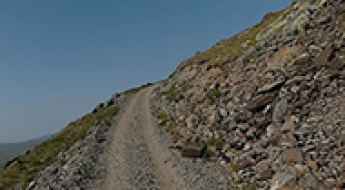
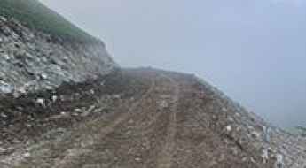
Tahir Gediği: Driving the 3,022m unpaved track in Erzurum
Tahir Gediği is a high mountain pass at an elevation of 3,022m (9,914ft) above sea level, located in the Erzurum Province of eastern Turkey. Situated southeast of the city of Erzurum, it is one of the highest mountain passes of Turkey. The road is a primitive, unpaved track that scales the southern ridges of the Palandöken Mountains, crossing a barren and high-altitude landscape.