What are the most spectacular roads in Turkey?
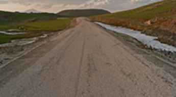
Straddling Europe and Asia, Turkey is one of the most exciting countries in the world to drive, and a must on any driver’s list. First on the list must be the challenging D915 (Bayburt-Of) Road. It stands as one of the world's most challenging roads, nestled between the Black Sea and the Northeast Anatolia regions. This road is for experts only.
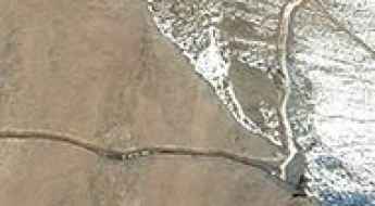
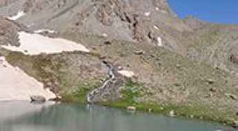
Covering an area of 783,356 square kilometers and sharing borders with eight countries, Turkey is home to about 200 roads listed as the most spectacular in the world. For the bravest drivers, the dangerous Kemaliye Stone Road above the Euphrates River is one of the most extreme roads in the world. This handmade road is for drivers with strong nerves only, with drops of hundreds of meters, unprotected by guardrails, and 38 unlit tunnels. The construction of the road started in 1870 and was finished in 2002. The road to Kus Yuvasi Pass will take your breath away. At 1,388m (4,553ft) above sea level, the pass is located in the Mediterranean Region of the country.
The Karabet Geçidi, at 2,994m (9,822ft) above sea level in Van Province, is one of Europe's highest paved roads, offering panoramic views. If the previous roads are not enough, the country is home to Gök Dağ, one of the highest roads in Europe, climbing up to 3,417m (11,210ft) above sea level. There are many construction companies established in Turkey that worked for building the new, better roads that attract many tourists each year.
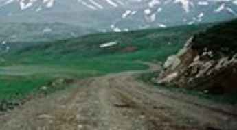
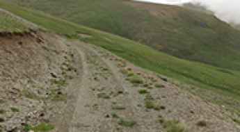
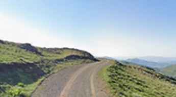
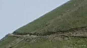
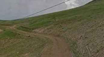
Driving the steep unpaved road to Spikor Geçidi
Spikor Geçidi, also known as Sipikör Geçidi, is a high mountain pass reaching 2,394 meters (7,854 ft) above sea level on the boundary between the provinces of Erzincan and Gümüşhane in Turkey. This is not a road for a casual road trip; it is a raw, unpaved mountain track that cuts through the high Anatolian ridges. Driving here means leaving the asphalt behind for 10.7 kilometers of loose soil, jagged rocks, and thin air where the weather can shift from sun to a blinding storm in minutes. It is a technical climb where the mechanical limits of your vehicle and your ability to choose the right line on a steep, unstable surface are the only things that matter.
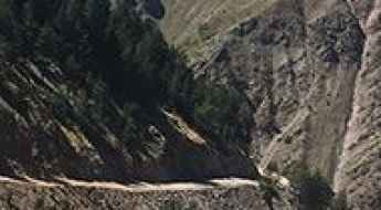
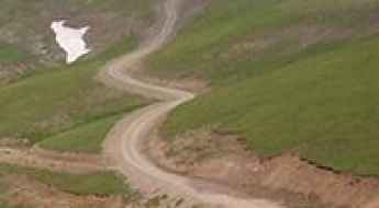
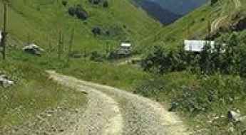
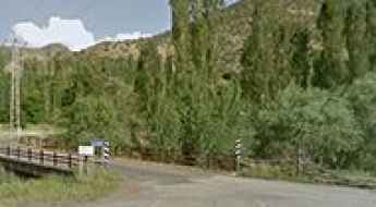
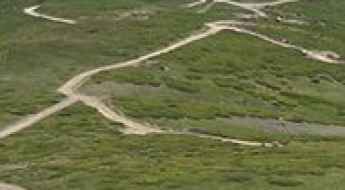
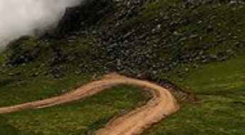
Olgunlar Yaylası-Hüngamek Road is recommended for drivers with strong nerves
Located in Artvin Province, on the Black Sea coast of Turkey, the road from Olgunlar Yaylası to Hüngamek is a very difficult drive. It’s one of the highest roads in the country.
Saç Dağı Geçidi
Saç Dağı Geçidi is a high mountain pass at an elevation of 2.207m (7,240ft) above the sea level, located in Ağrı Province at the eastern end of Turkey, near the border with Iran.
Take An Unforgettable Drive to Dadaş Geçidi
Dadaş Geçidi is a high mountain pass at an elevation of 2.357m (7,732ft) above the sea level, located in Erzurum Province in the Eastern Anatolia region of Turkey.
How to drive the unpaved road to Akdağ Tepesi?
Akdağ Tepesi is a high mountain pass at an elevation of 2,927m (9,603ft) above sea level, located in northeastern Turkey. Situated on the boundary between the Trabzon and Rize provinces, the road is one of the highest roads of Turkey. This primitive track crosses the high ridges of the Pontic Mountains, serving as a seasonal link between remote alpine villages.
Road to Limni Gölü: Driving the 9.31% Unpaved Track in Turkey
Located on the boundary between the Gümüşhane and Trabzon provinces in northeastern Turkey, Limni Gölü is a high mountain lake at an elevation of 2,407m (7,896ft) above sea level. The route to the lake is a technical mountain track that crosses the Pontic Mountains, providing access to the high-altitude alpine plateau.
How to drive the wild 4x4 road to Tobamızga Lake?
Tobamızga Gölü is a high mountain lake at an elevation of 2.720m (8,923ft) above sea level, located in Rize Province, in Turkey.
Kadırga Yaylası: The steep concrete climb in the Pontic Mountains
Kadırga Yaylası is a high mountain plateau at an elevation of 2,414 meters (7,919 ft) above sea level, situated on the boundary between Gümüşhane and Trabzon provinces in northeastern Turkey. The road to the summit is a technical ascent through the Pontic Mountains, recently upgraded with a concrete surface to handle the extreme erosion and mud of the region. The physical reality of driving to this plateau involves managing sustained high-altitude gradients on a narrow track where the traction on wet concrete becomes a critical factor for any vehicle.
Çatalören Geçidi: Driving the high-altitude D955 in Erzurum
Çatalören Geçidi is a high mountain pass at an elevation of 2,363 meters (7,752 ft) above sea level, located in the Erzurum province of eastern Anatolia, Turkey. Situated on the D955 highway, the pass is a critical logistical link in one of the highest and coldest regions of the country. The physical reality of driving this pass involves managing a wide but steep paved road where the engine's torque is tested by the altitude and the car is completely exposed to the violent weather systems of the Armenian Highlands.
Driving the steep unpaved road to Mount Hasan (Hasan Dağı) in Turkey
Mount Hasan (Hasan Dağı) is a massive extinct stratovolcano reaching an elevation of 1,974m (6,476ft) above sea level. Located in the Aksaray Province of central Turkey, the road to the summit area is a high-altitude climb that offers some of the most dramatic volcanic landscapes in Anatolia, characterized by its deep red soil and stark peak.
Road to Göksu Geçidi: Driving the 2,344m Paved Pass in Erzurum
Located in the Erzurum Province of eastern Turkey, Göksu Geçidi is a high mountain pass reaching an elevation of 2,344m (7,690ft) above sea level. Situated in the Eastern Anatolia region, the pass is a critical logistical link for regional transit, specifically for heavy vehicle traffic navigating between high-altitude districts under extreme weather conditions.
Seçedil Dağı: A high-altitude 4x4 track in Artvin Province
Seçedil Dağı is a remote high-altitude mountain pass at an elevation of 2,821 meters (9,255 ft) above sea level in the Artvin Province of northeastern Turkey. Located in the Şavşat District, near the border with Georgia, this unpaved mountain track climbs directly through the steep slopes and sharp ridges of the Pontic Alps. It is one of the highest mountain roads of Turkey.
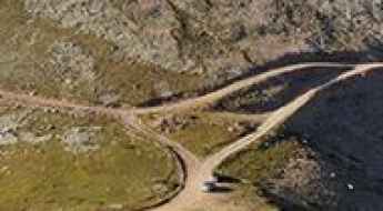
How to to drive the extreme unpaved road to Topuzdüzü Tepesi in Gümüşhane?
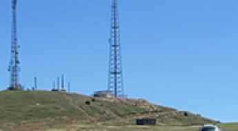
Topuzdüzü Tepesi is a high mountain peak at an elevation of 2,518m (8,261ft) above sea level, located in the Gümüşhane Province of Turkey. The 5.2 km road to the communication tower at the summit is a steep gravel path with a 14.63% average gradient.
How to drive the unpaved road to Tekfur Tepesi?
Tekfur Tepesi is a high mountain pass at an elevation of 3.075m (10,088ft) above sea level, located in Rize Province of Turkey. It’s one of the highest roads in the country.
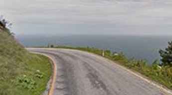
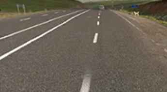
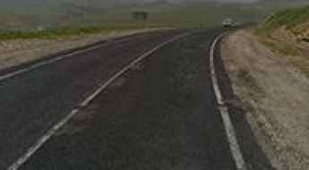
How to drive the scenic coastal road from Cide to Kastamonu?
Located in the Black Sea region of Turkey, the drive from Cide to Kastamonu, part of the D010 road, is said to be one of the World’s Most Scenic Drives. The journey winds around the rocky hills and perfectly blue sea.
A high mountain road from Zeyrek to Aşağı Özbağ
Located in the Erzurum Province of the Eastern Anatolia region of Turkey, a high mountain road from Zeyrek to Aşağı Özbağ tops out at 2.701m (8,861ft) above the sea level.
How to drive the unpaved road to Kalkanlı Dağları in the Black Sea region
Kalkanlı Dağları is a high mountain pass at an elevation of 2,597m (8,520ft) above sea level, located in Turkey’s Black Sea region.
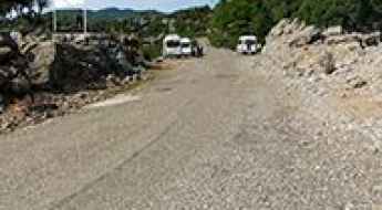
Selge Road
The ancient Roman city of Selge lies at an elevation of 1.000m (3,280ft) above the sea level, in the District of Manavgat, Antalya Province, in Turkey.
Driving the steep high altitude track to Polot Tepesi
Polot Tepesi is a high-altitude summit reaching 2,862 meters on the rugged border between the Trabzon and Gümüşhane provinces in Turkey. The track to the top is a raw, unpaved mountain path that serves as a brutal reminder of the technical driving required in the Pontic Mountains. This is a journey through a high-alpine environment where the road is nothing more than a bumpy ribbon of loose stone and dirt, constantly exposed to the shifting weather of the Black Sea region.
Kurubaş Geçidi
Kurubaş Geçidi is a high mountain pass at an elevation of 2.236m (7,335ft) above the sea level, located in eastern Turkey's Van Province.
Driving the high altitude track to Köse Dağı in Sivas
Köse Dağı is a massive peak that reaches an elevation of 2,932 meters in the Sivas province of eastern Turkey. This is one of the highest tracks in the country, sitting right on the rugged boundary with Erzincan. The road to the summit is a raw mountain path that was never intended for anything but serious off-road machinery. It is a slow, grinding climb through a landscape of barren rock and high-altitude scree where the air is thin and the terrain is constantly shifting due to the extreme weather that hits this part of Turkey for most of the year.
How to drive the paved road to Çakırbaba Geçidi in Erzurum?
Çakırbaba Geçidi is a high mountain pass at an elevation of 2.407m (7,896ft) above sea level, located in Erzurum Province of Turkey.
Mount Karadag in Karaman: The Ultimate Road Trip Guide
Mount Karadag, the Black Mountain, is an extinct volcano at an elevation of 2.267m (7,437ft) above the sea level, located in Karaman Province, in Central Anatolia, Turkey.
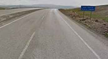
Driving the high altitude Ipek Geçidi in eastern Turkey
Ipek Geçidi is a high mountain pass that reaches an elevation of 2,025 meters in the Ağrı Province, at the easternmost edge of Turkey. Sitting on the D100 highway, which forms part of the European E80 route, this pass is one of the most critical transit points for heavy goods moving between Europe and Iran. While the road is fully asphalted, the high altitude and the extreme weather of eastern Anatolia make it a technical challenge for any vehicle, especially during the long winter months when the asphalt turns into a sheet of ice.
How to drive the paved road to Yukarıkent Geçidi in Eastern Anatolia
Yukarıkent Geçidi is a high mountain pass at an elevation of 2.423m (7,949ft) above sea level, located in the Eastern Anatolia Region of Turkey.
Driving the brutal unpaved road to Büyükagara Lake in Artvin
Büyükagara Lake is a high-altitude alpine lake at an elevation of 2,688 meters (8,818 ft) above sea level, located in the Artvin Province of the Black Sea region in Turkey. Tucked into the steep Kaçkar Mountains, the lake is accessed via a steep, unpaved mountain track climbing from the deep valleys of the area.
Driving the rough and slow unpaved road to Sağrak Gölü
Sağrak Gölü is a high-altitude crater lake sitting at 2,659 meters above sea level in the Dereli district of Giresun Province, Turkey. Located in the rugged Black Sea Region, the road to this alpine basin is a primitive track that separates casual tourists from serious mountain drivers. This isn't a road to be taken lightly; it is a 7.7-kilometer stretch of rough gravel and loose dirt where the average speed drops to walking pace. Driving here means committing your vehicle to a constant grind through the Purcell-like peaks of northeastern Turkey, where the isolation is total and the mechanical strain is unrelenting.
Artabil
Artabil is a high mountain peak at an elevation of 2.891m (9,484ft) above the sea level, located in Gümüşhane Province in the Black Sea region of Turkey.
Ilgaz Dağı is pure adventure in Turkey
Ilgaz Dağı is a high mountain peak at an elevation of 2.321m (7,614ft) above sea level, located in Kastamonu Province, in Turkey.
How difficult is the steep gravel road to Kavakdağı Tepesi in Turkey?
Kavakdağı Tepesi is a high mountain peak reaching an elevation of 2,428m (7,965ft) above sea level in the Erzurum Province of Eastern Anatolia. The climb to the summit is a short but brutal transition from the main highways into the raw, unmaintained terrain of the Turkish highlands. The track is a rugged gravel path that serves as a secondary access route, where the thin air and the loose surface turn a simple drive into a test of traction and mechanical limits for any vehicle attempting the ascent.
Süvarihalil Geçidi
Süvarihalil Geçidi is a high mountain pass at an elevation of 2.442m (8,011ft) above the sea level, located in the Hakkâri Province of Turkey, a few kilometres away from the Iraq-Turkey border.
How to drive the paved road to Boğatepe Geçidi?
Boğatepe Geçidi is a high mountain pass at an elevation of 2,353m (7,719ft) above sea level, located in the Eastern Anatolia region of Turkey.
The Ultimate Road Trip To Seyithan Lake
Seyithan Gölü is a high mountain glacial lake at an elevation of 3.298m (10,820ft), located in Hakkâri province of Turkey. It’s one of the highest roads of the country.
How To Travel The Palovit-Trovit Road
Located in the Rize Province of the Black Sea region of Turkey, the unpaved road from Palovit to Trovit is one of the highest roads of the country.
Can I drive the unpaved road to İkizkaya Tepesi?
İkizkaya Tepesi is a high mountain pass at an elevation of 2.726m (8,943ft) above sea level, located in Artvin Province, in Turkey.
A Most Tricky Scenic Road to Samistal Plateau
Samistal is a high mountain plateau at an elevation of 2.838m (9,311ft) above the sea level, located in the Çamlıhemşin district of Rize province, in Turkey.