What are the most spectacular roads in Turkey?
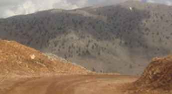
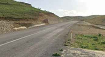
Straddling Europe and Asia, Turkey is one of the most exciting countries in the world to drive, and a must on any driver’s list. First on the list must be the challenging D915 (Bayburt-Of) Road. It stands as one of the world's most challenging roads, nestled between the Black Sea and the Northeast Anatolia regions. This road is for experts only.
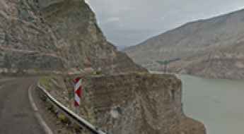
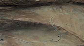
Covering an area of 783,356 square kilometers and sharing borders with eight countries, Turkey is home to about 200 roads listed as the most spectacular in the world. For the bravest drivers, the dangerous Kemaliye Stone Road above the Euphrates River is one of the most extreme roads in the world. This handmade road is for drivers with strong nerves only, with drops of hundreds of meters, unprotected by guardrails, and 38 unlit tunnels. The construction of the road started in 1870 and was finished in 2002. The road to Kus Yuvasi Pass will take your breath away. At 1,388m (4,553ft) above sea level, the pass is located in the Mediterranean Region of the country.
The Karabet Geçidi, at 2,994m (9,822ft) above sea level in Van Province, is one of Europe's highest paved roads, offering panoramic views. If the previous roads are not enough, the country is home to Gök Dağ, one of the highest roads in Europe, climbing up to 3,417m (11,210ft) above sea level. There are many construction companies established in Turkey that worked for building the new, better roads that attract many tourists each year.
Driving the bumpy, grueling road to Kemalan Hill
Kemalan Tepesi is a high mountain pass at an elevation of 3.451m (11,322ft) above sea level, located in Hakkâri Province, in Turkey. It’s one of the highest roads in the country.
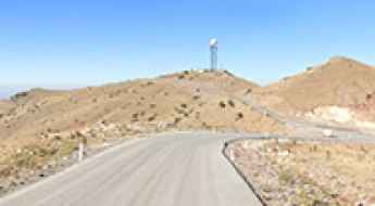
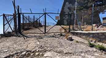
Driving to Elma Dagi: Abandoned NATO Antennas and Cold War Relics
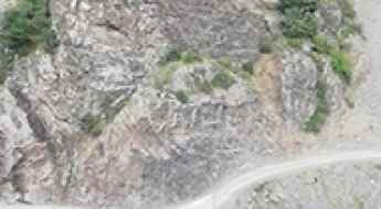
Elma Dağı (Mount Elma) is a high mountain peak at an elevation of 1,857m (6,092ft) above sea level, located in the Ankara Province of Turkey.
Road trip guide: Conquering Cankurtaran Gecidi in Ardahan province
Cankurtaran Geçidi is a high mountain pass at an elevation of 2,150m (7,053ft) above sea level, located in Ardahan Province, in the Eastern Anatolia region of Turkey.
Driving the extreme 4x4 road to Koç Tepesi in Hakkâri
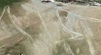
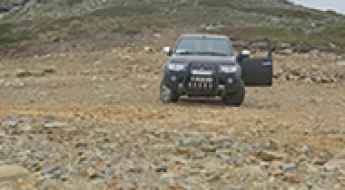
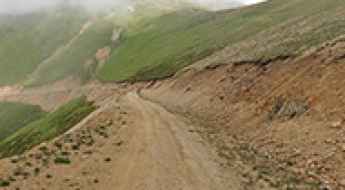
Koç Tepesi is a massive mountain pass sitting at an elevation of 3,069 meters (10,068 ft) above sea level in the Hakkâri Province of southeastern Turkey. This is not just a high point on a map; it is one of the highest mountain roads in Turkey. The track to the summit is a raw, unpaved ribbon of earth that defies the jagged peaks near the Van border. Driving here means committing your vehicle to a high-altitude world where the air is thin, the ground is unstable, and the isolation is absolute. This is a technical ascent that demands a well-prepared 4x4 and a driver who knows how to manage a motor at the limits of its oxygen intake.
Ultimate 4wd destination: Mount Mevzi
Mevzi Dağı is a high mountain peak at an elevation of 2.984m (9,790ft) above sea level, located in Turkey. It’s one of the highest roads in the country.
Ziyarettepe Pass: Driving the Paved D.300 Highway in Turkey
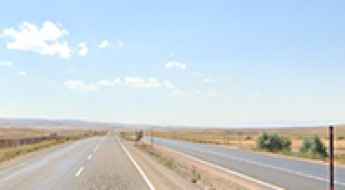
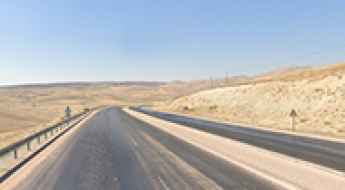
Ziyarettepe Pass, known locally as Ziyarettepe Geçidi, is a high mountain pass at an elevation of 1,887 meters (6,190 ft) above sea level, located right on the provincial border between Kayseri and Sivas in Central Anatolia, Turkey. Traversed by the paved State Road D.300, this high-altitude highway segment forces drivers to face extreme winter blizzards, sudden black ice sheets, and heavy frozen mountain winds.
The Military Unpaved Road to Mount Kandil in Hakkari Province
Kandil Dağı is a high mountain peak at an elevation of 3,456m (11,338ft) above sea level, located in the Yüksekova District of Turkey. It’s one of the highest roads in the country.
Driving the challenging 4x4 road to Mengene Mountain
Mengene Dağı is a high mountain peak at an elevation of 3.176m (10,419ft) above sea level, located in Van Province, in Turkey. It’s one of the highest roads in the country.
Driving the deadly road to Pirinkayalar Pass
Pirin Kayalar Geçidi is a mountain pass at an elevation of 1,122m (3,681ft) above sea level, located in the Erzurum province of eastern Anatolia, in Turkey.
A memorable road trip to Akoren Gecidi in Erzurum
Akören Geçidi is a high mountain pass at an elevation of 2,105m (6,906ft) above sea level, located in Erzurum Province, Turkey.
Buyuk Hacet Tepesi: The Ultimate Road Trip Guide
Büyük Hacet Tepesi is a high mountain peak at an elevation of 2.573m (8,441ft) above sea level, located in Kastamonu Province, Turkey.
How to Drive the Challenging D955 Road in Turkey?
D955 is a challenging mountain road located in the eastern part of Turkey, with many mountain passes with an altitude above 2000m.
How to drive to Anamas Plateau in the Taurus Mountains?
Reaching the Anamas Plateau (Anamas Yaylası) is a journey into the rugged, high-altitude wilderness of the Taurus Mountains. At 2,000m (6,500ft) above sea level, this Mediterranean plateau in Isparta Province is far from the paved tourist tracks. The route, known locally as the Çayır Plateau Road (Çayır Yaylası Yolu), is a relentless climb where the asphalt disappears and the real driving begins. It’s a road that demands respect, a steady gear, and a vehicle that won't complain when the stones start hitting the undercarriage.
Driving the steep mountain track to Aktas Tepe in Marmara
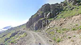
Aktaş Tepe is a high-altitude challenge that towers over the Bursa Province in northwest Turkey. Reaching the summit at 2,227 meters means tackling a rugged mountain track that was never designed for comfort. Formerly known as Kıran Hill, this peak is the highest point in the Marmara region, and the road up there is a relentless grind of loose stones, deep ruts, and sharp turns. This is a remote climb where the mountain doesn't forgive mechanical weaknesses or poor planning, especially when the weather turns and the forest starts to reclaim the path.
Ziyeret Pass: Driving the 101km High-Altitude Road on D.300
Reaching a peak elevation of 1,933m (6,341ft), Ziyeret Pass (Ziyeret Geçidi) is the primary high-altitude crossing on the D.300 State Road in Central Anatolia. Situated south of Ziyarettepe, it serves as the geographical apex for long-distance transit between the provincial seats of Kayseri and Sivas.
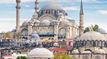
Turkey: A Land of Timeless Wonders and Tailor-Made Adventures
Turkey has a history and stunning natural features, ancient ruins, beautiful seashores, and intensive bazaars in the cities located on the borders of Europe and Asia. The Country's landscape can be described as diverse, ranging from the city skyline adorned with minarets to the otherworldly feeling of Cappadocia. However, to reveal the essence of this fascinating country, it is necessary to go on a tour that will be interesting for you.
Is the 4x4 road to Dikenli Dağı in Erzurum Province difficult?
Dikenli Dağı is a high-altitude mountain peak reaching 2,794m (9,166ft) above sea level in the Erzurum Province of northeastern Turkey. Located in the Eastern Anatolia Region, this summit is accessed via a brutal mountain track that tests the suspension and the clearance of any vehicle. It is a remote, unpaved route where the lack of maintenance and the harsh Anatolian weather have created a landscape of rocks and deep ruts that only the most capable off-road vehicles can handle.
How to get by car to Pusur Dagi?
Puşur Dağı is a high mountain pass at an elevation of 2,755 m (9,038 ft) above sea level, located in Turkey.
How to drive the wild unpaved road to Uzengili Plateau?
Üzengili Yaylası is a high mountain plateau at an elevation of 2,535m (8,316ft) above sea level, located on the border of Trabzon and Bayburt provinces of Turkey.
Driving the high altitude Pasli Geçidi on the D965 road
Pasli Geçidi is a high mountain pass reaching an elevation of 2,020 meters in the Kars Province of eastern Turkey. Sitting on the D965 highway, this pass is a critical link between the high plateaus of Kümbetli and the deep valleys of Kağızman. While the road is fully paved, it is far from a standard highway drive; it is a route of extremes where the smooth asphalt of the plains quickly gives way to steep, broken sections that test the cooling systems and brakes of any vehicle crossing the Eastern Anatolia region.
Driving the paved road to Kovalik Geçidi in Erzincan
Kovalik Geçidi is a high mountain pass reaching an elevation of 2,004 meters (6,574 ft) above sea level in the Erzincan Province of northeastern Turkey. While the road through the pass has been fully paved since 2017, do not let the fresh asphalt fool you; this is a high-altitude climb through the rugged Anatolian landscape where the weather and the steep gradients demand respect. Serving as a vital link in the region, Kovalik is the civilized prelude to the much more aggressive and unpaved Sipikör Geçidi, where the pavement ends and the real technical driving begins.
Driving the Salmankaş Geçidi: Three eras of a Turkish mountain pass
Salmankaş Geçidi is a high mountain pass located on the boundary between the provinces of Gümüşhane and Bayburt in northeastern Turkey. Situated in the rugged Pontic Mountains, this pass has historically served as a vital link for caravans and military routes between the Black Sea coast (Trabzon and Araklı) and Eastern Anatolia. Today, Salmankaş is a rare geographical case where three distinct generations of engineering coexist: an ancient 10km gravel shortcut, a winding 18km paved road, and a modern 4.1km twin-tube tunnel, with elevations ranging from 2,280m to 2,373m depending on the chosen route.
How to drive the steep road to the Tap Tepe transmitter in Kars
Tap Tepe is a high-mountain peak at an elevation of 2,367 meters above sea level, located in the Kars Province of Turkey.
How to drive the unpaved road to Ayşe Nur Dağı in Van?
Ayşe Nur Dağı is a high mountain pass at an elevation of 2,927 meters (9,603 ft) above sea level, located in the Van Province of Turkey. It is one of the highest roads of Turkey.
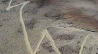
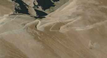
Can you drive the 24 hairpin turns to Sarıç Dağı in Gümüşhane?
Sarıç Dağı is a high mountain peak at an elevation of 2,100m (6,889ft) above sea level, located in the Gümüşhane Province of Turkey. The 8.6 km ascent is a primitive unpaved road cut into the cliffside, featuring 24 sharp hairpin turns and vertical drops of over 300 meters.
How to drive the unpaved road to the TRT Vericisi İstasyonu at Sarıçınar Dağı?
Sarıçınar Dağı is a high mountain peak at an elevation of 1.788m (5,866ft) above sea level, located in Antalya Province, in Turkey.