What are the most spectacular roads in Canada?
Located in the northern part of North America, Canada -the second-largest country in the world- hosts many challenging drives, with more than 100 roads listed as the most spectacular worldwide. With mountains, lakes, rivers and coasts, the country has roads for every driver.
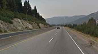
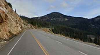
If you’re up for a scenic drive, the Icefields Parkway in the Canadian Rockies is a must do. Located in Alberta province, the road through big mountains, glaciers, and deep blue lakes is one of the most scenic drives in the world. But due to the geography of the country, you can tackle some challenging roads, such Coquihalla Highway, one of the worst roads in winter. In spring, summer, or fall, it's a breeze, but in winter, there are at least 400-500 accidents and plenty of fatalities.
If you’re up for a lifetime adventure, try the Trans-Labrador Highway, one of the world's most epic and remote road trips. Located in the province of Newfoundland and Labrador, most of the road features a well-packed asphalt/gravel surface, but along the route, drivers will experience sharp curves, winding parts, narrow bridges, and steep grades. And a very scenic yet difficult drive is the Bella Coola Road in British Columbia. It’s a 454-kilometer drive known for its steep grades and scenic views through a very diverse landscape.
Top 12 most dangerous highways of Canada
Whether it is potholes, traffic congestion, or deteriorated pavement, many of Canada’s highways are in serious need of improvement.
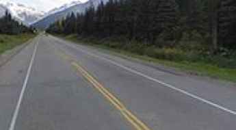
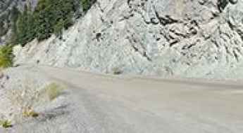
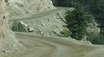
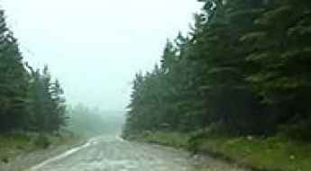
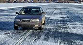
Coquihalla Highway is one of the worst roads in winter
Coquihalla Highway is an extreme freeway located in British Columbia, Canada's westernmost province. It’s one of the worst roads in all of North America during winters. There were 32 fatal crashes between 2004 and 2013 (according to ICBC). In spring, summer, or fall, it's a breeze, but in winter, there are at least 400-500 accidents and plenty of fatalities.
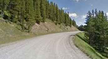
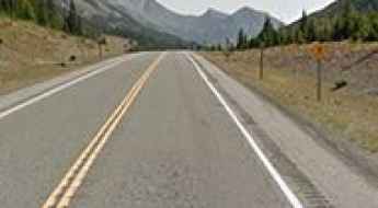
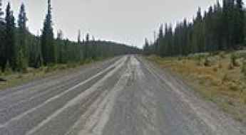
Explore the Scenic Beauty of Alberta Provincial Highway 40
Alberta Provincial Highway 40 offers a highly picturesque drive through western Alberta, Canada. Various segments of the road feature a combination of paved and gravel sections.
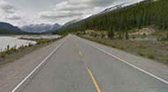
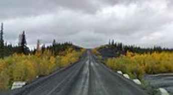
Trans-Labrador Highway: Driving the world’s most remote paved wilderness
The Trans-Labrador Highway (TLH) is one of the world's most epic and remote road trips. Stretching across the rugged wilderness of Newfoundland and Labrador in eastern Canada, this highway was once feared for its sharp gravel and car-destroying potholes. After decades of construction, the Trans-Labrador Highway is now completely paved. While the final seal was completed in 2022, it remains one of the world's most remote and challenging driving experiences, where the luxury of asphalt meets the raw danger of the Canadian wilderness.
Driving the treacherously steep Bella Coola Road in British Columbia
Bella Coola Road is a 454-kilometer drive in British Columbia, Canada, linking Bella Coola and Williams Lake. Known for its steep grades, this scenic route takes you through diverse landscapes, from desert canyons near the Fraser River to glaciated peaks.
What are the highest roads in Canada?
Located in the northern part of North America, Canada is the second-largest country in the world, defined by colossal scale and breathtaking mountain grandeur. The nation’s most dramatic topography lies in the west, where the colossal Canadian Rockies dominate Alberta’s border and the rugged Coast and Columbia ranges extend across the entirety of British Columbia. These towering regions are studded with ancient glaciers, crystalline lakes, and vast canyons.
Driving the Icefields Parkway in the Canadian Rockies
Located in the Alberta province of Western Canada, Icefields Parkway is the name of a very rewarding drive through big mountains, glaciers, and deep blue lakes. It’s one of the most scenic drives in the world.
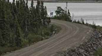
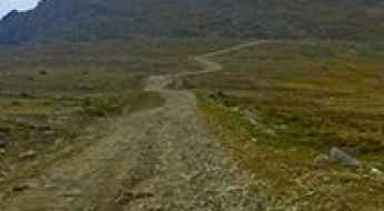
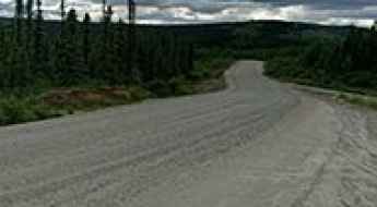
Trans-Taiga Road is a very remote drive in Canada
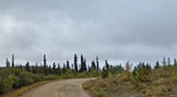
The Trans-Taiga Road, a 666km stretch in northern Quebec, Canada, connects the James Bay Road to the Caniapiscau Reservoir. This unpaved road, devoid of towns, serves as the most remote accessible location by car in North America.
Heckman Pass: gradients of 18%, no guardrails and sheer drop-offs
Heckman Pass is a high mountain pass at an elevation of 1.524m (5,000ft) above sea level, located in west-central British Columbia, Canada.
Dempster Highway is a Top Canadian Drive to the Arctic
Running across miles of desolate Arctic landscape in Canada, Dempster Highway is the only all-weather road to cross the Arctic Circle.
Driving the legendary Alaska Highway is a lifetime experience
The Great Alaska Highway connects America’s most isolated state with the lower 48. Constructed during World War II it serves as one of the few options to get up north to the Final Frontier without getting on a boat or plane. While driving up to Alaska sounds easy enough, this long voyage is not one to be underestimated.
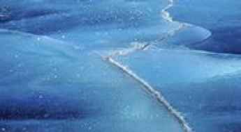
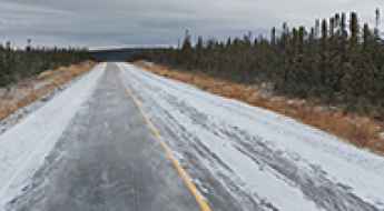
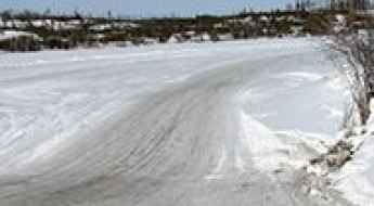
Dettah Ice Road is a cold highway in the Northwest Territories
Dettah Ice Road is located in the North Slave Region of the Northwest Territories, Canada. This ice road connects Yellowknife and the small community of Dettah in the winter through the Great Slave Lake.
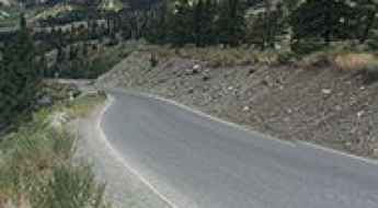
Smith Dorrien Trail is a dusty scenic drive of Canada
Smith Dorrien Trail is the name of a very scenic drive located in Kananaskis, in the Alberta province of Canada. It's one of the highest roads in the country.
Kootenay Pass is an awe-inspiring route in Canada
Kootenay Pass is a high mountain pass, situated at an elevation of 1,782m (5,846ft) above sea level, located in the province of British Columbia, Canada.
Highwood Pass is the highest paved road of Canada
Highwood Pass is a high mountain pass at an elevation of 2,217m (7,273ft) above sea level, located in Kananaskis Country, in the Alberta province of Canada. It’s said to be the highest paved road in the country.
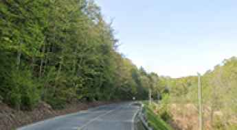
Driving the Curvy Forks of The Credit Road
Forks of The Credit Road is a very scenic yet curvy drive, located in Caledon, in the Regional Municipality of Peel in the Greater Toronto Area of Ontario, Canada.
Travel guide to the top of Grey Creek Pass in Canada
Grey Creek Pass is a high mountain pass at an elevation of 2.083m (6,833ft) above sea level located in the Regional District of East Kootenay, in the Canadian province of British Columbia. It's one of the highest roads in Canada.
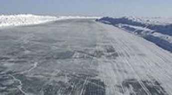
Tibbitt to Contwoyto Winter Road is the world’s longest heavy haul ice road
Tibbitt to Contwoyto Winter Road is an ice road located in the Northwest Territories and Nunavut in Northern Canada. The road, named after the first and the last lakes on the ice road, was built for the first time in 1982. It is a supply route for several gold and diamond mines in the Canadian arctic.
Princeton Summerland Road is a drive with superb views in BC
Princeton Summerland Road is a very scenic drive located in British Columbia, Canada. It’s a good ride with some nice corners and scenery.
Fort Chipewyan Winter Road crosses breathtaking landscapes in Alberta
Fort Chipewyan Winter Road is the name of an ice road running through some of the most breathtaking landscapes in all Alberta, in Canada.
Tuktoyaktuk Winter Road closed permanently on April 2017
Tuktoyaktuk Winter Road was an ice road in the Northwest Territories of Canada, running across the frozen Mackenzie River and the Arctic Ocean. It was one of the world's northernmost roads.
The journey is the destination along the Anticosti Island Road
Route de l'Île d'Anticosti (also known as Henri-Menier Road or Transanticostienne Road) is a very scenic drive on Anticosti Island, in Canada. It’s the island's unpaved main road.
Yoho Valley Road is a steep, narrow drive with intense hairpin turns in BC
Yoho Valley Road is a very scenic journey located in British Columbia, Canada's westernmost province. It’s closed from October to June.
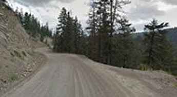
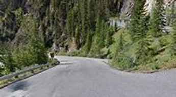
Highway 40 is a treacherous road in the heart of BC
Highway 40 is a delightful yet challenging drive located in the heart of British Columbia, Canada. The drive is suitable for all vehicles, but expect some narrow sections with 11%-13% grade switchbacks.
Canoe Mountain is a truly outstanding SUV adventure in Canada
Canoe Mountain is a high mountain peak at an elevation of 2,628m (8,622ft) above sea level, located in east-central British Columbia, Canada. It’s one of the highest roads in the country.
Coquihalla Summit in BC is a chillout in high mountains
Coquihalla Summit is a mountain pass at an elevation of 1,249m (4,097ft) above sea level, located in British Columbia, Canada's westernmost province.
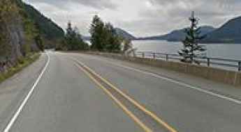
How to drive the Sea to Sky Highway from Vancouver to Whistler?
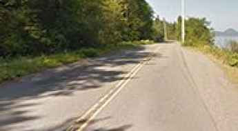
Sea to Sky Highway is a picturesque cliffside roadway offering access to the most beautiful scenery in British Columbia, Canada. It’s one of the world's most spectacular seaside drives and is a veritable invitation for a road trip.
Route 389 is an awe-inspiring road through remote areas of Canada
The Quebec Provincial Highway 389 is a very challenging drive linking the province of Quebec with Newfoundland and Labrador, the most easterly province of Canada. In places, it is narrow and twisty. There are few services.
Duffey Lake Road (Whistler to Lillooet) is a great summer drive in BC
Located in British Columbia, Canada, Duffey Lake Road (Highway 99) is a very scenic and less travelled road trip.
Cabot Trail is one of the most famous coastal roads of Canada
Cabot Trail in Nova Scotia, Canada, is one of the most scenic drives in the world. This scenic roadway straddles northern Victoria County and Inverness County on Cape Breton Island, in the Canadian province of Nova Scotia. The Cabot Trail is more than a magnificent world-renowned drive – it is an experience… One to delight in… one to be savoured.
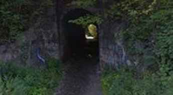
The Haunted Screaming Tunnel of Niagara Falls
Located on the northwestern corner of Niagara Falls, in the Canadian province of Ontario, the Screaming Tunnel is a small limestone tunnel that has garnered a reputation as one of the Top Haunted Roads in the world. Local legend has it that the tunnel is haunted by the ghost of a young girl who met a tragic end there. This legend, combined with the eerie atmosphere of the tunnel, attracts curious visitors and paranormal enthusiasts alike.
The journey is the destination along the scenic Thousand Islands Parkway of Canada
Thousand Islands Parkway is a very scenic drive with stunning views located in the Ontario province of Canada.
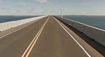
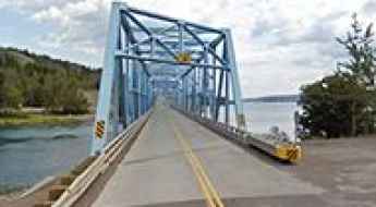
Confederation Bridge is the world's largest bridge over icy waters
Located in Canada, Confederation Bridge is eight miles long and stretches over very, very cold water. It’s one of the most spectacular bridges in the world.
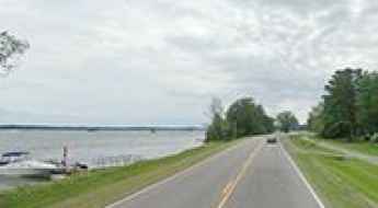
Riverhurst Crossing is a Canadian ice road
Riverhurst Crossing is an ice road constructed each year at Riverhurst, allowing vehicles to cross Lake Diefenbaker, a reservoir and bifurcation lake in the Canadian province of Saskatchewan.
Top of the World Highway is one of the world's top drives
The remote Top of the World Highway is a very scenic drive between Canada and the U.S. state of Alaska. Built in 1955, the winding road is only open during the summer months.
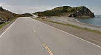
Pacific Rim Highway: experience the romantic isolation of the region
Located on Vancouver Island in the province of British Columbia, Canada, the Pacific Rim Highway is a very scenic drive. Along the way, you can experience the iconic isolation of the area.