What are the most spectacular roads in Canada?
Located in the northern part of North America, Canada -the second-largest country in the world- hosts many challenging drives, with more than 100 roads listed as the most spectacular worldwide. With mountains, lakes, rivers and coasts, the country has roads for every driver.
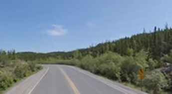
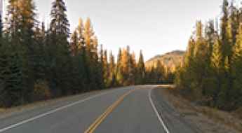
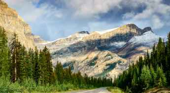
If you’re up for a scenic drive, the Icefields Parkway in the Canadian Rockies is a must do. Located in Alberta province, the road through big mountains, glaciers, and deep blue lakes is one of the most scenic drives in the world. But due to the geography of the country, you can tackle some challenging roads, such Coquihalla Highway, one of the worst roads in winter. In spring, summer, or fall, it's a breeze, but in winter, there are at least 400-500 accidents and plenty of fatalities.
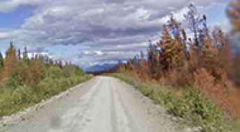
If you’re up for a lifetime adventure, try the Trans-Labrador Highway, one of the world's most epic and remote road trips. Located in the province of Newfoundland and Labrador, most of the road features a well-packed asphalt/gravel surface, but along the route, drivers will experience sharp curves, winding parts, narrow bridges, and steep grades. And a very scenic yet difficult drive is the Bella Coola Road in British Columbia. It’s a 454-kilometer drive known for its steep grades and scenic views through a very diverse landscape.

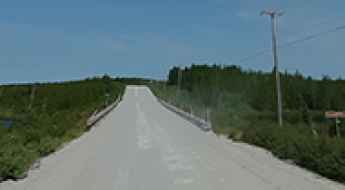
Murtle River bridge
Located in British Columbia, Canada, it’s a picturesque bridge with some good views of the Murtle River. It’s one of the most spectacular bridges in the world.
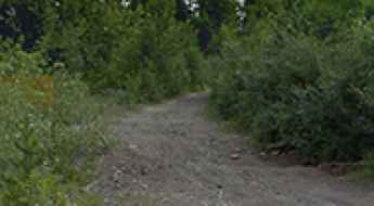
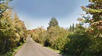
Driving the scenic Ingraham Trail in Yellowknife
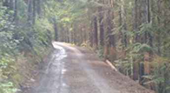
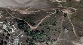
Located in the Northwest Territories of Canada, the scenic Ingraham Trail is a road to adventure just out of Yellowknife, running to Tibbit Lake at the end of the trail.
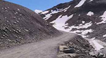
Baldy Rocks
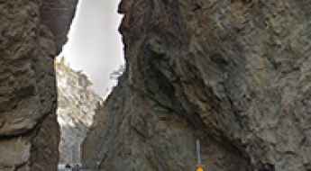
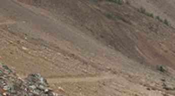
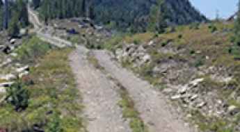
Baldy Rocks is a high mountain pass at an elevation of 1.975m (6,479ft) above the sea level, located in the Selkirk Mountains, British Columbia, in western Canada.
How to Survive and Journey through the Remote Nahanni Range Road
Nahanni Range Road is the name of a very remote drive that starts in the Yukon and ends in the Nortwest Territories of Canada. General public travel is not advised.
Travel Guide to Tiara Peak
Tiara Peak is a high mountain peak located in the front ranges of Kananaskis Country, in the heart of Alberta, Canada. A minor gravel road, east of the summit, climbs up to 1.885m (6,184ft) above the sea level.
Take the Scenic Route and Discover Nancy Greene Summit in BC
Nancy Greene Summit is a high mountain pass at an elevation of 1.581m (5,187ft) above sea level, located in British Columbia, Canada's westernmost province.

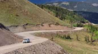
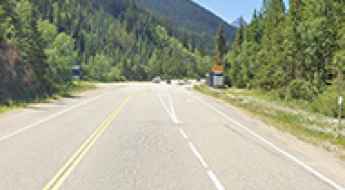
How to drive the scenic British Columbia Highway 93?
Highway 93 is a north-south route that runs through the southeastern part of British Columbia, connecting with U.S. Highway 93 at the Canada-U.S. border. It follows the Crowsnest Highway (Highway 3) and Highway 95, passing through Radium Hot Springs, and crosses the Continental Divide into Alberta at Vermilion Pass, where it continues as Alberta Highway 93.
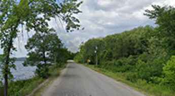
How To Have The Ultimate Road Trip To Levette Lake in BC
Levette Lake is a blue mountain lake through the trees located in Squamish-Lillooet Regional District, in the province of British Columbia, in Canada.
Top Canada Road Trips To Enjoy When On Vacation!
Driving across Canada involves navigating vast distances through diverse geological zones, from the high-altitude passes of the Rockies to the permafrost tracks of the Arctic. Logistical success on these routes depends on precise timing regarding seasonal closures, understanding the mechanical demands of isolated highways, and managing fuel supplies in territories where service stations can be separated by hundreds of kilometers.
Canada’s Open Roads: The Ultimate Guide to Thrilling Road Trips
When it comes to embarking on a road trip adventure, few countries offer the diversity and beauty that Canada does. With its vast landscapes, pristine wilderness, and well-maintained highways, Canada is a road-trippers paradise. We'll take you on a journey through some of the most awe-inspiring Canada’s open roads, sharing tips, insights, and must-visit destinations along the way.
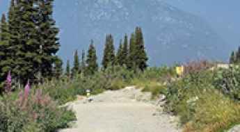
Take the Scenic Route and Discover Sinclair Pass in BC
Sinclair Pass is a mountain pass at an elevation of 1.486m (4,875ft) above the sea level, located in British Columbia, Canada's westernmost province.
Route du Nord is a very remote road with little traffic in Quebec
Located in the James Bay territory, in the central part of Quebec, in Canada, Route du Nord (North Road) is a very defiant road not really intended for regular traffic.
Adventure along the wild road to Little White Mountain in BC
Little White Mountain is a high mountain peak at an elevation of 2.142m (7,027ft) above the sea level, located in the south of Canada’s British Columbia province. It’s one of the highest roads of the country.
Driving the 4x4 Road to the Lookout at Greenstone Mountain in BC
Greenstone Mountain is a high peak at an elevation of 1,798m (5,898ft) above sea level, located in the Canadian province of British Columbia.
Magnetic Hill in Moncton: Canada’s Classic Gravity Illusion
Magnetic Hill is a world-famous gravity hill located in Moncton, New Brunswick. Situated at the base of Lutes Mountain, this paved section of road is known for a powerful optical illusion where vehicles in neutral appear to roll uphill against the force of gravity.
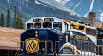
Exploring Canada by Train: A Journey of Scenic Beauty and Cultural Richness
Canada gives an exceptional opportunity for travelers to see its immense beauty in a relaxed and immersed way via rail. The country's vast landscapes extend from coast to coast. Travelling across Canada by rail is more than just a way to get around; it is an adventure that shows the nation's diversified scenery, fascinating history, and active culture.
Driving the Rough 4x4 Road to the Lookout at Mara Mountain in BC
Mara Mountain is a high peak with an elevation of 2,249m (7,378ft) above sea level, located in the province of British Columbia, Canada. It’s one of the highest roads in the country.
A Wild 4x4 Road to Moose Mountain in Alberta
Moose Mountain is a high mountain peak at an elevation of 2,347 m (7,700 ft) above sea level, located in the province of Alberta, Canada. It’s one of the highest roads in the country.
Driving the wild 4x4 trail to Silver Mountain in BC
Silver Mountain is a high mountain peak at an elevation of 2.541m (8,336ft) above sea level, located in the province of British Columbia, Canada. It’s one of the highest roads in the country.
What are the driving hazards of the road to Mount Buchanan Lookout in BC?
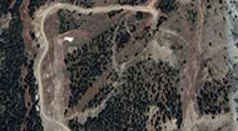
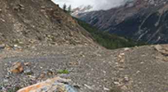
Mount Buchanan Lookout is a high-altitude observation point at an elevation of 1,910m (6,266ft) above sea level located in the Selkirk Mountains of British Columbia. The 10.9 km access route from BC-31A is a steep, unpaved mountain road where a 10.7% average gradient and narrow hairpins are the main hazards.
How to Get to the Lookout at Eureka Mountain by Car
Eureka Mountain is a high peak reaching an elevation of 1,968m (6,456ft) above sea level, located in British Columbia, Canada.
A steep unpaved road to Whitehorn Mountain in AB
Whitehorn Mountain is a high mountain peak at an elevation of 2.525m (8,284ft) above sea level, located in the province of Alberta, Canada. It’s one of the highest roads in the country.
How to Get to the Lookout at Mount Lavina by Car?
Mount Lavina is a high mountain peak at an elevation of 2,246m (7,368ft) above sea level, located in British Columbia, Canada. It’s one of the highest roads in the country.
How to Travel the Wild Road to Idaho Peak in British Columbia
Idaho Peak is a high mountain at an elevation of 2,121m (6,958ft) above sea level, located in British Columbia, Canada. It’s one of the highest roads in the country.
How to drive the high-altitude mining road to Peak 09-48in British Columbia
Peak 09-48 is a high mountain summit at an elevation of 2,402 meters (7,880 ft) above sea level, located in the Regional District of East Kootenay, in the southeastern part of British Columbia, Canada. Reaching the peak involves driving one of the highest roads in the country.
A challenging 4x4 trail to Mount Slade in BC
Mount Slade is a high mountain peak located in the province of British Columbia, Canada. A gravel road east of the summit climbs up to 2,464 m (8,083 ft) above sea level. It’s one of the highest roads in the country.
A challenging 4x4 trail to Watch Peak in BC
Watch Peak is a high mountain peak located in the province of British Columbia, Canada. A gravel road south of the summit climbs up to 2.403m (7,883ft) above sea level. It’s one of the highest roads in the country.
Driving the high-altitude lookout road to Hailstone Butte in Alberta
Hailstone Butte is a high mountain peak reaching an elevation of 2,326m (7,631ft) above sea level, located in the Kananaskis region of Alberta, Canada. Situated within the Plateau Mountain Ecological Reserve, the summit is home to an active fire lookout and is accessed via one of the highest roads in the country.
Driving the Wild 4x4 Road to the Lookout at Cornwall Hills in British Columbia
Cornwall Hills is a high mountain peak at an elevation of 2,037m (6,683ft) above sea level, located in the Canadian province of British Columbia. It’s one of the highest roads in the country.
What You Need to Know About Driving the Wild Road to The Cleaver in BC
The Cleaver is a high mountain peak at an elevation of 2.262m (7,421ft) above sea level, located in the province of British Columbia, Canada. It’s one of the highest roads in the country.
How to drive the steep unpaved road to the summit of Whistler Mountain in BC?
Whistler Mountain is a high mountain peak at an elevation of 2,175m (7,135ft) above sea level, located in British Columbia, Canada. The dirt and gravel track climbing to the summit features extreme gradients and ranks as one of the highest driveable routes in the country.
How to get by car to Matienda Lake in the Northern Ontario region?
Matienda Lake is a remote freshwater lake located in the Northern Ontario region of Canada. It sits within the boundaries of Matinenda Provincial Park and is known for its size, clear waters, and accessibility by road. The lake attracts visitors interested in fishing, boating, and other outdoor activities, and is surrounded by forested terrain typical of the Algoma District.
Yellowhead Pass: The Lowest Crossing of the Canadian Rockies
Yellowhead Pass is a mountain pass at an elevation of 1,131m (3,711ft) above sea level, located on the provincial boundary between Alberta and British Columbia, Canada. Coordinates: 52.8897, -118.4633. Situated within Jasper National Park, it serves as a primary transport corridor through the Continental Divide.
Driving the 4x4 maintenance road to Blackcomb Mountain in BC
Blackcomb Mountain is a high mountain peak at an elevation of 2,252m (7,388ft) above sea level, located in the Squamish-Lillooet Regional District of British Columbia. The access route is a grueling service track used for chairlift maintenance, ranking as one of the highest roads in Canada.
Ministers Island: A Road That Appears Twice a Day
Located in the Bay of Fundy, in the Canadian province of New Brunswick, Ministers Island offers one of the most unusual driving experiences in North America. To reach this historic 500-acre estate, you don't use a bridge or a ferry; you simply wait for the Atlantic Ocean to move out of the way, revealing a road hidden on the sea floor. It’s one of the periodically flooded roads around the world.
Piccolo Summit: The brutal 13% maintenance track in Whistler
Piccolo Summit is a high mountain peak at an elevation of 2,034 meters (6,673 ft) above sea level, located in the Fitzsimmons Range of British Columbia, Canada. The road to the summit is a raw, unpaved service track used for resort infrastructure maintenance, standing as one of the highest roads in Canada. The physical reality of this route involves managing a massive 1,586-meter elevation gain over a very short distance, where the extreme steepness and loose sub-alpine gravel test the vehicle's low-range gearing and cooling capacity to their absolute limits.