What are the most spectacular roads in Switzerland?
Set high in the Alps, in the central part of Europe, Switzerland offers a driving experience like no other. With about 200 of the most famous roads in the world, it’s worth noting the challenging mountain roads the country offers, renowned for their stunning Alpine landscapes.
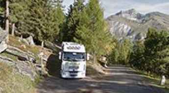
Most of the country's roads are on the list of the most famous and iconic drives worldwide. So, when travelling to the country, you need to try Furka Pass, the Alpine road for James Bond. The pass was immortalized by the Aston Martin DB5 / Ford Mustang car chase in James Bond's Goldfinger. It’s one of the most famous Alpine roads in Switzerland. Or the amazing mountain road to St. Gotthard Pass, at an elevation of 2,110m (6,922ft) above sea level. It’s also worth driving through Great Saint Bernard Pass, one of the most famous roads in the Alps, climbing up to 2,469m (8,100ft) above sea level on the border with Italy.
The list wouldn’t be complete without Grimsel Pass, a 5-star road in the Swiss Alps, on the border between the Bern and Valais cantons, or the Umbrail Pass, an iconic Alpine road with 35 hairpin turns on the Swiss-Italian border. The road to the summit is currently the highest paved road in Switzerland and one of the highest paved roads in the Alps.
The Ultimate Guide to Traveling to Roc d'Orzival
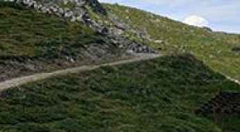
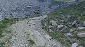
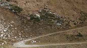
Roc d'Orzival is a high mountain peak at an elevation of 2.814m (9,232ft) above the sea level, located in the district of Sierre in the Swiss canton of Valais.
Vordersee
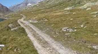
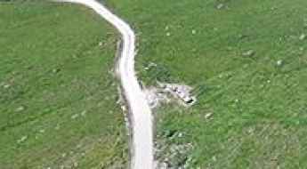
Vordersee is a high mountain reservoir at an elevation of 2.374m (7,788ft) above the sea level, located in the canton of Valais in Switzerland.
Berghaus Arflina
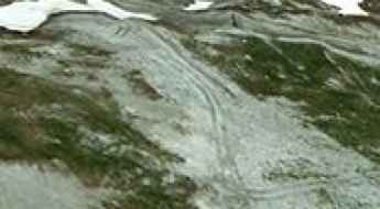
Berghaus Arflina is a high mountain refuge at an elevation of 2.000m (6,557ft) above the sea level, located in the Plessur Alps, in the canton of Graubünden, Switzerland.
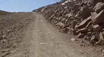
Driving the unpaved Pass da Costainas in the Swiss Alps
Pass da Costainas is a high mountain pass reaching an elevation of 2,254m (7,395ft) above sea level, located in the easternmost corner of Switzerland, within the canton of Graubünden. This remote alpine crossing in the Sesvenna Range is a critical link between the Val Müstair and the S-charl valley, offering a raw, high-altitude driving experience on a strictly unpaved roadbed.
Driving the 833m Narrow Lago di Luzzone Tunnel in Ticino
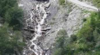
Lago di Luzzone Tunnel is a narrow single-lane mountain gallery at an elevation of 1,606 meters (5,269 ft) above sea level, located in the Ticino canton of Switzerland. Completed in 1998, the tunnel cuts through the granite walls of the Blenio District to provide vehicle access toward the southern shore of the Luzzone reservoir dam.
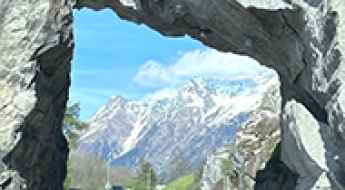
How to Reach the Kissing Rocks of Bregaglia by Car?
The Kissing Rocks are a natural landmark located in the Maloja Region in the canton of Grisons in Switzerland.
Arflinafurgga
Arflinafurgga is a high mountain pass at an elevation of 2.245m (7,365ft) above the sea level, located in the Plessur Alps, in the canton of Graubünden (Switzerland).
Driving the wild road to Bella Lui
Bella Lui is a high mountain peak at an elevation of 2.537m (8,323ft) above sea level, located in the canton of Valais in Switzerland.
How to drive the unpaved road to Pas du Boeuf?
Pas du Boeuf is a high mountain peak at an elevation of 2.685m (8,809ft) above sea level, located in Switzerland’s Valais canton.
Le Grammont
Le Grammont is a high mountain peak, at an elevation of 2.004m (6,574ft) above the sea level, located in Valais, Switzerland.
Passo del Scengio
Passo del Scengio is a high mountain pass at an elevation of 2.215m (7,267ft) above the sea level, located in the Viamala Region in the Swiss canton of Graubünden.
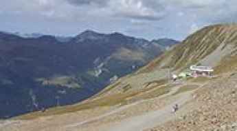
How to drive the steep 4x4 service road to Bettmerhorn in the Bernese Alps?
Bettmerhorn is a high mountain peak at an elevation of 2,492 meters (8,175 ft) above sea level, located in the Raron district of Valais, Switzerland. The access to the summit area is restricted to a steep, unpaved service track used exclusively for ski lift maintenance and mountain restaurant supply vehicles.
How steep is the 4x4 road to Sasseneire in the Swiss Alps?
Sasseneire, known locally as "the black rock," is a high mountain peak reaching an elevation of 2,493m (8,179ft) above sea level in the Pennine Alps of Switzerland. Located between Val de Moiry and Val d'Herens in the canton of Valais, the road to the summit is one of the most extreme climbs in the district of Hérens. This is a journey that starts on asphalt but quickly transitions into a brutal, unpaved track where the incline is so severe that it tests the absolute traction limits of any 4x4 vehicle.
Lej da Diavolezza
Lej da Diavolezza is a high mountain lake at an elevation of 2.697m (8,848ft) above the sea level, located in the Swiss canton of Graubünden.
How to drive the steep track to Pointe des Mossettes?
Pointe des Mossettes is an international high mountain pass at an elevation of 2,252m (7,388ft) above sea level, located on the border between France (Haute-Savoie) and Switzerland (Valais). The summit is situated at the highest point of the Les Portes du Soleil ski domain, above Avoriaz. The access route is a mixed-surface road that is paved in the lower sections and turns into a technical unpaved track as it nears the summit, requiring a high-clearance 4x4 vehicle.
How to drive the unpaved road to Mont Rogneux in Valais?
Mont Rogneux is a high mountain peak at an elevation of 2.281m (7,483ft) above sea level, located in the canton of Valais in Switzerland.
Weissfluhjoch
Weissfluhjoch is a high mountain peak at an elevation of 2.666m (8,746ft) above the sea level, located the canton of Graubünden, in Switzerland.
Jakobshorn
Jakobshorn is a high mountain peak at an elevation of 2.580m (8,464ft) above the sea level, located in Switzerland’s Graubünden canton.
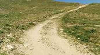
How to drive to Alpage d'Eison in the Val d'Hérens?
Alpage d'Eison is a high-altitude mountain pasture and seasonal settlement at an elevation of 2,400m (7,874ft) above sea level, located in the Canton of Valais, Switzerland. It is a prime example of a traditional Swiss alpage, where cattle graze during the summer months.
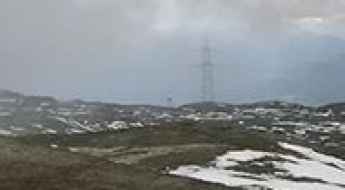
Driving the brutal ski station road to Vorabpass in Graubünden
Vorabpass is a high-altitude mountain gap that sits at 2,571 meters in the Swiss Alps, right on the border between the cantons of Glarus and Graubünden. The road to the summit is a raw service track for the Flims Laax Falera ski resort, designed for heavy machinery and chairlift maintenance rather than standard vehicles. It is a punishing drive that takes you through a landscape of barren rock and glacial debris, where the air is thin and the terrain is constantly shifting due to the extreme weather at this elevation.
How to drive the unpaved road to Aletschbord Vantage Point in Valais
Aletschbord Vantage Point is a famous lookout point over the Aletsch Glacier at an elevation of 2.138m (7,014ft) above sea level, located in the canton of Valais in Switzerland. Drive with care as this is a mountain road with drops.
Stockji
Stockji is a high mountain peak at an elevation of 2.539m (8,330ft) above the sea level, located in the district of Goms in the canton of Valais in Switzerland.
Driving the steep service road to Greppon Blanc in Valais
Greppon Blanc is a high mountain peak at an elevation of 2,635m (8,645ft) above sea level, located in the canton of Valais, Switzerland. Situated above the Veysonnaz and Thyon resorts, the summit is a key point within the famous 4 Vallées ski area.
How to drive the unpaved road to Malanser Alp?
Malanser Alp is a high mountain plateau at an elevation of 1.840m (6,036ft) above sea level, located in the canton of St. Gallen, in Switzerland. The drive is brutally steep (average of 14.14%).
Piz Cartas
Piz Cartas is a high mountain peak at an elevation of 2.704m (8,871ft) above the sea level, located in the district of Albula in the canton of Grisons in Switzerland.
Minschuns
Minschuns is a high mountain peak at an elevation of 2.514m (8,248ft) above the sea located in the district of Inn in the Swiss canton of Graubünden.
Things to Know Before Driving to Col de Vore in the Western Swiss Alps
Col de Voré is a high mountain pass at an elevation of 1.950m (6,397ft) above sea level, located in the municipality of Ormont-Dessus, in the Aigle district of Switzerland.
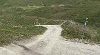
Things to Know Before Driving to Col des Anderets in the Western Swiss Alps
Col des Andérets is a high mountain pass at an elevation of 2,031m (6,663ft) above sea level, located in the municipality of Ormont-Dessus, in the Aigle district of Switzerland.