What are the most spectacular roads in Switzerland?
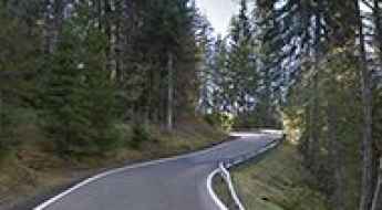
Set high in the Alps, in the central part of Europe, Switzerland offers a driving experience like no other. With about 200 of the most famous roads in the world, it’s worth noting the challenging mountain roads the country offers, renowned for their stunning Alpine landscapes.
Most of the country's roads are on the list of the most famous and iconic drives worldwide. So, when travelling to the country, you need to try Furka Pass, the Alpine road for James Bond. The pass was immortalized by the Aston Martin DB5 / Ford Mustang car chase in James Bond's Goldfinger. It’s one of the most famous Alpine roads in Switzerland. Or the amazing mountain road to St. Gotthard Pass, at an elevation of 2,110m (6,922ft) above sea level. It’s also worth driving through Great Saint Bernard Pass, one of the most famous roads in the Alps, climbing up to 2,469m (8,100ft) above sea level on the border with Italy.
The list wouldn’t be complete without Grimsel Pass, a 5-star road in the Swiss Alps, on the border between the Bern and Valais cantons, or the Umbrail Pass, an iconic Alpine road with 35 hairpin turns on the Swiss-Italian border. The road to the summit is currently the highest paved road in Switzerland and one of the highest paved roads in the Alps.
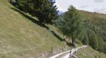
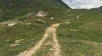
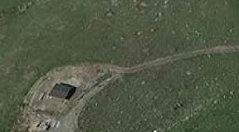
Alp Mandelon
Alp Mandelon is a high mountain pass at an elevation of 2.066m (6,778ft) above the sea level, located inthe Pennine Alps, in the canton of Valais, Switzerland.
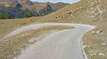
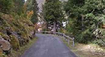
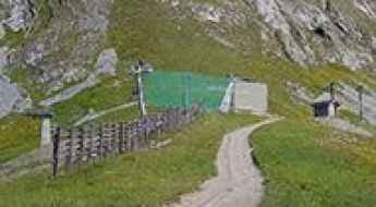
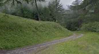
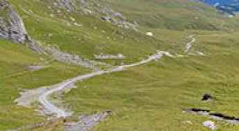
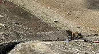
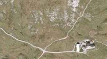
Strada Alpe Piora, a challenging road in the Swiss Alps
Strada Alpe Piora is the name of a very challenging road located in the Northern region of Canton Ticino, in Switzerland.
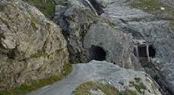
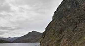
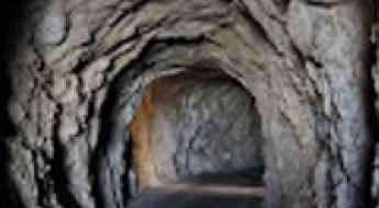
The dark galleries of Lac de Mauvoisin: A tunnel carved into the Alps
Located at the head of the Val de Bagnes in the Swiss canton of Valais, the Mauvoisin Dam (Barrage de Mauvoisin) is not only one of the highest arched dams in Europe but also home to one of the most atmospheric tunnel drives in the Alps. The service galleries that skirt the Lac de Mauvoisin offer a raw, unpolished experience through the heart of the mountain.
Driving the military track to Cima di Medeglia in Ticino
The road to Cima di Medeglia is a brutal military track that climbs out of the Bellinzona district. This is not your typical Swiss alpine road; it is a narrow, rugged path that follows the mountain crest with very little room for error. The surface is a mix of old broken asphalt and loose dirt that will make your tires hunt for grip, especially on the steep ramps. You need a vehicle with good clearance because the ruts and stones can easily catch the undercarriage if you try to take it too fast.
Driving the narrow and steep gravel road to Aurafreida
Aurafreida is a high-altitude mountain pass sitting at 2,160 meters above sea level in the Bernina district of the Swiss canton of Graubünden. This is not a road for the casual traveler; it is a technical Alpine track that starts with a deceptive stretch of asphalt before turning into a raw, narrow ribbon of white gravel. Tucked south of the famous Bernina Pass, Aurafreida is a test of spatial awareness and gear management, where the mountainside drops away sharply and the track is often scarcely wide enough for a single vehicle.
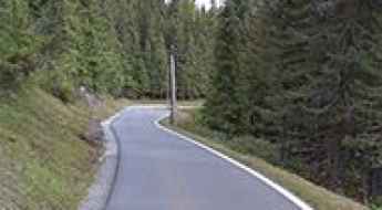
Driving the steep Fruttstrasse to Melchsee in Switzerland
Melchsee is a high-altitude alpine lake at an elevation of 1,891m (6,204ft) above sea level located in the Canton of Obwalden, Switzerland. The road to the lake, known as the Fruttstrasse, is a tight asphalt mountain lane that connects the valley floor to the high plateau of Melchsee-Frutt.
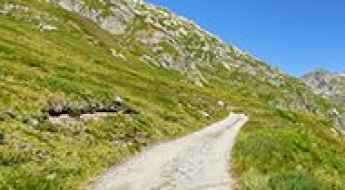
How to drive the remote unpaved road to Cabane de Chanrion in Valais
Cabane de Chanrion is a high mountain hut at an elevation of 2.471m (8,106ft) above sea level, located in the canton of Valais in Switzerland.
Glaspass
Glaspass is a high mountain pass at an elevation of 1.846m (6,056ft) above the sea level, located in the district of Hinterrhein in the Swiss canton of Graubünden.
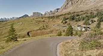
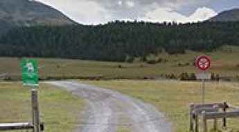
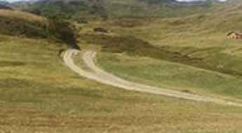
Ibergeregg Pass, a delightful yet challenging drive in Switzerland
Ibergeregg Pass is a mountain pass at an elevation of 1.410m (4,625ft) above the sea level, located in the canton of Schwyz in Switzerland.
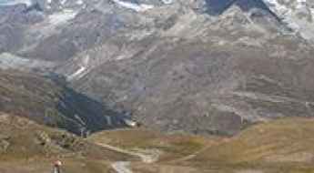
Gornergrat
Gornergrat is a high mountain peak at an elevation of 2.934m (9,625ft) above the sea level, located in the canton of Valais, in the southwestern part of Switzerland. It’s one of the highest roads of Europe.
Portes de Culet
Portes de Culet is a high mountain pass at an elevation of 1.787m (5,862ft) above the sea level, located in the canton of Valais in Switzerland.
Col des Becs de Bosson
Col des Becs de Bosson is a high mountain peak at an elevation of 2.882m (9,455ft) above the sea level, located in the Swiss canton of Valais.
Zervreilasee
Zervreilasee is a high mountain reservoir at an elevation of 1.862m (6,108ft) above the sea level, located in the canton of Graubünden, Switzerland.
Stralegg
Stralegg is a high mountain pass at an elevation of 1.675m (5,495ft) above the sea level, located in the Appenzell Alps, in the canton of St. Gallen, close to the Switzerland-Lichenstein border.
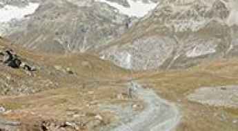
How to drive the unpaved road to Schwarzsee at the foot of the Matterhorn?
Schwarzsee is a high mountain lake at an elevation of 2,588m (8,490ft) above sea level, located in the Canton of Valais, Switzerland. Sitting right at the base of the iconic Matterhorn, the road to the "Black Lake" is a brutal unpaved climb that ranks among the highest roads in Switzerland.
Travel guide to the top of Pointe du Tsaté
Pointe du Tsaté is a high mountain peak at an elevation of 2.491m (8,172ft) above the sea level, located in the in the central part of the canton of Valais in Switzerland. The average gradient is 10.21%.
Road to Pas-de-Maimbré: Driving the 17.71% Service Track in Valais
Pas-de-Maimbré is a high mountain peak at an elevation of 2,362 meters (7,749 ft) above sea level, located in the Valais Alps, in Switzerland. The access road to the summit area is a steep, unpaved service track used strictly for the maintenance of the Anzère gondola station and the telecommunication tower situated at the crest.
Alpe di Gesero
Alpe di Gesero is a high mountain pass at an elevation of 1.774m (5,816ft) above the sea level, located in the Lepontine Alps, on the Swiss canton of Ticino.
Driving the steep road to Alpe Cortaccio in Ticino
Alpe Cortaccio is a high mountain pass at an elevation of 1,067m (3,498ft) above sea level, located in the district of Locarno, in Switzerland. It is widely considered one of the steepest paved climbs in the Swiss Alps.

Driving the steep and narrow paved road to Täschalp
Täschalp is a high-altitude mountain settlement sitting at 2,225 meters above sea level in the heart of the Swiss Alps, within the canton of Valais. The road leading to the summit is a punishing ribbon of asphalt that defies the steep mountain walls above the village of Täsch. This is a technical climb designed for high-altitude service, where the thin air and the unrelenting 11% slope put a massive strain on any vehicle's cooling system. It’s a route where the peaks of the Weisshorn dominate the skyline, but your focus must remain entirely on the narrow tarmac and the sharp drops that line the track.
Refuge de Saint-Laurent
Refuge de Saint-Laurent is a high mountain refuge at an elevation of 2.492m (8,175ft) above the sea level, located in the municipality of Nendaz, in the district of Conthey in the canton of Valais in Switzerland.
Col du Tronc
Col du Tronc is a high mountain pass at an elevation of 1.612m (5,288ft) above the sea level, located in the district of Martigny, in the canton of Valais, in Switzerland.
Buvette d'Arolla
Buvette d'Arolla is a high mountain restaurant at an elevation of 2.879m (9,445ft) above the sea level, located in the Swiss Alps, located in the canton of Valais.
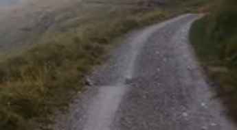
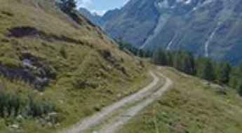
How to drive the unpaved road to Alp Mora in Graubünden
Alp Mora is a high mountain pass at an elevation of 2.340m (7,677ft) above sea level, located in Switzerland.
How to get to Arete de Sorebois in Valais?
Arête de Sorebois is a high mountain peak at an elevation of 2,834 m (9,297 ft) above sea level, located in Valais canton, in Switzerland. It’s one of the highest roads in the country.
Driving the steep chairlift access road to Hörnli in Arosa
Hörnli is a high mountain peak that towers over the Alpine resort of Arosa in the Swiss canton of Graubünden. Reaching an elevation of 2,514 meters, the track to the summit is a raw mountain path used primarily for chairlift maintenance. This is one of the steepest drives you can find in the region, cutting through the high-altitude terrain of the Plessur Alps. The road is only accessible for a very short window in late summer, usually around the end of August, once the last of the winter snow has finally melted off the higher rocky sections.
Passo dell'Uomo
Passo dell'Uomo is a high mountain pass at an elevation of 2.224m (7,296ft) above the sea level, located in the district of Leventina in the canton of Ticino in Switzerland.
Tannensee
Tannensee is a high mountain lake at an elevation of 1.976m (6,482ft) above the sea level, located in the canton of Obwalden, Switzerland.
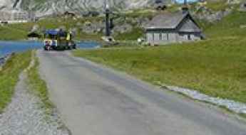
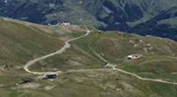
Thyon 2000
Thyon 2000 is a ski station at an elevation of 2.095m (6,873ft) above the sea level located in the Swiss Alps, located in the canton of Valais.
Fuorcla Spadla
Fuorcla Spadla is a high mountain peak at an elevation of 2.796m (9,173ft) above the sea level, located in the Swiss canton of Grisons.
Pas d’Arpilles: Driving the extreme 9.8% chairlift road in Valais
Reaching an elevation of 2,568m (8,425ft) above sea level, Pas d’Arpilles is a high mountain peak located in the heart of the Swiss Alps, within the canton of Valais. Situated in the Pennine Alps, this summit is a technical challenge reserved for high-clearance vehicles, serving as a vital access route for the mountain infrastructure of the Crans-Montana region.
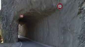
Venturing through Darkness: Exploring Switzerland's Historic Tunnel de les Agites
Tunnel de les Agites is a high mountain tunnel at an elevation of 1.517m (4,977ft) above the sea level, located in the district of Aigle in the canton of Vaud in Switzerland.
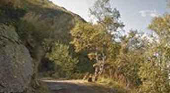
Route Chalais-Vercorin
Route Chalais-Vercorin is a very scenic drive located in the heart of the Rhone valley, in the canton of Valais in Switzerland.
Driving the steep road to Berghaus Nagens
Berghaus Nagens is a high mountain refuge at an elevation of 2,172m (7,121ft) above sea level. It is located in the Imboden Region, within the Swiss canton of Graubünden. It sits right in the heart of the Flims-Laax-Falera mountain area.
Faninpass
Faninpass is a high mountain pass at an elevation of 2.215m (7,267ft) above the sea level, located in the Plessur Alps, in the canton of Graubünden (Switzerland).
How to drive the unpaved road to Passo di Lucendro in Ticino
Passo di Lucendro is a high mountain pass at an elevation of 2.184m (7,165ft) above sea level, located in the canton of Ticino, in Switzerland.