What are the most spectacular roads in India?
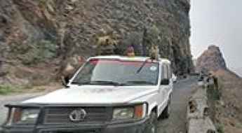
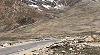
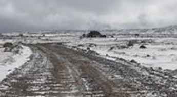
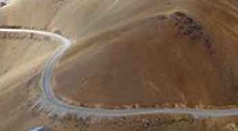
Located in the southern part of Asia, India covers a total area of 3,287,263 square kilometres (1,269,219 sq mi). With a very diverse landscape, comprising snow-capped peaks of the Himalayas, plains and a coastline stretching over 7,500 kilometers, the country offers never-ending driving experiences and 200 of the most spectacular roads in the world. One of the most challenging drives is the road to Umling La. At 5.882m (19,300ft) above sea level it is the highest paved road on Earth offering views that can make you feel on top of the world. If you like challenging mountain roads situated at high elevations, remember to check out our list of the highest roads in India.
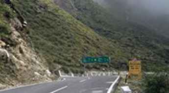
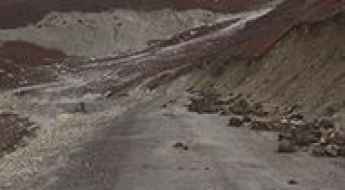
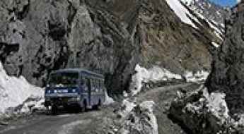
The country shares borders with Pakistan, China, Nepal, Bhutan, Bangladesh and Myanmar. Some of the borders are on high mountain passes, so the country features some of the highest roads in the world. Another driving challenges are the road from Kishtwar to Keylong, said to be India's most terrifying road, or the isolated road to Jalori Pass, a mountain pass at 3,134m (10,282ft) above sea level. The country experiences a wide range of climates, from tropical to alpine, and monsoon rains influencing much of the country.
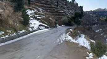
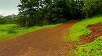
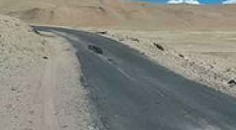
Driving the dizzying road from Dalhousie to Khajjiar
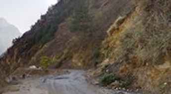
Located in the northwestern part of Himachal, in India, driving the challenging road from Dalhousie to Khajjiar is no easy task.
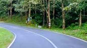
Driving the NH 183A Road in Kerala is Not for the Faint of Heart
NH 183A is a curvy mountain road located in the state of Kerala, in South India. It can become very slippery after rain, making it challenging to navigate.
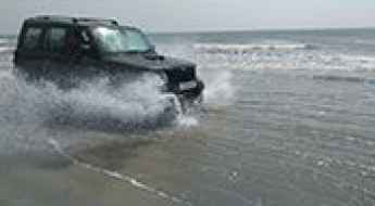
Muzhappilangad Drive-in Beach: a must do in India
Located in the Kannur district of Kerala, in India, Muzhappilangad Beach is the only drive-in beach in Asia. With 4 km of firm sand and shallow water, it attracts cars and motorcyclists from everywhere. Just be sure to avoid getting salt water on your vehicle.
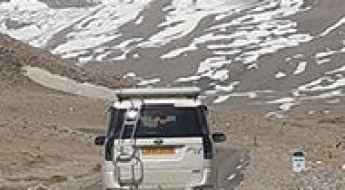
A paved road to the glacial Gurudongmar Lake
Gurudongmar Lake is a high mountain glacial lake at an elevation of 5,154 m (16,909 ft) above sea level, located in the Indian state of Sikkim. It’s one of the highest roads in the country.
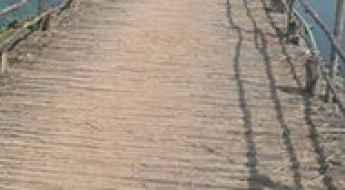
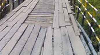
The Kolleru Wood Bridge is not for the sissies
Located in West Godavari district of the Indian state Andhra Pradesh, the Kolleru Wood Bridge is one of the most spectacular bridges in the world.
A Very Bumpy, Grueling Road to Sangetsar Lake
Sangetsar Lake is a high mountain lake at an elevation of 3,708m (12,165ft) above sea level, located in the Tawang district in the northwestern part of Arunachal Pradesh, in India. It’s one of the world’s famous hairpin roads.
The Scenic Road to Varandha Ghat is Not for the Faint-Hearted
Varandha Ghat is a mountain pass at an elevation of 545m (1,788ft) above sea level, located in the state of Maharashtra, in India.
Driving the Road with Vertical Cliffs and No Guardrails to Gangotri
Gangotri is a small town located in the northern part of Uttarakhand, India, at an elevation of 3,415m (11,204ft) above sea level. The road to the town runs along vertical cliffs without guardrails.
The Breathtaking Road to Sirsir La
Sirsir La is a high mountain pass at an elevation of 4,804m (15,761ft) above sea level, located in the Ladakh region of Jammu and Kashmir, India.
Road Trip Guide: Conquering Depsang La
Depsang La is a high mountain pass at an elevation of 5,376 m (17,637 ft) above sea level, located in the Leh district of Jammu and Kashmir, India. It’s one of the highest roads in the country.
The Road to Kaobal Gali is Recommended for Drivers with Strong Nerves
Kaobal Gali is a high mountain pass at an elevation of 4,167m (13,671 ft) above sea level, located in the northern part of India.
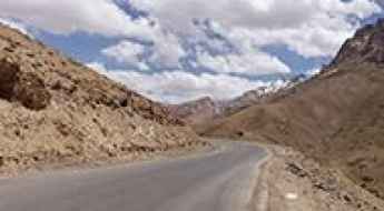
A paved mountain road to Tso Kar Lake
Tso Kar is a high mountain lake at an elevation of 4,530m (14,860ft) above sea level, located in the southern part of Ladakh in the Indian state of Jammu and Kashmir.
A new paved road to Tso Lhamo Lake
Tso Lhamo Lake is a high mountain glacial lake at an elevation of 5,330m (17,490ft) above sea level, located in North Sikkim, India. It’s one of the highest roads in the country.
Extreme weather conditions on the road to Badrinath Temple
Located in Uttarakhand, India, Badrinath is a mountain temple at an elevation of 3,133m (10,279ft) above sea level.
A wild unpaved military road to Kiu La
Kiu La is an international high mountain pass at an elevation of 5.711m (18,736ft) above the sea level, located on the China-India border. It’s one of the world's highest motorable roads.
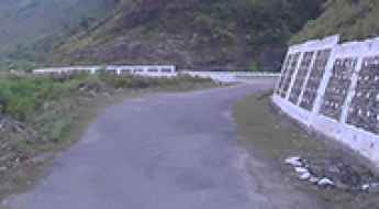
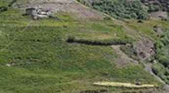
How to get by car to Kondaveedu Fort in Andhra Pradesh?
Kondaveedu Fort is an ancient hill fortress at an elevation of 292m (958ft) above sea level, located in Guntur district, in the Coastal Andhra region of the Indian state of Andhra Pradesh.
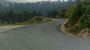
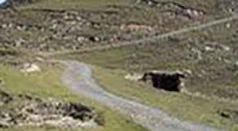
How To Drive the Road to Rajmachi in Maharashtra?
Rajmachi is a mountain town at an elevation of 660m (2,165ft) above sea level, located in the Indian state of Maharashtra.
Crossing the spectacular Shansha Bridge in India
Located in the Indian state of Himachal Pradesh, the Shansha Bridge is in very poor condition. It’s one of the most spectacular bridges in the world.
A Road to Daulat Beg Oldi, a High Mountain Military Base
Daulat Beg Oldi is a military base at an elevation of 5,067m (16,624ft) above sea level, located in the Jammu and Kashmir state of India. It’s one of the highest roads in the country.
A Paved Mountain Road to Polongka La in Southern Ladakh
Polongka La is a high mountain pass at an elevation of 4,844m (15,892ft) above sea level, located in the southern part of Ladakh in the Indian state of Jammu and Kashmir.
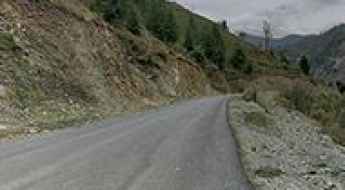
A steep cliff road from Jyotirmath to Malari
The paved high mountain road from Jyotirmath to Malari road is located in the Indian state of Uttarakhand, within the Nanda Devi National Park.
A difficult unpaved road to the international Imis La
Imis La is an international high mountain pass at an elevation of 5,290m (17,355ft) above sea level, situated on the border of India and China. It is one of the major passes over the main Himalayan Range and ranks among the highest roads in the country.

How to get by car to Korzok, one of the highest towns in India
Located in the Ladakh region of the northern Indian state of Jammu and Kashmir, Korzok is one of the highest towns in the country, at an elevation of 4,570m (15,000ft) above sea level.
How to Get by Car to Lamayuru Monastery in Ladakh?
Lamayuru Monastery is a high mountain monastery at an elevation of 3,510m (11,515ft) above sea level, located in the Leh district of Ladakh, India.
An awe-inspiring road to Jot Pass in Himachal Pradesh
Jot Pass is a high mountain pass at an elevation of 2,440m (8,005ft) above sea level, located in the Indian state of Himachal Pradesh.
Kongka La is pure adventure
Kongka La is a high mountain pass at an elevation of 5,192m (17,034ft) above sea level, located in the disputed region of Aksai Chin along the Chinese-Indian Line of Control. This remote and rugged area lies at the intersection of Ladakh (administered by India) and Xinjiang (administered by China), making it a flashpoint in one of the most sensitive border disputes in Asia. It's one of the highest roads in the country.
Driving the Paved NH 109K Road in Uttarakhand is Not a Good Idea
NH 109K is the name of a paved road located in the state of Uttarakhand, in India. If your GPS ever thinks it's a good idea to drive on this road, it may be time to get a new one.
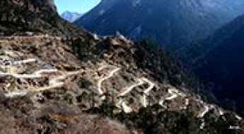
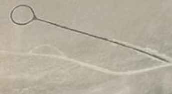
Jalebi bends: 23 hairpin bends on the old road to Fotu La
Jalebi Bends, also known as Jalebi Road or the Old route to Fotu La, is a series of 23 hairpin bends located in the Leh district of Ladakh, India.
Driving the Scenic Paved Mountain Road to Namshang La
Namshang La is a high mountain pass at an elevation of 4,960m (16,273ft) above sea level, located in the Ladakh region of the northern Indian state of Jammu and Kashmir.
The road to Umba La is for drivers with strong nerves only
Umba La, also known as Umbala Top, is a high mountain pass standing at an elevation of 4.496m (14,750ft) above sea level. It is situated in the Indian state of Jammu and Kashmir, nestled within the Suru Valley near the Line of Control (LoC), which delineates the Indian- and Pakistani-controlled territories of the former princely state of Jammu and Kashmir.
Kungzhag La, one of the World's highest motorable roads
Kungzhag La is a high mountain peak at an elevation of 5.780m (18,963ft) above the sea level, located on the Indian (Sikkim) and Chinese (Tibet) border. It’s one of the World's highest motorable roads.
Here's How To Have The Ultimate Road Trip To Kaldang-Kildang La
Kaldang-Kildang La is a high mountain pass at an elevation of 4.095m (13,435ft) above the sea level, located in the Ladakh region of the Indian state of Jammu and Kashmir.
The road to Demchok-Dêmqog Border is not for the sissies
The Demchok-Dêmqog is a high mountain border at an elevation of 4.219m (13,841ft) above the sea level, located on the Line of Actual Control between Jammu and Kashmir (India) and Tibet Autonomous Region (China).
Travel guide to the top of Natha Top
Natha Top is a high mountain peak at an elevation of 2.677m (8,782ft) above the sea level, located in Udhampur district in Jammu and Kashmir, India.
A Most Tricky Scenic Road to Rangdum Monastery
Rangdum Monastery is an imposing 18th century Buddhist monastery, at an elevation of 4.031m (13,225ft) above the sea level, located in the head of the Suru Valley, in Ladakh, a region of India in the state of Jammu and Kashmir.
The hairpinned road to Sapi La
Sapi La is a high mountain pass at an elevation of 4.397m (14,425ft) above the sea level, located in Ladakh, a region of India in the state of Jammu and Kashmir.
Travel guide to the top of Padri Pass
Padri Pass is a high mountain pass at an elevation of 3.037m (9,963ft) above the sea level, located on the boundary of Jammu and Kashmir and Himachal Pradesh, in northern India.
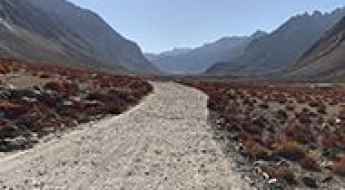
Lake Moriri: one of the most beautiful roads in northern India
Tso Moriri is a high mountain lake at an elevation of 4.522m (14,836ft) above the sea level, located in the Ladakh region of the northern Indian state of Jammu and Kashmir.
Ane La
Ane La is an international high mountain pass at an elevation of 5.370m (17,618ft) above the sea level, located on the China-India border. It’s one of the highest mountain roads of the country.