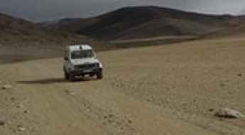
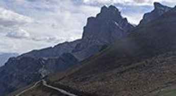
What are the most spectacular roads in India?
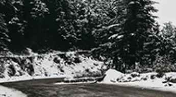
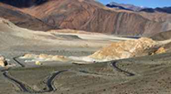
Located in the southern part of Asia, India covers a total area of 3,287,263 square kilometres (1,269,219 sq mi). With a very diverse landscape, comprising snow-capped peaks of the Himalayas, plains and a coastline stretching over 7,500 kilometers, the country offers never-ending driving experiences and 200 of the most spectacular roads in the world. One of the most challenging drives is the road to Umling La. At 5.882m (19,300ft) above sea level it is the highest paved road on Earth offering views that can make you feel on top of the world. If you like challenging mountain roads situated at high elevations, remember to check out our list of the highest roads in India.
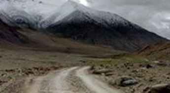
The country shares borders with Pakistan, China, Nepal, Bhutan, Bangladesh and Myanmar. Some of the borders are on high mountain passes, so the country features some of the highest roads in the world. Another driving challenges are the road from Kishtwar to Keylong, said to be India's most terrifying road, or the isolated road to Jalori Pass, a mountain pass at 3,134m (10,282ft) above sea level. The country experiences a wide range of climates, from tropical to alpine, and monsoon rains influencing much of the country.
Travel guide to the top of Gyu La
Gyu La is a high mountain pass at an elevation of 4.550m (14,927ft) above the sea level, located in northern India’s Jammu and Kashmir state.
Driving in India: A Logistic and Survival Guide for Foreign Drivers
India is a massive subcontinent with a road network that handles everything from high-altitude Himalayan passes to tropical coastal highways. For any driver planning a cross-country trip, understanding the seasonal logistics and regional infrastructure is more important than knowing the history of the country.
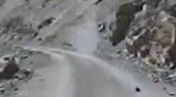
The road to Chocho Kuri La is not for the faint of heart
Chocho Kuri La is a high mountain pass at an elevation of 3.995m (13,106ft) above the sea level, located in the Leh district, in the Indian union territory of Ladakh.
Archu La, a hidden treasure road in India
Archu La is a high mountain pass at an elevation of 4.199m (13,776ft) above the sea level, located in Kargil district, in the Indian administered Union territory of Ladakh.
Lamzo La, a winding road only for experienced drivers
Lamzo La is a high mountain pass at an elevation of 4.911m (16,112ft) above the sea level, located in northern India’s Leh District.
Zursair La
Zursair La is a high mountain pass at an elevation of 4.960m (16,272ft) above the sea level, located in Leh District, Jammu and Kashmir in northern India.
The Wild Road to Charchagan La
Charchagan La is a high mountain pass at an elevation of 4.924m (16,154ft) above the sea level, located in the Changthang Plateau, in Ladakh in Northern India.
Is the road to Phatarian Gali suitable for RVs?
Phatarian Gali is a mountain pass at an elevation of 2,558 meters (8,392 ft) above sea level, located in the Jammu region of Jammu and Kashmir, India. The long mountain road crosses the ridge line to connect the localities of Ramban and Baddar.
The Wild Road to Tsermangchen La
Tsermangchen La is a high mountain pass at an elevation of 3.882m (12,736ft) above the sea level, close to the famous Leh city, in the Leh district of Ladakh, India.
How to get by car to Rizong Monastery in Ladakh?
Rizong Gompa is a high mountain monastery at an elevation of 3.420m (11,220ft) above sea level, located in Ladakh, in India.
Harong La
Harong La is a high mountain pass at an elevation of 4.273m (14,019ft) above the sea level, located in northern India’s Jammu and Kashmir state.

Driving the Lalung Valley Road, One of the Highest Roads on Earth
Located in Jammu and Kashmir, in India, the challenging Lalung Valley Road is one of the highest roads on Earth, ending at 5,803m (19,038ft) above sea level.
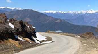
Driving the paved road to Mandala Top in Arunachal Pradesh
Mandala Top is a high mountain pass at an elevation of 3,220m (10,564ft) above sea level, located in the state of Arunachal Pradesh in India.
Driving the world’s highest motorable road to Mig La Pass in Ladakh
In October 2025, the Border Roads Organisation (BRO) made history once again by completing the construction of the world’s highest motorable road at Mig La Pass. Reaching a staggering elevation of 19,400 ft (5,913 m), this new route in the Ladakh region of India has officially surpassed the previous Guinness World Record held by the nearby Umling La (19,024 ft). It's one of the highest roads in the country.
The Ultimate Guide to Traveling the Bumiktse La
Bumiktse La is a high mountain pass at an elevation of 4.420m (14,501ft) above the sea level, located in the Leh district, in the Indian union territory of Ladakh.
An epic enthralling road to Kharsang La
Kharsang La is an international high mountain pass at an elevation of 4.437m (14,557ft) above the sea level, located on the Indo-China border.
Dare to drive the steep road to Changi La
Changi La is a high mountain peak at an elevation of 4.235m (13,894ft) above sea level, located in the Indian administered union territory of Ladakh.
Driving the remote road to Manman Top is an otherworldly experience
Manman Top is a high mountain pass, standing at an elevation of 4,302m (14,114ft) above sea level, situated in the Indian state of Jammu and Kashmir. The journey to the summit offers a complete off-roading adventure.
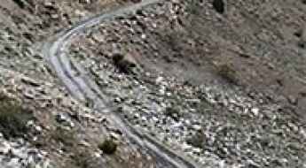
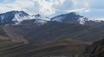
Off the Beaten Track: 7 Remote Indian Roads Worth Every Rupee
India is home to some of the world’s most dangerous roads, extreme and unforgettable driving experiences, and terrain that tests both driver and machine. While routes like the Leh Manali Highway or Khardung La are well-known among thrill-seekers, there are lesser-travelled roads that offer even more heart-stopping experiences. These are the roads that don’t make it into every travel blog, but perhaps should.
How to drive the unpaved Shashila Road to Kharbu La?
Kharbu La is a high mountain pass at an elevation of 3,509 meters (11,512 ft) above sea level, located in the Ladakh region of northern India. The pass is situated on the unpaved Shashila Road, running through the high valleys of the Himalayan range.
Tstato La: Driving one of the highest mountain passes in Ladakh
Tstato La is an extreme high-mountain pass reaching a staggering elevation of 5,056m (16,587ft) above sea level, located in the Ladakh region of Jammu and Kashmir, India. Situated in the remote Changthang plateau, this track represents one of the most challenging driving experiences in the northern part of the country.
An epic and enthralling road to Lamsu La
Lamsu La is a high mountain pass at an elevation of 3,672m (12,047ft) above sea level, located in the Ladakh region of India.
Driving the steep road to Shakhar La
Shakhar La is a high mountain pass at an elevation of 3,602m (11,817ft) above sea level, located in the Ladakh region of northern India. The pass is situated in the Aryan Valley, north of Chiktan. It is one of the many high-altitude tracks in the Himalayas that connect small, isolated mountain settlements.
An epic and enthralling road to Barla La
Barla La is a high mountain pass, standing at an elevation of 4,207m (13,802ft) above sea level, located in the Ladakh region of India.
The breathtaking 4x4 road to Gongma La
Gongma La is a high mountain pass at an elevation of 4,886m (16,030ft) above sea level, located in the Leh District of Jammu and Kashmir, India.
Driving the military road to Mankogh La
Mankogh La is a high mountain pass at an elevation of 5,197m (17,050ft) above sea level, located in the Ladakh union territory of India, near the Line of Actual Control with China. It’s one of the highest roads in the country.
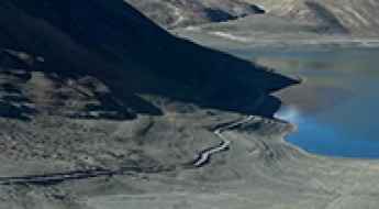
The paved road to Surtok La with stunning views of Pangong Lake
Surtok La is a high mountain pass at an elevation of 4,356m (14,291ft) above sea level, located in the Leh district of Ladakh, India.
Tsang Chok La: Driving the 5,461m international pass between India and China
Tsang Chok La is an international mountain pass at an elevation of 5,461m (17,916ft) above sea level, situated on the boundary line between the Uttarkashi District (Uttarakhand, India) and Zanda County (Ngari Prefecture, Tibet Autonomous Region, China). The track crosses the high ridge of the Central Himalayas.

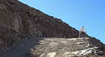
How to reach the 5,676m summit of Black Top?
Black Top is an extreme high-altitude mountain pass reaching an elevation of 5,676m (18,622ft) above sea level. Located in the sensitive border region between India and China, it stands as one of the highest mountain passes of India. The road to the summit is a minor gravel track that branches off from the Chuti Chang La pass. Logistically, this 4.5 km spur represents one of the most aggressive climbs on Earth, requiring specialized oxygen-enrichment protocols for personnel and heavy-duty mechanical preparation for vehicles.
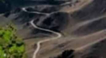
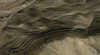
How to drive the 13 switchbacks to Chyupa La in Ladakh?
Chyupa La is a high-altitude mountain pass at an elevation of 4,424m (14,514ft) above sea level, located in the Leh district of Ladakh, India.