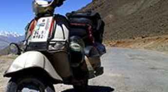
What are the most spectacular roads in India?
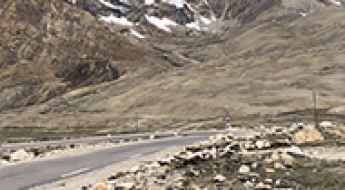
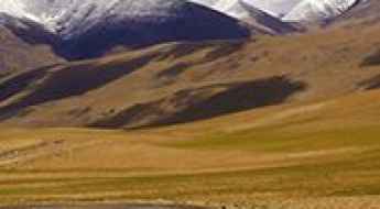
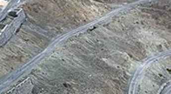
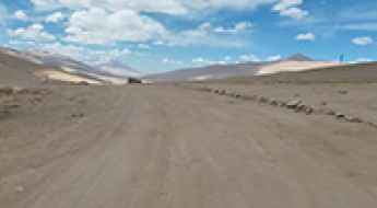
Located in the southern part of Asia, India covers a total area of 3,287,263 square kilometres (1,269,219 sq mi). With a very diverse landscape, comprising snow-capped peaks of the Himalayas, plains and a coastline stretching over 7,500 kilometers, the country offers never-ending driving experiences and 200 of the most spectacular roads in the world. One of the most challenging drives is the road to Umling La. At 5.882m (19,300ft) above sea level it is the highest paved road on Earth offering views that can make you feel on top of the world. If you like challenging mountain roads situated at high elevations, remember to check out our list of the highest roads in India.
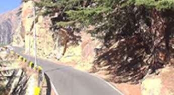
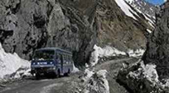
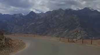
The country shares borders with Pakistan, China, Nepal, Bhutan, Bangladesh and Myanmar. Some of the borders are on high mountain passes, so the country features some of the highest roads in the world. Another driving challenges are the road from Kishtwar to Keylong, said to be India's most terrifying road, or the isolated road to Jalori Pass, a mountain pass at 3,134m (10,282ft) above sea level. The country experiences a wide range of climates, from tropical to alpine, and monsoon rains influencing much of the country.
A new paved road to Tso Lhamo Lake
Tso Lhamo Lake is a high mountain glacial lake at an elevation of 5,330m (17,490ft) above sea level, located in North Sikkim, India. It’s one of the highest roads in the country.
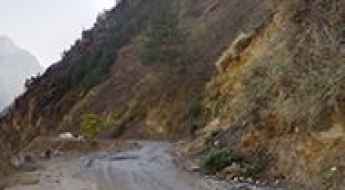
Driving the Road with Vertical Cliffs and No Guardrails to Gangotri
Gangotri is a small town located in the northern part of Uttarakhand, India, at an elevation of 3,415m (11,204ft) above sea level. The road to the town runs along vertical cliffs without guardrails.
Road Trip Guide: Conquering Depsang La
Depsang La is a high mountain pass at an elevation of 5,376 m (17,637 ft) above sea level, located in the Leh district of Jammu and Kashmir, India. It’s one of the highest roads in the country.
A Road to Daulat Beg Oldi, a High Mountain Military Base
Daulat Beg Oldi is a military base at an elevation of 5,067m (16,624ft) above sea level, located in the Jammu and Kashmir state of India. It’s one of the highest roads in the country.
A paved mountain road to Tso Kar Lake
Tso Kar is a high mountain lake at an elevation of 4,530m (14,860ft) above sea level, located in the southern part of Ladakh in the Indian state of Jammu and Kashmir.
Extreme weather conditions on the road to Badrinath Temple
Located in Uttarakhand, India, Badrinath is a mountain temple at an elevation of 3,133m (10,279ft) above sea level.
A difficult unpaved road to the international Imis La
Imis La is an international high mountain pass at an elevation of 5,290m (17,355ft) above sea level, situated on the border of India and China. It is one of the major passes over the main Himalayan Range and ranks among the highest roads in the country.
A Paved Mountain Road to Polongka La in Southern Ladakh
Polongka La is a high mountain pass at an elevation of 4,844m (15,892ft) above sea level, located in the southern part of Ladakh in the Indian state of Jammu and Kashmir.
The road to Kongka La is pure adventure
Kongka La is a high mountain pass at an elevation of 5,192m (17,034ft) above sea level, located in the disputed region of Aksai Chin along the Chinese-Indian Line of Control. It's one of the highest roads in the country.
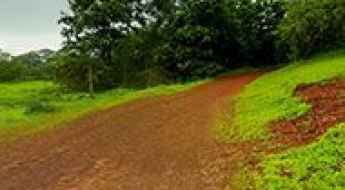
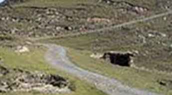
How To Drive the Road to Rajmachi in Maharashtra?
Rajmachi is a mountain town at an elevation of 660m (2,165ft) above sea level, located in the Indian state of Maharashtra.
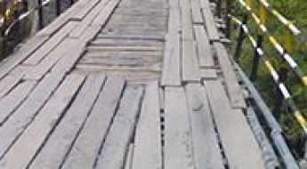
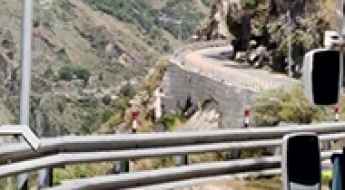
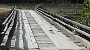
Crossing the spectacular Shansha Bridge in India
Located in the Indian state of Himachal Pradesh, the Shansha Bridge is in very poor condition. It’s one of the most spectacular bridges in the world.
How to get by car to Korzok, one of the highest towns in India
Located in the Ladakh region of the northern Indian state of Jammu and Kashmir, Korzok is one of the highest towns in the country, at an elevation of 4,570m (15,000ft) above sea level.
How to get to the summit of Natha Top in Jammu and Kashmir?
Natha Top is a high mountain peak at an elevation of 2,677m (8,782ft) above sea level, located in the Udhampur district of Jammu and Kashmir, India.
An awe-inspiring road to Jot Pass in Himachal Pradesh
Jot Pass is a high mountain pass at an elevation of 2,440m (8,005ft) above sea level, located in the Indian state of Himachal Pradesh.
A steep cliff road from Jyotirmath to Malari
The paved high mountain road from Jyotirmath to Malari road is located in the Indian state of Uttarakhand, within the Nanda Devi National Park.
How to Get by Car to Lamayuru Monastery in Ladakh?
Lamayuru Monastery is a high mountain monastery at an elevation of 3,510m (11,515ft) above sea level, located in the Leh district of Ladakh, India.
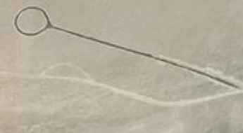
Jalebi bends: 23 hairpin bends on the old road to Fotu La
Jalebi Bends, also known as Jalebi Road or the Old route to Fotu La, is a series of 23 hairpin bends located in the Leh district of Ladakh, India.
Kungzhag La is one of the World's highest motorable roads
Kungzhag La is a high mountain peak at an elevation of 5,780m (18,963ft) above sea level, located on the border between India and China. It’s one of the World's highest motorable roads.
How to get by car to the challenging Demchok-Demqog Border?
The Demchok-Dêmqog is a high mountain border at an elevation of 4,219m (13,841ft) above sea level, located on the border between India and China.
Driving the Scenic Paved Mountain Road to Namshang La
Namshang La is a high mountain pass at an elevation of 4,960m (16,273ft) above sea level, located in the Ladakh region of the northern Indian state of Jammu and Kashmir.
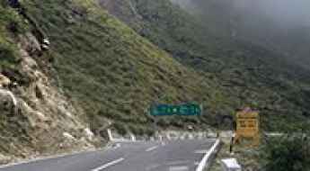
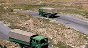
Driving the Hindustan-Tibet Road: A Challenging Adventure on India's NH-22
India is a country abandoned with a lot of interesting architecture. While it offers a variety of cultures, natural beauty, and adventure, the country has a lot to offer its visitors. The Hindustan-Tibet highway, for example, is a great place to go on an adventure ride.
How to Get by Car to Rangdum Monastery in the Ladakh Region?
Rangdum Monastery is a Buddhist site located at an elevation of 4,031 m (13,225 ft) above sea level, located in the Suru Valley, Ladakh, in the Indian union territory of Jammu and Kashmir. It is accessible by road and stands in one of the most remote and high-altitude valleys in the region.
Here's How To Have The Ultimate Road Trip To Kaldang Kildang La
Kaldang-Kildang La is a high mountain pass at an elevation of 4,095m (13,435ft) above sea level, located in the Ladakh region of India.
The road to Umba La is for drivers with strong nerves only
Umba La, also known as Umbala Top, is a high mountain pass standing at an elevation of 4.496m (14,750ft) above sea level. It is situated in the Indian state of Jammu and Kashmir, nestled within the Suru Valley near the Line of Control (LoC), which delineates the Indian- and Pakistani-controlled territories of the former princely state of Jammu and Kashmir.
Travel guide to the top of Padri Pass
Padri Pass is a high mountain pass at an elevation of 3037m (9963ft) above sea level, located in India.
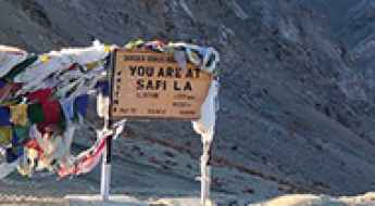
How to Drive the Hairpinned Road to Sapi La?
Sapi La is a high mountain pass at an elevation of 4,397m (14,425ft) above sea level, located in the Kargil district of the Indian union territory of Ladakh. There are plenty of hairpin turns.
How to drive the military road to the summit of Ane La?
Ane La is an international high mountain pass at an elevation of 5,370m (17,618ft) above sea level, located on the China-India border. It’s one of the highest roads in the country.
How to drive the beautiful road to Lake Moriri in northern India?
Tso Moriri is a high mountain lake at an elevation of 4.522m (14,836ft) above sea level, located in the Ladakh region of India.
Driving the wild unpaved road to Tsaka La in the Himalayas
Tsaka La is a high mountain pass at an elevation of 4,646 m (15,242 ft) above sea level, located in Ladakh, India.
Col Chewang Rinchen Setu bridge is said to be India's highest altitude all-weather permanent bridge
At an elevation of 4.358m (14,297ft) above the sea level, Col Chewang Rinchen Setu bridge is India's highest altitude all-weather permanent bridge.
An Explorer's Guide to the Mayudia Pass
Mayudia Pass is a high mountain pass at an elevation of 2.645m (8,677ft) above the sea level, located in the Indian state of Arunachal Pradesh.
Can civilians drive to Rezang La on the India-China border?
Rezang La, also known as Rechin La, is a high mountain pass at an elevation of 5,199m (17,057ft) above sea level, located on the Line of Actual Control (LAC) between Indian-administered Ladakh and the Chinese-administered Spanggur Lake basin. It's one of the highest roads in the country.
Traversing the Tunnel Beneath Kumbhe Waterfall: Maharashtra's Majestic Intersection
Situated within the Western Ghats of Maharashtra, in India, the Kumbhe waterfall stands as a breathtaking spectacle amidst the serenity of nature.
Traversing the Chandana River Bridge is not for the sissies
Located in the Indian state of Assam, the Chandana River Bridge is one of the most spectacular bridges in the world.
Driving the new Nimmu–Padum–Darcha road in India
The Nimmu–Padum–Darcha road (NPDR), also known as the Zanskar Highway, serves as a vital link between the Indian union territory of Ladakh and the state of Himachal Pradesh, traversing through the picturesque region of Zanskar.
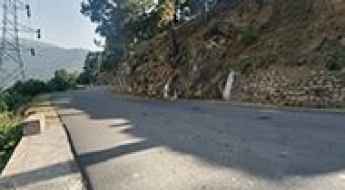
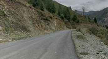
If you love to drive, you’ll love the Patni Top road
Patnitop (or Patni Top) is a hilltop tourist location at an elevation of 2.048m (6,719ft) above sea level, located in Udhampur district in Jammu and Kashmir, in India.
Hamboting La
Hamboting La is a high mountain pass at an elevation of 4.056m (13,307 ft) above the sea level, located in Ladakh region, in the Indian state of Jammu and Kashmir.
A memorable road trip to Namika La in the Himalayas
Namika La is a high mountain pass at an elevation of 3,823m (12,542ft) above sea level, located in Ladakh, India.
How to drive the unpaved road to Khungyami La, one of the world’s highest motorable passes
Khungyami La is an international high mountain pass situated on the sensitive border between China and India at an elevation of 5,844m (19,173ft) above sea level. It is one of the highest motorable roads in the world.