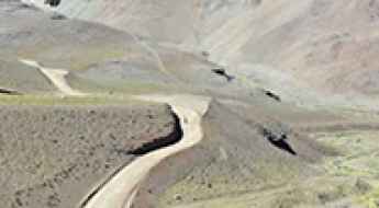
What are the most spectacular roads in Chile?
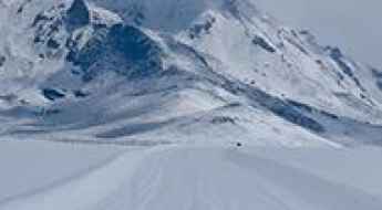
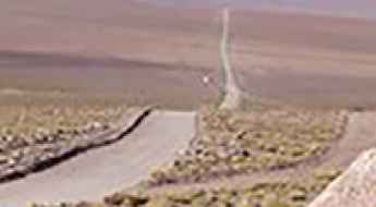
From the dunes of the Atacama to the ice of Patagonian glaciers, Chile is a dream for road trip enthusiasts. Located in South America, the narrow and long country hosts a never-ending list of mountain passes acting as a border with other countries. It’s worth remembering the country shares borders with Argentina, Bolivia and Peru. So, prepare to conquer Agua Negra Pass, the highest road between Argentina and Chile. At an elevation of 4.774m (15,662ft) above sea level and located on the border of Argentina and Chile, it's one of the highest roads in Chile. And, don’t miss Planchon Pass in the Andes, at 2.515m (8,251ft) above sea level, on the border with Argentina.
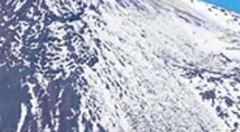
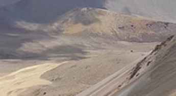
When you travel to Chile, there are hundreds of roads that must be in your list as it hosts more than 150 roads listed on the most spectacular drives in the world. Starting on Ruta 5, part of the Panamerican Highway, that offers a glimpse of Chile's dramatic geography; Paso Internacional Los Libertadores, a series of hairpin turns on the border with Argentina, and ending at Ojos del Salado stratovolcano, the world’s highest active volcano. At 6,891m (22,608ft) above sea level, this mountain has been the scene of several records for attaining the highest altitude aboard a land vehicle. It’s one of the highest accessible points by car on Earth.
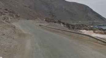
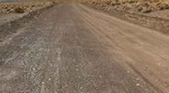
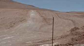
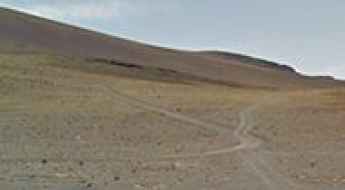
Road B-898
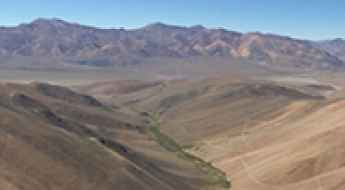
Carretera B-898 is a very scenic drive located in Antofagasta Province, in northern Chile. The road, also known as Ruta Patrimonial de Taltal, is 30.0 km long.
Portezuelo de Guaitiquina
Portezuelo de Guaitiquina is an international high mountain pass at an elevation of 4.288m (14,068ft) above the sea level, located on the border of Chile and Argentina.
Portezuelo El Gaucho
Portezuelo El Gaucho is a high mountain pass at an elevation of 4.177m (13,704ft) above the sea level, located in Huasco Province, in Atacama Region of Chile.
Cerro Azufrera de los Cuyanos
Cerro Azufrera de los Cuyanos is a high mountain peak at an elevation of 5.553m (18,218ft) above the sea level, located in the Atacama Region of Chile, near the Argentinian border. It’s one of the highest roads of the country.
Paso la Chapetona, pure adventure in the Andes
Paso la Chapetona is an international high mountain pass at an elevation of 3.654m (11,988ft) above the sea level, located on the border of Argentina and Chile. The road is less used due its difficulty.
Laguna Casiri Hembra and Casiri Macho
Lagoon Casiri is a high mountain lagoon at an elevation of 4.856m (15,931ft) above the sea level, located on the border of Chile and Bolivia.
Abra Chapoco
Abra Chapoco is a high mountain pass at an elevation of 4.400m (14,435ft) above the sea level, located in Parinacota Province, Arica and Parinacota Region, in Chile.
Scaling the Skies: The Journey Up Putana Volcano- Among Earth's Highest Roads on Earth
Volcán Putana is a stratovolcano located in the Antofagasta region of Chile. A former mine access road climbs up to 5.779m (18,959ft) above the sea level. It’s one of the highest roads on Earth.
Portezuelo Caballo Muerto
Portezuelo Caballo Muerto is a high mountain pass at an elevation of 4.410m (14,468ft) above the sea level, located in the Nevado Tres Cruces National Park in the Atacama Region of Chile.
Portezuelo El Choclo
Portezuelo El Choclo is a high mountain pass at an elevation of 3.375m (11,072ft) above the sea level, located in the Atacama region of Chile.
Portezuelo de Chulluncallani
Portezuelo de Chulluncallani is a high mountain pass at an elevation of 4.492m (14,737ft) above the sea level, located in the Arica y Parinacota Region, in Chile, near the Bolivian border.
A gravel road to the Damas Pass border in the Andes
Paso de las Damas is an international high mountain pass at an elevation of 3.081m (10,108ft) above the sea level, located on the border of Chile and Argentina, in the Andes mountains.
Cerro Carasilla
Cerro Carasilla is a high mountain peak at an elevation of 5.047m (16,558ft) above the sea level, located in the Antofagasta Region of Chile, near the Bolivian border.
Cerros de Anocarire
Cerros de Anocarire is a high mountain peak at an elevation of 4.845m (15,895ft) above the sea level, located in the Arica and Parinacota Region, Chile.
Road trip guide: Conquering Mina Centinela
Mina Centinela is a high mountain copper mine located in the Atacama Region of Chile. It’s one of the highest roads of the country.
The Ultimate Guide to Conquering Cerro Tecar
Cerro Tecar is a high mountain peak at an elevation of 5.088m (16,692ft) above the sea level, located in the Antofagasta region, in northern Chile’s Atacama Desert. It’s one of the highest roads of the country.
An epic road to Abra Mina Maricunga in the Andes
Abra Mina Maricunga is a high mountain pass at an elevation of 4.567m (14,983ft) above the sea level, located in the Atacama Region of Chile.
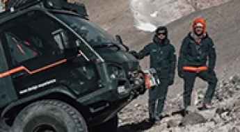
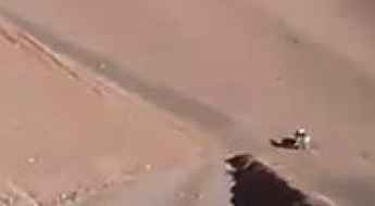
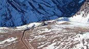
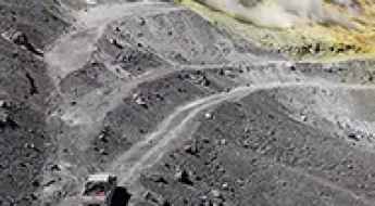
A truck powered by solar energy sets altitude record: it has climbed a volcano in Chile
The transportation of goods by road still lacks heavy electric vehicles that meet certain operational needs. As a result, companies in the sector and drivers continue to await the development of hydrogen fuel cell technology and electric battery systems as solutions to the specific requirements of professional transportation. However, the industry is also considering other options, as demonstrated by the Swiss solar truck that has achieved an impressive feat by conquering the highest active volcano on Earth, located in Chile.
A wild mining road to Vicuña volcano in the Andes
Vicuña is a volcano at an elevation of 5.495m (18,028ft) above sea level, straddling the border between Argentina and Chile. It’s one of the highest roads of the country.
A 4x4 mine road to Cerro El Potro in the Andes
Cerro El Potro is a mountain peak at an elevation of 5.472m (17,952ft) above sea level, straddling the border between Argentina and Chile. It’s one of the highest roads of the country.
The breathtaking road to Cerro La Gitana in the Andes
Cerro La Gitana is a high mountain peak at an elevation of 4,696m (15,406ft) above sea level, located in the Coquimbo Region of Peru. It’s one of the highest roads in the country.
A mining road to Cerro del Carmen in the Andes
Cerro del Carmen is a high mountain peak at an elevation of 5,145m (16,879ft) above sea level, located on the border of Argentina and Chile. It's one of the highest roads in the country.
A wild mining road to Abra de La Deidad in the Andes
Abra de La Deidad is a high mountain pass at an elevation of 4.907m (16,099ft) above sea level, located in the Coquimbo Region of Chile. It’s one of the highest roads in the country.
A 4x4 mine road to Marancales Sur in the Andes
Marancales Sur is a volcano at an elevation of 5.421m (17,785ft) above sea level, straddling the border between Argentina and Chile. It’s one of the highest roads of the country.
Driving the forbidden border road to Portezuelo de Chaxas in the Andes
Portezuelo de Chaxas is an international high mountain pass at an elevation of 4,494m (14,744ft) above sea level, located on the border of Chile and Bolivia.
A wild 4x4 road to Coipitas Pass in the Andes
Paso Coipitas is an international high mountain pass at an elevation of 4.221m (13,848ft) above sea level, located on the border of Argentina and Chile.
A 4x4 mine road to Cerro Vidal Gormaz in the Andes
Cerro Vidal Gormaz is a mountain peak at an elevation of 4.988m (16,364ft) above sea level, located in the Atacama Region of Chile. It’s one of the highest roads of the country.
The breathtaking road to Cerro Umurata in the Andes
Cerro Umurata, also known simply as Umurata, is a volcano situated on the border of Bolivia and Chile. A 4x4 mining trail ascends to an altitude of 5,542 meters (18,182 feet) above sea level near the summit, offering breathtaking views of the Andean highlands. It’s one of the highest roads of South America.
Driving the international border road to Salin Pass in the Andes
Portezuelo de Salín is an international high mountain pass at an elevation of 4,015m (13,172ft) above sea level, located on the Argentinian-Chilean border.
A Wild Mining Road to Tatio Volcano in the Atacama Desert
Volcán Tatio is a dormant stratovolcano located in the Atacama Desert of Chile. North of the summit, a mining road climbs up to 5,184m (17,007ft) above sea level. It’s one of the highest roads in the country.
Travelling through the international Colchane-Pisiga Pass
Paso Colchane-Pisiga is an international high mountain pass at an elevation of 3,695m (12,122ft) above sea level, located on the Chilean-Bolivian border.
Exploring the Remote and Rugged Abra de La Honda o del Portillo: A High Andean International Pass
Abra de La Honda o del Portillo is an international high mountain pass, at an elevation of 4,156m (13,635ft) above sea level, located on the border of Argentina and Chile.
How to get by car to Lastarria Volcano in the Andes?
Volcán Lastarria is a stratovolcano located on the border between Chile and Argentina. A mining road south of the summit tops out at 5,324m (17,467ft) above sea level. It’s one of the highest roads in the country.
How to Get by Car to Taapaca Volcano on the Chilean Highlands?
Volcán Taapacá is a stratovolcano located in the Parinacota Province of Chile. North of the summit, a mining road climbs up to 5,450m (17,880ft) above sea level. It’s one of the highest roads in the country.
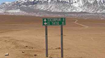
How to get by car to Tocorpuri Volcano on the border of Chile and Bolivia?
Volcán Tocorpuri is a dormant stratovolcano located on the border between Chile and Bolivia. North of the summit, a mining road climbs up to 5,563 m (18,251 ft) above sea level. It’s one of the highest roads in the country.
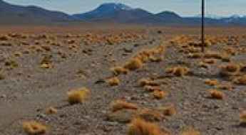
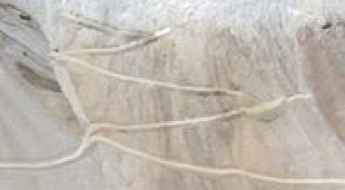
How to Drive Across the High Desert of Siloli?
The Desierto de Siloli is a remote high-mountain desert located in southwestern Bolivia, in the Potosí Department, near the Chilean border. Known for its altitude and isolation, the area sits at around 4,500 meters above sea level and forms part of the route between Uyuni and the Eduardo Avaroa Andean Fauna National Reserve. The road to reach it is entirely unpaved and one of the most striking off-road routes in South America.