What are the most spectacular roads in Chile?
From the dunes of the Atacama to the ice of Patagonian glaciers, Chile is a dream for road trip enthusiasts. Located in South America, the narrow and long country hosts a never-ending list of mountain passes acting as a border with other countries. It’s worth remembering the country shares borders with Argentina, Bolivia and Peru. So, prepare to conquer Agua Negra Pass, the highest road between Argentina and Chile. At an elevation of 4.774m (15,662ft) above sea level and located on the border of Argentina and Chile, it's one of the highest roads in Chile. And, don’t miss Planchon Pass in the Andes, at 2.515m (8,251ft) above sea level, on the border with Argentina.
When you travel to Chile, there are hundreds of roads that must be in your list as it hosts more than 150 roads listed on the most spectacular drives in the world. Starting on Ruta 5, part of the Panamerican Highway, that offers a glimpse of Chile's dramatic geography; Paso Internacional Los Libertadores, a series of hairpin turns on the border with Argentina, and ending at Ojos del Salado stratovolcano, the world’s highest active volcano. At 6,891m (22,608ft) above sea level, this mountain has been the scene of several records for attaining the highest altitude aboard a land vehicle. It’s one of the highest accessible points by car on Earth.
Cerro Blanco
Cerro Blanco is a high mountain peak at an elevation of 5.161m (16,932ft) above the sea level, located in the Andes, in the Tarapacá Region of Chile. It’s one of the highest mountain roads of the country.
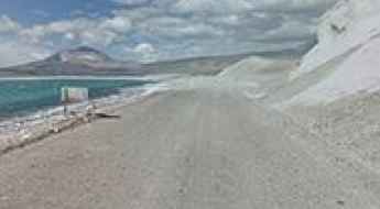
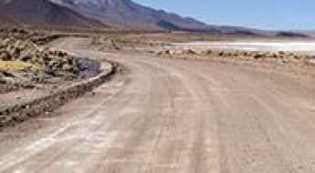
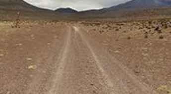
Laguna Santa Rosa
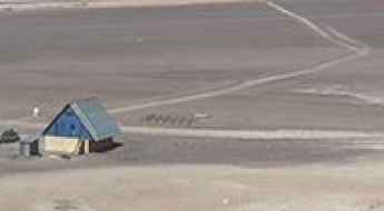
Laguna Santa Rosa is a high mountain salt lake at an elevation of 3.810m (12,500ft) above the sea level, located in northern Chile’s Atacama Desert. Daytime temperatures will reach up to 30 °C, while at night temperatures will tend to drop very low, even below freezing point in winter. There are often also b winds in the area.
Laguna Salar de Pajonales
Laguna Salar de Pajonales is a high mountain lake at an elevation of 3.541m (11,617ft) above the sea level, located in the Región de Antofagasta, in Chile.
Geisers del Tatio
Located within the Andes Mountains of northern Chile, El Tatio is the highest geyser field of the world, at an elevation of 4.320m (14,173ft) above the sea level.
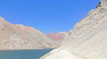
How to drive the mountain road to La Laguna reservoir?
Embalse la Laguna is a high mountain reservoir at an elevation of 3.180m (10,433ft) above sea level located in the Coquimbo Region of Chile.
Laguna Verde
Located in the Andes Mountains of Chile, Laguna Verde is a high mountain lake at an elevation of 4.328m (14,200ft).
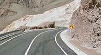
Ruta 23 CH, a 5 stars road in the Andes
Chile Route 23 (Ruta 23 CH) is a very scenic road located on an arid high plateau in the Andes mountains in the northern portion of Chile.
How to drive the volcanic tracks of Cerro Llullaillaco?
Cerro Llullaillaco is a dormant volcano situated on the international border between Argentina (Salta Province) and Chile (Antofagasta Region). A technical unpaved road on the southwest flank of the volcano reaches an elevation of 5,049m (16,564ft). This is a former mining track located in the heart of the Andes, characterized by extreme isolation and a surface composed of volcanic ash and sharp basalt rocks that test the limits of any off-road vehicle.
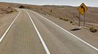
Quebrada de Camarones
Quebrada de Camarones is a mountain pass at an elevation of 1.391m (4,563ft) above the sea level located in the Arica y Parinacota Region in Chile.
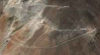
Cerro Las Campanas: Driving to the giant telescopes of the Atacama
Cerro Las Campanas is a high mountain peak at an elevation of 2,380m (7,810ft) above sea level, located in the Atacama Desert of northern Chile. The road leads directly to the Las Campanas Observatory astronomical facilities near the border of the Atacama and Coquimbo regions.
Cerro Tololo
Cerro Tololo is a high mountain pass at an elevation of 2.207m (7,241ft) above the sea level, located in the foothills of the Andes, in the Coquimbo Region of northern Chile.
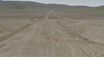
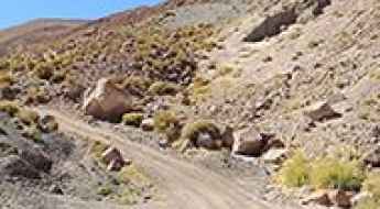
Road C-173
C-173 is a high mountain track located in the Atacama region of Chile, running entirely over the 3.000m above the sea level.
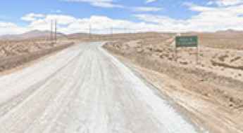
Ruta A-235
A-235 is a very exciting journey in the heart of the Las Vicuñas National Reserve, in the Arica and Parinacota Region of Chile. It runs entirely over 4.100m above the sea level.
Cuesta Chita
Cuesta Chita is a high mountain pass at an elevation of 4.512m (14,803ft) above the sea level, located in the Andes mountains of northeastern Chile. It’s one of the highest roads of the country, running entirely over 3.000m above the sea level.
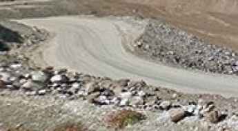
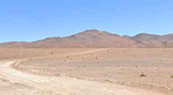
Chollay-Punta Colorada Road
Chollay-Punta Colorada road is one of the most scenic drives in Chile. The road climbs several mountain passes through more than 30 hairpin turns.
The road to Portezuelo Paranal in the Andes will take your breath away
Portezuelo Paranal is a high mountain pass at an elevation of 4.832m (15,853ft) above the sea level located in the Antofagasta Region of Chile, near the Argentinian border. It’s one of the highest roads of the country.
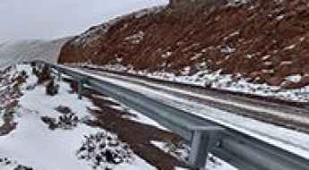
The road to Paso Barros Arana in the Andes
Paso Barros Arana is a high mountain pass at an elevation of 3.431m (11,256ft) above the sea level, located on an arid high plateau in the Andes mountains of northeastern Chile.
How to drive the unpaved road to Portezuelo Maricunga in the Atacama Desert
Portezuelo Maricunga is a high mountain pass at an elevation of 4,133m (13,559ft) above sea level, located in the heart of northern Chile’s Atacama Desert.
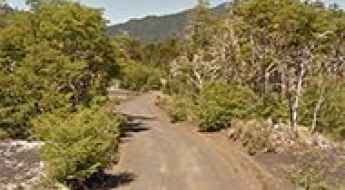
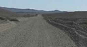
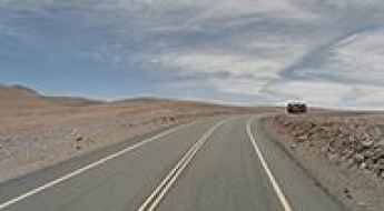
Road R-925-S
R-925-S is a very scenic drive located at the foot of the Andes, in the Province of Cautín, Araucanía Region, in Chile.
How to drive through San Juan Pass in the Andes?
Paso de San Juan is a high mountain pass at an elevation of 3.607m (11,833ft) above sea level, located in the San Pedro de Atacama commune, in Chile.
How to drive the unpaved road to Quebrada Blanca?
Quebrada Blanca is a high mountain pass at an elevation of 4.389m (14,399ft) above sea level, located in the Tarapacá Region of Chile.
Claudio Lucero Refuge
Refugio Claudio Lucero is a high mountain refuge at an elevation of 4.527m (14,852ft) above the sea level, located in the Atacama Region of Chile, near the Argentinian border.
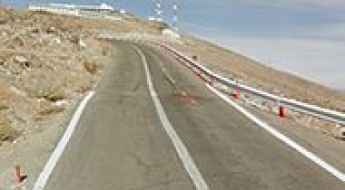
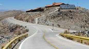
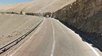
Driving the steep road to La Silla Observatory in the Atacama
La Silla is a high mountain peak at 2,400 meters, standing as a sentinel in the southern Atacama Desert of northern Chile. This is the driest and most remote desert on Earth, and the road to the summit, the C-541, is the only lifeline to one of the world's most important astronomical hubs. While the road is asphalted to allow for the transport of delicate optical equipment, the drive is a brutal encounter with the Andean foothills, where the heat, the isolation, and the steep gradients test the cooling system and the driver's focus at every kilometer.
Valle Nevado chairlift
Valle Nevado chairlift lies in the Andes Mountains of Chile, at an elevation of 3.306m (10,846ft) above the sea level.
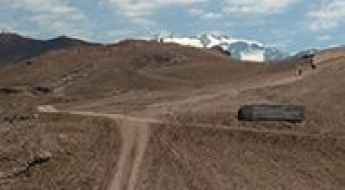
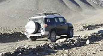
How to drive the high-altitude mine road to Volcán Apagado?
The high-altitude mine road to Volcán Apagado is an extreme unpaved mountain track situated on the international border between Chile (Antofagasta Region) and Bolivia (Potosí Department). The 14.6-kilometer dirt trail starts from the B-145 road near Ayaviri and climbs the rugged volcanic slopes to reach a maximum elevation of 5,343 meters (17,529 ft) above sea level.
Cerro Canasa
Cerro Canasa is a high mountain pass at an elevation of 4.304m (14,119ft) above the sea level, located in the Chilean Tarapacá Region, near the Bolivian border.
Nevados de Vilcún
Nevados de Vilcún is a ski resort at an elevation of 1.508m (4,947ft) above the sea level, located within the Conguillío National Park, in the Araucania region of Chile.
How to drive the unpaved Ruta Lapislázuli to Paso la Chapetona?
Paso la Chapetona, also known as Paso del Azufre Norte, is a high mountain pass at an elevation of 3,654m (11,988ft) above sea level, situated on the border between Chile and Argentina. For drivers, this is a dead-end mining track known as Ruta Lapislázuli, which climbs the Andes from the Chilean side toward the mineral deposits of the Coquimbo Region.
Mirador de Toconce
Mirador de Toconce is a high mountain observation deck at an elevation of 3.339m (19,954ft) above the sea level located in the Antofagasta region of Chile.
Atacama Refuge
Refugio Atacama is a high mountain refuge at an elevation of 5.256m (17,244ft) above the sea level, located in the Atacama Region of Chile, near the Argentinian border.
Cerro Capi
Cerro Capi is a mountain at an elevation of 965m above the sea level located in northern Chile’s Atacama Desert. The road is extremely steep, with sections up to 15%.
Driving the steep and truck-filled Cuesta de Llanta
Cuesta de Llanta is one of the most punishing and high-pressure sections of road in the Atacama Desert. Located in the Chañaral Province of northern Chile, this short but brutal climb is part of the Route C-13, the main lifeline for the massive mining operations in Diego de Almagro and the ghost town of Potrerillos. It is a world of dust, heat, and heavy machinery where the asphalt is constantly tortured by the weight of oversized trucks. Driving here is an exercise in patience and nerves, as you navigate steep inclines while surrounded by the constant roar of industrial traffic.
How to drive the unpaved road to Azufrera Tacora?
Azufrera Tacora is an abandoned sulphur mine at an elevation of 4.518m (14,822ft) above sea level, located on the border of Chile and Peru.
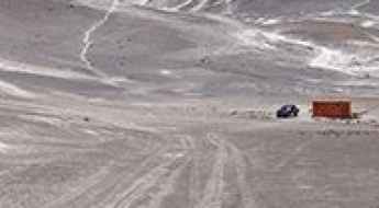
Cerro Camellos: A high-altitude 4x4 challenge in the Atacama Desert
Reaching the summit of Cerro Camellos is like driving on another planet. At 4,431m (14,537ft) above sea level, this peak in the Tarapacá Region of northern Chile is a place of absolute isolation. The landscape is a mix of volcanic rock, white dust, and a sky so blue it feels artificial. If you decide to leave the asphalt and head up here, make sure your vehicle is ready for the thin air and the punishing desert heat.
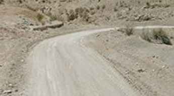
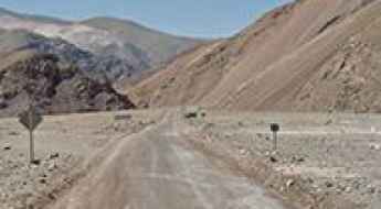
Road D-447
Carretera D-447 is a very scenic drive located in the Elqui Province, Coquimbo Region, in Chile. This is a maintained road where a high clearance 2WD vehicle is able to travel safely at low speeds on long dry straight-of-ways, without losing control due to wash boarding, ruts, or dips.
Is the road to Cerro Azufrera de los Cuyanos the ultimate high-altitude test in Chile?
Cerro Azufrera de los Cuyanos is a massive volcano located in the Atacama Region of Chile, near the border with Argentina. A mining road near the summit climbs up to 5,553m (18,218ft) above sea level. It’s one of the highest roads in the country.