What are the most spectacular roads in Chile?
From the dunes of the Atacama to the ice of Patagonian glaciers, Chile is a dream for road trip enthusiasts. Located in South America, the narrow and long country hosts a never-ending list of mountain passes acting as a border with other countries. It’s worth remembering the country shares borders with Argentina, Bolivia and Peru. So, prepare to conquer Agua Negra Pass, the highest road between Argentina and Chile. At an elevation of 4.774m (15,662ft) above sea level and located on the border of Argentina and Chile, it's one of the highest roads in Chile. And, don’t miss Planchon Pass in the Andes, at 2.515m (8,251ft) above sea level, on the border with Argentina.
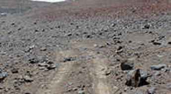
When you travel to Chile, there are hundreds of roads that must be in your list as it hosts more than 150 roads listed on the most spectacular drives in the world. Starting on Ruta 5, part of the Panamerican Highway, that offers a glimpse of Chile's dramatic geography; Paso Internacional Los Libertadores, a series of hairpin turns on the border with Argentina, and ending at Ojos del Salado stratovolcano, the world’s highest active volcano. At 6,891m (22,608ft) above sea level, this mountain has been the scene of several records for attaining the highest altitude aboard a land vehicle. It’s one of the highest accessible points by car on Earth.
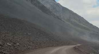
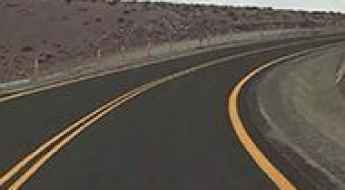
Conquer the Spectacular Paso Internacional Los Libertadores: Chile-Argentina Border Crossing
Chile and Argentina share more than 5,000 miles of border, most of them drawn on the imposing peaks of the Andes. With over 40 border crossings between the two countries spread over the mountains, the most spectacular is Paso Internacional Los Libertadores, also known as Paso del Cristo Redentor.
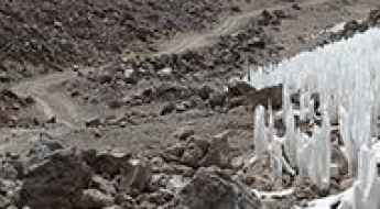
Ojos del Salado is one of the highest accessible points by car on Earth
Ojos del Salado is a massive stratovolcano on the Argentina-Chile border and the highest volcano in the world at 6,891m (22,608ft) above sea level. This mountain has been the scene of several records for attaining the highest altitude aboard a land vehicle. It’s one of the highest accessible points by car on Earth.
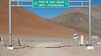
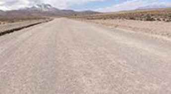
Agua Negra Pass is the highest road between Argentina and Chile
Paso de Agua Negra (Black Water Pass) is an international high mountain pass at an elevation of 4.774m (15,662ft) above sea level, located on the border of Argentina and Chile. It's one of the highest roads in the country.
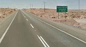
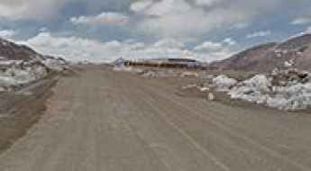
Route 5 is Chile's longest route
Part of the Panamerican Highway, Ruta Nacional 5 is said to be Chile's longest route. It's a notoriously dangerous drive filled with deep valleys, steep drops, and desert.
What are the highest roads in Chile?
Located along the southwestern edge of South America, Chile is the world's longest country—a spectacular, narrow strip of land defined entirely by the opposing forces of the vast Pacific Ocean and the immense, towering Andes Mountains. Running the entire length of the nation, the Andes create a constant geographical barrier, featuring peaks that rank among the highest in the Americas.
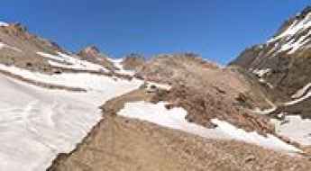
Driving the road to Embalse El Yeso and Termas del Plomo
Embalse El Yeso is a turquoise reservoir at an elevation of 2,605m (8,546ft) above sea level, located in the Santiago Metropolitan Region of Chile. Situated in the heart of the Cajón del Maipo, this Andean dam is a primary water source for Santiago and offers a high-altitude driving experience through the rugged mountain landscape near the Argentinian border.
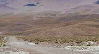
Road trip guide: Conquering Planchon Pass in the Andes
Paso del Planchón is an international high mountain pass at an elevation of 2.515m (8,251ft) above sea level, located on the border of Argentina and Chile.
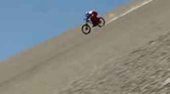
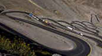
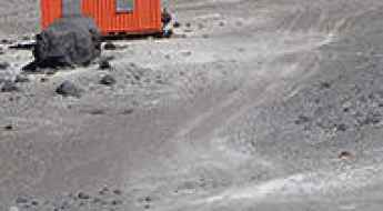
The World’s Fastest Downhill Mountain Bike Ride in the Atacama desert
Austrian downhill rider Max Stöckl broke the world speed record for stock mountain bikes on gravel, in the Atacama desert of Chile, reaching an incredible top speed of over 167 km/h (104 miles per hour).
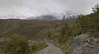
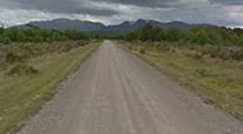
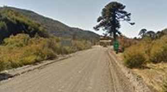
Driving the Chilean Carretera Austral is a lifetime adventure
Carretera Austral is one of the most spectacular and challenging drives in the world. Running through the northwestern part of Chilean Patagonia, it’s a lifetime adventure for anybody.
Cerro Sairecabur: The Ultimate Road Trip Guide
Cerro Sairécabur is a volcano at an elevation of 5.541m (18,179ft) above sea level, located on the border between Bolivia and Chile. It’s one of the highest roads in the country.
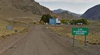
How to drive the Andean border road to Futaleufu Pass
Paso Futaleufú is an international mountain pass at an elevation of 335m (1,099ft) above sea level, located on the border of Chile and Argentina.
An Andean border road to Cardenal Antonio Samore Pass
Paso Cardenal Antonio Samoré is an international mountain pass at an elevation of 1.306m (4,284ft) above sea level, located on the border of Chile and Argentina. It is one of the main mountain passes through the southern Andes.
An Andean mountain road to Pehuenche Pass
Paso Pehuenche is an international high mountain pass at an elevation of 2.557m (8,389ft) above sea level, on the border of Chile and Argentina.
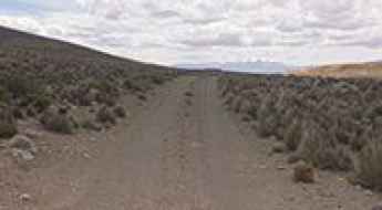
How to drive the unpaved road to Guallatiri Volcano?
Guallatiri is a stratovolcano located in the Putre commune of Chile. An unpaved road on its northern side climbs up to an elevation of 5.240m (17,191ft) above sea level. The drive requires a 4WD vehicle with high clearance. It’s one of the highest roads in the country.
An old mine road to the summit of Cerro Aucanquilcha
Cerro Aucanquilcha is a massive stratovolcano located in the Antofagasta Region of Chile. An old mine road used to run to the top, but now much of it about 5.500m (18,044ft) above sea level has been wiped out by landslides. For many years it was the highest drivable road in the world.
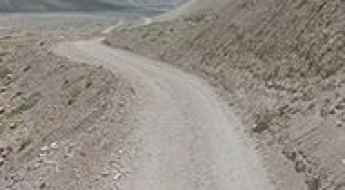
Sico Pass is a scenic border pass in the Andes
Paso de Sico is an international high mountain pass at an elevation of 4.092m (13,425ft) abovee sea level, located on the border of Chile and Argentina.
Tejos Refuge is one of the highest roads of South America
Refugio Tejos is a high mountain hut at an elevation of 5,800m (19,000ft) above sea level, located in Chile. It's one of the highest motorable roads in the world.
Conquering the scenic Y290 road in the Chilean Patagonia
Carretera Y290 is a very scenic road running straddling Torres de Paine and Última Esperanza provinces in the Chilean region of Magallanes and Antártica Chilena, near the Argentinian border.
Get behind the wheels for the Chilean CH-265, one of the planet’s most scenic roads
Ruta CH-265 is a great drive located in the Aysén Region of the Chilean Patagonia. It is one of the world's most scenic drives. The road is unpredictable, grueling, unsafe and tough, but yet captivating, charming, and strikingly beautiful.
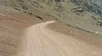
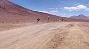
Travel guide to Llano Chajnantor in Chile
Llano Chajnantor is an arid high mountain plateau at an elevation of 5.042m (16,541ft) above sea level, located in El Loa Province, in the Antofagasta Region of Chile. It's one of the highest roads of the country.
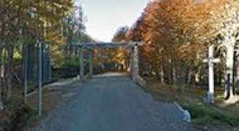
The road with 65 hairpin turns to Christ the Redeemer of the Andes
Set high in the Andes, Cristo Redentor de los Andes is a massive 4-ton statue at an elevation of 3,832m (12,572ft) above sea level, located on the border between Argentina and Chile.
Carirriñe Pass is a scenic, lesser-traveled mountain pass between Chile and Argentina
Paso Carirriñe is an international high mountain pass at an elevation of 1.150m (3,772ft) above sea level, located on the border of Chile and Argentina. The road is less used but very beautiful.
How to get by car to Termas Valle de Colina natural pools?
Located in the Santiago Metropolitan Region of Chile, at an elevation of 2,500m (8,202ft) above sea level, Termas Valle de Colina comprises 9 natural pools of thermal water with temperatures up to 50 ºC.
Ruta 3 Tierra del Fuego is the southernmost paved road on Earth
Ruta 3 in Tierra del Fuego is one of the world's most spectacular drives. Stretching 395km (245 miles) through the Tierra del Fuego Province of Argentina, it is said to be the southernmost paved road on Earth.
Pichachen Pass is a vital border road from Argentina to Chile in the Andes
Paso Internacional Pichachén is an international high mountain pass at an elevation of 2.063m (6,768ft) above sea level, located on the border of Argentina and Chile.
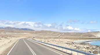
How to get by car to Chungara Lake in Chile?
Lago Chungará is a high mountain lake at an elevation of 4,517m (14,820ft) above sea level, located in the Parinacota Province of the Arica and Parinacota Region in Chile. It’s the 10th highest lake in South America.
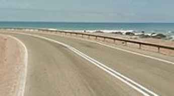
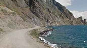
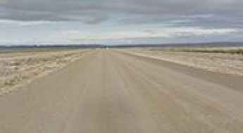
Ruta 1 is a Coastal Road Surrounded by a Lunar-Like Depression
Located in northern Chile, Ruta 1 is a very scenic coastal road running through a dramatic surrounding landscape. It is considered one of the best coastal drives in the world.
Driving the international border road to Socompa Pass in the Andes
Paso Socompa is an international high mountain pass at an elevation of 3.876m (12,716ft) above sea level, located on the Argentinian-Chilean border.
Driving Ruta 9 to Faro San Isidro, the Southernmost Lighthouse on the American Mainland
San Isidro Lighthouse is located in the XII Region of Magallanes and Chilean Antarctica, in southern Patagonia, Chile. It's the southernmost lighthouse on the mainland continent. Lit in 1904, it's part of a chain of eight century-old lighthouses placed along the shores of the Strait of Magellan.
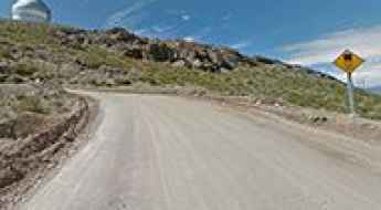
Travel guide to the top of Cerro Pachon
Cerro Pachón is a high mountain peak at an elevation of 2,696 meters (8,845 feet) above sea level, located in the Coquimbo Region of Chile.
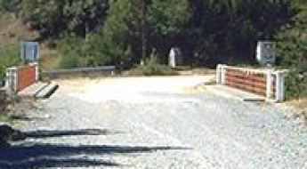
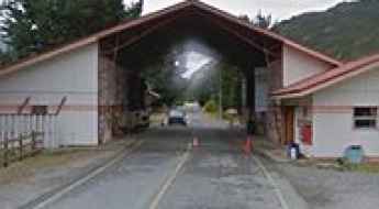
The Rio Encuentro bridge crossing from Argentina to Chile
Paso Internacional Río Encuentro is unique among Andean crossings. Instead of a high-altitude climb, this border is defined by a 30-meter international bridge over the Encuentro River. This small span connects the Chubut Province in Argentina with the Los Lagos Region in Chile, serving as a vital link between the towns of Corcovado and Palena. It’s one of the most spectacular bridges in the world.
Driving one of the highest roads of South America to Tacora Volcano
Volcan Tacora is a stratovolcano located in the Arica y Parinacota Region of Chile, near the Peruvian border. A mine road near the summit tops out at 5.590m (18,339ft) above sea level. It’s one of the highest roads of South America.
Portezuelo del Cajon is an Andean gravel pass
Portezuelo del Cajón is an international high mountain pass on the border between Chile and Bolivia, at an elevation of 4,480m (14,698ft) above sea level, located on the lower southeast flank of the Juriques volcano, in the Andes.
Travelling Through Ruta 27 (CH-27) in the Andes
Ruta 27 is a high mountain road located in the northern part of Chile, crossing an arid plateau in the Andes mountains.
Mamuil Malal Pass: a border road in the Andes
Paso Mamuil Malal is an international high mountain pass at an elevation of 1,253m (4,111ft) above sea level, on the border between Chile and Argentina.
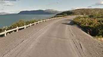
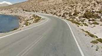
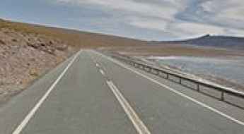
A stunning coastal road from Caldera to Huasco
Located in the Atacama Region of Chile, the road from Caldera to Huasco is one of the most amazing coastal drives in the country.