What are the most spectacular roads in Bolivia?
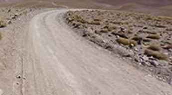
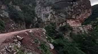
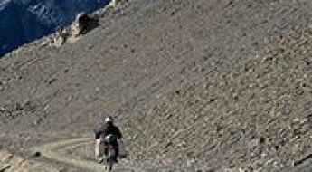
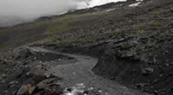
Located in South America, Bolivia is home to the most famous road in the world: the unpaved Death Road. Locally known as Carretera de los Yungas, this gravel dirt track covers a 36.4km (22.61 miles) stretch between La Paz and Coroico.
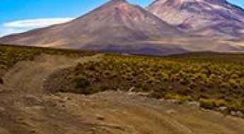
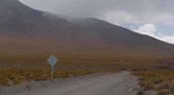
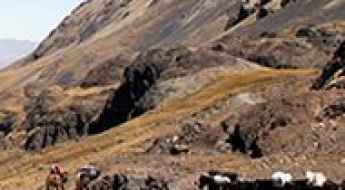
Part of the Andes Mountains (in the western part of the country), Bolivia is home to amazing mountain roads, including a few challenging mountain passes acting as a border. It’s worth driving the international Chungara-Tambo Quemado Pass, at 4.687m (15,377ft) above sea level on the border with Chile. For lovers of mountain roads, don’t miss Cerro Sairécabur, a volcano at 5.541m (18,179ft) above sea level, on the border with Chile. It’s one of the highest roads in Bolivia. Or Cerro Uturuncu, a stratovolcano in the Potosí Department, climbing up to 6.008m (19,711ft) above sea level. It’s one of the highest roads in the world. If you’re brave enough, you can tackle El Angosto, one of the deadliest roads in the world. Located in the Tarija Department, the Pilcomayo canyon ranks among the world's most treacherous roads.
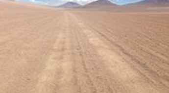
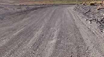
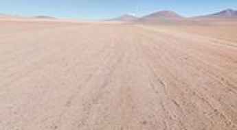
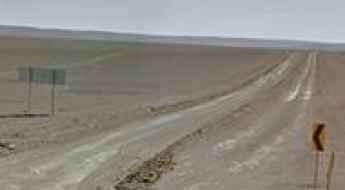
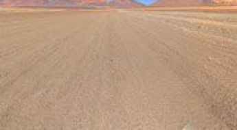
How to Drive Across the High Desert of Siloli?
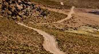
The Desierto de Siloli is a remote high-mountain desert located in southwestern Bolivia, in the Potosí Department, near the Chilean border. Known for its altitude and isolation, the area sits at around 4,500 meters above sea level and forms part of the route between Uyuni and the Eduardo Avaroa Andean Fauna National Reserve. The road to reach it is entirely unpaved and one of the most striking off-road routes in South America.
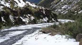
How to drive the challenging road to La Cumbre?
La Cumbre is a high mountain pass at an elevation of 4,506 m (14,783 ft) above sea level, located in the Cochabamba department of Bolivia.
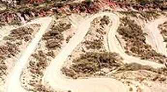
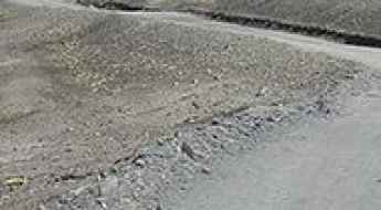
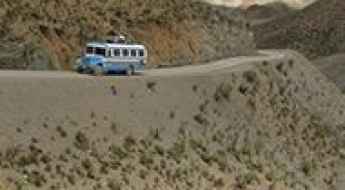
How to drive the hairpin turns to Collpani?
Collpani is a rural settlement located in the La Paz Department of Bolivia. The road to the town is one of the roads with the most hairpin turns in the world. This route is not recommended if your passengers are prone to car sickness. Don’t stuff your belly too much. Eventually, you might feel vomiting temptations.
How to drive the road from Quime to Sacambaya Valley in La Paz?
The Quime-Sacambaya Valley Road is a high mountain narrow trail located in the La Paz Department of Bolivia.
A memorable road trip to Abra Laguna Morijon
Abra Laguna Morijon is a high mountain pass at an elevation of 4,901 m (16,079 ft) above sea level, located in the Sur Lípez Province of Bolivia. It's one of the highest roads in the country.
How to get by car to Laguna Colorada in the altiplano of Bolivia?
Laguna Colorada is a shallow red salt lake at an elevation of 4.278m (14,035ft) above sea level, located in the Potosí department of Bolivia.
Driving the road to Cerro Gigante is not a piece of cake
Cerro Gigante is a high mountain pass at an elevation of 5.286m (17,342ft) above sea level, located in the La Paz Department, in Bolivia. It's one of the highest roads in the country.
The Road To Cerro Cañapa Has It All
Cerro Cañapa is a high mountain peak at an elevation of 5.629m (18,467ft) above the sea level, located in the Nor Lípez province of the Bolivian department of Potosí, close to the border with Chile. It’s one of the highest roads of the country.
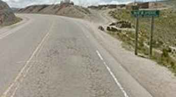
Tarija-Villamontes Road
The Tarija-Villamontes road is an amazing journey in the mountains of south-eastern Bolivia. Part of the Ruta Nacional 11, the road links Tarija (or San Bernardo de la Frontera de Tarixa) and Villamontes. It’s said to be the most dangerous road in the country.
The road to Abra Puca Loma: be ready to make room for oncoming vehicles
Abra Puca Loma is a high mountain pass at an elevation of 4.804m (15,761ft) above sea level, located in the Cordillera de Lípez in the Sud Lípez Province of the Potosí Department in southwestern Bolivia. It's one of the highest roads in the country.
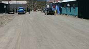
San Antonio de Lipez
San Antonio de Lipez is a ghost town in Andes landscape at an elevation of 4.758m (15,610ft) above the sea level, located in the Cordillera de Lípez in the Sud Lípez Province of the Potosí Department in southwestern Bolivia. The town is said to be haunted.
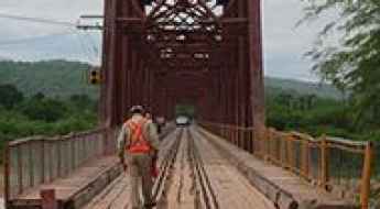
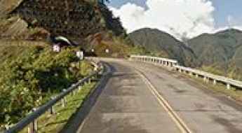
Pilcomayo bridge
Located in the Tarija Department in south-eastern Bolivia, the bridge over the Pilcomayo river, is one of the most spectacular bridges in the world.
La Cumbre Apacheta
La Cumbre Apacheta is a high mountain pass at an elevation of 4.871m (15,980ft) above the sea level, located in the La Paz Department, in Bolivia. It's one of the highest mountain roads of the country.
Laguna Salada
Laguna Salada is a high mountain salt lake at an elevation of 4.407m (14,458ft) above the sea level, located in the Sur Lípez Province of the Potosí Department, Bolivia.
Bolivar Mine
Mina Bolivar is a mine at an elevation of 5.161m (16,932ft) above the sea level, located in Sur Lípez (or Sud Lípez) province in the Potosí Department in southwestern Bolivia. It's one of the highest mountain roads of the country.
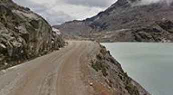
Lago Zongo
Lago Zongo is a high mountain lake at an elevation of 4.776m (15,669ft) above the sea level, located in La Paz Department, in Bolivia.

Pan-American Highway, the longest road in the world
The challenging Pan-American Highway is one of the biggest adventures in the world. It’s a network of roads covering almost 30,000 kilometres (19,000 mi) from North America to South America. It’s said to be the longest road on Earth.
Laguna Jankho Khota
Laguna Jankho Khota is a high mountain lake at an elevation of 4.701m (15,423ft) above the sea level, located in La Paz Department, in Bolivia.
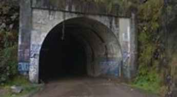
Tunel San Rafael
Located in the La Paz Department, in Bolivia, the San Rafael Tunnel is one of the highest tunnels in the world, at an elevation of 3.040m (9,973ft) above the sea level.
Visviri Pass
Paso Visviri is an international high mountain pass at an elevation of 4.095m (13,435ft) above the sea level, located on the border of Chile and Bolivia.
The road to Curiquinca Volcano isn’t an easy one
Curiquinca is a stratovolcano at an elevation of 5.625m (18,454ft) above the sea level, located on the border between Bolivia and Chile. It's one of the highest mountain roads of the country.
Lago Laramcota
Lago Laramcota is a high mountain lake at an elevation of 4.851m (15,915ft) above the sea level, located in the Kimsa Cruz mountain range in the Andes of Bolivia. The road to the lake, also known as Laram Quta, is gravel, rocky, tippy and bumpy at times. It's one of the highest mountain roads of the country.
Driving the unpaved road to Paso Sanchez in La Paz Department
Paso Sanchez is a high mountain pass at an elevation of 4,792m (15,721ft) above sea level, located in La Paz Department, in Bolivia. It’s one of the highest roads in the country.
Cordón de Inacaliri
Cordón de Inacaliri is a volcano at an elevation of 5.395m (17,700ft) above the sea level, located on the Chilean-Bolivian border. It’s one of the highest mountain roads of the country.
Cerro Santa Isabel
Cerro Santa Isabel is a high mountain peak at an elevation of 5.153m (16,906ft) above the sea level, in the Cordillera de Lípez in the Sud Lípez Province of the Potosí Department in southwestern Bolivia. It's one of the highest mountain roads of the country.
Ch'iyar Qirini
Ch'iyar Qirini is a high mountain peak at an elevation of 5.194m (17,040ft) above the sea level, located in La Paz Department, in Bolivia. It's one of the highest mountain roads of the country.
A rough 4x4 road to Portezuelo Sairécabur
Portezuelo Sairécabur is a high mountain peak at an elevation of 5.541m (18,179ft) above the sea level, located northeast of San Pedro de Atacama, on the border of Bolivia and Chile. It's one of the highest roads of the country.
Laguna Verde
Laguna Verde is a high mountain salt lake at an elevation of 4.300m (14,100ft) above the sea level, located in the Sur Lípez Province of the Potosí Department, Bolivia.
Apacheta de Irpa o Cancosa Pass
Paso Apacheta de Irpa o Cancosa is an international high mountain pass at an elevation of 4.010m (13,156ft) above the sea level, located on the border of Chile and Bolivia.
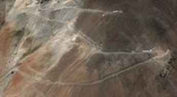
Antenas de Entel (Jamp'aturi)
Located in the La Paz Department, in Bolivia, las Antenas de Entel is a high mountain communication tower at an elevation of 4.937m (16,197ft) above the sea level. It's one of the highest mountain roads of the country.
Cuesta de Sama
Cuesta de Sama is a high mountain pass at an elevation of 3.889m (12,759ft) above the sea level located in the Tarija Department in Bolivia.
Unduavi Tunnel
Tunel de Unduavi is a high mountain tunnel at an elevation of 3.402m (11,161ft) above the sea level, located in La Paz Department, in Bolivia, within the Cordillera Real of the Bolivian Andes.
Travel guide to the top of Mullu Apachita
Mullu Apachita is a high mountain pass at an elevation of 5.018m (16,463ft) above the sea level, located in La Paz Department, in Bolivia. It's one of the highest mountain roads of the country.
Mecoya-Mecoyita Pass
Paso de Mecoya-Mecoyita is an international high mountain pass at an elevation of 2.373m (7,785ft) above the sea level, located on the Bolivian-Argentinian border.
Laguna Milluni
Laguna Milluni is a high mountain lake at an elevation of 4,565m (14,977ft) above the sea level, located in the Cordillera Real of the Bolivian Andes.
Apagado Volcano
Volcán Apagado is a volcano at an elevation of 5.343m (17,529ft) above the sea level, located on the border of Chile (Región de Antofagasta) and Bolivia (Potosi Department).