What are the most spectacular roads in Bolivia?
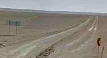
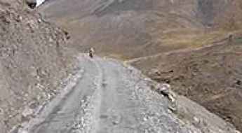
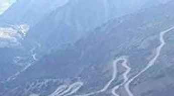
Located in South America, Bolivia is home to the most famous road in the world: the unpaved Death Road. Locally known as Carretera de los Yungas, this gravel dirt track covers a 36.4km (22.61 miles) stretch between La Paz and Coroico.
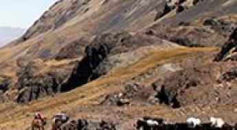
Part of the Andes Mountains (in the western part of the country), Bolivia is home to amazing mountain roads, including a few challenging mountain passes acting as a border. It’s worth driving the international Chungara-Tambo Quemado Pass, at 4.687m (15,377ft) above sea level on the border with Chile. For lovers of mountain roads, don’t miss Cerro Sairécabur, a volcano at 5.541m (18,179ft) above sea level, on the border with Chile. It’s one of the highest roads in Bolivia. Or Cerro Uturuncu, a stratovolcano in the Potosí Department, climbing up to 6.008m (19,711ft) above sea level. It’s one of the highest roads in the world. If you’re brave enough, you can tackle El Angosto, one of the deadliest roads in the world. Located in the Tarija Department, the Pilcomayo canyon ranks among the world's most treacherous roads.
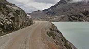
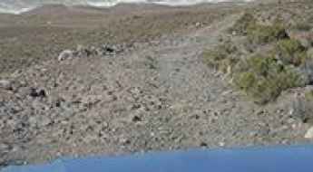
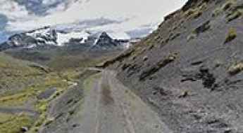
Driving the high altitude road to Zongo and Milluni lakes in Bolivia
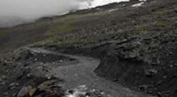
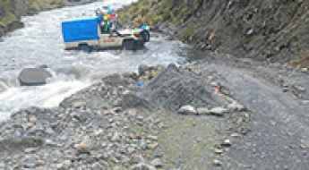
The road through the Zongo Valley, in the heart of the Bolivian Cordillera Real, is a high-altitude gauntlet that connects a series of four stunning glacial lakes. From the industrial remnants near Laguna Milluni and Milluni Chico to the staggering heights of Lago Zongo and the remote Jankho Khota, this 30-kilometer gravel track is a masterclass in Andean survival. Climbing to elevations well above 4,700 meters, the route is a raw, unpaved ribbon of earth that cuts through a barren landscape of rock and ice, where the thin air and the treacherous terrain push both man and machine to their absolute breaking point.
Bolivar Mine
Mina Bolivar is a mine at an elevation of 5.161m (16,932ft) above the sea level, located in Sur Lípez (or Sud Lípez) province in the Potosí Department in southwestern Bolivia. It's one of the highest mountain roads of the country.
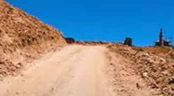
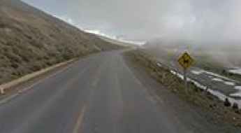
How to drive through the 4,095m Paso Visviri?
Paso Visviri is an international high-altitude mountain pass at an elevation of 4,095m (13,435ft) above sea level, situated on the border between Chile and Bolivia. The pass serves as a logistical link between the Chilean hamlet of Visviri, in the Arica and Parinacota Region, and the Bolivian town of Charaña. The 4.7 km transit is entirely unpaved, consisting of a gravel and dirt track that requires specialized mechanical preparation to overcome the extreme altitude and unpredictable surface conditions of the Altiplano.
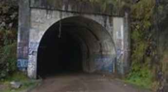
How to drive the Tunel San Rafael in La Paz
Located in the La Paz Department, in Bolivia, the San Rafael Tunnel is one of the highest tunnels in the world, at an elevation of 3.040m (9,973ft) above sea level.
The road to Curiquinca Volcano isn’t an easy one
Curiquinca is a stratovolcano at an elevation of 5.625m (18,454ft) above the sea level, located on the border between Bolivia and Chile. It's one of the highest mountain roads of the country.
Driving the unpaved road to Paso Sanchez in La Paz Department
Paso Sanchez is a high mountain pass at an elevation of 4,792m (15,721ft) above sea level, located in La Paz Department, in Bolivia. It’s one of the highest roads in the country.
Ch'iyar Qirini
Ch'iyar Qirini is a high mountain peak at an elevation of 5.194m (17,040ft) above the sea level, located in La Paz Department, in Bolivia. It's one of the highest mountain roads of the country.
Cerro Santa Isabel
Cerro Santa Isabel is a high mountain peak at an elevation of 5.153m (16,906ft) above the sea level, in the Cordillera de Lípez in the Sud Lípez Province of the Potosí Department in southwestern Bolivia. It's one of the highest mountain roads of the country.
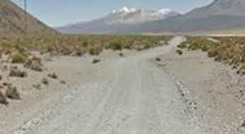
How to drive the unpaved track of Paso Apacheta de Irpa o Cancosa?
Paso Apacheta de Irpa o Cancosa is an international high mountain pass at an elevation of 4,010m (13,156ft) above sea level, situated on the border between Chile and Bolivia. The 11.6 km route connects the Chilean village of Cancosa in the Tarapacá Region with Bella Vista in Bolivia. Known logistically as a rugged unpaved corridor, the pass is served by the A-557 road in Chile and Camino Bella Vista in Bolivia, requiring high-clearance vehicles and specialized driving protocols for the Altiplano terrain.
How to drive the gravel road to Mecoya-Mecoyita Pass?
The Mecoya-Mecoyita Pass (Paso de Mecoyita) is an international high mountain crossing at an elevation of 2,373m (7,785ft) above sea level, situated on the border between Argentina and Bolivia. The route spans 4 km, linking the settlement of Mecoyita in the Salta Province (Argentina) with Mecoya in the Tarija Department (Bolivia). The track is known as RN45 on the Bolivian side and remains unnamed on the Argentinian sector, consisting of a technical gravel surface that is highly sensitive to moisture.
Antenas de Entel (Jamp'aturi)
Located in the La Paz Department, in Bolivia, las Antenas de Entel is a high mountain communication tower at an elevation of 4.937m (16,197ft) above the sea level. It's one of the highest mountain roads of the country.
Unduavi Tunnel
Tunel de Unduavi is a high mountain tunnel at an elevation of 3.402m (11,161ft) above the sea level, located in La Paz Department, in Bolivia, within the Cordillera Real of the Bolivian Andes.
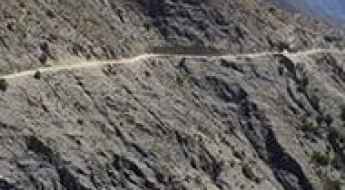
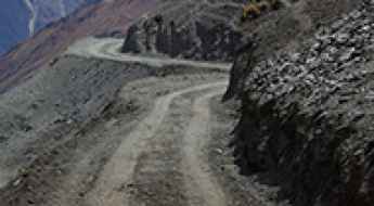
Driving the treacherous Cuesta de Sama pass in Tarija
Cuesta de Sama is a high-altitude mountain pass reaching 3,889 meters in the Tarija Department of southern Bolivia. Linking the towns of Iscayachi and San Lorenzo, this 40.6-kilometer stretch of gravel is one of the most high-conflict routes in the region. It is a world of vertical drops, deep ripio, and a constant flow of heavy trucks and buses that share a track often too narrow for two vehicles. Here, the mountain doesn't just test your engine; it tests your ability to stay calm when you are forced to reverse along a cliff edge in zero visibility.
Travel guide to the top of Mullu Apachita
Mullu Apachita is a high mountain pass at an elevation of 5.018m (16,463ft) above the sea level, located in La Paz Department, in Bolivia. It's one of the highest mountain roads of the country.
A wild road to Cerro Rico, the silver mountain that eats men
Cerro Rico (Spanish for "Rich Mountain") is a cone-shaped peak famed for its historically large silver deposits at an elevation of 4.760m (15,616ft) above the sea level, located in the Tomás Frías Province in the Potosí Department in Bolivia.
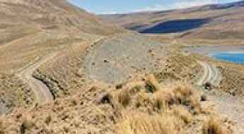
Driving to Laguna Blanca and Laguna Verde in the Dalí Desert
The drive to Laguna Blanca and Laguna Verde is a high-altitude unpaved mountain route located in the Potosí Department of southwestern Bolivia. Situated within the Eduardo Avaroa National Reserve at the foot of the Licancabur volcano, these two salt lakes are connected by a narrow natural strip of land surrounded by rugged Altiplano terrain.
Laguna Estrellani
Laguna Estrellani is a high mountain lagoon at an elevation of 4.671m (15,324ft) above the sea level, located in the La Paz Department, in Bolivia.
Pelechuco Pass: a winding road only for experienced drivers
Paso Pelechuco is a high mountain pass at an elevation of 4.863m (15,954ft) above the sea level, located in the La Paz Department in Bolivia, near the Peruvian border. It’s one of the highest roads of the country.
Laguna Tuni
Laguna Tuni is a high mountain lake at an elevation of 4.494m (14,744ft) above the sea level, located in La Paz Department, in Bolivia. The road to the lake, located within the Cordillera Real of the Bolivian Andes, is gravel, rocky, tippy and bumpy at times with several hairpin turns.
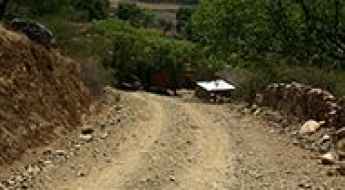
Huanacuno-Yunchara Road
The Carretera Huanacuno-Yunchara is a high mountain road located in southern Bolivia. This road tests the skill, and courage, of any driver. It’s definitely not for anyone suffering from vertigo or a fear of landslides.
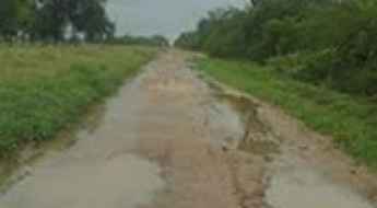
Carretera Picada 108: Crossing the Wild Chaco to the Bolivian Border
Located in the heart of the Gran Chaco, Carretera Picada 108 is a grueling unpaved route linking the region of Mariscal Estigarribia with the Bolivian border. Stretching across the vast departments of Boquerón in Paraguay, this road is a legendary test of endurance for off-roaders, crossing the infamous Ruta Transchaco and penetrating one of the most remote wilderness areas in South America.
Wisalla
Wisalla is a high mountain pass at an elevation of 4.304m (14,120ft) above the sea level, located in the Andes of Bolivia. This is a maintained road where a high clearance 2WD vehicle is able to travel safely at low speeds on long dry straight-of-ways, without losing control due to wash boarding, ruts, or dips.
Cerro Cachi Laguna
Cerro Cachi Laguna is a high mountain peak at an elevation of 5.491m (18,015ft) above the sea level, located in the department of Potosi of southwestern Bolivia, near the Chilean border. It’s one of the highest roads of the country.
Ultimate 4wd destination: Ulla Qhaya
Ulla Qhaya is a high mountain peak at an elevation of 5.078m (16,660ft) above the sea level, located in the La Paz Department in Bolivia. It’s one of the highest roads of the country.
How to drive the 46 hairpin turns to Luribay?
Luribay is a high-mountain town located in the José Ramón Loayza Province, in Bolivia.
Laram Quta
Laram Quta is a high mountain lake at an elevation of 4.494m (14,744ft) above the sea level, located in La Paz Department, in Bolivia.
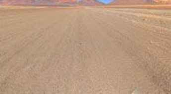
How difficult is the high-altitude road to Paso Salar Capina in Bolivia?
Paso Salar Capina is a high mountain pass reaching an elevation of 4,654m (15,269ft) above sea level, located in the Potosí department of southwestern Bolivia. Situated in the heart of the Andes near the Chilean border, the road to the summit is a raw, unpaved track that crosses one of the most desolate landscapes on Earth. This is a journey through the Altiplano, where the extreme altitude and the shifting sands of the volcanic soil turn a 26-kilometer drive into a grueling test for both the vehicle's cooling system and the driver's endurance.
The breathtaking road to Cerro Umurata in the Andes
Cerro Umurata, also known simply as Umurata, is a volcano situated on the border of Bolivia and Chile. A 4x4 mining trail ascends to an altitude of 5,542 meters (18,182 feet) above sea level near the summit, offering breathtaking views of the Andean highlands. It’s one of the highest roads of South America.
Driving the breathtaking road to Paso Caquella
Paso Caquella is a high mountain pass at an elevation of 4.352m (14,278ft) above the sea level, located in the Nor Lípez Province in the Potosí Department in Bolivia.
A drive to Sunchulli Pass is an otherworldly experience
Sunchulli Pass is a high mountain pass at an elevation of 5,034m (16,515ft) above sea level, located in the La Paz Department, Bolivia. It’s one of the highest roads in the country.
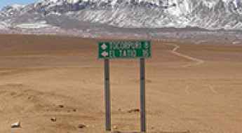
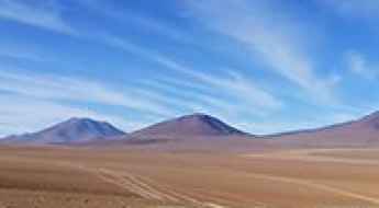
How to get by car to Tocorpuri Volcano on the border of Chile and Bolivia?
Volcán Tocorpuri is a dormant stratovolcano located on the border between Chile and Bolivia. North of the summit, a mining road climbs up to 5,563 m (18,251 ft) above sea level. It’s one of the highest roads in the country.
Driving the unpaved Illampu Circuit through Abra de la Calzada in the Andes
Abra de la Calzada is a high mountain pass at an elevation of 5,062m (16,607ft) above sea level, located in Larecaja Province of Bolivia. It’s one of the highest roads in the country.
Driving the road to Katantika Pass in La Paz is for brave drivers only
Paso Katantika is a high mountain pass at an elevation of 4,717m (15,475ft) above sea level, located in the Franz Tamayo Province of Bolivia.
How to get by car to Cumbre Chuchu in the Andes?
Cumbre Chuchu is a high mountain pass at an elevation of 4,653m (15,265ft) above sea level, located in the La Paz Department of Bolivia.
How to drive the unpaved road to Rhity Apacheta Pass in La Paz Department?
Paso Rhity Apacheta is a high mountain pass at an elevation of 4,874m (15,990ft) above sea level, located in La Paz Department, in Bolivia. It’s one of the highest roads in the country.
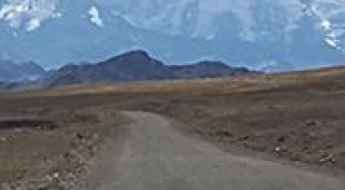
Driving the remote Sarani Pass in the Bolivian Andes
Sarani Pass is a high-altitude mountain pass located at an elevation of 4,522m (14,835ft) above sea level, in the Larecaja Province of Bolivia.