What are the most spectacular roads in Bolivia?
Located in South America, Bolivia is home to the most famous road in the world: the unpaved Death Road. Locally known as Carretera de los Yungas, this gravel dirt track covers a 36.4km (22.61 miles) stretch between La Paz and Coroico.
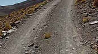
Part of the Andes Mountains (in the western part of the country), Bolivia is home to amazing mountain roads, including a few challenging mountain passes acting as a border. It’s worth driving the international Chungara-Tambo Quemado Pass, at 4.687m (15,377ft) above sea level on the border with Chile. For lovers of mountain roads, don’t miss Cerro Sairécabur, a volcano at 5.541m (18,179ft) above sea level, on the border with Chile. It’s one of the highest roads in Bolivia. Or Cerro Uturuncu, a stratovolcano in the Potosí Department, climbing up to 6.008m (19,711ft) above sea level. It’s one of the highest roads in the world. If you’re brave enough, you can tackle El Angosto, one of the deadliest roads in the world. Located in the Tarija Department, the Pilcomayo canyon ranks among the world's most treacherous roads.
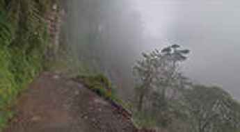
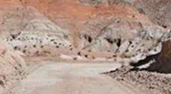
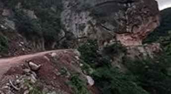
Death Road in Bolivia is the world's most famous gravel track
Carretera de los Yungas is probably the most famous road in the world. This gravel dirt track covers a 36.4km (22.61 miles) stretch between La Paz and Coroico, in the Yungas area of the Bolivian department of La Paz. Known globally as the "Death Road," it is a place where engineering limits meet raw human fear.
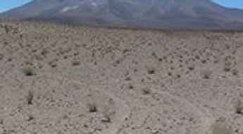
Travel guide to the top of Cerro Uturuncu
Cerro Uturuncu is a stratovolcano located in the Potosí Department of Bolivia. A minor gravel road climbs up to 6.008m (19,711ft) above sea level. It’s one of the highest roads in the world. The biggest problem is the extremely low oxygen for engine combustion.
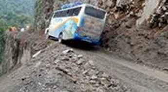
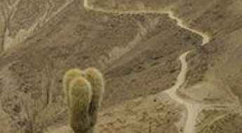
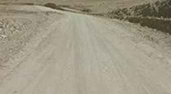
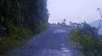
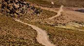
South Yungas Road is a scenically rewarding but dangerous trip
South Yungas Road is the name of a dangerous mountain road located in the La Paz Department, in Bolivia.
How to get by car to Cerro Chacaltaya, the world's highest ski resort?
Cerro Chacaltaya is a high mountain peak at an elevation of 5.260m (17,257ft) above the sea level, located in La Paz Department of Bolivia. It's one of the highest roads of the country.
Navigating Ollague Volcano: An Epic Journey on One of South America's Highest Roads
Volcán Ollagüe is an imposing andesite stratovolcano located in the Andes. Standing at an elevation of 5,868m (19,251ft) above sea level, it marks the boundary between northern Chile's Antofagasta region and Bolivia's Potosí department. It's one of the highest roads of South America.
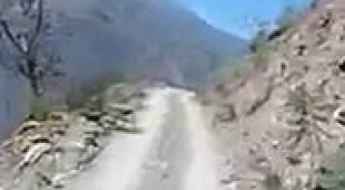
The dangerous road to Caranavi is not for the faint of heart
Caranavi is a small town located in the Caranavi Province in the Yungas region of Bolivia. The road to the town is simply terrifying.
What are the highest roads in Bolivia?
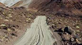
Located in the heart of western-central South America, Bolivia is a vast, landlocked nation, equal in size to California and Texas combined. Its unique geography is defined by the majestic Andes, where high-altitude peaks bear a striking resemblance to the rugged Himalayas. This challenging terrain, featuring the vast, desolate Altiplano plateau and plunging, humid valleys, creates a driving experience unlike any other. It is here, with roads clinging to dizzying slopes, that travelers find some of the highest, most remote, and most breathtaking mountain passes on the entire continent.
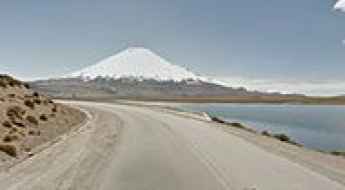
Driving the international Chungara-Tambo Quemado Pass
Paso Chungara-Tambo Quemado is an international high mountain pass at an elevation of 4.687m (15,377ft) above sea level located on the border of Chile and Bolivia.
El Angosto is one of the deadliest roads in the world
Located in the Tarija Department in Bolivia, near the Paraguayan border, El Angosto de Villamontes, also known as the Pilcomayo canyon, is one of the world's most dangerous roads.
Antiguo Puente de Pailón is a challenging bridge in Bolivia
Located in the small town of Pailón in Bolivia, the old bridge in Pailon was one of the most spectacular bridges in the world.
A treacherous border road to Salar de Ollague Pass in the Andes
Paso Salar de Ollagüe is an international high-mountain border pass at an elevation of 3,695 meters (12,122 ft) above sea level, located in the Andes range on the frontier between Chile and Bolivia.
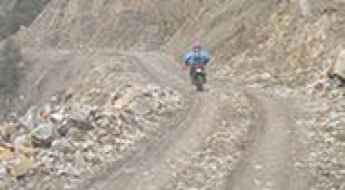
Driving a 4x4 mine road to Acotango Volcano in the Andes
Volcán Acotango is a volcano located on the border of Bolivia and Chile. A 4x4 mining trail climbs up to 5,509m (18,074ft) above sea level near the summit. The track beyond this point continues further, but it is impassable. It is one of the highest roads in the country.
Driving the unpaved road to Cienaga de Paicone-Rio Mojon Pass
Paso Internacional Ciénaga de Paicone-Río Mojón is an international high mountain pass at an elevation of 3,645 meters (11,958 feet) above sea level, located on the border between Argentina and Bolivia.
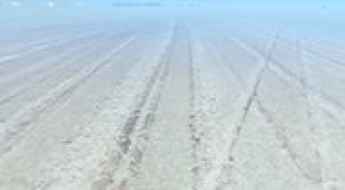
A salt road to Isla Incahuasi in the middle of Salar de Uyuni
Isla Incahuasi is an island in the middle of Salar de Uyuni, a sea of salt at an elevation of 3.656m (11,995ft) above sea level, in Bolivia.
A 4x4 adventure to Condor Pass in the Salvador Dalí Desert
Paso del Condor is a high mountain pass at an elevation of 4,730m (15,518ft) above sea level, located in the Potosí Department of Bolivia. It is one of the highest roads in the country.
The Winding Road from Tupiza to Quiriza is for Experienced Drivers Only
Located in the Potosí Department of Bolivia, the road from Tupiza to Quiriza is a challenging mountain drive not for the faint of heart.
Camino al Sol de la Mañana: a challenging track to Cerro Sanabria
Cerro Sanabria is a high mountain pass at an elevation of 4.844m (15,892ft) above sea level, located in Sur Lípez Province in the Potosi Department of Bolivia.
How to get by car to Colquechaca, the highest town of Bolivia?
Colquechaca is a small town at an elevation of 4,167 m (13,671 ft) above sea level, located in the Province of Chayanta, in Bolivia. It’s one of the highest towns accessible by car on Earth.
How to get by car to Sol de Mañana, a Bolivian geyser?
Sol de Mañana is a geyser and a geothermal area at an elevation of 4,921m (16,145ft) above sea level, located in Sur Lípez Province of Bolivia. The geothermal area is characterized by intense volcanic activity, including fumaroles and geysers.
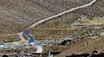
How to drive the challenging Ruta Nacional 25 in the Andes?
Ruta Nacional 25 (RN25) is an amazing and exciting drive that runs across the Andes mountain range in Bolivia.
Travelling through the international Colchane-Pisiga Pass
Paso Colchane-Pisiga is an international high mountain pass at an elevation of 3,695m (12,122ft) above sea level, located on the Chilean-Bolivian border.
A Steep, Challenging Road to Abra Tres Cruces
Abra Tres Cruces is a high mountain pass at an elevation of 4,729m (15,515ft) above sea level, located in La Paz province, Bolivia. It's one of the highest roads in the country.
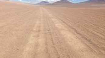
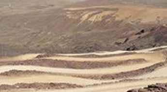
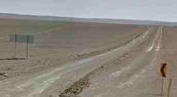
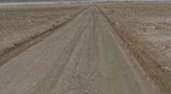
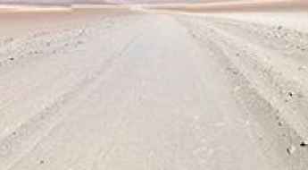
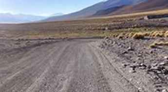
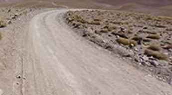
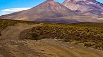
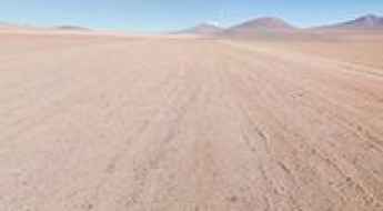
How to Drive Across the High Desert of Siloli?
The Desierto de Siloli is a remote high-mountain desert located in southwestern Bolivia, in the Potosí Department, near the Chilean border. Known for its altitude and isolation, the area sits at around 4,500 meters above sea level and forms part of the route between Uyuni and the Eduardo Avaroa Andean Fauna National Reserve. The road to reach it is entirely unpaved and one of the most striking off-road routes in South America.
How to drive the challenging road to La Cumbre?
La Cumbre is a high mountain pass at an elevation of 4,506 m (14,783 ft) above sea level, located in the Cochabamba department of Bolivia.
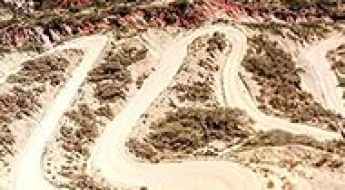
How to drive the hairpin turns to Collpani?
Collpani is a rural settlement located in the La Paz Department of Bolivia. The road to the town is one of the roads with the most hairpin turns in the world. This route is not recommended if your passengers are prone to car sickness. Don’t stuff your belly too much. Eventually, you might feel vomiting temptations.
How to get by car to Laguna Colorada in the altiplano of Bolivia?
Laguna Colorada is a shallow red salt lake at an elevation of 4.278m (14,035ft) above sea level, located in the Potosí department of Bolivia.
A memorable road trip to Abra Laguna Morijon
Abra Laguna Morijon is a high mountain pass at an elevation of 4,901 m (16,079 ft) above sea level, located in the Sur Lípez Province of Bolivia. It's one of the highest roads in the country.
Driving the road to Cerro Gigante is not a piece of cake
Cerro Gigante is a high mountain pass at an elevation of 5.286m (17,342ft) above sea level, located in the La Paz Department, in Bolivia. It's one of the highest roads in the country.
How to drive the road from Quime to Sacambaya Valley in La Paz?
The Quime-Sacambaya Valley Road is a high mountain narrow trail located in the La Paz Department of Bolivia.
Driving the high-altitude mining track to Cerro Cañapa in Bolivia
Cerro Cañapa is a mountain peak at an elevation of 5,629m (18,467ft) above sea level, located in the Nor Lípez province, Potosí Department, in Bolivia. The route to the summit is a dirt track built for sulfur mining operations near the border with Chile. It is one of the highest roads of South America.
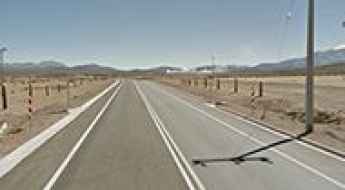
Tarija-Villamontes Road
The Tarija-Villamontes road is an amazing journey in the mountains of south-eastern Bolivia. Part of the Ruta Nacional 11, the road links Tarija (or San Bernardo de la Frontera de Tarixa) and Villamontes. It’s said to be the most dangerous road in the country.
San Antonio de Lipez
San Antonio de Lipez is a ghost town in Andes landscape at an elevation of 4.758m (15,610ft) above the sea level, located in the Cordillera de Lípez in the Sud Lípez Province of the Potosí Department in southwestern Bolivia. The town is said to be haunted.
The road to Abra Puca Loma: be ready to make room for oncoming vehicles
Abra Puca Loma is a high mountain pass at an elevation of 4.804m (15,761ft) above sea level, located in the Cordillera de Lípez in the Sud Lípez Province of the Potosí Department in southwestern Bolivia. It's one of the highest roads in the country.
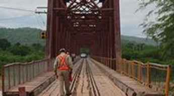
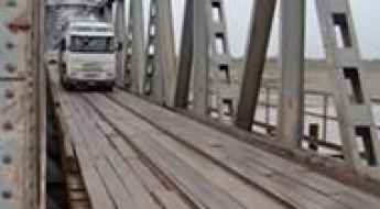
Pilcomayo bridge
Located in the Tarija Department in south-eastern Bolivia, the bridge over the Pilcomayo river, is one of the most spectacular bridges in the world.
La Cumbre Apacheta
La Cumbre Apacheta is a high mountain pass at an elevation of 4.871m (15,980ft) above sea level, located in the La Paz Department, in Bolivia. It's one of the highest roads in the country.
Laguna Salada
Laguna Salada is a high mountain salt lake at an elevation of 4.407m (14,458ft) above the sea level, located in the Sur Lípez Province of the Potosí Department, Bolivia.