What are the most spectacular roads in Mexico?
Located in North America, Mexico is a country with a wide collection of stunning drives. It’s home to about 150 roads listed as the most spectacular in the world.
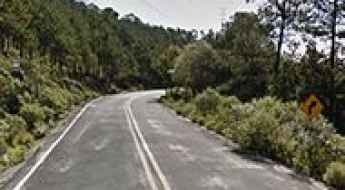
With very diverse geography, comprising high mountains such as the Sierra Madre Occidental and Sierra Madre Oriental, and stunning beaches providing scenic coastal drives, when traveling to Mexico don’t forget to add to your list the infamous Espinazo del Diablo, a thrilling and challenging Mexican mountain road. This road is renowned internationally for its hairpin turns. Another notable road is Carretera Federal 1, which is full of blind corners with no barriers or hard shoulders. Spanning the length of the Baja California Peninsula, it is often called the Carretera Transpeninsular or Transpeninsular Highway.
If you prefer mountain roads, try the road to Cortes Pass, a mountain pass at an elevation of 3,692m (12,112ft) above sea level. It’s one of the highest roads in Mexico. If you like unpaved roads, try the drive to Sierra Negra volcano, an extinct volcano at 4,576m (15,013ft) in the state of Puebla.
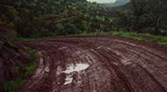
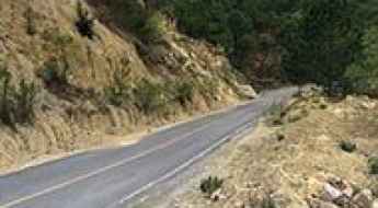
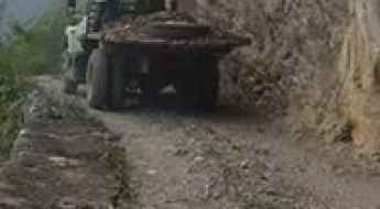
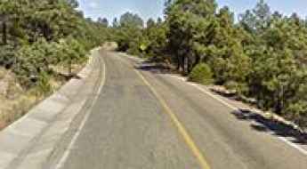
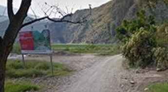
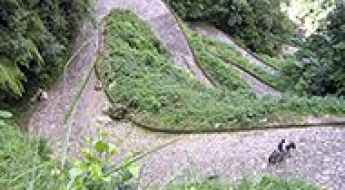
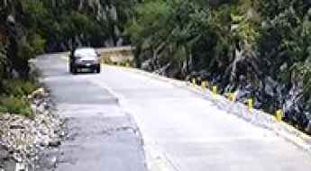
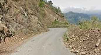
Driving the unpaved Bajada a Zirupa in Chihuahua
Bajada a Zirupa is a gravel mountain road located in the mountains of the Mexican state of Chihuahua.
How to Get by Car to La Lobera in Baja California
La Lobera is a magnificent sea crater located on the west coast of the Mexican state of Baja California.
How to Get by Car to Calakmul, a Maya Site
Calakmul is a Maya archaeological site located in the Mexican state of Campeche, deep in the jungles of the greater Petén Basin region of Mexico.
The Wild Road to El Capulin
El Capulín is a high mountain town at an elevation of 3,075m (10,088ft) above sea level, located in Mexico. It’s one of the highest roads in the country.

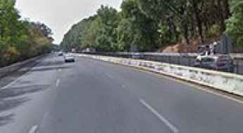
La Marquesa is One of the Deadliest Highways in Mexico
Mexico City-Toluca (Mexico 15D or 134D) is a very dangerous road that links Mexico City and Toluca, in Mexico.
A high mountain road from Xalatlaco to El Ajusco
Straddling Mexico State and Mexico City, the road from Xalatlaco to El Ajusco is one of the most scenic drives in Mexico.
Nuevo Leon 20: a memorable road trip
Located in the Mexican state of Nuevo León, the Nuevo Leon 20 runs along the San Isidro canyon.
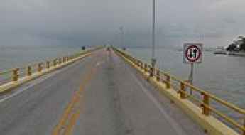
Traversing the spectacular Zacatal Bridge
Located southwest of Ciudad del Carmen, in the state of Campeche in Mexico, Puente El Zacatal is one of the most spectacular bridges in the world. The bridge connects the Atasta peninsula and the Isla del Carmen.
Driving the road to Mesa del Nayar with spectacular views
Mesa del Nayar (Road from Ixcatán-Jesús María Mexico 44) is a very scenic drive in Mexico, departing at Jesús María (430 masl) and running to the coast at Ruiz, Nayarit.
Driving through the Federal Road 95D
Carretera Federal 95D is a dangerous mountain road located in the central part of Mexico.
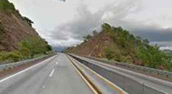
Driving Through the Defiant Highway del Sol
Autopista del Sol (Mexico City-Acapulco, Mexico 95D) is a modern four-lane toll highway located in the southern part of Mexico that links Mexico City with Acapulco.
Fog and Bad Weather on the Road to Paso de la Muerte
Death Pass (Paso de la Muerte in Spanish) is a terrible high mountain road linking the small community of Conrado Castillo to the rest of the state of Tamaulipas, in Mexico.
The road to Cofre de Perote isn’t an easy one
Cofre de Perote is an extinct volcano at an elevation of 4.160m (13,648ft) above the sea level, located in the Mexican state of Veracruz. It’s one of the highest mountain roads of the country.
Driving the defiant Guadalupe y Calvo Road
Road to Guadalupe y Calvo (Mexico 24) can be a challenging long drive from Parral Chihuahua to middle of nowhere, well actually Guadalupe y Calvo town, but the road actually continues to middle of nowhere, to a zone under construction down to Sinaloa sate at Badiguarato, home of the world's famous druglord El Chapo.
The wild road to Cerro de la Viga
Cerro de la Viga is a high mountain peak at an elevation of 3.556m (11,666ft) above the sea level, located in the Sierra Madre Oriental range, in the Mexican state of Coahuila. It’s one of the highest mountain roads of the country.
Lagunas de Zempoala: a dangerous mountain road
Lagunas de Zempoala are several high mountain lakes at an elevation of 2.900m (9,500ft) above the sea level located between the states of Morelos and State of Mexico, Mexico.

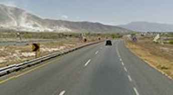
Road Mexico 101
Some years ago, the Mexico 101 (San Luis Potosí - Cd Victoria libre road) was the only highway road route between these both major cities in Mexico. It’s a small windy, dangerous road that caused many fatal accidents. Back then many drivers decided to detour in Monterrey city to avoid this dangerous route.
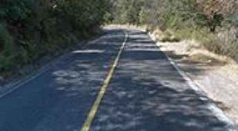
Driving the hairpinned Tolantongo Road
With more than 40 hairpin curves, this road tests the skills of any driver. No guardrails or any security involved. This gravel road offers great views of Tolantongo canyon walls and mountains.
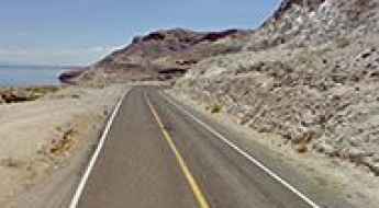
Baja California Road 163
Baja California Road 163 is a very scenic drive running along the Gulf of California in the Mexican state of Baja California.
Take the Scenic Route and Discover Road Mexico 105 Metztitán Canyon
This segment of Mexico 105 crosses a magnificent desert landscape with huge canyons and cactus.
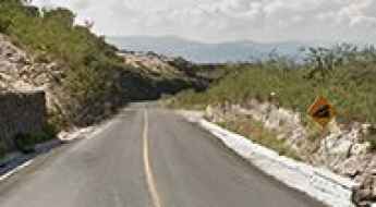
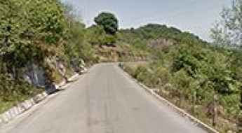
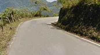
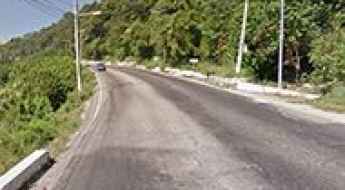
Driving through Camino a Rayones (Nuevo Leon state route 7)
Camino a Rayones is a very scenic drive in the mountains of Sierra Madre Oriental in Nuevo León state, in Mexico.

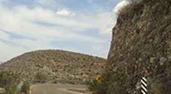
Supercarretera Tehuantepec-Oaxaca
Supercarretera Tehuantepec-Oaxaca (Mexico 135D) Paso de Calapa is the main highway in Oaxaca to Mexico city. Some parts of the road offer spectacular views of Sierra Madre del Sur mountains, canyons and it offers different biomes such cactus desert, oak forest, rainforest in same route.
Tapalpa Road
Located in the Mexican state of Jalisco, the Road to Tapalpa (Jalisco state route 436) is a scenic paved mountain road climbing up to Tapalpa town at 2.060m (6,758ft) above the sea level.
Tolantongo-Metztitlán Road
Carretera Tolantongo-Metztitlán is a narrow and dirt dangerous road in the desert mountains of Mexico.
Driving the scenic road from Huayacocotla to Zontecomatlán
The road from Huayacocotla to Zontecomatlán is an uncategorized state route in Veracruz. Starting at an elevation of 2.220m (7,283ft) above the sea level, near Huayacocotla, the road gradually descends the mountains into the low coastal valleys of the gulf.
Maconí
The road to Maconí, a small town located in the state of Querétaro, in north-central Mexico, offers spectacular views of the canyon and mountains surrounding the Sierra Gorda mountain range.
Pan-American Highway, the longest road in the world
The challenging Pan-American Highway is one of the biggest adventures in the world. It’s a network of roads covering almost 30,000 kilometres (19,000 mi) from North America to South America. It’s said to be the longest road on Earth.
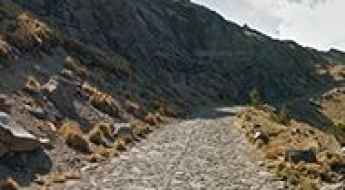
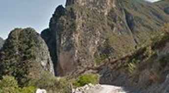
Camino del Caracol
Located in Chiapas state, in southern Mexico, near Guatemala and under the Volcan Tacana which is the second highest peak in Central America, Camino del Caracol is a very challenging cobblestoned track.
Driving the extremely dizzy Tepehuacán de Guerrero Road
Tepehuacán de Guerrero Road is an uncategorized Hidalgo state route road, located in the heart of Sierra Madre Oriental mountains at north of the state.
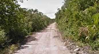
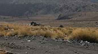
A challenging 4x4 road to Laguna Salada
Laguna Salada is a small lagoon located on the east coast of the Yucatán Peninsula in in the southeast corner of Mexico. The road to reach the lake is extremely challenging. This trail passes through remote areas, so you need to be prepared
Hidalgo state route 37 Metztitán Canyon
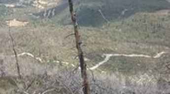
From the T junction at Mexico 105 at 1310 masl in Los Venados, a spectacular road goes deep missing into the canyon and then to the Sierra Madre mountains in Hidalgo state to the road of Tepehuacán de Guerrero.
Carretera Escenica (Acapulco)
This is a beautiful urban coastal road located in Acapulco, Mexico. This is a dangerous road due constant repairs, extremely high traffic and constant gun battles between police and criminals, the fact this is a resort city it’s classified today in 2016 as the most dangerous city in Mexico with 8 murders everyday.
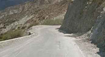
El Chorro
La Carbonera (Mexico 57D, autopista Saltillo-Matehuala) offers spectacular views of the Sierra Madre Oriental high mountains: desert canyons, some pine forest and a segment of sharp/dangerous curves in same highway, step grades, even a tunnel in the route.
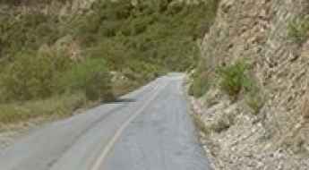
Driving the wild San Isidro Canyon Road
Cañon de San Isidro is a very scenic canyon in the Mexican state of Nuevo León. This is definitely one road trip that you want to record with lots of photographs. Landslides can occur anytime and can sometimes block some sections of the road.
Pico de Orizaba
Pico de Orizaba is a high mountain peak at an elevation of 4.614m (15,137ft) above the sea level, located on the border between the states of Veracruz and Puebla, in Mexico. It’s one of the highest roads of the country.
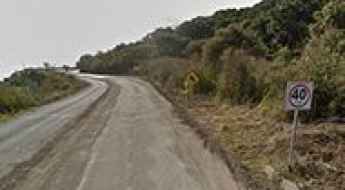
Tianguistengo-Yatipán Road
This is a very scenic beautiful uncategorized state route in Hidalgo, communicating two small indigenous community of Nahualt people.