What are the most spectacular roads in Mexico?
Located in North America, Mexico is a country with a wide collection of stunning drives. It’s home to about 150 roads listed as the most spectacular in the world.
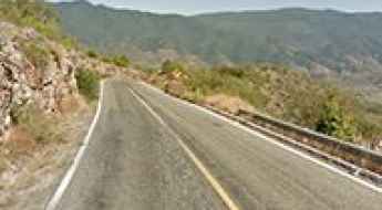
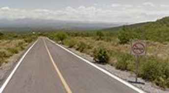
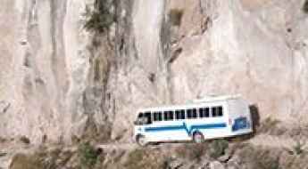
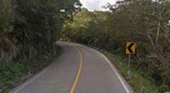
With very diverse geography, comprising high mountains such as the Sierra Madre Occidental and Sierra Madre Oriental, and stunning beaches providing scenic coastal drives, when traveling to Mexico don’t forget to add to your list the infamous Espinazo del Diablo, a thrilling and challenging Mexican mountain road. This road is renowned internationally for its hairpin turns. Another notable road is Carretera Federal 1, which is full of blind corners with no barriers or hard shoulders. Spanning the length of the Baja California Peninsula, it is often called the Carretera Transpeninsular or Transpeninsular Highway.
If you prefer mountain roads, try the road to Cortes Pass, a mountain pass at an elevation of 3,692m (12,112ft) above sea level. It’s one of the highest roads in Mexico. If you like unpaved roads, try the drive to Sierra Negra volcano, an extinct volcano at 4,576m (15,013ft) in the state of Puebla.
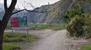
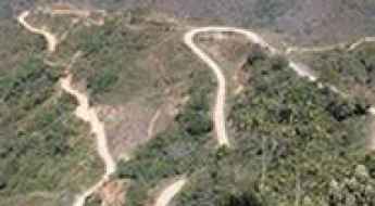
Tolantongo-Metztitlán Road
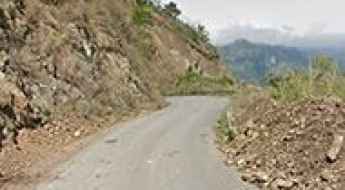
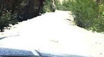
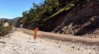
Carretera Tolantongo-Metztitlán is a narrow and dirt dangerous road in the desert mountains of Mexico.
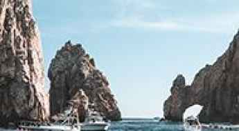
Road Trip Guide: Mexico's Most Picturesque Coastal Drives
Driving through Mexico’s coastal regions involves navigating a diverse network of federal highways, ranging from the high-speed toll roads (Cuotas) of the Yucatan to the demanding, narrow mountain passes of the Oaxacan Sierra. A successful logistical plan requires understanding fuel availability in remote sectors, managing livestock hazards on unfenced roads, and adhering to strict daytime driving protocols for safety. This guide analyzes the technical requirements for Mexico’s primary coastal corridors.
How to drive the paved road to Maconí in Querétaro?
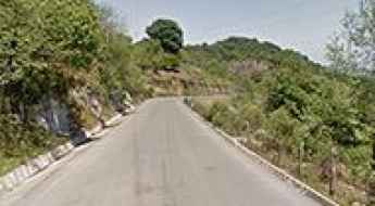
Maconí is a small town located in the state of Querétaro, in Mexico. The road to the town offers spectacular views of the canyon and mountains surrounding the Sierra Gorda mountain range.
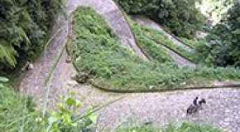
Camino del Caracol
Located in Chiapas state, in southern Mexico, near Guatemala and under the Volcan Tacana which is the second highest peak in Central America, Camino del Caracol is a very challenging cobblestoned track.
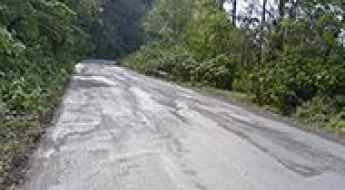
Driving the scenic road from Huayacocotla to Zontecomatlán
The road from Huayacocotla to Zontecomatlán is an uncategorized state route located in Veracruz.
Pico de Orizaba
Pico de Orizaba is a high mountain peak at an elevation of 4.614m (15,137ft) above the sea level, located on the border between the states of Veracruz and Puebla, in Mexico. It’s one of the highest roads of the country.
Driving the wild San Isidro Canyon Road
Cañon de San Isidro is a very scenic canyon in the Mexican state of Nuevo León. This is definitely one road trip that you want to record with lots of photographs. Landslides can occur anytime and can sometimes block some sections of the road.
The wild road to the abandoned Albergue Tlamacas
Albergue Tlamacas is an abandoned hotel at an elevation of 3.962m (12,998ft) above the sea level, located in State of Mexico. It’s one of the highest roads of the country.
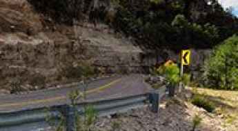
Sola de Vega Road: Driving the Mexico 131 from Oaxaca to Puerto Escondido
The Sola de Vega Road is a mountain section of the paved Federal Highway 131 located in the state of Oaxaca, Mexico. The completely asphalted route crosses the rugged ridges of the Sierra Madre del Sur to connect the capital city of Oaxaca with the coastal town of Puerto Escondido, reaching a maximum elevation of 2,180 meters (7,152 ft) above sea level.
How to drive the Tianguistengo-Yatipán Road?
Tianguistengo-Yatipán is a very scenic uncategorized state route located in Hidalgo, in Mexico.
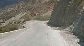
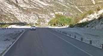
El Chorro
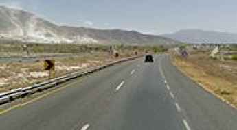
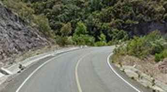
La Carbonera (Mexico 57D, autopista Saltillo-Matehuala) offers spectacular views of the Sierra Madre Oriental high mountains: desert canyons, some pine forest and a segment of sharp/dangerous curves in same highway, step grades, even a tunnel in the route.
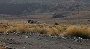
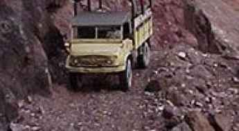
A challenging 4x4 road to Laguna Salada
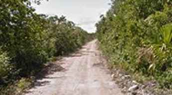
Laguna Salada is a small lagoon located on the east coast of the Yucatán Peninsula in in the southeast corner of Mexico. The road to reach the lake is extremely challenging. This trail passes through remote areas, so you need to be prepared
Hidalgo state route 37 Metztitán Canyon
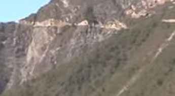
From the T junction at Mexico 105 at 1310 masl in Los Venados, a spectacular road goes deep missing into the canyon and then to the Sierra Madre mountains in Hidalgo state to the road of Tepehuacán de Guerrero.
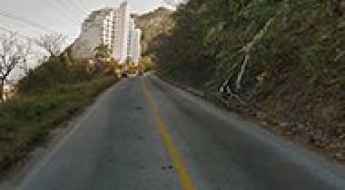
Carretera Escenica (Acapulco)
This is a beautiful urban coastal road located in Acapulco, Mexico. This is a dangerous road due constant repairs, extremely high traffic and constant gun battles between police and criminals, the fact this is a resort city it’s classified today in 2016 as the most dangerous city in Mexico with 8 murders everyday.
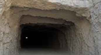
Las 4 Palmas Mine
Located in the Mexican state of Coahuila, Mina Las 4 Palmas is an abandoned mine. The mine is round, 300m wide and 350m deep.
Ruta Tarahumara
Ruta Tarahumara (Creel-Guachochi) is a windy, scenic, two lanes road that communicates the towns of Creel and Guachochi in Chihuahua state. The primary reason of the built of Ruta Tarahumara was to communicate and develop the land of indigenous people of Tarahumara (Raramuri) to the rest of the state and help or bring tourists to the Copper canyon area among other attractions.
Driving the extreme mountain roads to San Juan Petlapa in Oaxaca
The Caminos de Sierra de Juárez, specifically the San Juan Petlapa Road, represent one of the most extreme geographical challenges in the Sierra Madre Oriental of Oaxaca, Mexico. Linking the Mexico 175 and 179 highways, this route is a relentless series of vertical climbs and descents that traverse deep canyons and high mountain passes. The road is a mechanical torture test, where the physical reality of driving involves shifting from the high-altitude cold of Cuajimoloyas at 3,170 meters to the tropical heat of San Juan Petlapa at 660 meters in just a few dozen kilometers of technical, narrow track.
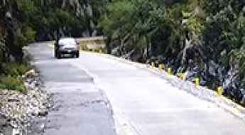
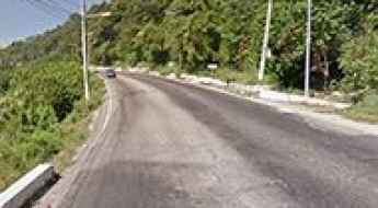
Mismaloya Road
Carretera a Mismaloya (Mexico 200 south of Puerto Vallarta) is a beautiful coastal scenic drive from South of Puerto Vallarta to Tomatlán beach, this drive offers great views of Bandera Bay with the Los Arcos islands, including the access of some tropical sand beaches next to the road.
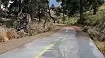
Driving the scenic but foggy Mexico 105 through Peñas de Tlanchinol
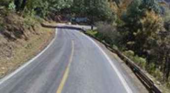
The section of Mexico 105 known as Peñas de Tlanchinol is a stunning yet treacherous mountain drive in the heart of Hidalgo. Located in central-eastern Mexico, this road serves as a dramatic transition between the high Sierra and the tropical Huasteca. It is a world of towering rocky hills and dense, lush forests where the pavement is often wet and the clouds sit permanently on the tarmac. Driving here means navigating a winding ribbon of asphalt that requires constant focus on the road's edge and the unpredictable mountain weather.
La Huasteca Canyon Road
Located in northeastern Mexican, La Huasteca canyon road lies near Santa Catarina and goes deep into the Sierra de las Cumbres mountains to a canyon dam.
Driving the steep and winding road to Chipinque in Monterrey
The Road to Chipinque is a high-altitude mountain drive located in the northeastern Mexican state of Nuevo León. Starting from the upscale area of San Pedro Garza García, the road climbs aggressively into the Sierra Madre Oriental. This is not a casual city drive; it is a technical ascent that leads into a private ecological park where the air cools rapidly and the forest closes in on the asphalt. While it offers a break from the heat of Monterrey, the constant incline and the sharp, narrow turns demand total focus and a vehicle with a reliable cooling system to handle the 700-meter vertical gain.
Road Mexico 182
Mexico 182 (Tuxtepec-Teotitlán) is a very scenic and dangerous route in Oaxaca state. The road offers stunning views of Sierra Madre Oriental Mountains, valleys, and canyons of different biomes such tropical rain forest, pine forest and desert in same route. There are views of Miguel Aleman lake too.
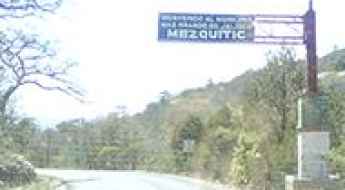
El Mortero Road
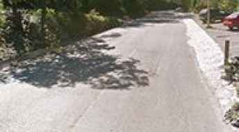
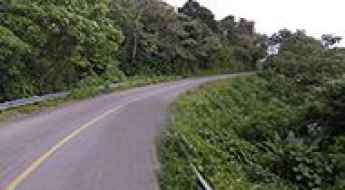
Located between Monte Escobedo and Mezquitic towns, El Mortero Road is a scenic drive of long valleys and some hills.
Camino a Canoas
Camino a Canoas is a high mountain road to a town named "Canoas" in Durango state. However the town it's in Durango state, the main purpose of the road its to communicate Zacatecas state with Nayarit state.
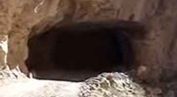
Tunel la Encantada
La Encantada tunnel is a high mountain tunnel at an elevation of 1.485m (4,872ft) above the sea level, the state of Coahuila in Mexico.
How to drive the paved road to Grutas de Bustamante in Nuevo León State?
Grutas de Bustamante, also known as grutas del Palmito, is a natural cave located in Nuevo León State, in Mexico.
El Frunce Road
Located in the Mexican state of Durango, this is an extreme mountain road. It’s terribly narrow. Your wheels will be astounded at the wonderful views of the mountains spread out before you! They are terrible for drivers who are prone to vertigo.
Road Mexico 85 Los Marmoles
This section of the Mexican Federal road 85 is located within Los Marmoles National Park. This road offers greet views of marble canyons and cliffs along the route, some few overviews and encrusted towns in the way.
Sumidero Canyon Overlook Road
Located in the Chiapas state in southern Mexico, the Sumidero Canyon Overlook road is the main gate to the overlooks and viewpoints of Sumidero Canyon National Park.
Morelos Road
Carretera a Morelos is a very dangerous, long, tedious, unpaved/gravel route to town of Morelos in Chihuahua state.
Road Jalpa-Tlaltenango
Carretera Jalpa-Tlaltenango (Mexico 70) is a mountain drive between the cities of Jalpa, at 1.380m (4,527ft) above the sea level, and Tlaltenango, at 1.710m (5,610ft) asl.
Camino a El Cuale
Camino a El Cuale is a very rough long dirt road linking Talpa de Allende to El Tuito in Jalisco state, in Mexico.
Camino a Ozolotepec: Driving the High Mountain Road in Oaxaca
Camino a Ozolotepec is a high-altitude mountain road located in the Sierra Sur region of the Oaxaca state, Mexico. The unpaved route connects the remote mountain settlements of Santo Domingo Ozolotepec, San Juan Ozolotepec, and San Francisco Ozolotepec.
The insane road to Cumbre de Guerachi
Cumbre de Guerachi is a high mountain town at an elevation of 2.440m (8,005ft) above the sea level, located in the northern Mexican state of Chihuahua.
Los Altares Road
Located in the Mexican state of Durango, Los Altares is a very scenic drive between forest and rock formations.
Pinal de Amoles (Road Mexico 120)
Located in central Mexico, Carretera Pinal de Amoles (Mexico 120) offers great landscapes in the transition from desert, temperate forest and tropical jungle.