What are the most spectacular roads in Mexico?
Located in North America, Mexico is a country with a wide collection of stunning drives. It’s home to about 150 roads listed as the most spectacular in the world.
With very diverse geography, comprising high mountains such as the Sierra Madre Occidental and Sierra Madre Oriental, and stunning beaches providing scenic coastal drives, when traveling to Mexico don’t forget to add to your list the infamous Espinazo del Diablo, a thrilling and challenging Mexican mountain road. This road is renowned internationally for its hairpin turns. Another notable road is Carretera Federal 1, which is full of blind corners with no barriers or hard shoulders. Spanning the length of the Baja California Peninsula, it is often called the Carretera Transpeninsular or Transpeninsular Highway.
If you prefer mountain roads, try the road to Cortes Pass, a mountain pass at an elevation of 3,692m (12,112ft) above sea level. It’s one of the highest roads in Mexico. If you like unpaved roads, try the drive to Sierra Negra volcano, an extinct volcano at 4,576m (15,013ft) in the state of Puebla.
The horrendous road to Nevado de Colima
Nevado de Colima is a high mountain peak at an elevation of 3.991m (13,093ft) above sea level located in the Mexican state of Jalisco. The road to the summit is horrendous with sections up to 12%. 4x4 is the only option. It's one of the highest roads of the country.
Cumbres de Maltrata is a dangerous Mexican road
Cumbres de Maltrata is part of the México 150D, the main highway linking Mexico City to the Gulf. It’s said to be the most dangerous highway in Mexico (with 4 accidents per day), according to CAPUFE.
How to get by car to Cerro de la Cúpula in Baja California?
Cerro de la Cúpula is a high mountain peak at an elevation of 2,806m (9,206ft) above sea level, located in the Mexican state of Baja California.

Travelling the busy Road Mexico 45
Queretaro-León (Mexico 45) is a busy highway located in Mexico which gets almost all traffic from northwest and north of Mexico and the US (except northeast Mexico).
Carreteras más altas de México
Ubicado en la parte sur de América del Norte, México es un país de extremos. El país tiene 9.330 kilómetros de costas, pero está atravesado por dos sierras montañosas conocidas como Sierra Madre Oriental y Sierra Madre Occidental. México tiene un gran número de montañas combinadas con cañones profundos en el centro del país, vastos desiertos en el norte y densos bosques con abundantes lluvias en la zona sr y este.
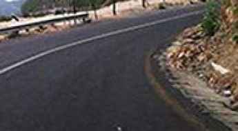
Bajada a Xichu is a drive with spectacular views of Sierra Madre Oriental
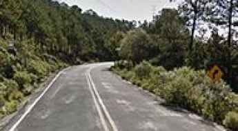
Xichú is a Mexican city located in the Northeast region of the state of Guanajuato. The road to the city is called Bajada a Xichú. It’s a scenic road with spectacular views of Sierra Madre Oriental mountains and canyons.
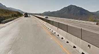
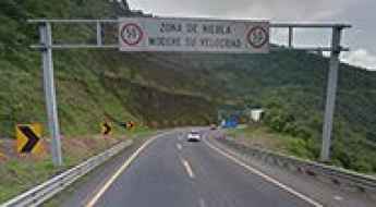
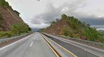
Saltillo-Monterrey Highway is a Mexican killer road
Autopista Mexico 40D and Mexico 40 were considered Mexico deadliest highways, until the new toll route opened to traffic in 2009. The original “libre” route had sharp curves and long steep grades, until it was improved around 2000’s. Currently “libre” highway is still dangerous, but the dead list was reduced due the traffic changes after the opening of the toll route.
The hairpinned road to Barranca de Beltran
Barranca de Beltrán roads (both Mexico 54D and Mexico 54, autopista Guadalajara-Manzanillo) link Guadalajara to the Pacific Ocean, mainly the cities like Colima and the resort city of Manzanillo.
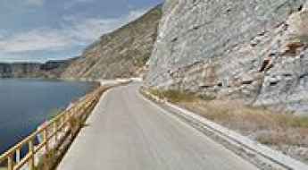
Travelling through the unstable Baja California Scenic Highway
Baja California Scenic Highway (Mexican Federal Highway 1D) is a very scenic toll road located in the northwestern Mexican state of Baja California.

Cuesta del Cajon is a scenic road through pine forests
Cuesta del Cajón is a beautiful scenic road running through pine forests and small rocky canyons, located in the state of Chihuahua, in Mexico.
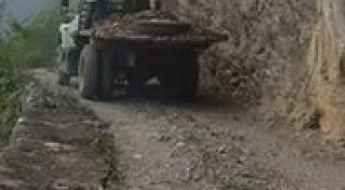
The road to Urique is not recommended due to security concerns
Urique is a small town located at the bottom of Urique Canyon, in the northern Mexican state of Chihuahua. The road to the town is extremely steep, unsurfaced, and rugged. It will test both vehicle and driver.

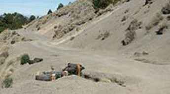
Driving the Wild 4x4 Road to Piedra Grande Hut
Refugio Piedra Grande is a high mountain hut at an elevation of 4,255m (13,959ft) above sea level, located in Mexico. It’s one of the highest roads in the country.
A Paved Road Through the Peguis Canyon in Chihuahua
Located in the Mexican state of Chihuahua, Cañón Pegüis is a breathtaking geological feature where the Conchos River cuts 2,000 feet through a mountain.

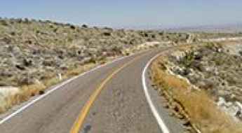
Travelling the scenic Road Mexico 16
Mexico 16 (Chihuahua-Hermosillo Road) is both one of the most scenic and monotonous roads in northern Mexico. It offers beautiful pine forests and desert landscapes but can feel repetitive due to its long stretches of similar views.
Travelling through the curvy Plan de Barrancas in Sierra Madre
Plan de Barrancas roads (Mexico 15 and Mexico 15D, autopista Guadalajara-Tepic) link Guadalajara to the Pacific Ocean, mainly the cities of Tepic and the resort city of Puerto Vallarta.
Mexico-Tuxpan Highway is a Marvel of Engineering
Autopista Mexico-Tuxpan (Mexico 132D) is another great engineering achievement. This highway was under construction for over 30 years due to scandals of corruption, insufficient funds, and the challenges posed by the rugged mountains of the Sierra Madre Oriental.
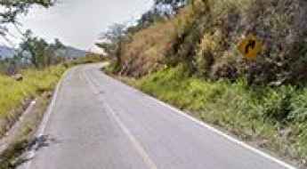
Adventure along the curvy Road Mexico 199
Mexico 199 is a defiant high mountain road with stunning views, located in the Mexican state of Chiapas.
Driving the scenic Camino Rivera del Pilon
Camino Rivera del Pilón is a scenic road running along the Pilon river straddling Nuevo León and Coahuila states, in Mexico.
Highway Mexico 150D: One of the Deadliest Roads in the country
Highway Mexico 150D is a winding, 6-lane highway that connects Mexico City and Puebla. This mountainous route reaches an elevation of 3,230m (10,597ft) above sea level.
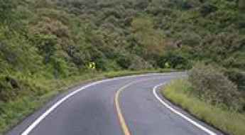
How to drive the scenic Mexico 175 (Tuxtepec Road)?
The Tuxtepec road is said to be Mexico’s most scenic road. It offers everything you could wish for on a road trip: mountains, desert, pine forest, jungle, cactus, mountain lakes, lots of curves, scenic views, hairpin curves, rivers, and canyons... Except polar or ice environments, you can find it all here.
La Ventosa (Mexico 185) is One of the Most Dangerous Roads in Mexico
La Ventosa (English: The Windy) is a small town in the Oaxaca state of Mexico. It lends its name to Mexico Highway 185 due to the high-speed winds that blow across the area almost year-round.
How to get by car to Puerto Cancun in Baja California Sur?
Puerto Cancún is a small community of fishermen located on the western coast of the Mexican state of Baja California Sur.
A beautiful drive to Presa Zimapan
Straddling Hidalgo and Querétaro states of Mexico, the road to Zimapán reservoir is an uncategorized state route, offering great views of the mountains, the reservoir, and canyon walls.
Driving through the Mexican Federal Road 307
Carretera Federal 307 is a very scenic jungle-drive located in the state of Chiapas, in Mexico.
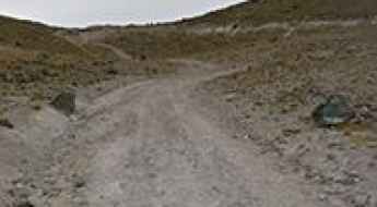
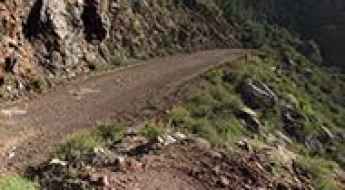
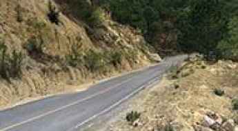
Driving the unpaved Bajada a Zirupa in Chihuahua
Bajada a Zirupa is a gravel mountain road located in the mountains of the Mexican state of Chihuahua.
How to Get by Car to La Lobera in Baja California
La Lobera is a magnificent sea crater located on the west coast of the Mexican state of Baja California.
How to Get by Car to Calakmul, a Maya Site
Calakmul is a Maya archaeological site located in the Mexican state of Campeche, deep in the jungles of the greater Petén Basin region of Mexico.
The Wild Road to El Capulin
El Capulín is a high mountain town at an elevation of 3,075m (10,088ft) above sea level, located in Mexico. It’s one of the highest roads in the country.

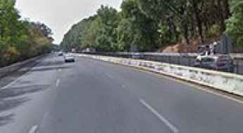
La Marquesa is One of the Deadliest Highways in Mexico
Mexico City-Toluca (Mexico 15D or 134D) is a very dangerous road that links Mexico City and Toluca, in Mexico.
A high mountain road from Xalatlaco to El Ajusco
Straddling Mexico State and Mexico City, the road from Xalatlaco to El Ajusco is one of the most scenic drives in Mexico.
Nuevo Leon 20: a memorable road trip
Located in the Mexican state of Nuevo León, the Nuevo Leon 20 runs along the San Isidro canyon.

Traversing the spectacular Zacatal Bridge
Located southwest of Ciudad del Carmen, in the state of Campeche in Mexico, Puente El Zacatal is one of the most spectacular bridges in the world. The bridge connects the Atasta peninsula and the Isla del Carmen.
Driving the road to Mesa del Nayar with spectacular views
Mesa del Nayar (Road from Ixcatán-Jesús María Mexico 44) is a very scenic drive in Mexico, departing at Jesús María (430 masl) and running to the coast at Ruiz, Nayarit.
Driving through the Federal Road 95D
Carretera Federal 95D is a dangerous mountain road located in the central part of Mexico.
Driving Through the Defiant Highway del Sol
Autopista del Sol (Mexico City-Acapulco, Mexico 95D) is a modern four-lane toll highway located in the southern part of Mexico that links Mexico City with Acapulco.
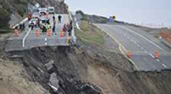
Fog and Bad Weather on the Road to Paso de la Muerte
Death Pass (Paso de la Muerte in Spanish) is a terrible high mountain road linking the small community of Conrado Castillo to the rest of the state of Tamaulipas, in Mexico.