What are the most spectacular roads in Mexico?
Located in North America, Mexico is a country with a wide collection of stunning drives. It’s home to about 150 roads listed as the most spectacular in the world.
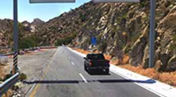
With very diverse geography, comprising high mountains such as the Sierra Madre Occidental and Sierra Madre Oriental, and stunning beaches providing scenic coastal drives, when traveling to Mexico don’t forget to add to your list the infamous Espinazo del Diablo, a thrilling and challenging Mexican mountain road. This road is renowned internationally for its hairpin turns. Another notable road is Carretera Federal 1, which is full of blind corners with no barriers or hard shoulders. Spanning the length of the Baja California Peninsula, it is often called the Carretera Transpeninsular or Transpeninsular Highway.
If you prefer mountain roads, try the road to Cortes Pass, a mountain pass at an elevation of 3,692m (12,112ft) above sea level. It’s one of the highest roads in Mexico. If you like unpaved roads, try the drive to Sierra Negra volcano, an extinct volcano at 4,576m (15,013ft) in the state of Puebla.
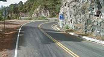
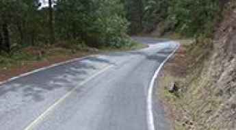
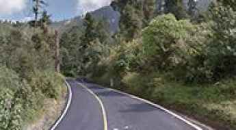
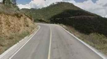
Espinazo del Diablo is a Mexican Thrilling and Challenging Mountain Road
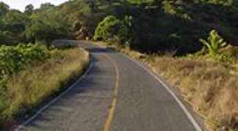
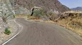
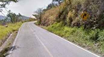
Espinazo del Diablo is a famous mountain road in Mexico, situated between Mazatlan on the west coast of mainland Mexico and Durango. This road is renowned locally and internationally for its hairpin turns and zigzagging bends. The road is predominantly situated over 2,000 meters above sea level.
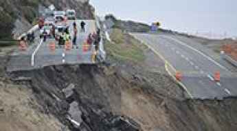
The Five Most Dangerous Roads In Mexico
We should start this article off with a disclaimer, and so we will. Nobody should deliberately go looking for the world’s most dangerous roads with the intention of driving down them.
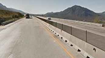
Carretera Federal 1 in Mexico is full of blind corners with no barriers
Carretera Federal 1 is a very dangerous highway in Mexico that spans the length of the Baja California Peninsula. The road is often called the Carretera Transpeninsular or Transpeninsular Highway.
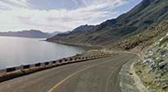
La Rumorosa is a road for James Bond in Mexico
La Rumorosa is a mountain pass at an elevation of 1.232m (4,042ft) above sea level, located in Baja California, Mexico.
Driving the scenic Mil Cumbres Road in Mexico
Carretera Mil Cumbres (One Thousand Hills Road in Spanish) is a very scenic drive located in the Michoacán state, in Mexico.
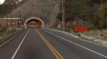
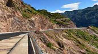
Durango-Mazatlan Highway: the road with 115 bridges and 61 tunnels
Mexico 40D is an amazing journey in the western Sierra Madre of Mexico. Also known as the Autopista Durango-Mazatlán, it’s one of Mexico’s greatest engineering feats, with 115 bridges and 61 tunnels.
The road to Raíces, the highest town of Mexico
Located in the Municipio of Zinacantepec, in the State of Mexico, Raíces is the highest town in the country, at an elevation of 3,531m (11,919ft) above sea level. It’s one of the highest towns accessible by car on Earth.
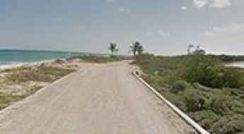
How to Get by Car to Punta Allen in Mexico?
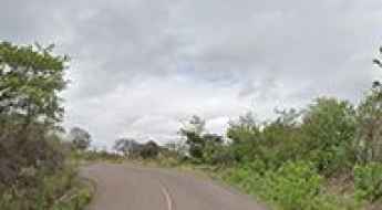
Located in the Mexican state of Quintana Roo, Punta Allen is the largest village at the end of the Boca Paila Peninsula. It’s one of the most spectacular coastal drives in the world. No cars, no smog, no noise at all. Lots of birds and animals around.
An epic enthralling road to Cortes Pass
Paso de Cortés is a high mountain pass at an elevation of 3.692m (12,112ft) above sea level located on the boundary between Puebla and the State of Mexico, in Mexico. It’s one of the highest roads in the country.
Take An Unforgettable Drive to Sierra Negra volcano in Mexico
Sierra Negra is an extinct volcano, standing at an elevation of 4,576m (15,013ft) above sea level, located in the Mexican state of Puebla. It’s one of the highest roads in the country.
What are the highest roads in Mexico?
Located in the southern portion of North America, Mexico is a land of extraordinary topographical contrast and immense scale. Defined by vast geographical barriers, the country boasts a massive coastline but is dominated inland by two colossal mountain systems: the Sierra Madre Oriental and the Sierra Madre Occidental. Crucially, the central heart of Mexico is pierced by the Trans-Mexican Volcanic Belt (Eje Volcánico Transversal), a chain of soaring, snow-capped volcanoes and high plateaus.
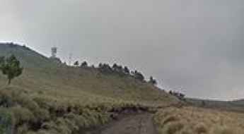
Driving one of the highest roads of Mexico to La Joya-Iztaccíhuatl hut
Set high in the Izta-Popo Zoquiapan National Park, in the State of Mexico, La Joya is a high mountain hut at an elevation of 3,977m (13,047ft) above sea level. It’s one of the highest roads in the country.
Road trip guide: Conquering Altzomoni Peak in Mexico
Altzomoni is a volcanic peak at an elevation of 4.027m (13,211ft) above sea level, located in the State of Mexico. It’s one of the highest roads of the country.

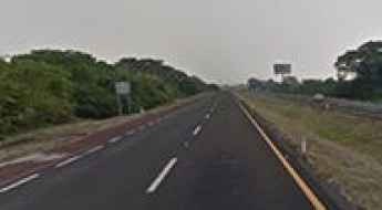
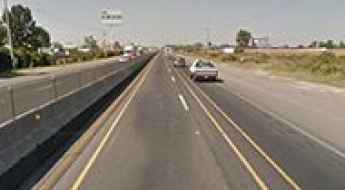
Highway Mexico 57D is the busiest road in the country
Mexico City-Queretaro (Mexico 57D) is said to be the busiest highway in Mexico, carrying most of the commercial traffic from the north of the country and the US directly into Mexico City.
Michoacan Coastal Road is a road with beaches and rocky cliffs in Mexico
Michoacán Coastal Road is a very scenic coastal drive along the Pacific Ocean in the Mexican state of Michoacán.
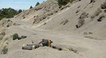
You May Want to Explore The Dangerous Road to Ojuela
Ojuela is a small mining ghost town located northeast of the state of Durango, in Mexico. The tortuous road to the town should not be attempted by those who don't know how to reverse.
Driving the scenic road to Batopilas, the Magic Town of Mexico
Batopilas de Manuel Gómez Morín is a small town at an elevation of 501m (1,643ft) above sea level located in the Mexican state of Chihuahua.
How to drive to Nevado de Toluca in Mexico?
Nevado de Toluca is a towering, inactive stratovolcano located in Estado de México. A road near the summit tops out at 4.254m (13,956ft) above sea level. It’s one of the highest roads of the country.
Dare to Drive Cuesta de los Arrepentidos to Real de Catorce in Mexico
Located in the Mexican state of San Luis Potosí, Cuesta de los Arrepentidos (Repentant’s Slope) ranks among the scariest roads on Earth.
How To Travel The Challenging Mexican Federal Highway 131
Mexican Federal Highway 131 is a very scenic yet defiant road located in the Mexican state of Zacatecas.
A Scenic Drive to San Cristobal de la Barranca in Jalisco
San Cristóbal de la Barranca is a small town located in the Mexican state of Jalisco. The road to the town is very scenic.

Puchutla Road is not recommended if you suffer of dizziness
Mexico 175 (Puchutla Road) is a long, curvy and scenic drive. If you suffer of dizziness, this road is not recommended to you. Over 6 hours of constant movement with curves everywhere, small towns with speed bumps and scenic views of the Sierra Madre Mountains.
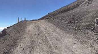
A challenging 4x4 road to Cerro Potosí, one of the Mexico's highest peaks
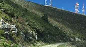
Cerro el Potosí is a high mountain peak at an elevation of 3.721m (12,208ft) above sea level, located in Nuevo León state, in Mexico. It’s one of the highest roads of the country.
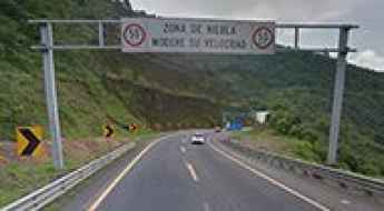
Cumbres de Maltrata is a dangerous Mexican road
Cumbres de Maltrata is part of the México 150D, the main highway linking Mexico City to the Gulf. It’s said to be the most dangerous highway in Mexico (with 4 accidents per day), according to CAPUFE.
Ruta Tepehuana is a windy and narrow road with incredible views
Ruta Tepehuana (Camino a Huzamota) is located in Durango, Mexico. This road is known for being windy, narrow, and potentially hazardous, offering views of the Sierra Madre mountains and canyons. Elevations range from 2,700 meters above sea level to the canyon's bottom at 500-0 meters.
Saltillo-Monterrey Highway is a Mexican killer road
Autopista Mexico 40D and Mexico 40 were considered Mexico deadliest highways, until the new toll route opened to traffic in 2009. The original “libre” route had sharp curves and long steep grades, until it was improved around 2000’s. Currently “libre” highway is still dangerous, but the dead list was reduced due the traffic changes after the opening of the toll route.
Travelling the busy Road Mexico 45
Queretaro-León (Mexico 45) is a busy highway located in Mexico which gets almost all traffic from northwest and north of Mexico and the US (except northeast Mexico).
The horrendous road to Nevado de Colima
Nevado de Colima is a high mountain peak at an elevation of 3.991m (13,093ft) above sea level located in the Mexican state of Jalisco. The road to the summit is horrendous with sections up to 12%. 4x4 is the only option. It's one of the highest roads of the country.
How to get by car to Cerro de la Cúpula in Baja California?
Cerro de la Cúpula is a high mountain peak at an elevation of 2,806m (9,206ft) above sea level, located in the Mexican state of Baja California.
Travelling through the unstable Baja California Scenic Highway
Baja California Scenic Highway (Mexican Federal Highway 1D) is a very scenic toll road located in the northwestern Mexican state of Baja California.
Bajada a Xichu is a drive with spectacular views of Sierra Madre Oriental
Xichú is a Mexican city located in the Northeast region of the state of Guanajuato. The road to the city is called Bajada a Xichú. It’s a scenic road with spectacular views of Sierra Madre Oriental mountains and canyons.
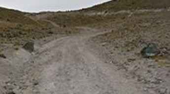
Driving the Wild 4x4 Road to Piedra Grande Hut
Refugio Piedra Grande is a high mountain hut at an elevation of 4,255m (13,959ft) above sea level, located in Mexico. It’s one of the highest roads in the country.
The hairpinned road to Barranca de Beltran
Barranca de Beltrán roads (both Mexico 54D and Mexico 54, autopista Guadalajara-Manzanillo) link Guadalajara to the Pacific Ocean, mainly the cities like Colima and the resort city of Manzanillo.
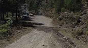
The road to Urique is not recommended due to security concerns
Urique is a small town located at the bottom of Urique Canyon, in the northern Mexican state of Chihuahua. The road to the town is extremely steep, unsurfaced, and rugged. It will test both vehicle and driver.
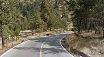
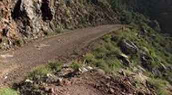
Cuesta del Cajón: Driving the scenic road through Chihuahua's pine forests
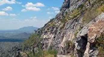
Cuesta del Cajón is a demanding mountain passage carved into the Sierra Madre Occidental in Chihuahua, Mexico. Known for its dense pine forests and deep rocky canyons, this section of State Route 11 is much more than a scenic drive; it is a technical challenge that tests a vehicle's braking system and a driver's precision. The route serves as a vital but treacherous link through the rugged terrain, where the natural beauty of the landscape is matched only by the concentration required to stay on the road.
How to drive the scenic Mexico 175 (Tuxtepec Road)?
The Tuxtepec road is said to be Mexico’s most scenic road. It offers everything you could wish for on a road trip: mountains, desert, pine forest, jungle, cactus, mountain lakes, lots of curves, scenic views, hairpin curves, rivers, and canyons... Except polar or ice environments, you can find it all here.