What are the most spectacular roads in England?
Located on the island of Great Britain, in the northern part of Europe, England is a country that shares borders with Scotland and Wales and covers an area of 130,279 square kilometers.
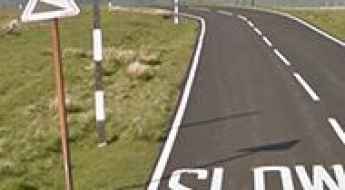
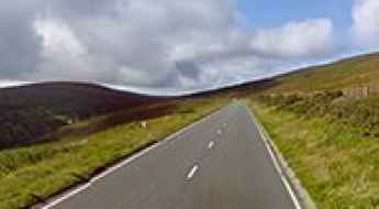
The roads in the country offer a bit of everything, with coastal drives, mountain roads and very steep streets. When travelling to England, you can’t miss Snake Pass, one of the best drives in the UK. At 512m (1,679ft) above sea level, the pass connects Manchester and Sheffield in Northern England and provides a challenging drive across the Pennines. For those preferring the most difficult challenges, don’t miss Hardknott Pass, one of the steepest roads in England, with a gradient of 1 in 3 (about 33%) or Porlock Hill, the steepest A road in England.
If you prefer different experiences, the country hosts the Stocksbridge Bypass. Featuring numerous reports of paranormal activity, it’s one of the Top Haunted Roads in the world. Or the stunning Swindon's Magic Roundabout, an insane 6-circle traffic junction within the Borough of Swindon. It has five smaller roundabouts directing traffic clockwise while cars travel counterclockwise around the inner circle. It's one of the world's 10 best roundabouts.
The Broomway is Britain’s most deadly path
Located in Essex, in the southeastern part of England, The Broomway is said to be Britain’s most deadly path, killing more than 100 people at over 600 years old. The Broomway is exceptionally dangerous.
A narrow road to Cow Green Reservoir in England
Cow Green is a reservoir at an elevation of 510m (1,673ft) above sea level, located on the county border between Cumbria and County Durham, in England.
Discovering the Thrills of Whinlatter Pass: A Breathtaking Road in Cumbria
Whinlatter Pass is a mountain pass at an elevation of 337m (1,105ft) above sea level located in Cumbria, England.
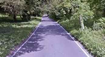
The Olympics cycling Zig Zag road at Box Hill in England
Zig Zag Road is a paved (pristine and smooth) drive winding its way up North Downs in Surrey county, in the South East of England. It has been dubbed as England's Most Twisty and Curved Road.
Adventure along the abandoned Old Mam Tor road
Located in the High Peak of Derbyshire, England, Old Mam Tor is the name of an abandoned road in 1979, after years of landslips. What's left of the road is still there, however impassible by cars.
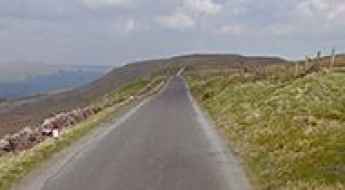
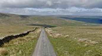
Cam High Road Is the Highest Road in England Outside of the North Pennines
Cam High Road is a narrow mountain road located in North Yorkshire, in England. It’s one of the highest roads in the country.
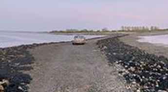
Osea Island Causeway is covered by sea water at high tide
Osea is a tidal island situated in the estuary of the River Blackwater in Essex, East England. Twice a day, the tidal causeway to the island disappears with the tides, leaving the area out to sea. It’s one of the periodically flooded roads around the world.
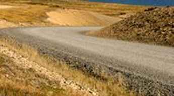
Darwin Road is a drive you'll never forget in the Falkland Islands
Darwin Road is a gravel road located in the Falkland Islands (Islas Malvinas), an archipelago in the South Atlantic Ocean on the Patagonian Shelf.
The Strood is a flooded road to Mersea Island in UK
The Strood is the only road to Mersea Island in UK. It’s covered by the tide twice a day for one week during the month. It’s one of the periodically flooded roads around the world.
Harthope Moss is a very famous climb in England
Harthope Moss is a mountain pass at an elevation of 628 m (2,060 ft) above sea level, located in County Durham, in England. It's one of the highest roads in the country.
Driving the Awe-Inspiring Snaefell Mountain Road in the Isle of Man
Snaefell Mountain Road is a leading motorsport destination located on the north east of the Isle of Man.
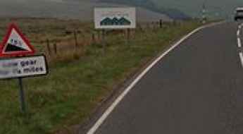
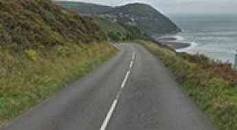
A39 road in England: The Ultimate Guide
The A39 Road is an extremely beautiful and rewarding drive to make in south-west England. The drive is definitely worth it, with stunning views and landscapes.
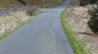
B6277 is said to be the highest B-road in Britain
Located in historic County Durham, England, the paved B6277 is said to be the highest B-road in Britain.
Driving the nerve-racking paved road to Killhope Cross
Killhope Cross is a mountain pass at an elevation of 629m (2,063ft) above sea level, located in England. It's one of the highest roads in the country.
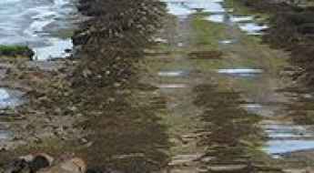
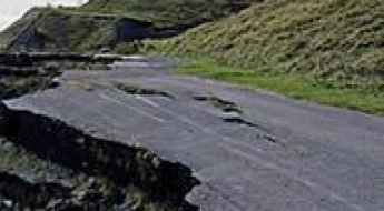
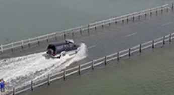
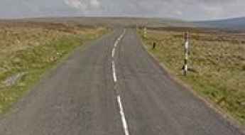
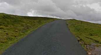
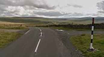
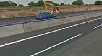
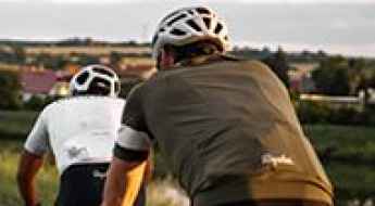
Driving England: 4 Unstable Coastal Roads and Steep Moorland Passes
Driving through the coastal cliffs and high moorland plateaus of England forces vehicles to face sections where geological collapse and brutal hill gradients constantly break the tarmac. Far from the standard multi-lane motorways, these four regional routes feature active cliff erosion, 33% single-lane walls, and blind hill crests with zero lateral protection.
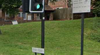
Jenkin Road in Sheffield is One of the Steepest Roads in the UK
Located in South Yorkshire, England, Jenkin Road is among the steepest climbs in the UK, boasting a maximum gradient of 17.2%.
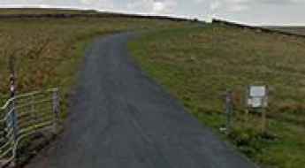
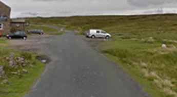
How to Get to Tan Hill Inn, the highest pub in Great Britain?
Located in the English county of North Yorkshire, Tan Hill Inn is the highest pub in Great Britain, at an elevation of 528m (1,732 ft) above the sea level.
A very narrow road to Chew Reservoir in Greater Manchester
Chew Reservoir is a reservoir at an elevation of 488m (1,600ft) above sea level, located in the Metropolitan Borough of Oldham in Greater Manchester, England. It was the highest constructed in England right up until 1971.
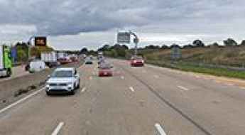
Why Is the M25 the Busiest Motorway in England?
Located in London, the capital of England, the M25 is an orbital motorway that almost completely encircles the country’s largest city. Officially known as the London Orbital Motorway, it is one of the busiest and most controversial roads in the United Kingdom. Loved by very few but used by millions, the M25 is essential for London’s transport network, linking counties, cities, airports, and major routes across the southeast of England.
Where are the highest pubs in the UK? A guide to the ultimate road trip stops
If you're scouting for pubs that combine history, great food, and spectacular views, consider heading to the UK's highest inns. From the captivating moors of North Wales to the scenic dales of North Yorkshire, these pubs offer more than just a pint.
Black Hill: One of the highest paved roads in the North Pennines
Black Hill is one of the highest spots where you can take a car in all of England, sitting at 607 meters right on the line between Cumbria and Northumberland. Up here, there is nothing to shield you: the asphalt cuts through open moorland where the wind blows with a real nasty bite and the fog can swallow the road in a heartbeat. The physical reality of the trip is that you are totally out in the open; the car takes a beating every time a storm rolls in from the Atlantic.
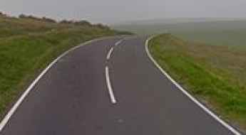
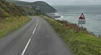
Beachy Head Road
Beachy Head Road is a great coastal route on England’s southeast coast. Stunning views but take extra care on windy days.
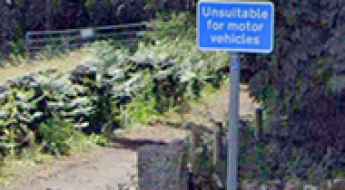
Is Bamford Clough in the Peak District the steepest road in England?
Located in the Peak District of England, Bamford Clough could be the steepest road in the world. A road sign warns drivers of a 35 percent gradient and that the way ahead is 'unsuitable for motor vehicles'.
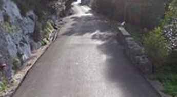
How to drive the steep Vigo Hill in Kent?
Located in the Borough of Gravesham in Kent, Vigo Hill is one of the toughest roads of England, hitting a 25% of maximum gradient.
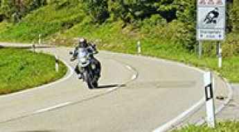
Motorcycle Safety: High-Risk Routes in the East Midlands
While motorcyclists account for only 1% of total road traffic in the UK, they represent a staggering 19% of all road fatalities. In regions like the East Midlands, where scenic rural A-roads meet heavy industrial corridors, the risk for bikers is particularly high. Understanding which sections are classified as having an "unacceptably high risk" is essential for any rider navigating this part of England.
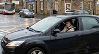
The deadliest UK Road Accident Statistics
We looked at the latest DVLA and UK Gov statistics to find the most dangerous situations on UK roads. From age and gender to left vs right turns, we’ve statistical found the most common situations for road accidents. For instance- statistically, in the UK, you are most likely to have an accident as a 20-29 female, driving a car to work, when making a right turn on an urban road at a T junction.
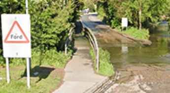
Things to Know Before Driving the Flooded Welney Wash Road
Located on the Norfolk Cambridgeshire border, in England, the infamous Welney Wash Road is one of the periodically flooded roads around the world.
Spur Battery
Spur Battery is an artillery battery at an elevation of 334m (1,095ft) above the sea level located in the British Overseas Territory of Gibraltar. It was built in 1902.
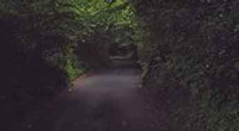
Phantom Tracks: A Guide to Britain’s Most Haunted Roads
For some road enthusiasts, the thrill of a journey isn't just about the curves or the scenery, but the legends that linger in the mist. Britain’s long history is etched into its tarmac, with dozens of routes claiming sightings of phantom hitchhikers, Roman legions, and unexplained phenomena. Whether you believe in the paranormal or not, these ten roads offer an eerie atmosphere that is perfect for a late-night expedition.
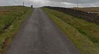
A singletrack road from Newbiggin to Westgate
Located in County Durham, in North East England, the road from Newbiggin to Westgate is a quiet, singletrack road. It's one of the highest roads of the country.
The inhumane climb to Dowgang Hush with 17% ramps
Dowgang Hush is a mountain pass at an elevation of 600m (1,968ft) above the sea level, located in Cumbria county, in North West England. It's one of the highest roads of the country.
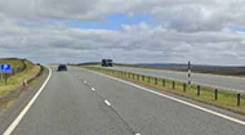
A66 to Stainmore Summit is a defiant road in bad weather
Stainmore Summit is a mountain pass at an elevation of 443m (1,453ft) above the sea level, located on the boundary of Cumbria and County Durham, in England.
Driving and Cycling the 8 Deadliest Road Blackspots in the UK
The UK's road network is a messy patch-work of historic narrow lanes and heavy modern traffic. In major cities, this mix creates lethal "blackspots" where heavy goods vehicles (HGVs), delivery vans, and cyclists are squeezed into the same tight spaces. These are not just points on a map; they are high-conflict zones where the physical layout of the road—from deep ruts to blind turns—puts everyone’s metal and nerves to the ultimate test. If you are driving or riding through these areas, you need to know exactly where the traps are hidden.
Rufford Ford is the river crossing that went viral on YouTube and TikTok
Nestled within the picturesque Nottinghamshire county in the East Midlands of England lies Rufford ford, an ancient river crossing that has stood the test of time for over a millennium. This historic site, spanning Rainworth Water east of Mansfield, has recently garnered significant attention after viral videos of cars crossing it.
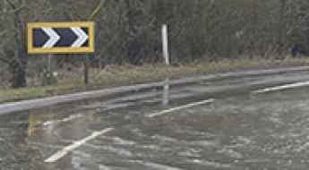
Driving the most dangerous and steep mountain passes in the UK
The UK road network is a brutal mix of ancient, narrow tracks and high-altitude mountain passes that catch many drivers off guard. From the rain-soaked asphalt of the Pennines to the vertical drops of the Lake District, these routes are less about the views and more about survival for your brakes and tires. If you are heading out to tackle these sectors, you need to forget the postcard images and focus on the ruts, the standing water, and the steep ramps that will push any standard vehicle to its mechanical limit.
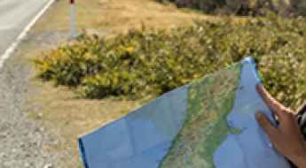
Efficiency and Resource Management on Long-Distance Routes
Planning a high-intensity road trip through remote or technical terrain requires more than just a sense of adventure; it requires meticulous resource management. Efficiency in fuel consumption, weight distribution, and stopover logistics isn't just about saving money—it’s about extending your vehicle's range and ensuring safety in areas where support is non-existent. Here is how to optimize your expedition logistics for maximum performance.