What are the most spectacular roads in Austria?
Covering an area of 83,871 square kilometres and sharing borders with 8 countries (Germany, the Czech Republic, Slovakia, Hungary, Slovenia, Italy, Switzerland and Liechtenstein), Austria is a mountainous country, set high in the central part of Europe.
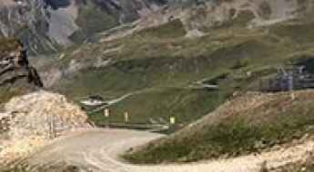
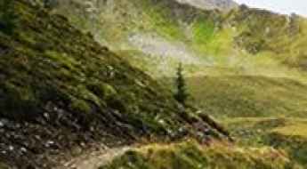
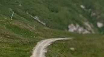
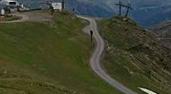
Set high in the Alps, the country provides challenging yet scenic mountain roads for every driver, the scenic Alpine roads, with stunning views of mountains, valleys, lakes, and forests. While in the country, don’t forget to drive the Silvretta High Alpine Road, the Dream Road of the Alps. It’s one of the most stunning and popular panoramic routes in the country. At 22.3 km long, this curvy road encompasses 34 curves and reaches 2.071m (6,794ft) above sea level. Also worth taking is the 48km long drive through the legendary Grossglockner High Alpine Road.
Also, don’t miss the Timmelsjoch, the highest pass of the Ötztal Alps. Also known as Passo del Rombo, is an international high mountain pass on the border with Italy, situated just a few meters below the iconic Passo dello Stelvio. Remember to plan carefully your trip, because Austria has a temperate continental climate, with warm summers and cold winters.
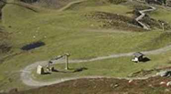
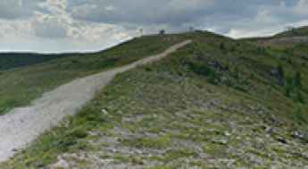
Stubnerkogel
Stubnerkogel is a high mountain peak at an elevation of 2.232m (7,322ft) above the sea level, located in the Austrian state of Salzburg.
How to drive the unpaved road to Magnetköpfl in Salzburg?
Magnetköpfl is a high mountain peak at an elevation of 2.690m (8,825ft) above sea level, located in the state of Salzburg in Austria.
A wild 4x4 road to Sillianer Hütte
Sillianer Hütte is a high mountain refuge at an elevation of 2.428m (7,965ft) above the sea level, located on the border of Austria and Italy.
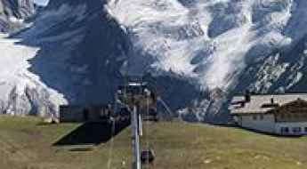
Bergstation Grubenkopfbahn
Bergstation Grubenkopfbahn is a chairlift at an elevation of 2.806m (9,206ft) above the sea level, located in the Austrian state of Tyrol.
Schareck
Schareck is a high mountain peak at an elevation of 2.552m (8,372ft) above the sea level, located in Carinthia, Austria.
Hohe Mut road: A steep 4x4 climb to the peak in the Ötztal Alps
Hohe Mut is a high mountain peak at an elevation of 2,652m (8,700ft) above sea level, located in the Ötztal Alps in the Tyrol region of Austria. This summit is a legendary destination for off-road drivers, offering one of the most demanding climbs in the Eastern Alps, with breathtaking views of surrounding glaciers and 3,000-meter peaks.
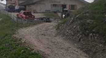
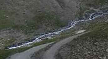
The road to Kaprun reservoir, a chillout in high mountains
Kaprun Hochgebirgsstauseen is a high mountain reservoir at an elevation of 2.038m (6,686ft) above the sea level, located in Salzburg, Austria.
Driving the Villacher Alpenstraße to the Dobratsch summit
Dobratsch is a high mountain peak at an elevation of 2,143 meters (7,030 ft) above sea level, located in the Austrian state of Carinthia. Rising above the city of Villach, the summit hosts a massive television tower, the Dobratsch Gipfelhaus refuge, and the high-altitude church of Maria am Stein.
Zupalseehütte
Zupalseehütte is an alpine mountain refuge at an elevation of 2.339m (7,673ft) above the sea level, located in the Austrian state of Tyrol.
Hoadl Haus
Hoadl Haus is a high mountain bar at an elevation of 2.338m (7,670ft) above the sea level, located in the Austrian state of Tyrol.
Road to Schattberg West: Driving the 20% Ski Service Track in Salzburg
Located in the Pinzgau region within the state of Salzburg, Schattberg West is a prominent mountain peak reaching an elevation of 2,087m (6,847ft) above sea level. Part of the Kitzbühel Alps, the summit is accessible via a technical ski-station service road that serves the local lift infrastructure and the Westgipfelhütte refuge.
Schwarzwand: Driving the 20% Service Track in Rauris
Located in the Pinzgau region of Salzburg, Austria, Schwarzwand is a high mountain peak reaching 2,173m (7,129ft) above sea level. The road to the summit is a functional service track designed for ski resort maintenance and chairlift access, starting from the town of Rauris.
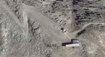
How to drive the 12.94% gradient of Zeblasjoch?
Zeblasjoch is an international high mountain pass at an elevation of 2,535m (8,316ft) above sea level, situated on the border between Austria and Switzerland. Located within the Samnaun Alps, the pass is reached via the Zeblastrasse, a technical unpaved road that serves as a high-altitude link between the Samnaun and Ischgl valleys. The 5 km route from Samnaun is characterized by extreme gradients and is strictly impassable from October to June due to heavy snow accumulation.
Rotmoosalm
Rotmoosalm is an alpine hut at an elevation of 2.037m (6,683ft) above the sea level, located in the beautiful Gais valley, in the district of Innsbruck-Land in the Austrian state of Tyrol.
Wildkogel: Driving the steep 30% ski-station road in Salzburg
Located in the Oberpinzgau region of Salzburg, Wildkogel is a high mountain peak reaching an elevation of 2,086m (6,843ft) above sea level. Situated in the heart of the Kitzbühel Alps, this peak offers a fascinating mountain landscape, but the road leading to the summit is a grueling test of power and traction, originally designed as a service road for the local ski station and chairlifts.
Kreuzkogel
Kreuzkogel is a high mountain peak at an elevation of 2.643m (8,671ft) above the sea level, located south of Salzburg, in Austria.
Tuxer Ferner Haus: The brutal 30% gravel climb in the Zillertal Alps
Located in the Zillertal valley of the Austrian state of Tyrol, the road to Tuxer Ferner Haus is a high-altitude challenge reaching an elevation of 2,615m (8,579ft) above sea level. This peak is part of the Hintertux Glacier system, one of the few ski resorts in the world offering skiing 365 days a year, meaning the road is a vital but brutal service track for the high-mountain infrastructure.
How to drive the steep road to Wanglspitz?
Wanglspitz is a high mountain peak at an elevation of 2.405m (7,890ft) above sea level, located in the province of Tyrol, Austria.
How to drive the unpaved road to Thurntaler in Tyrol?
Thurntaler is a high mountain peak at elevation of 2.390m (7,841ft) above sea level, located in the Austrian state of Tyrol.
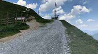
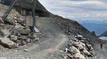
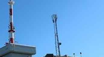
Driving the steep service road to Patscherkofel in the Tyrolean Alps
Patscherkofel is a prominent mountain peak serving as a major telecommunications and radar hub in the Austrian state of Tyrol. Reaching an elevation of 2,250m (7,381ft) above sea level, the summit is accessed via a grueling unpaved service road that overlooks the city of Innsbruck. This track is not designed for standard transit; it is a steep, technical climb through the alpine landscape where the mechanical endurance of the vehicle and the driver’s ability to manage loose gravel are tested at every turn.
Schartenkogel
Schartenkogel is a high mountain peak at an elevation of 2.289m (7,509ft) above the sea level, located in the Austrian state of Tyrol.
Schmiedingersee
Schmiedingersee is a high mountain lake at an elevation of 2.392m (7,847ft) above the sea level, located southwest of Salzburg, in Austria.
How to drive the unpaved road to Z1 Aussichtsplattform in Tyrol?
Z1 Aussichtsplattform is an observation deck at an elevation of 2.575m (8,448ft) above sea level, located in the Austrian state of Tyrol.
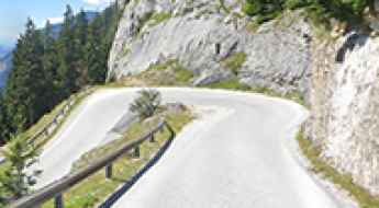
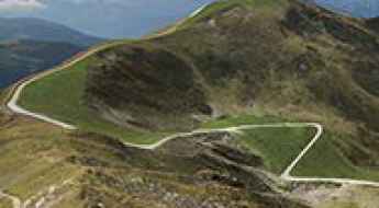
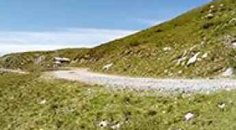
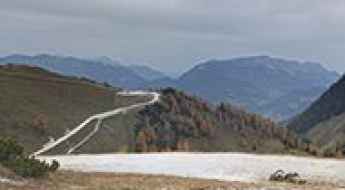
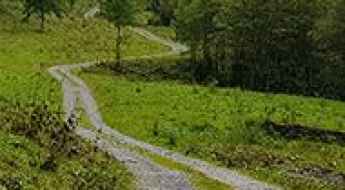
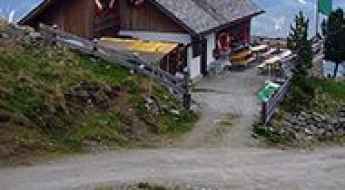
Driving the scenic Stoderzinken Alpine Road in the Austrian Alps
Stoderzinken Alpenstraße is a very scenic drive subject to a toll located in the Austrian state of Styria, offering rewarding panoramas.
Goldeck: enjoy a drive among the clouds in Austria
Goldeck is a high mountain peak at an elevation of 2.110m (6,922ft) above sea level, located in Carinthia, in Austria.
How to drive the unpaved road to Zillertal in Tyrol?
Zillertal is a high mountain pass at an elevation of 2.367m (7,765ft) above sea level, located in the Austrian state of Tyrol.
Jenner
Jenner is a high mountain peak at an elevation of 1.786m (5,859ft) above the sea level, located on the border of Germany and Austria.
Wildes Mannle: A Comprehensive Travel Guide
Wildes Mannle is a high mountain peak located in the Austrian state of Tyrol. To the south of the peak, a gravel mountain road climbs up to 2,648m (8,687ft) above sea level.
How to drive the steep service road to Golzentipp?
Golzentipp is a high mountain peak at an elevation of 2,236m (7,335ft) above sea level, located in the Gailtal Alps of Tyrol, Austria. The route is an unpaved service track primarily used for the maintenance of the local ski infrastructure and forest management. Logistically, it is a demanding ascent that requires a vehicle prepared for sustained steep gradients and loose alpine substrate.
How to drive the brutally steep unpaved road to Schwarzkogl in Tyrol?
Schwarzkogl is a high-mountain peak at an elevation of 2975m (9,760ft) above sea level, located in the Austrian state of Tyrol.
How to drive the unpaved road to Lago Volaia-Wolayersee
Lago Volaia-Wolayersee is a high mountain lake at an elevation of 1.963m (6,440ft) above sea level, located on the Austrian-Italian border.
How to drive the steep road to Darmstädter Hütte in Tyrol?
Darmstädter Hütte is a high-altitude mountain alpine refuge situated at an elevation of 2,383 meters (7,818 ft) above sea level, located in the Tyrolean region of western Austria. The access route to the hut is a restricted, high-gradient mountain track that cuts deep into the rugged terrain of the Verwall Alps.
How to get to Peter-Anich-Hutte in Tyrol?
Peter-Anich-Hütte is a high mountain refuge at an elevation of 1,909m (6,259ft) above sea level, located in the district of Innsbruck-Land in Austria. Expect sections that are as steep as 30%.
How challenging is the road to Pfaffenbichl?
Pfaffenbichl is a high mountain peak at an elevation of 2,303 meters (7,555 ft) above sea level, located in the Tyrol province in Austria.