What are the most spectacular roads in Austria?
Covering an area of 83,871 square kilometres and sharing borders with 8 countries (Germany, the Czech Republic, Slovakia, Hungary, Slovenia, Italy, Switzerland and Liechtenstein), Austria is a mountainous country, set high in the central part of Europe.
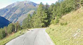
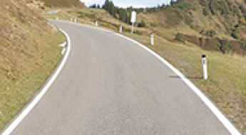
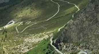
Set high in the Alps, the country provides challenging yet scenic mountain roads for every driver, the scenic Alpine roads, with stunning views of mountains, valleys, lakes, and forests. While in the country, don’t forget to drive the Silvretta High Alpine Road, the Dream Road of the Alps. It’s one of the most stunning and popular panoramic routes in the country. At 22.3 km long, this curvy road encompasses 34 curves and reaches 2.071m (6,794ft) above sea level. Also worth taking is the 48km long drive through the legendary Grossglockner High Alpine Road.
Also, don’t miss the Timmelsjoch, the highest pass of the Ötztal Alps. Also known as Passo del Rombo, is an international high mountain pass on the border with Italy, situated just a few meters below the iconic Passo dello Stelvio. Remember to plan carefully your trip, because Austria has a temperate continental climate, with warm summers and cold winters.
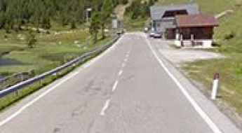
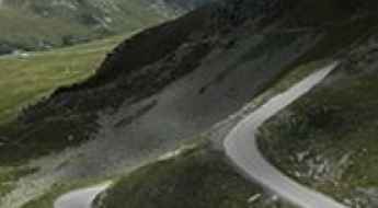
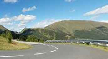
Nassfeld Pass is a classic road trip in the Carnic Alps
Nassfeld Pass-Passo di Pramollo is an international high mountain pass at an elevation of 1.534m (5,032ft) above sea level, located on the Italian-Austrian border.
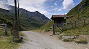
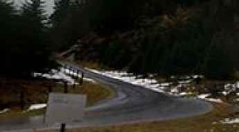
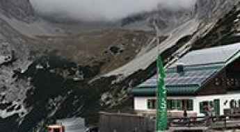
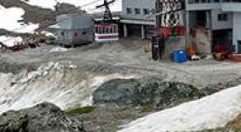
Adventure along the wild road to Starkenburger Hütte in the Stubai Alps
Starkenburger Hütte is a high mountain hut at an elevation of 2,237m (7,339ft) above sea level, located in the district of Innsbruck-Land in Austria.
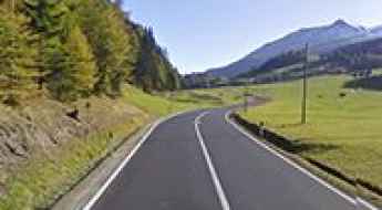
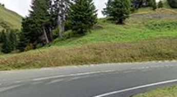
Driving the Pustertaler Hohenstrasse road in Tyrol
Pustertal High Alpine Road is a very scenic journey in the heart of the Austrian state of Tyrol with fabulous views. The road is a delight to drive, with every kind of twist and turn. It’s one of the scenic Austrian Alpine roads.
A memorable road trip to Reschen Pass in the Alps
Reschenpass-Passo di Resia is a high mountain pass at an elevation of 1.522m (4,993ft) above sea level, located in the Trentino-Alto Adige/Südtirol region of Italy, not far from the Austrian border.
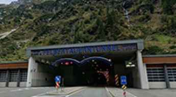
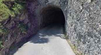
Driving Through the Felbertauern Tunnel in the Heart of the Alps
The Felbertauerntunnel is a high mountain tunnel at an elevation of 1,650m (5,413ft) above sea level, located on the border of Salzburg and Tyrol, in Austria.
Driving the Scenic Kalser Glocknerstrasse in Tyrol
Located in the Austrian state of Tyrol, the Kals Glockner Road (Kalser Glocknerstraße) is a very scenic journey through many hairpin bends. It’s one of the most scenic Austrian Alpine roads.
The Ultimate Guide to Traveling the Katschberg Pass
Katschberg Pass is a high mountain pass at an elevation of 1,641m (5,384ft) above sea level, located in Austria.
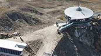
How to get by car to Edelweissspitze, the highest passable point of the Grossglockner High Alpine Road?
Edelweißspitze is a mountain peak at an elevation of 2,571m (8,435ft) above sea level, located in the Austrian state of Salzburg.
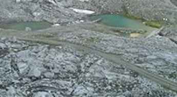
How to drive the steep Dolomitenstraße to Karlsbader Hütte?
The Dolomitenstraße is a high-mountain service road located in the Lienz Dolomites, in the Austrian state of Tyrol. Reaching an elevation of 2,244m (7,362ft) at the Karlsbader Hütte, the route is a technical climb starting from Bad Jungbrunn. Logistically, the road is divided into a public-access paved sector and a restricted unpaved track situated next to the Laserzsee lake.
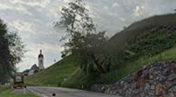
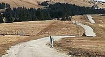
A scenic drive to Niederalpl Pass in the Austrian Alps
Niederalpl Pass is a mountain pass at an elevation of 1.232m (4,041ft) above sea level, located in the Austrian state of Styria.
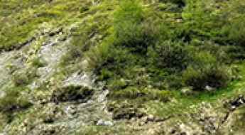
Strubklammstrasse is one of the narrowest roads in Austria
Located in the state of Salzburg, in Austria, and running along the Almbach River, the Strubklammstraße is one of the narrowest roads in the country.
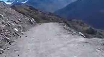
A very demanding road to Bergstation Schaufeljoch in the Alps
Bergstation Schaufeljoch is a high mountain cable car station at an elevation of 3,168m (10,393ft) above sea level, located in the Austrian state of Tyrol. It's one of the highest roads in Europe.
An iconic paved road to Furkajoch in the Austrian Alps
Furkajoch is a high mountain pass at an elevation of 1,761 m (5,778 ft) above sea level, located in the westernmost Austrian state of Vorarlberg.
Driving the unpaved road to Klammljoch (Passo di Gola)
Klammljoch-Passo di Gola is an international high mountain pass at an elevation of 2,288m (7,507ft) above sea level, located on the border of Austria and Italy.
A truly outstanding 4x4 adventure to Krummholzhutte
Krummholzhütte is a high mountain refuge at an elevation of 1,838m (6,026ft) above sea level, located in the Liezen district of Styria, in Austria.
Gaislachkoglbahn: The Thrilling James Bond Mountain Road
Gaislachkoglbahn is a high mountain peak at an elevation of 3,018 m (9,901 ft) above sea level, located in the Austrian state of Tyrol. The peak was the spectacular shooting location for the James Bond Spectre movie. It’s one of the highest roads in Europe.
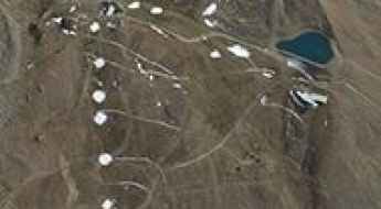
How to get by car to Finstertalspeicher in Tyrol?
Finstertalspeicher is a reservoir at an elevation of 2,325m (7,627ft) above sea level, located in the Austrian state of Tyrol.
A curvy road to Hochtannberg Pass in the Austrian Alps
Hochtannberg Pass is a high mountain pass at an elevation of 1,676 m (5,499 ft) above sea level, located in the westernmost Austrian state of Vorarlberg. It separates the Allgäu Alps from the Lechquellen Mountains and connects the Hochtannberg region and the Lech Valley near Warth with the Bregenzer Ach Valley near Schoppernau. The pass is also part of the European main watershed, with its lowest point at 1,660 m. In the relatively flat pass area lie Lake Kalbele (Kalbelesee) and, a bit southwest, Lake Körber (Körbersee).
Driving the road to Silzer Sattel is not a piece of cake
Silzer Sattel is a high mountain pass at an elevation of 1,692 m (5,551 ft) above sea level, located in the district of Imst in the Austrian state of Tyrol.
An old military road to the summit of Tilliacher Joch-Forcella Dignas
Tilliacher Joch-Forcella Dignàs is an international high mountain pass at an elevation of 2,094m (6,870ft) above sea level, located on the border between Italy and Austria.
Eisentalalm is the highest point of the Nockalmstrasse
Eisentalalm is a high mountain pass at an elevation of 2.042m (6,699ft) above sea level, located in Carinthia, Austria. It’s the highest point on the Nockalmstrasse.
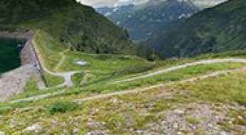
An iconic paved road to Zillergrund-Stausee
Zillergrund-Stausee is a high mountain reservoir at an elevation of 1.850m (6,069ft) above the sea level, located in the Zillertal in the Austrian state of Tyrol.
Wurmkogl
Wurmkogl is a high mountain peak at an elevation of 3.023m (9,917ft) above the sea level, located in the Ötztal Alps of Tyrol, Austria. It's one of the highest roads of Europe.
Driving to Mutkogel: A 2,972m glacier track in the Tyrol Alps
Located in the Austrian state of Tyrol, the track to Mutkogel is a high-altitude challenge that sits at the very limit of motorized Alpine exploration. Reaching an elevation of 2,972m (9,750ft) above sea level in the Ötztal Valley, this is one of the highest roads in Europe. It is not a transit route, but a raw, unpaved service track that provides access to the chairlift infrastructure, carved into a landscape of rock and ice where the air is thin and the weather is unforgiving.
How to drive the unpaved road to Festkogl in Tyrol
Festkogl is a high mountain peak at an elevation of 2.898m (9,507ft) above sea level located in the Austrian state of Tyrol.
Pfeishütte
Pfeishütte is an Alpine mountain refuge hut at an elevation of 1.926m (6,318ft) above the sea level, located below Mount Sonntagkar in Karwendel, in the Austria’s western state of Tyrol.
Roßfeldhöhenringstraße
The Roßfeldpanoramastraße is a toll-Alpine road located in the Alps of Berchtesgaden in the district of Berchtesgaden, Bavaria (Germany).
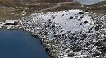
Zirmsee
Lake Zirm is a small lake in a rocky basin, at an elevation of 2.525m (8,284ft) above the sea level, located in Carinthia region, in southern Austria. The average gradient is 10.88% with sections up to 20%.
How to drive the unpaved road to Gletscherexpress Bergstation in Tyrol?
Gletscherexpress Bergstation is a high mountain lift at an elevation of 2.842m (9,324ft) above sea level, located in the Austrian state of Tyrol.
How to drive the steep 14.5% ascent to Sella Bistrizza?
Sella Bistrizza is a high mountain pass at an elevation of 1,718m (5,633ft) above sea level, located in the Carnic Alps on the border between Austria (Carinthia) and Italy (Friuli-Venezia Giulia). The road is a stabilized gravel track that provides access to the Oisternig massif. Logistically, this route is one of the steepest in the region, requiring a vehicle with high torque and a specialized cooling system to handle a sustained incline that exceeds the limits of standard passenger cars.
Weinflaschenkopf
Weinflaschenkopf is a high mountain peak at an elevation of 2.813m (9,229ft) above the sea level, located in the Austrian state of Salzburg.
How to drive the unpaved road to Hagener Hütte?
Hagener Hütte is a high mountain refuge at an elevation of 2.435m (7,988ft) above sea level, located in Austria.
Kitzsteinhorn
Kitzsteinhorn is a high mountain peak at an elevation of 2.738m (8,982ft) above the sea level, located southwest of Salzburg, in Austria.
Driving to Roseggerhaus: A steep 20% Alpine climb in Styria
Roseggerhaus is an Alpine mountain hut situated at an elevation of 1,576 meters (5,170 ft) above sea level in the Fischbach Alps, in the northeastern part of Styria, Austria. The short, mountain route leading to the original 1900 shelter is a steep ascent that turns from asphalt to rough, unpaved gravel with severe gradients.
How to drive the unpaved road to Gossenköllesee in Tyrol?
Gossenköllesee is a high-mountain alpine lake at an elevation of 2,445 meters (8,021 ft) above sea level, located in the Austrian state of Tyrol.
Unterer Bockhartsee
Unterer Bockhartsee is a high mountain lake at an elevation of 1.869m (6,131ft) above the sea level, located in the Austrian state of Salzburg.