What are the most spectacular roads in Kyrgyzstan?
Located in the heart of Central Asia, Kyrgyzstan is a dream come true for every driver, with stunning mountain roads. The country, one of the smaller Central Asian states, covers an area of 199,951 square kilometers and shares borders with 4 countries: Kazakhstan, Uzbekistan, Tajikistan and China.
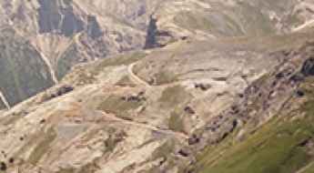
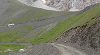
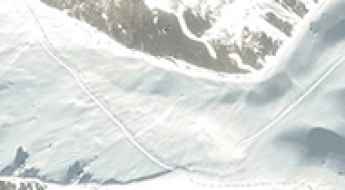
With over 90% of its landmass lying above 1,500 meters in elevation, it’s easy to see why drivers will be able to discover high mountain roads like Torugart Pass, a challenging border crossing between Kyrgyzstan and China, at 3.752m (12,310ft) above sea level; or Tossor Pass, a thrilling (scary) off road experience, at 3,901m (12,798ft) above sea level, in the Issyk-Kul Region. The country offers many 4x4 experiences, such as the road to Kok-Airyk Pass, only passable on July and August, at an elevation of 3.850m (12,631ft) above sea level. Driving through the pass, the driver will negotiate about 15 snaking sections of uncovered road with some stony places. Kyrgyzstan experiences a continental climate, with cold winters and warm summers, with significant regional variations due to its mountainous topography. For those seeking the most defiant drives, don’t forget to check out our content about the highest roads in Kyrgyzstan.
Pereval Choloktor
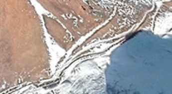
Pereval Choloktor is a high mountain peak at an elevation of 3.618m (11,870ft) above the sea level, located in Jalal-Abad Region of Kyrgyzstan.
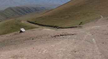
How to drive the unpaved road to Pereval Zhamanbay-Bel?
Pereval Zhamanbay-Bel is a high mountain pass at an elevation of 2230m (7,316ft) above sea level, located in the Jalal-Abad Region of Kyrgyzstan.
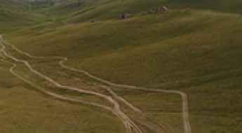
A memorable road trip to Pereval Ak-Bel'
Pereval Ak-Bel' is a high mountain pass at an elevation of 3.594m (11,791ft) above the sea level, located in the remote Issyk-Kul Region in north-eastern Kyrgyzstan, near the Chinese border.
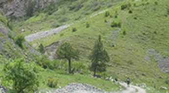
Driving the historic Pamir Highway to Pereval Soroka
Nestled in the heart of Kyrgyzstan, Pereval Soroka soars to heights of 3,560m (11,679ft) above the sea, offering an intriguing traverse through the Osh Region.
Pereval Akkyl
Pereval Akkyl is a high mountain pass at an elevation of 2.926m (9,599ft) above the sea level, located in the Jalal-Abad Region in western Kyrgyzstan.
Dzhuku Pass: Only for Experienced Drivers with Advanced Off-Road Skills
Pereval Dzhuku is a high mountain pass, situated at an elevation of 3,736m (12,257ft) above sea level in the Issyk-Kul District of Kyrgyzstan.
A Once in a Lifetime Drive through Koi-Jol Pass
Pereval Koi-Jol is a high mountain pass at an elevation of 3,823 meters (12,542 feet) above sea level, located in the Batken Region of Kyrgyzstan.
Driving the wild road to Kichik-Alay Pass
Pereval Kichik-Alay is a high mountain pass at an elevation of 4,140m (13,582ft) above sea level, located in the Osh Region of Kyrgyzstan. It’s one of the highest roads in the country.
How to drive the unpaved road to Shiman-Bel’ Pass?
Pereval Shiman-Bel’ is a high mountain pass at an elevation of 3,522m (11,555ft) above sea level, located in the Chong-Alay District of Kyrgyzstan.
Pereval Kyzyl-Kasa: Driving the 3,546m Dead-End Track in Nookat
Located in the Nookat District of the Osh Region in southwestern Kyrgyzstan, Pereval Kyzyl-Kasa (Перевал Кызыл-Каса) is a high-altitude mountain pass reaching 3,443m (11,295ft). The track is one of the more technical routes in the Alay Mountains, serving as a remote access path that actually continues beyond the pass to a summit at 3,546m.
A memorable road trip to Pereval Kum-Bel in southwestern Kyrgyzstan
Pereval Kum-Bel is a high mountain pass situated at an elevation of 2,681m (8,795ft) above sea level, located in the Leylek District of Kyrgyzstan. This remote pass is found within the Batken Region, in the southwestern corner of the country, crossing the rugged terrain of the Turkestan Range.
Driving the wild unpaved road through Kara Koo Pass in Jalal-Abad Region
Kara Koo Ashuu is a high mountain pass at an elevation of 2,768m (9,081ft) above sea level, located in the Jalal-Abad Region of Kyrgyzstan.
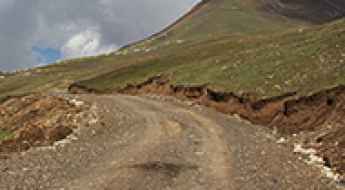
Can you drive to Askaly-Bell Pass in Kyrgyzstan by car?
Pereval Askala-Bel’ is a high mountain pass at an elevation of 2,824m (9,265ft) above sea level, located in the Alay District of Kyrgyzstan.
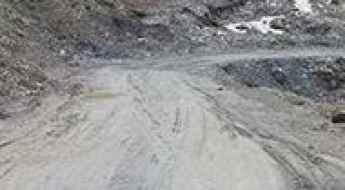
How difficult is the unpaved 4x4 road to Kosh-Bel Pass in Kyrgyzstan?
Pereval Kosh-Bel is a high mountain pass reaching an elevation of 3,577m (11,735ft) above sea level in the Kara-Suu District of the Osh Region, Kyrgyzstan. Located in the southwestern part of the country within the rugged Chalkuyruk Valley, the road is a brutal example of high-altitude logistics. This is not a route for casual exploration; it is a working track where the extreme terrain and the constant flow of heavy machinery create a driving environment that tests the structural integrity of any 4x4 vehicle.
How to Drive the Closed Road to Tartkul Pass
Tartkul Pass is an international high mountain pass at an elevation of 3,900m (12,795ft) above sea level, located on the border of China and Kyrgyzstan.
Adventure along the Wild Road to Semiz-Bel Pass in Issyk-Kul Region
Pereval Semiz-Bel is a high mountain pass at an elevation of 2,718m (8,917ft) above sea level, located in Issyk-Kul Region of Kyrgyzstan.
An unforgettable road to Kyzart Pass in Naryn Region
Pereval Kyzart is a high mountain pass at an elevation of 2,671m (8,763ft) above sea level, located in Naryn Region of Kyrgyzstan.
Driving the Forbidden Road to Dungurama Pass
Pereval Dungurama is an international high mountain pass at an elevation of 4,100m (13,451ft) above sea level, marking the border between China and Kyrgyzstan.
The Wild Unpaved Road to Ikizyak Pass in the Osh Region
Pereval Ikizyak is a high mountain pass at an elevation of 3,520m (11,548ft) above sea level, located in the Alay District of Kyrgyzstan.
The Breathtaking 4x4 Road to Pereval Ashusu
Pereval Ashusu is a high mountain pass at an elevation of 3,890m (12,762ft) above sea level, located in the Jeti-Ögüz district of Kyrgyzstan.
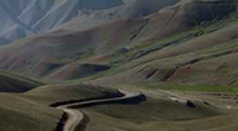
Pereval Kara-Kul’dzha: Driving a wild 4x4 track on the Kyrgyzstan Mountains
Pereval Kara-Kul’dzha is a high mountain pass at an elevation of 3,166m (10,387ft) above sea level, located in northwestern Kyrgyzstan. The pass sits on the border of the Talas and Jalal-Abad regions, near the source of the Chatkal River and within the Sary-Chelek Biosphere Reserve.
How to drive the steep mountain road to Donguz Pass in Naryn Region?
At an elevation of 3,348m (10,984ft) above sea level, Pereval Donguz (Donguz Pass) is a high-altitude mountain crossing in the Naryn Region of Kyrgyzstan. Located in the heart of the Tian Shan Mountains, this pass offers a grueling technical drive through one of the most rugged and isolated landscapes in Central Asia.
A memorable road trip to Chaar Archa Pass in Naryn Region
Chaar Archa is a high mountain pass at an elevation of 3,039m (9,970ft) above sea level, located in Naryn Region of Kyrgyzstan.
How to get by car to Tuz-Ashuu Pass in Naryn Region?
Pereval Tyuzashu is a high mountain pass at an elevation of 3,229m (10,593ft) above sea level, located in Naryn Region of Kyrgyzstan.
How to drive the remote road to Kosh-Moynok Pass in the Alay District
Pereval Kosh-Moynok is a high mountain pass at an elevation of 3,273m (10,738ft) above sea level, located in the Alay District of Kyrgyzstan.
Is the road to Eshigart Pass safe for standard vehicles?
Pereval Eshigart is a high mountain pass at an elevation of 3,135m (10,285ft) above sea level, located in the Osh Region of Kyrgyzstan.