What are the most spectacular roads in Kyrgyzstan?
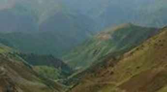
Located in the heart of Central Asia, Kyrgyzstan is a dream come true for every driver, with stunning mountain roads. The country, one of the smaller Central Asian states, covers an area of 199,951 square kilometers and shares borders with 4 countries: Kazakhstan, Uzbekistan, Tajikistan and China.
With over 90% of its landmass lying above 1,500 meters in elevation, it’s easy to see why drivers will be able to discover high mountain roads like Torugart Pass, a challenging border crossing between Kyrgyzstan and China, at 3.752m (12,310ft) above sea level; or Tossor Pass, a thrilling (scary) off road experience, at 3,901m (12,798ft) above sea level, in the Issyk-Kul Region. The country offers many 4x4 experiences, such as the road to Kok-Airyk Pass, only passable on July and August, at an elevation of 3.850m (12,631ft) above sea level. Driving through the pass, the driver will negotiate about 15 snaking sections of uncovered road with some stony places. Kyrgyzstan experiences a continental climate, with cold winters and warm summers, with significant regional variations due to its mountainous topography. For those seeking the most defiant drives, don’t forget to check out our content about the highest roads in Kyrgyzstan.
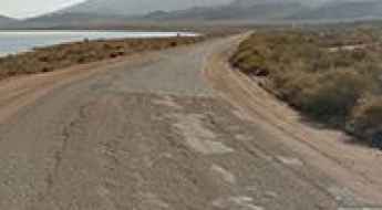
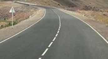
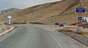
Highway A363/Issyk-Kul Lake
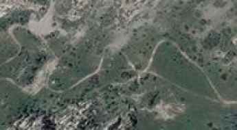
Located in Issyk-Kul Region, in the northeastern corner of Kyrgyzstan, Highway A363 is a very scenic drive running along the perimeter of Issyk-Kul Lake, the seventh deepest lake in the world.
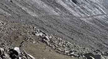
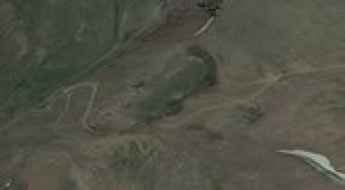
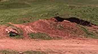
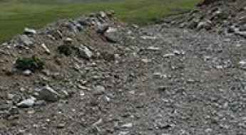
The destryed road to Pereval Tong
Pereval Tong is a high mountain pass at an elevation of 4.012m (13,162ft) above the sea level, located in Issyk-Kul Region in north-eastern Kyrgyzstan. It’s one of the highest roads of the country.
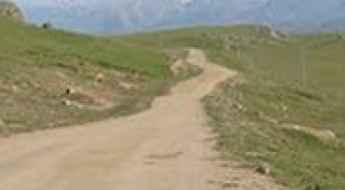
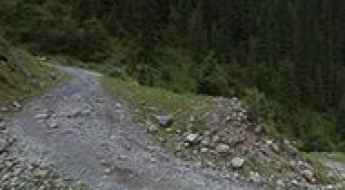
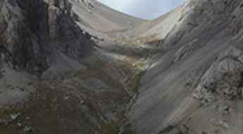
The Wild Road to Jalpak Bel pass
Pereval Dzhalpakbel is a high mountain pass at an elevation of 3.300m (10,826ft) above the sea level, located in the Region Naryn, in Kyrgyzstan.
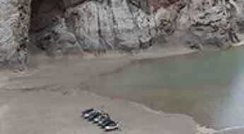
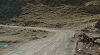
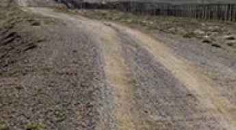
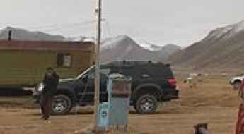
Driving to Kel-Suu Lake is only for special prepared vehicles
Kel-Suu is an alpine lake at an elevation of 3.525m (11,564ft) above the sea level, located in the At-Bashi District of Naryn Province of southeastern Kyrgyzstan.
Min-Kush Road
Min-Kush Road is a short mountain road located in the Jumgal District of Naryn Province of Kyrgyzstan.
Pereval Karakol
Pereval Karakol is a high mountain pass at an elevation of 3.485m (11,433ft) above the sea level, located in the Tian Shan mountains of Naryn province, in Kyrgyzstan.
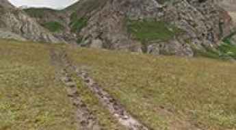
Driving the road to Altyn-Arashan is not a piece of cake
Altyn-Arashan is an alpine meadow at an elevation of 2.528m (8,293ft) above the sea level, located in Ak-Suu District, in the Issyk-Kul Region of Kyrgyzstan. The road is very bumpy and can be a scary experience.
Sary-Chelek Lake
Sary-Chelek Lake is a high mountain lake at an elevation of 1.893m (6,210ft) above the sea level, located in Jalal-Abad Province in Western Kyrgyzstan.
Jonbulak Ashuu
The Jonbulak Ashuu is a high mountain pass at an elevation of 3.018m (9,901ft) above the sea level, located in the Tian Shan mountains of the Region Naryn, in Kyrgyzstan.
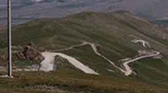
The Road To Otmok Pass Has It All
Pereval Otmek is a high mountain pass at an elevation of 3.331m (10,928ft) above the sea level, located in the Jayyl District of Chuy Region of Kyrgyzstan.
Pereval Metrebel
Pereval Metrebel is a high mountain peak at an elevation of 3.916m (12,847ft) above the sea level, located in Osh Region, Kyrgyzstan. It’s one of the highest mountain roads of the country.
How to drive the unpaved road to Pereval Naryn?
Pereval Naryn is a high mountain pass at an elevation of 3.414m (11,200ft) above sea level, located in the Region Naryn, in Kyrgyzstan.
Pereval Tjilbel
Pereval Tjilbel is a high mountain pass at an elevation of 3.256m (10,682ft) above the sea level, located in northern Naryn Region of Kyrgyzstan.
How to drive the paved Road A371 through Pereval Taunmurun
A371 is a high mountain road located in the southern part of Kyrgyzstan, running from Sary-Tash to the border with China at Irkeshtam Pass.
Lenin Peak Base Camp: Driving the 4x4 Road from Sary Mogul
The road to Lenin Peak Base Camp, known locally as the Achik-Tash track, is a high-altitude unpaved mountain route reaching an elevation of 3,623 meters (11,886 ft) above sea level, located in the Osh Region of Kyrgyzstan. Positioned within the Alay Valley beneath the Trans-Alay Range, the single-lane path serves as the main vehicular access to the mountaineering staging camp.
How To Have The Ultimate Road Trip To Pereval Sarymoynak?
Pereval Sarymoynak is a high mountain pass at an elevation of 3,133m (10,278ft) above sea level, located in the Issyk-Kul Region of Kyrgyzstan.
Nichke pass
Nichke pass is a high mountain pass at an elevation of 3.925m (12,877ft) above the sea level, located in Batken Region of Kyrgyzstan. It’s one of the highest roads of the country.
Pereval Terek
Pereval Terek is a high mountain pass at an elevation of 3.374m (11,069ft) above the the sea level, located in the Talas Region of Kyrgyzstan.
Pereval Kum Bel
Pereval Kum Bel is a high mountain pass at an elevation of 3.256m (10,682ft) above the sea level, located in Jalal-Abad Region of Kyrgyzstan.
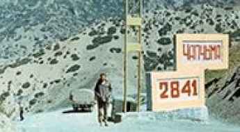
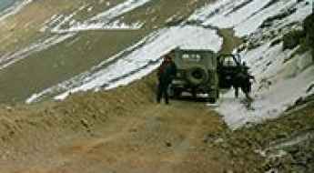
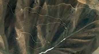
Driving the treacherous gravel road to Pereval Chapchyma in Kyrgyzstan
Pereval Chapchyma is a high mountain pass at an elevation of 2,841m (9,320ft) above sea level, located in the Jalal-Abad Region of Kyrgyzstan. Connecting the villages of Kurulush and Terek-Say, the road is a vital but dangerous corridor used by heavy industrial traffic from the local antimony mines, carved into a landscape of vertical drops and unstable soil.
Pereval Ayrytash: The treacherous 10% gravel climb in Kyrgyzstan
Located in the Jalal-Abad Region of western Kyrgyzstan, Pereval Ayrytash is a formidable mountain pass reaching an elevation of 2,882m (9,455ft) above sea level. Situated south of the massive Toktogul Reservoir, this pass is widely considered one of the most treacherous and technically demanding mountain drives in the country, carved into a landscape of jagged peaks and deep valleys.
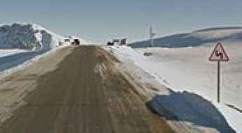
Pereval Tyuz-Ashuu
Pereval Tyuz-Ashuu is a high mountain pass at an elevation of 3.408m (11,181ft) above the sea level, located in the southern part of the Jayyl District of Chuy Region of Kyrgyzstan.
How to drive the unpaved road to Aktog Pass?
Aktog Pass is a high mountain pass at an elevation of 3.444m (11,299ft) above sea level, located in the Isxsyk-Kul Region, in Kyrgyzstan.
Pereval Kyndy
Pereval Kyndy is a high mountain pass at an elevation of 3.410m (11,187ft) above the sea level, located in the Naryn Province, northern Kyrgyzstan.
Avoid the road through Kyrk-Kyz Pass
Kyrk-Kyz pass is a high mountain pass at an elevation of 3.222m (10,570ft) above the sea level, located in Naryn Province, in the east of Kyrgyzstan.
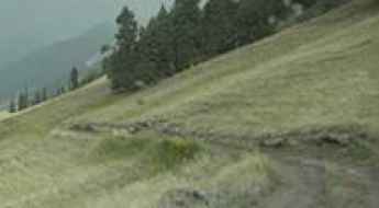
Road trip guide: Conquering Karakol Gorge
Karakol Gorge is the name of an alpine canyon carved by Karakol River, located in Ak-Suu District, in the Issyk-Kul Region of Kyrgyzstan.
How to drive the steep Pereval Mazar-Asjuu in the Tien Shan?
Pereval Mazar-Asjuu is a high mountain pass at an elevation of 3,832m (12,572ft) above sea level, located in the Chuy Region of Kyrgyzstan.
The road to Base Camp Maida Adyr is for drivers with strong nerves
Base Camp Maida Adyr is a high mountain camp at an elevation of 2.600m (8,530ft) above the sea level, located in Ak-Suu District, southeast Issyk-Kul Region, Kyrgyzstan.
If you love to drive, you’ll love the Kubaky Pass road
Kubaky Pass is a high mountain pass at an elevation of 2.168m (7,112ft) above the sea level, located in the Issyk-Kul Region, in the northeastern corner of Kyrgyzstan.
Pereval Ashpara-Ashuu
Pereval Ashpara-Ashuu is a high mountain pass at an elevation of 3.871m (12,700ft) above the sea level, located in the Chuy Region of Kyrgyzstan.
Conquering Peak Patamushta in Kyrgyzstan
Peak Patamushta is a high mountain peak at an elevation of 4,088m (13,412ft) above sea level, located in the At-Bashy district of the Naryn region in Kyrgyzstan.
Here's How To Have The Ultimate Road Trip To Pereval Taunmurun
Pereval Taunmurun is a high mountain pass at an elevation of 3.545m (11,630ft) above the sea level, located in the Osh Region of Kyrgyzstan.
Pereval Tyuzashu
Pereval Tyuzashu is a high mountain pass at an elevation of 3.400m (11,154ft) above the sea level, located in the Naryn Province, northern Kyrgyzstan.
Pereval Kitjine-Sarybeles: The high-altitude 4x4 track to Kel-Suu Lake
Located in the At-Bashi District of Naryn Province, in southeastern Kyrgyzstan, Pereval Kitjine-Sarybeles is a high mountain pass reaching an elevation of 3,542m (11,620ft) above sea level. This secluded pass sits in the shadow of the Chinese border, offering access to some of the most remote and stunning alpine scenery in the Tian Shan mountain range.
Travel guide to the top of Pereval Masail
Pereval Masail (Masail Pass) is a high mountain pass at an elevation of 3.275m (10,744ft) above the sea level, located in the remote Naryn Region, in the east of Kyrgyzstan.
Driving the high 4x4 track to Pereval Dzhargart
Pereval Dzhargart is a high-altitude mountain pass reaching an elevation of 3,540 meters (11,614 ft) above sea level, located on the boundary between the Talas and Chuy regions in Kyrgyzstan. This pass is a technical off-road challenge that branches off from the Pereval Ala-Bel, located on the legendary Pamir Highway (M41). Driving here means leaving the relative safety of the main transit route to face a raw, unpaved track where the high summit altitude and the rough gravel surface demand a high-clearance 4WD vehicle and a driver who knows how to manage a vehicle at the limits of its performance.