What are the most spectacular roads in Armenia?
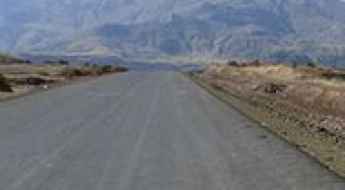
Armenia is a landlocked country located in West Asia, within the Armenian plateau. The country is bordered by Georgia, Azerbaijan, Iran and Turkey and covers an area of approximately 29,743 square kilometers and hosts countless mountains, providing a high number of scenic yet challenging high mountain drives.
The climate is highland continental with hot summers and cold winters, so before venturing to drive some mountain roads, better to check the conditions, as some roads are totally impassable in winters due to its mostly mountainous geography, with the Lesser Caucasus Mountains dominating the landscape.
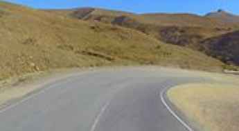
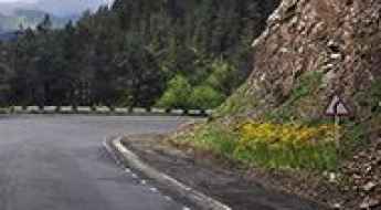
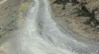
When travelling to Armenia, don’t forget to drive the demanding road to Aragats Research Station, ending at 3.199m (10,495ft) above sea level, in the province of Aragatsotn. For those seeking the most defiant drives, don’t forget to check out our content about the highest roads of Armenia. You can also try the steep paved road to Meghri Pass, a challenging drive, climbing up to 2.535m (8,316ft) above sea level or discover the thrills of Vardenyats Pass: a serpentine road through Armenia's mountains, topping out at 2.410m (7,906ft) above sea level, in the Vayots Dzor Province.
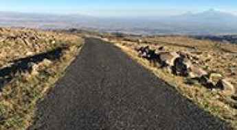
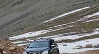
Driving the demanding road to Aragats Research Station
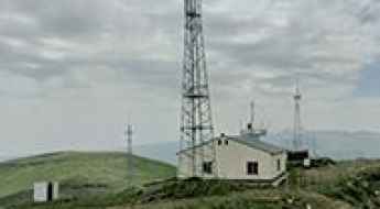
Aragats Cosmic Ray Research Station is a high-altitude cosmic ray station at an elevation of 3.199m (10,495ft) above sea level, located in the province of Aragatsotn, in Armenia. It's one of the highest roads of the country.
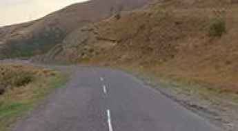
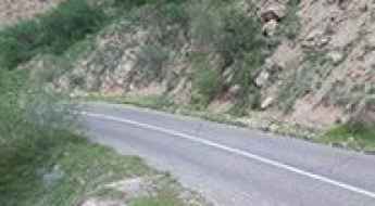
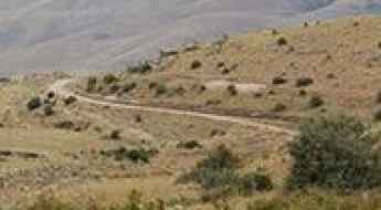
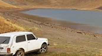
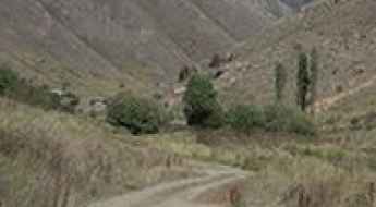
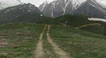
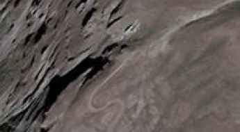
Vardenyats Pass: a serpentine road through Armenia's mountains
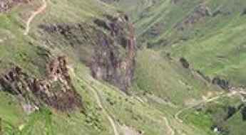
Vardenyats Pass is a high mountain pass at an elevation of 2.410m (7,906ft) above sea level, located in the Vayots Dzor Province of Armenia.
What are the highest roads in Armenia?
Located in the Southern Caucasus region of Eurasia, Armenia is one of the oldest nations in the world. The country is a landlocked country in the Transcaucasia region, between the Black and Caspian Seas. Situated along the route of the Great Silk Road, Armenia has a rich and ancient culture. It’s bordered on the north and east by Georgia and Azerbaijan and on the south and west by Iran and Turkey. It’s a very mountainous country, almost totally covered by the Lesser (or Little) Caucasus Mountains, with fast flowing rivers and few forests but with many trees. The climate is highland continental: hot summers and cold winters.
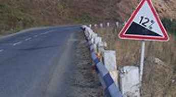
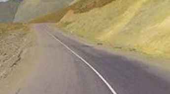
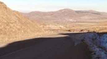
A steep paved road to Meghri Pass
Meghri Pass is a high mountain pass at an elevation of 2.535m (8,316ft) above sea level, located in Syunik province of Armenia.
Road Trip Guide: Conquering the Devil’s Bridge of Armenia
Devil’s Bridge (Satani Kamurj) is a natural bridge over the Vorotan River, located near Tatev village in the Syunik Province of Armenia. It’s one of the most gorgeous and marvelous natural spots in the country.
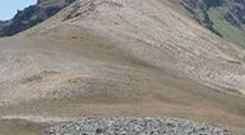
Mount Ughtasar is for 4wd vehicles in good weather only
Mount Ughtasar is a high mountain peak at an elevation of 3.296m (10,813ft) above sea level, located in the Syunik Province of Armenia. The site is reached only by four-wheel drive in good weather (the best time to visit is between mid-July and the end of August). It's one of the highest roads in the country.
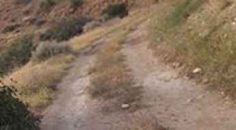
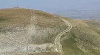
The road to Vorotan Pass is not recommended if you're prone to car sickness
Vorotani Lerrnants'k' is a high mountain pass at an elevation of 2,344m (7,690ft) above sea level, located in Armenia.
How to Get to Mount Armaghan Volcano by Car?
Mount Armaghan is an extinct volcano at an elevation of 2,811m (9,222ft) above sea level, located in the Gegharkunik Province of Armenia.
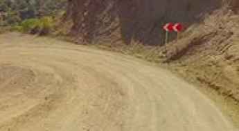
Driving the paved mountain road to Sotk Pass on the border of Azerbaijan and Armenia
Pereval Zodskij is an international high mountain pass at an elevation of 2,374m (7,788ft) above sea level, located on the border of Azerbaijan and Armenia.
A wild 4x4 road to Kaputzhukh Pass
Kaputzhukh Pass is an international high mountain pass at an elevation of 3,492m (11,456ft) above sea level, located on the border of Azerbaijan and Armenia. It's one of the highest roads in the country.
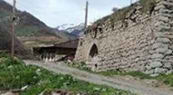
How to get by car to Noravank Monastery in the Vayots Dzor Province?
Noravank is a 13th-century monastery with a bi-level church showcasing medieval cantilever architecture, located in the Vayots Dzor Province of Armenia.
The Road That Leads Into a Volcano: Mount Vayots
Mount Vayots (also known as Vayots Sar or Dalik Tapa) is an extinct volcano in Armenia’s Vayots Dzor Province.
Road to Ayich’ingil Lerrnants’k’: Driving the 3,466m High Border Track
Situated on the border between the Syunik Province of Armenia and the Nakhchivan Autonomous Republic of Azerbaijan, Ayich’ingil Lerrnants’k’ is a high mountain peak reaching an elevation of 3,466m (11,371ft) above sea level. Located in the Zangezur Mountains (Caucasus range), the road to the summit is one of the highest roads in the country, engineered for high-altitude logistics and border transit.
Driving the high-altitude 4x4 track through the Geghama Ridge in Armenia
The traverse of the Geghama Ridge is one of the most demanding off-road expeditions in Armenia. This 41 km unpaved high-altitude trail connects the village of Geghard in Kotayk Province with Sarukhan in Gegharkunik, crossing two of the highest mountain roads of Armenia. It is a remote journey through a volcanic landscape of obsidian, alpine lakes, and absolute isolation.
Sevan Pass
Sevan Pass is a high mountain pass at an elevation of 2.130m (6,988ft) above the sea level, located in the Gegharkunik Province of Armenia.
The road to Trchkan Waterfall isn’t an easy one
Located in the Shirak Province of Armenia, at 23.5 meters high, the Trchkan Waterfall is said to be the highest waterfall in the country.
Why is the road to Bechenagskiy Pereval closed to traffic?
Bechenagskiy Pereval, also known as the Bichenek Pass, is a high mountain pass at an elevation of 2,346 meters (7,696 ft) above sea level, located on the border between the Nakhchivan exclave of Azerbaijan and the Syunik Province of Armenia. Crossing the Lesser Caucasus range, the pass is a dead end; though the asphalt of the R49 and M-13 highways physically exists, the international border has been strictly sealed by military forces for decades.
Lake Akna
Lake Aknalich is a volcanic mountain lake at an elevation of 3.045m (9,990ft) above the sea level, located at the east of Kotayk Province of Armenia. It’s one of the highest roads of the country.
Shativank
Shativank is a fortified monastery with a church located in the Vayots Dzor Province of Armenia. It’s one of the oldest monasteries of the province.
How to drive the 10% average gradient of K’ashat’agh?
K’ashat’agh is an international mountain pass at an elevation of 2,874 meters (9,429 ft) above sea level, located on the border between the Gegharkunik Province of Armenia and the Gadabay District of Azerbaijan. The unpaved mountain track links the village of Artanish with the rugged border crest, climbing directly through the steep slopes of the Lesser Caucasus range.
Pavarotlar: Driving the brutal Soyuq Yolu in the Zengezur Mountains
Pavarotlar is one of the most extreme high-altitude points in the Nakhchivan enclave of Azerbaijan. Reaching an elevation of 3,132m (10,275ft) above sea level, this mountain peak sits directly on the border with Armenia within the rugged Zengezur mountain range. The road to the summit, known locally as Soyuq Yolu, is a formidable mountain track that ranks among the highest mountain roads of Armenia and Azerbaijan, offering a vertical challenge that few vehicles can sustain.
Bargooshat Pass
Bargooshat Pass is a high mountain pass at an elevation of 3.009m (9,872ft) above the sea level, located in Syunik, the southernmost province of Armenia. The average gradient is 19,49%. It's one of the highest mountain roads of the country.
How long is the unpaved road to Geghak’ar in Syunik?
Geghak’ar is a high mountain peak at an elevation of 3,182 meters (10,439 ft) above sea level, located in the Syunik province of southern Armenia. Positioned within the Kajaran Municipality, the mountain track to the summit is one of the highest mountain roads of Armenia.
Karmir Pass
Karmir Pass is a high mountain pass at an elevation of 2.184m (7,165ft) above the sea level, located in the Gegharkunik Province of Armenia, near the border of Azerbaijan.
A remote 4x4 road to Hank’asar
Hank’asar is a high mountain peak at an elevation of 2.985m (9,793ft) above the sea level, located in Syunik, the southernmost province of Armenia.
Vardenis ridge
Vardenis ridge is a high mountain pass at an elevation of 3.040m (9,973ft) above the sea level, located in the Vayots Dzor province, at the southeastern end of Armenia. It’s one of the highest roads of the country.
Mount Teghenis
Mount Teghenis is a high mountain peak at an elevation of 2.839m (9,314ft) above the sea level, located in the Aragatsotn province of Armenia.
Mount Spitakasar
Mount Spitakasar is a volcanic massif at an elevation of 3.255m (10,679ft) above the sea level, located in the Ararat Province of Armenia. It’s one of the highest roads of the country.
East Sevan Ridge
East Sevan is a ridge at an elevation of 3.376m (11,076ft) above the sea level, located on the border of Armenia and Azerbaijan. It's one of the highest roads of the country.
The rough and bumpy road to Tashtuni Lernants’k’
Tashtuni Lernants’k’ is a high mountain peak at an elevation of 2.489m (8,166ft) above the sea level, located in Syunik province, in Southern Armenia.
Sevakatar
Sevakatar is a high mountain pass at an elevation of 3.223m (10,574ft) above the sea level, located in Ararat Province, in Armenia. It’s one of the highest roads of the country.
Tsaghkavet
Tsaghkavet is a high mountain peak at an elevation of 3.081m (10,108ft) above the sea level, located in Ararat province of Armenia. It’s one of the highest roads of the country.
How long is the unpaved road to Ughtusar in Armenia?
Ughtusar is a high mountain peak at an elevation of 3,052m (10,013ft) above sea level in the Ararat Province of Armenia. The track to the summit is one of the highest roads in Armenia, crossing an ancient volcanic field of loose stones and high-altitude pastures.
Sheksar
Sheksar is a high mountain peak at an elevation of 3.073m (10,082ft) above the sea level, located in the Vayots Dzor Province of Armenia. It’s one of the highest roads of the country.
A wild 4x4 road to Ulaghbyur
Ulaghbyur is a high mountain pass at an elevation of 3.568m (11,706ft) above sea level, located in Syunik province of Armenia. It’s one of the highest roads in the country.
Jradzor
Jradzor is a high mountain pass at an elevation of 2.909m (9,543ft) above the sea level, located in Syunik, the southernmost province of Armenia.