What are the most spectacular roads in Armenia?
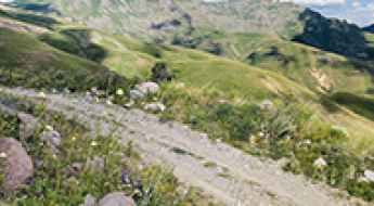
Armenia is a landlocked country located in West Asia, within the Armenian plateau. The country is bordered by Georgia, Azerbaijan, Iran and Turkey and covers an area of approximately 29,743 square kilometers and hosts countless mountains, providing a high number of scenic yet challenging high mountain drives.
The climate is highland continental with hot summers and cold winters, so before venturing to drive some mountain roads, better to check the conditions, as some roads are totally impassable in winters due to its mostly mountainous geography, with the Lesser Caucasus Mountains dominating the landscape.
When travelling to Armenia, don’t forget to drive the demanding road to Aragats Research Station, ending at 3.199m (10,495ft) above sea level, in the province of Aragatsotn. For those seeking the most defiant drives, don’t forget to check out our content about the highest roads of Armenia. You can also try the steep paved road to Meghri Pass, a challenging drive, climbing up to 2.535m (8,316ft) above sea level or discover the thrills of Vardenyats Pass: a serpentine road through Armenia's mountains, topping out at 2.410m (7,906ft) above sea level, in the Vayots Dzor Province.
Is the unpaved road to Piramza Pass in Armenia difficult?
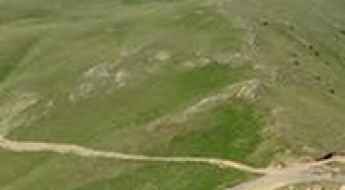
Piramza Pass is a high mountain pass at an elevation of 2,795m (9,169ft) above sea level, located in the Syunik Province of southern Armenia. This remote gravel track offers a direct but demanding shortcut through the rugged Armenian Highlands.
Mount Tsaghkunyats
Mount Tsaghkunyats is a high mountain peak at an elevation of 2.809m (9,215ft) above the sea level, located in Kotayk province, in the central part of Armenia.
Kovasar: The ultimate ridge climb to Ditavanq Chapel
Mount Kovasar is a prominent peak at an elevation of 2,784m (9,133ft) above sea level, located in southern Armenia. This mountain is a prime destination for off-road enthusiasts due to the challenging track that leads to the Ditavanq mountain chapel at its summit.
Tagheri: Driving the steep mountain track from Poqr Shen
Tagheri is a high mountain peak at an elevation of 2,996m (9,829ft) above sea level, located in the Ararat province of Armenia. This high-altitude destination offers a challenging drive through the rugged landscape of the Lesser Caucasus, providing panoramic views of the surrounding peaks.
Driving the military ridge to Bagnatun: A 2,768m border climb in Vayots Dzor
Rising to 2,768m (9,081ft) above sea level in the Vayots Dzor province, Bagnatun (also known as Harsnasar) is more than just a mountain peak; it is a high-altitude military ridge sitting directly on the volatile border between Armenia and the Nakhchivan enclave of Azerbaijan. The drive to the summit is a raw, technical off-road experience where the track follows the spine of the mountain, offering zero margin for error and a constant military presence that adds a heavy atmosphere to the climb.
Can I drive the military track to the international Saridara Pass?
Saridara Pass is a high mountain pass at an elevation of 3,727m (12,227ft) above sea level, located on the border between Armenia and Azerbaijan.