What are the most spectacular roads in Afghanistan?
Afghanistan is a landlocked country, located on the Iranian Plateau, at the crossroads of Central Asia and South Asia. Despite its natural wonders, right now is better to avoid all travel to Afghanistan, due to terrorism, risk of wrongful detention, kidnapping and crime.
The country is 652,864 km2 (252,072 sq mi), and bordered by 6 countries: Pakistan, Iran, Turkmenistan, Uzbekistan, Tajikistan and China. We advise against all travel to and within Afghanistan. Border crossing points may be closed without notice, especially during increased border tensions or concerns about increased risk of a terrorist attack. There are Taliban checkpoints on roads throughout the country and in Kabul.
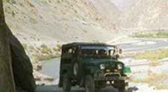
Despite the risks, the country features many spectacular roads, some of them among the most challenging in the world, on a landscape characterized by rugged mountains, vast deserts, and fertile valleys. Navigating the Kabul-Jalalabad Highway is a difficult drive in Taliban territory following the Kabul River Gorge for 64 kilometers (40 mi). This two-lane highway runs through 600-meter-high cliffs. Salang Pass is a mountain pass at 3,878m (12,723ft) on the boundary between Parwan and Baghlan provinces. Back to war times, Highway 1 is the Afghan Highway to Hell. And the hostile and toxic Salang Tunnel sits at 3,400m (11,154ft) above sea level, with limited lighting, inadequate ventilation, and marred by potholes.
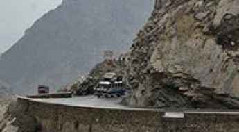
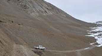
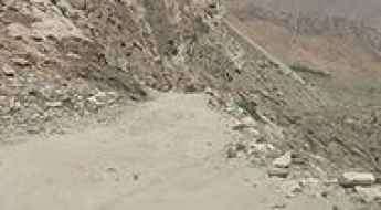
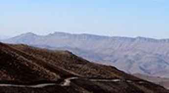
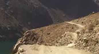
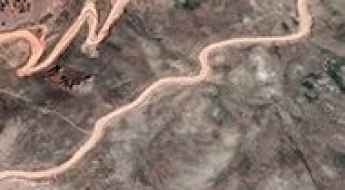
Perils and Beauty: Navigating the Kabul-Jalalabad Highway in Afghanistan
The Kabul-Jalalabad Highway is a challenging road located in Afghanistan, following the Kabul River Gorge for 64 kilometers (40 mi) in Taliban territory. This two-lane highway runs through 600-meter-high cliffs, and fatal traffic accidents are common due to reckless driving
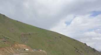
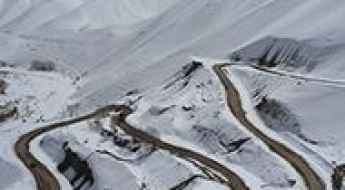
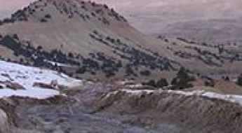
A road with heavy snowfalls and strong winds to Salang Pass
Salang Pass is a high mountain pass at an elevation of 3,878m (12,723ft) above sea level, located on the boundary between Parwan and Baghlan provinces, in Afghanistan. It's one of the highest roads in the country.
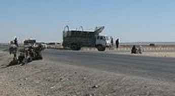
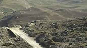
Highway 1 is the Afghan Highway to Hell
Running from Kabul to Kandahar, NH0101 is the name of a very challenging drive located in the heart of Afghanistan. It was nicknamed the Highway to Hell.
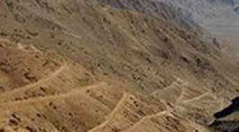
K-G Pass, everything you need to know about this famed Afghan road
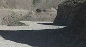
Khost-Gardez Pass is a high mountain pass at an elevation of 2.897m (9,504ft) above sea level, located on the boundary between Paktia and Khost provinces of Afghanistan.
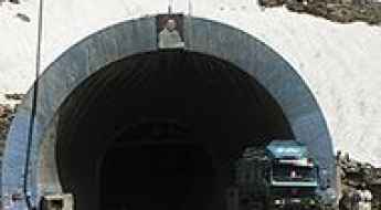
Driving through the hostile and toxic Salang Tunnel in the Hindu Kush Mountains
Salang Tunnel is a high mountain tunnel at an elevation of 3,400m (11,154ft) above sea level located in Afghanistan. The tunnel has limited lighting, inadequate ventilation, and is marred by potholes.
The ultimate road trip to the legendary Dorah Pass
Dorah Pass is an international high mountain pass at an elevation of 4,538m (14,888ft) above sea level, located on the border of Afghanistan and Pakistan. It's one of the highest roads in the country.
A tricky road to the international Wakhjir Pass
Wakhjir Pass is an international high mountain pass at an elevation of 4.836m (15,866ft) above sea level, located on the border of Afghanistan and China. China has finished building a military road to the pass. It's one of the highest roads in the country.
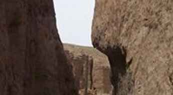
Driving the defiant road through the Tangi Tashkurgan Gorge
Tangi Tashkurgan is an amazing gorge located in the Balkh province of Afghanistan.
Driving the Road to Anjuman Pass is Not a Piece of Cake
Kotal-e Anjoman is a high mountain pass at an elevation of 4,430m (14,534ft) above sea level, located in Badakhshan Province, in Afghanistan. The road to the summit—or lack thereof—is extreme. It's one of the highest roads in the country.
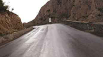
Driving the Wild Paved Road to Shibar Pass in the Koh-e-Baba Mountains
Kōtal-e Shibar is a high mountain pass at an elevation of 3,000 m (9,843 ft) above sea level, located in the Koh-e-Baba mountains of central Afghanistan.
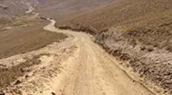
A Challenging Unpaved Road to Yaghurda Pass
Kotal-e Yagharda is a high mountain pass reaching an elevation of 3,525m (11,564ft) above sea level, located in the Badakhshan Province of Afghanistan. This long-distance unpaved route is one of the most isolated mountain crossings in the northeastern part of the country, near the border with Tajikistan.
A journey on the infamous Saricha Road
Saricha Road is an extreme drive located in northeastern Afghanistan. Expect rough gravel conditions and the need to drive primarily in 1st and 2nd gear.
A Difficult and Dangerous Road to Lataband Pass
Kotal-e Lataband is a high mountain pass at an elevation of 2,154m (7,066ft) above sea level, located in Kabul Province, in Afghanistan.
The road to Hajigak Pass is not for timid drivers
Kotal e Hajigak is a high mountain pass at an elevation of 3.504m (11,496ft) above sea level, located on the boundary between Maidan Wardak and Bamyan provinces of Afghanistan.
A memorable road trip to Tera Pass
Kotal-e Tirah is a high mountain pass at an elevation of 2.895m (9,498ft) above sea level, located in Afghanistan.
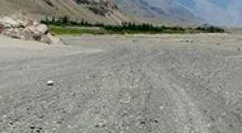
A high mountain road from Eshkashem to Gaz Khan
Located in the Wakhan Valley of Badakhshan Province, in north-eastern Afghanistan, the high mountain road from Eshkashem to Gaz Khan runs entirely over 2,700 m above sea level.

Road trip guide: Conquering the Unai Pass
Unai Pass is a high mountain pass at an elevation of 3,000m (9,843ft) above sea level, located in Maidan Wardak Province of Afghanistan.
How to travel the defiant road from Dowshi to Puli Khumri in Baghlan Province?
Located in Baghlan Province, in Afghanistan, the road linking Dowshi (also known as Dushi) and Puli Khumri is a very challenging yet scenic drive.
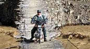
Driving across the terrifying Ghudar Bridge in Afghanistan
The Ghudar Bridge is a nightmare of local engineering spanning the Lazir River in the Nili district of Afghanistan's Daykundi Province. This is not a bridge built with steel and concrete; it is a precarious 50-meter hanging structure made of wood logs, sticks, and tensioned cables. For the people of Ghodar, it is a vital lifeline, but for anyone else, it is one of the most spectacular and dangerous bridges in the world. Crossing it means trusting your life to a surface that shifts and groans under every wheel, with no safety nets and a direct drop into the raging currents below.
Pazhuk Pass
Pazhuk Pass is a high mountain pass at an elevation of 3.160m (10,367ft) above the sea level, located in in north-eastern Afghanistan.
How to drive the unpaved pass of Kotal-e Korgah in Daykundi?
Kotal-e Korgah is a high-altitude mountain pass at an elevation of 3,204m (10,511ft) above sea level, located in the Daykundi Province (also spelled Daikundi) of central Afghanistan. Technically, the route is one of the most isolated unpaved tracks in the central highlands, demanding a high-clearance 4x4 vehicle and a strict logistical protocol due to the extreme volatility of the region and the total absence of emergency infrastructure.
Kawak Pass is one of the gnarliest roads in Taliban territory
Kawak Pass is a high mountain pass at an elevation of 3.671m (12,043ft) above sea level, located on the boundary between Panjshir and Baghlan provinces, in Afghanistan. It's one of the highest roads in the country.
Can you drive the unpaved road to Shahtigh Pass?
Shah Tigh Pass is a high mountain pass at an elevation of 3.316m (10,879ft) above sea level, located in Daykundi province, in Afghanistan.
How to drive the dangerous Lapis Route through Sabzak Pass?
Sabzak Pass (Kōtal-e Sabzak) is a high mountain pass at an elevation of 2,552 meters (8,372 ft) above sea level, located on the boundary between Herat and Badghis provinces in northwestern Afghanistan. Part of the historical Lapis Route, this 32.9 km unpaved sector connects Masjed-e Chubi with Musami through a severely degraded dirt ledge that combines extreme terrain decay with heavy security risks.
Driving the wild road to Tagab-e Anjuman
Tagab-e Anjuman is a high mountain pass at an elevation of 3.013m (9,885ft) above sea level, located in the north-eastern part of Afghanistan.
How dangerous is the mountain road over Kotal-e Palpi in Afghanistan?
Kotal-e Palpi, also known as Palphi Pass or Kotal Palfi, is a high mountain pass reaching an elevation of 2,885m (9,465ft) above sea level in the Baghlan Province of north-eastern Afghanistan. The road over the pass is a notoriously dangerous unpaved track that connects the town of Nahrin with the remote villages of Godri and Gozar-e Langar. This is a journey through a high-conflict and geographically hostile region where the combination of extreme gradients, poor road maintenance, and total isolation makes it one of the most treacherous drives in the Hindu Kush foothills.
Can I drive the unpaved road to Kōtal-e Sabzak?
Kōtal-e Sabzak is a high mountain pass at an elevation of 3.274m (10,741ft) above sea level, located in the Samangan district of Afghanistan.
Hawz e Wighnaan
Wighnaan pool is a high mountain reservoir at an elevation of 2.600m (8,530ft) above the sea level, located in Takhar Province, northern Afghanistan. It’s definitely not for anyone suffering from vertigo or a fear of landslides. One mistake and it's a free fall to your death. In many places the road is bordered by a drop of hundreds of meters (many hundreds of feet) unprotected by guardrails.
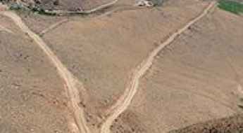
Driving the AH77 in Ghor: Kotal-e Lashkar Rah and the high passes of Central Afghanistan
If you want to know where the asphalt ends and mechanical torture begins, the AH77 in central Afghanistan is the place. This 115 km stretch through Ghor Province, between Chaghcharān and Lal wa Sarjangal, is a gauntlet of dust, high-altitude passes, and sharp rocks that tests every weld on your rig. Forget the "Asian Highway" designation; this is a raw dirt track where heavy trucks and local vans have carved ruts deep enough to rip the oil pan right off your chassis if you don't have enough ground clearance.
Kotal-e Ghar Jawin
Kotal-e Ghar Jawin is a high mountain pass at an elevation of 3.769m (12,365ft) located in Badakhshan Province in north-eastern Afghanistan. It's one of the highest roads in the country.
Kotal-e Qonaq: a dangerous curvy road to the summit
Kotal-e Qonaq is a high mountain pass at an elevation of 3.407m (11,177ft) above the sea level, located on the border of Daykundi and Bamyan provinces, in the central part of Afghanistan.
How to drive the lonely road to Kotal-e Faramoz?
Pereval Faramoz is a high mountain pass at an elevation of 3.143m (10,311ft) above sea level, located in Yakawlang District, in Afghanistan.
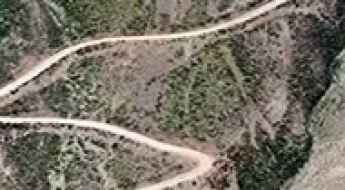
How to drive the unpaved A77 to Band-e Ghuk?
Band-e Ghuk (also known as Pereval Guk) is a high mountain pass at an elevation of 2,907m (9,537ft) above sea level, located in the Chaghcharān district of the Ghor Province in central Afghanistan. The route is a critical but volatile segment of the A77 highway, spanning 108 km (67 miles) of totally unpaved terrain. The road connects Chishti Sharif, following the Hari River valley, with Sharak, traversing one of the most isolated and logistically challenging regions of the central Afghan highlands.
Driving the unpaved National Highway 39 to Kotal-e Tamazan
Kotal-e Tamazan is a high mountain pass at an elevation of 2,413m (7,916ft) above sea level on the border between Urozgan and Daykundi provinces in central Afghanistan. The pass is part of the National Highway 39 (NH39), a 56 km dirt track that connects Gizab and Nili.
Driving Shah Mansoor Pass, Afghanistan's Majestic Heights
Kotal-e Shah Mansoor is a high mountain pass at an elevation of 3.638m (11,935ft) above the sea level, located in Ghazni Province, in Afghanistan. It's one of the highest roads in the country.
Driving the Kotal-e Shatu in Bamyan: A 11,000ft high-altitude dirt climb
Located in the heart of the Bamyan Province, Kotal-e Shatu is a high mountain pass that separates the adventurous from the reckless. Reaching an elevation of 3,405m (11,171ft) above sea level, this 63.2 km (39.27 miles) transit between Panjab and Yakawlang is a raw, unpaved journey through the rugged core of central Afghanistan. It is a route where the landscape is as unforgiving as the mechanical stress it puts on your vehicle.