What are the most spectacular roads in Spain?
Spain, with its rich tapestry of history, culture, and landscapes, is not just a country to be visited; it's a country to be experienced on the open road. From the buzzing plazas of Madrid to the serene villages of Andalusia, every corner of Spain hides a story waiting to be discovered.
Imagine steering through Sa Calobra Road in Mallorca, often likened to a wet strand of spaghetti dropped on the floor. With its twists, turns, and unparalleled views, it’s a marvel of engineering set amidst nature's grandeur. Then there's the ascent to Pico del Veleta, a journey that doesn’t just climb mountains but touches the sky, making it Europe’s highest paved road.
Drive further and let the road to Formentor Lighthouse in Mallorca mesmerize you with its coastal charms. Each turn is a portrait of the sea meeting the land in a passionate embrace. Meanwhile, the adrenaline junkies might find their calling in Alto de l’Angliru, nestled in Asturias. This challenging ascent has been the playground for many cycling legends, testing their mettle against its grueling gradient.
For a more rhythmic experience, embark on GC-200 Road, a symphony of 365 curves, each echoing a day of the year. As you navigate this sinuous stretch, it offers panoramas that seem painted by the gods themselves.
As you cruise these Spanish roads, each kilometer unravels a tale, a flavor, or a melody of this vibrant land. So, rev up your engines and let Spain's spectacular routes guide you through a journey of soulful discoveries and unforgettable vistas. You will discover many treasures created by skilled workers employed by construction firms with tradition in Spain.
Sa Calobra is the Snake Road of Mallorca
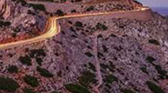
Located on the island of Mallorca, in Spain, Sa Calobra Road is one of the most scenic drives in the world. Imagine dropping a long piece of wet spaghetti on the floor. The pattern it makes looks something like what the road looks. If you really want a challenge, try tackling it by bike.
Pico del Veleta is the highest paved road of Europe
Pico del Veleta is a high mountain peak at an elevation of 3,369m (11,053ft) above sea level, located in the region of Andalusia, Spain. It's one of the highest roads in Europe. At an altitude of around 3,000m, road conditions become significantly worse.
Las carreteras más altas de España
Situado en la zona suroeste de Europa, España es un país muy montañoso. A pesar de ser más famoso, mundialmente, por sus playas, España es el segundo país más montañoso de Europa, con muchos picos de más de 3.000 metros de altura. Subir a alguno de estos puertos de montaña te ofrecerá algunas de las vistas más espectaculares que puedas imaginar.
The sensational road to Formentor Lighthouse in Mallorca
Far de Formentor is a spectacular lighthouse built in 1863, at an elevation of 119m (390ft) above sea level, located at the eastern end of Mallorca's Formentor peninsula, in Spain. It’s one of the best roads in Mallorca.
Alto de l’Angliru is the Ultimate Cycling Ascent in Asturias
Alto de l’Angliru is a high mountain peak at an elevation of 1.558m (5,111ft) above sea level, located in the province and autonomous community of Asturias, in Spain. It’s one of the hardest and most epic climbs you can ride on two wheels.
GC-200 is an exhilarating road with 365 curves and spectacular views in the Canary Islands
GC-200 is said to be the most challenging road in Spain. It’s an exhilarating drive with stunning coastal and mountain scenery located in the western region of Gran Canaria Island. It's also one of Europe's top drives with cliff-edge moments. The road has it all, from hairpin bends to sheer cliff-edge drops. It's one of the best roads on the Canary Islands.
MA-10 is the wildest road of Mallorca
MA-10 is a very scenic drive located on the northern part of the island of Mallorca, in the Balearic Islands of Spain. It’s known as ‘the wildest road on the island,’ running across the heart of the Serra de Tramuntana. It’s one of the best roads in Mallorca.
An epic road trip to Puig Major in Mallorca
Puig Major is a mountain peak at an elevation of 1,417m (4,648ft) above sea level, located on the Spanish island of Mallorca. The top of this mountain is off-limits as a military zone, and corresponding permission by the Air Force will be required. It’s one of the best roads in Mallorca.
Taking on the Twists and Turns of TF-21 Road on the Canary Islands
Located on the island of Tenerife, in the Canary Islands of Spain, the curvy TF-21 is one of the most spectacular roads in Europe. It's one of the best roads on the Canary Islands.
Alto Velefique is one of the most iconic climbs in Spain
Alto de Velefique is a high mountain pass at an elevation of 1,793m (5,882ft) above sea level, located in Almeria Province, in the autonomous community of Andalusia, Spain.
What are the highest roads in Spain?
Located in southwestern Europe, Spain is a very mountainous country. It is perhaps most well-known for its sandy beaches, but Spain is the most mountainous country in Europe after Switzerland, and climbing to the top of some of the country’s highest peaks will reward you with the most spectacular sights ever.
Punta de Teno Lighthouse is the Fast and Furious 6 road
Faro de Punta de Teno is a beautiful lighthouse built between 1891 and 1893 located in Tenerife, one of the Canary Islands of Spain. It's one of the best roads on the Canary Islands.
Añisclo Canyon is a Spanish balcony road
Cañon del Añisclo is a very scenic canyon located in the province of Huesca, in Aragon, Spain. During some periods of the year, the road is just one direction. It’s one of the most scenic canyon roads in Spain.
GI-682 is a scenic coastal road with 1000 bends in Costa Brava
GI-682 is a sinuous coastal road located in Girona, Spain. This utterly scenic ride is exhilarating but hugely dangerous, driving along the cliffs with a perfect surface and incredible views. It's one of the best coastal drives in the world.
Puerto de Ibañeta is a classic road trip in northern Spain
Puerto de Ibañeta is a mountain pass at an elevation of 1,063m (3,487ft) above sea level located in Navarra autonomous community, in Spain.
A wild road to Pico de las Nieves in the Canary Islands
Pico de las Nieves is a high mountain peak at an elevation of 1,942m (6,371ft) above sea level, located on the island of Gran Canaria, Canary Islands, Spain. It’s the second-highest peak on the island and boasts one of the best roads in the Canary Islands.
Hoya de la Mora: The Ultimate Road Trip Guide
Hoya de la Mora is a natural spot at an elevation of 2.550m (8,366ft) above sea level, located in the autonomous community of Andalusia, in Spain. It's one of the highest roads in Spain.
Ruta Urdon-Tresviso is a challenging mule track
Ruta Urdón-Tresviso is the name of a mule track located in the Liebana zone, straddling the Autonomous Communities of Asturias and Cantabria, in Spain. The track is permanently closed to vehicles.
Road trip guide: Conquering Playa de Cofete on Canary Islands
Playa de Cofete is a stunning beach located in Fuerteventura, Canary Islands, Spain. The history of the road is the subject of several conspiracy theories, often involving Nazis. It's one of the best roads on the Canary Islands.
Rat Penat is a brutal road with ramps up to 23% in Barcelona
Rat Penat is a mountain peak at an elevation of 593m (1,945ft) above sea level, located in the province of Barcelona, Catalonia, in Spain. The road to the summit is very steep, hitting a 23% maximum gradient through some of the ramps.
The Wild Road to Collado de Sahun
Collado de Sahún is a high mountain pass at an elevation of 1.998m (6,555ft) above sea level, located in the province of Huesca, in Spain.
The inhumane climb to Alto de Carrascoy with 18% ramps
Alto de Carrascoy is a mountain peak at an elevation of 1,062m (3,484ft) above sea level, located in the Region of Murcia, an autonomous community of Spain. The climb is brutal with sections up to 18%.
A winding road with steep slopes to Puerto de las Palomas
Puerto de las Palomas is a mountain pass at an elevation of 1,190m (3,904ft) above sea level, located in the province of Cádiz, in Spain.
The wild road to Picon del Fraile in northern Spain
Picón del Fraile is a high mountain peak at an elevation of 1,590m (5,216ft) above sea level, located on the boundary between Cantabria and Castile and León, in Spain.
GC-210 is the Fast&Furious road on Canary Islands
Located on the central part of the island of Gran Canaria in the province of Las Palmas on Canary Islands, Spain, the challenging GC-210 road is a steep and hair-raising journey. It’s said to be the loneliest road on the island. It's one of the best roads on the Canary Islands.
Antonio Parietti was the creator of art road masterpieces
Antonio Parietti Coll was a Spanish road engineer of the 20th century. His most famous configurations are located on the Spanish Mediterranean island of Mallorca through the eastern Serra de Tramuntana: the serpentine road to Cala de Sa Calobra (1932) and the road to Cap Formentor.
Take An Unforgettable Drive to Puerto de Escullar in Andalusia
Puerto de Escúllar is a high mountain pass at an elevation of 2.036m (6,679ft) above the sea level, located in the province of Granada, in the autonomous community of Andalusia, Spain.
A narrow road with a 15% slope to Turó de l'Home
Turó de l'Home is a high mountain peak at an elevation of 1.697m (5,567ft) located in the province of Barcelona, in the center of the autonomous community of Catalonia, in Spain. It was the site of a Transair Douglas Dakota accident in 1959, with 32 fatalities. The climb is really wild, with sections up to 15%.
A brutally steep (28%) road to Cuitu Negru in Spain
Cuitu Negru is a high mountain peak at an elevation of 1.848m (6,062ft) above the sea level, located on the boundary of Asturias and Castile and Leon, in Spain. The wild, remote and steep road to the summit was paved in 2012 to be a final stage of Vuelta a España race.
TF-436 is a challenging zigzag road on Canary Islands
TF-436 a short zig-zag road located in the island of Tenerife, on Canary Islands, Spain. It’s one of the most spectacular drives of Europe. It's one of the best roads on the Canary Islands.
MA-1131 is a narrow high shelf road in Mallorca
Carretera MA-1131 is one of the most exciting drives in the world. Located on the island of Mallorca, part of the Spanish autonomous community of the Balearic Islands, this tortuous route runs from the Tramuntana Sierra to the Mediterranean Sea. It’s a very narrow high shelf road intimidating to beginners, or those not fond of heights. Some buses have to try twice to make some of the turns. It’s one of the best roads in Mallorca.
A wild road (14.2%) to Alto de San Miguel de Aralar
Alto de San Miguel de Aralar is a mountain peak at an elevation of 1.233m (4,045ft) above the sea level, located in the province and autonomous community of Navarre, in Spain.
The brutally steep (23%) paved road to Bola del Mundo
Bola del Mundo (the ball of the world) is a high mountain peak at an elevation of 2.265m (7,431ft) above the sea level, located on the edge of the Spanish provinces of Madrid and Segovia. It's one of the highest roads of Spain.
Driving the classic Puerto de Pajares, a must do in Spain
Puerto de Pajares is a mountain pass at an elevation of 1.381m (4,530ft) above sea level, located on the boundary of León province (Castile and León) and the Principality of Asturias, in Spain. For many years it was the main route in and out of Asturias.
Port d'Aulà is one of the most beautiful roads of the Pyrenees
Port d’Aulà is an international high mountain pass at an elevation of 2.265m (7,431ft) above the sea level, located on the border of France and Spain.
ALP-822 in Almeria is not your road if you don't like heights
ALP-822 is a very scenic yet defiant road located in the eastern part of the province of Almería, in Andalusia, Spain. This is not your road if you have passengers that don't like heights. It's spectacular or terrifying, depending on how you handle heights.
Unveiling the Beauty of Col du Pourtalet: A Scenic Mountain Pass at the France-Spain Border
Col du Pourtalet is an international high mountain pass at an elevation of 1.798m (5,898ft) above the sea level, located on the border of Spain and France. The pass offers the most beautiful views of Ossau Valley.
N634 is one of the Spanish best coastal roads
Tucked away on northern Spain, the scenic N634 Road is said to be one of the world's best coastal drives, running along the Cantabrian Sea. It was rewarded as one of the world's best roads of 2015.
A 5 stars road to Port de la Bonaigua in the Pyrenees
Port de la Bonaigua is a high mountain pass at an elevation of 2.080m (6,824ft) above the sea level, located in the Province of Lleida, in the western part of the autonomous community of Catalonia, in Spain.
Exploring the Thrilling Puerto del Ponton in Spain's Cantabrian Mountains
Puerto del Pontón is a mountain pass at an elevation of 1.298m (4,258ft) located in the Province of León, in the northwestern part of the autonomous community of Castile and León, in Spain.
Vielha Tunnel: Traversing Spain's Pyrenees at High Altitude
Nestled in the Province of Lleida, in Catalonia's north-western corner, Spain, the Vielha tunnel stands at an impressive elevation of 1,635m (5,364ft) above the sea level.
Conquer the Scenic Challenge of San Glorio Pass: A Paved Mountain Road in Picos de Europa
Puerto de San Glorio is a mountain pass at an elevation of 1.604m (5,262ft) above the sea level, located on the boundary of Cantabria and Castile and Leon, in Spain.
Unveiling the Allure of Puerto de las Señales: A Scenic Road Amidst the Cantabrian Mountains
Puerto de las Señales is a high mountain pass at an elevation of 1.629m (5,344ft) above the sea level, located in the province of Leon, in the northwestern part of the autonomous community of Castile and Leon of Spain.
Driving the paved road to Somport Pass in the Pyrenees
Puerto de Somport-Col du Somport is an international high mountain pass at an elevation of 1.637m (5,370ft) above the sea level, on the border of France and Spain.
Facing the most challenging drives of Mallorca
Mallorca isn't necessrily a dangerous driving experience compared to many other places, but it still poses its challenges. Additionally, whilst it’s a relatively small island, it has a near infinite amount of ways to navigate. There’s a lot to see and with limited time, you want to choose your transport wisely.
