What are the most spectacular roads in Spain?
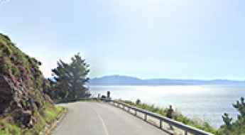
Tucked away on the Iberian Peninsula, in the southwestern part of Europe, the roads of Spain offer the best way to discover the country’s diverse topography. It features mountain roads, even the highest paved road in Europe, as well as stunning coastal drives on the Balearic Islands and the Canary Islands.
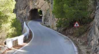
The country is home to Pico del Veleta, the highest paved road in the European continent. Ending at 3,369m (11,053ft) above sea level, it's one of the highest roads in Europe. At an altitude of around 3,000m, road conditions become significantly worse. For those seeking mountain roads, Alto de l’Angliru is the ultimate cycling ascent in Asturias. Climbing up to 1.558m (5,111ft) above sea level, it’s one of the hardest and most epic climbs you can ride on two wheels.
If you’re up for a drive on scenic roads, Mallorca hosts two stunning drives: the sensational road to Formentor Lighthouse and Sa Calobra, the Snake Road. Located on the island of Mallorca, Sa Calobra Road is one of the most scenic drives in the world. Imagine dropping a long piece of wet spaghetti on the floor. The pattern it makes looks something like what the road looks. If you really want a challenge, try tackling it by bike. On the Canary Islands, GC-200 is an exhilarating road with 365 curves and spectacular views. The road has it all, from hairpin bends to sheer cliff-edge drops. It's one of the best roads on the Canary Islands.
So, rev up your engines and let Spain's spectacular routes guide you through a journey of soulful discoveries and unforgettable vistas. You will discover many treasures created by skilled workers employed by construction firms with tradition in Spain.
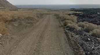
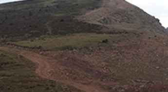
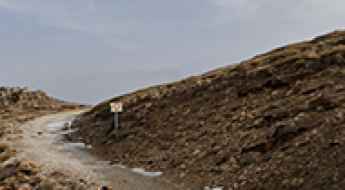
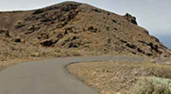
A gravel road to the virgin Verodal beach in Canary Islands
Located on the northwestern coast of El Hierro, the smallest and farthest south and west of the Canary Islands, Spain, in the Atlantic Ocean off the coast of Africa, Playa del Verodal is a red volcanic sand beach.
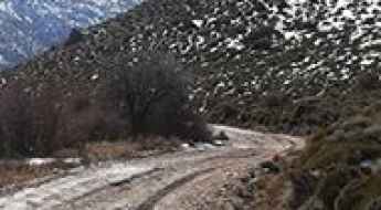
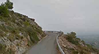
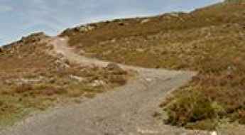
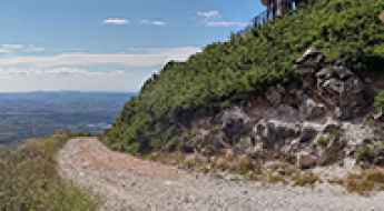
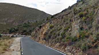
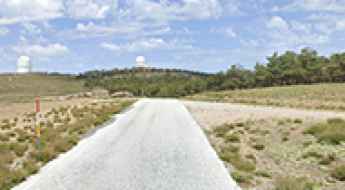
The road to Pico Faeda is a must
Pico Faeda is a high mountain peak at an elevation of 2.008m (6,587ft) above the sea level, located on the boundary of León and Zamora provinces in the autonomous community of Castilla y León, in northern Spain.
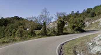
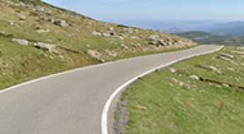
Conquering the Curvy Wonders: Driving Adventures in Catalonia's Priorat Region
Nestled in Catalonia's picturesque Priorat region, you'll find an absolute haven for driving enthusiasts, with winding roads that carve through the rugged terrain and provide an exhilarating driving experience.
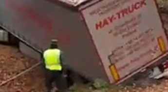
The Triangulo de la Pantaloneta in Spain terrifies Russian and Ukrainian truck drivers
Triangulo de la Pantaloneta is an area, located in the La Rioja region of Spain, that has gained notoriety as authorities frequently need to intervene to rescue trucks stuck amid steep roads, trees, and thick vegetation.
Driving the wild Collado del Tejo
Collado del Tejo is a high mountain pass at an elevation of 1.889m (6,197ft) above the sea level, located in the province of Granada, in the region of Andalucia, southern Spain.
The brutal climb to Cruz de Linares in Asturias with 16% ramps
Puerto Cruz de Linares is a mountain pass at an elevation of 842m (2,762ft) above the sea level, located in the province and autonomous community of Asturias, in Spain.
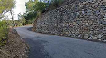
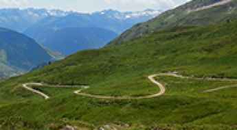
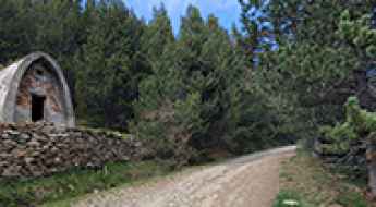
Driving the Panoramic L-501 in Lleida: The Road That Has It All
Located in the Pre-Pyrenees of Lleida, the L-501 road—known locally as La Pista (The Track)—is a uniquely challenging and rewarding route for motorcyclists and driving enthusiasts. Stretching 41 km, its appeal lies in the isolation, the countless primitive stone tunnels carved into the rock, and its significant history.
The wild road to Port des Canonge in the Tramuntana Range of Mallorca
Port des Canonge is a small beach town located in the Balearic Islands of Spain. The road to the town is extremely challenging, with very sharp U-shaped curves.
The Road to Paso de los Lobos in Salamanca Will Take Your Breath Away
Paso de los Lobos is a high mountain pass at an elevation of 1,500m (4,921ft) above sea level, located in the province of Salamanca, in Spain.
How to get to Soria Waterfall in the Canary Islands by car?
Cascada de Soria is a wonderful waterfall located on the island of Gran Canaria, in the Canary Islands of Spain. Be warned, the mountain road to the waterfall isn’t for the faint-hearted.
Pico Fuente Nueva: Driving to the astronomical heights of La Palma
Reaching a staggering elevation of 2,361m (7,746ft) above sea level, Pico Fuente Nueva is a high mountain peak located on the island of La Palma, in the Canary Islands. Situated within the borders of the Caldera de Taburiente National Park, it represents one of the highest roads in the country, offering a driving experience that takes you literally above the clouds.
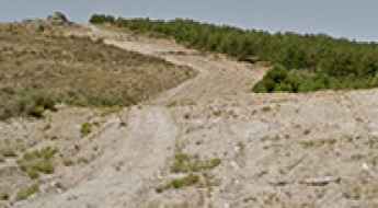
How to drive the steep road to the summit of Montagut?
El Montagut is a mountain peak at an elevation of 948m (3,110ft) above sea level, situated in the Serra del Montmell range in Tarragona, Catalonia. The ascent is a technical mix of degraded asphalt and a final gravel spur. Logistically, the route demands precise throttle control due to the sudden transition from paved road to a steep, unpaved track near the summit.
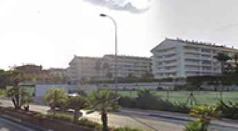
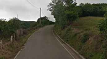
What Is It Like to Drive the Marbella Golden Mile?
Located on southern Spain’s Costa del Sol, part of the Andalusia region, the Marbella Golden Mile is a well-known stretch in Marbella and one of the first places people associate with the city. Dating back to the 1950s, this famous strip has become a symbol of luxury and exclusivity.
Alto de la Cobertoria is a classic climb in Asturias
Alto de la Cobertoria is a mountain pass at an elevation of 1,181 meters (3,874 feet) above sea level, located in Asturias, Spain. The road to the summit is brutal, hitting a maximum gradient of 12.3% on some of the ramps.
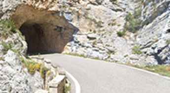
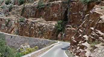
How to get by car to Foz de Zafrane in Aragon?
Foz de Zafrané is a very scenic ravine located in the province of Zaragoza, in Spain. It’s one of the best canyon roads in Spain.
Things to Know Before Driving the Wild Road to Monte Jaizkibel
Monte Jaizkibel is a mountain peak at an elevation of 532m (1,745ft) above sea level, located in the autonomous community of Basque Country, in Spain.
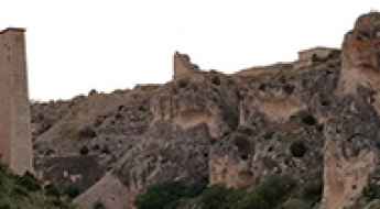
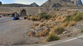
How to get by car to Miravet Castle in Tarragona?
Castell de Miravet is a large Romanesque castle rebuilt by the Knights Templar, located in the Province of Tarragona, Catalonia, Spain.
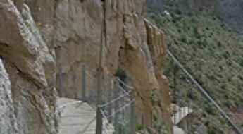
Caminito del Rey Is a Thrilling Journey Through Malaga’s Most Dangerous and Stunning Gorge
Caminito del Rey is a pedestrian walkway constructed along the cliffs of the Gaitanes Gorge, located between the municipalities of Ardales, Álora, and Antequera in the Malaga province, Andalusia, Spain. The path stretches over three kilometers with an additional 4.8 kilometers of access routes. It is attached to the rock walls within the gorge, with sections that are only one meter wide, hanging up to 105 meters (344 feet) above the river, on steep cliff faces.
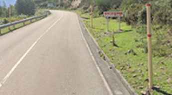
The brutal climb to Puerto de Onil with 15% ramps
Puerto de Canalís de Onil is a mountain pass at an elevation of 1.015m (3,330ft) above the sea level, located in the comarca of L'Alcoià, in the province of Alicante, in the Valencia region of Spain.
A desert-like 4x4 road to Cerro de Maria Antonia in Andalusia
Cerro de Maria Antonia is a high mountain peak at an elevation of 1,924m (6,312ft) above sea level, located in Almeria Province, in the autonomous community of Andalusia, Spain.
Driving the Wild Road to Collada de Bracons in the Catalan Pre-Pyrenees
Collada de Bracons is a mountain pass situated at an elevation of 1,136m (3,727ft) above sea level, located in the comarca of Osona in Catalonia, Spain.
How many Pigtails are in Spain? Driving the 5 legendary "Nudos de Corbata"
While millions of drivers traverse Spanish highways every day, only a handful know that the national road network hides five extraordinary "pigtails". After a deep investigation across the map, we have located the only points in Spain where the road literally ties itself in a knot to conquer the impossible terrain.
Driving the Iconic Road to Collado del Diablo in Sierra Nevada
Collado del Diablo is a high mountain pass at an elevation of 2,319m (7,608ft) above sea level, located in the province of Granada, in Spain. It’s one of the highest roads in the country.
The volcanic road to Playa del Paso on the Canary Islands
Playa del Paso is a small beach with crystal blue water and black sand located in Lanzarote, one of the Canary Islands, in Spain.
The challenging road with 300 turns to Puerto de Tiscar in Andalusia
Puerto de Tíscar is a mountain pass at an elevation of 1,189 m (3,900 ft) above sea level, located in the province of Jaen, in Spain. The road through the summit features more than 300 turns.
A memorable 4x4 road trip to Pico de Urbion
Pico de Urbión is a high mountain peak at an elevation of 2,168m (7,112ft) above sea level, located in the northern part of the province of Soria, in Spain.
Is the road to Pico El Morredero in León difficult to drive?
Reaching the summit of Pico El Morredero is a short but brutal climb into the high peaks of the Montes Aquilanos. At 2,021m (6,630ft) above sea level, this peak in the Province of León offers one of the most raw driving experiences in the El Bierzo region. This isn't a road for tourists; it’s a rugged service track that carves through the slate and shale of the northern Spanish highlands, where the wind always blows and the grip is never guaranteed.
Driving the Highest Paved Road in Cantabria to Collado de la Fuente del Chivo
Collado de la Fuente del Chivo is a high mountain peak at an elevation of 1,992m (6,535ft) above sea level, located in Cantabria, an autonomous region on Spain’s north coast.
Is the road to Albergue de San Francisco in Sierra Nevada difficult to drive?
Reaching the Albergue de San Francisco is a journey into the high, thin air of the Sierra Nevada. At 2,206m (7,237ft) above sea level, this historic refuge in the province of Granada is a landmark of the Penibaetic System. But don't let the "scenic" label fool you; the access is a raw, unpaved mountain track that carves through the San Juan Valley. This isn't a road for a Sunday cruise; it’s a restricted backcountry route where the rocks are sharp and the weather can flip from baking sun to a freezing gale in minutes.
Driving the Challenging Road to Coth de Varrados in Val d'Aran
Còth de Varradòs is a high mountain pass at an elevation of 2,052 m (6,732 ft) above sea level, located in Val d'Aran, Spain.
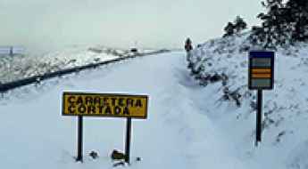
A wild blocked road through Estrecho del Hocino in Albacete
Estrecho del Hocino is a very scenic canyon located in Albacete province, in Spain. It’s one of the most scenic canyon roads in the country.
Is the road to Collada de Cármenes in León difficult to drive?
Collada de Cármenes is a mountain pass reaching an elevation of 1,343m (4,406ft) above sea level in the province of León, Spain. Located in the heart of the Cantabrian Mountains, the pass serves as a transition between the valleys of Cármenes and Villamanín. While the main road is a smooth ribbon of asphalt, the real challenge for drivers lies at the summit, where a primitive and narrow 4x4 track breaks away toward the high-altitude ruins of an ancient copper mine.
How to drive to Faro de Finisterre, the westernmost lighthouse in Europe?
Faro de Finisterre is a lighthouse located in the Province of A Coruña, on the northwestern coast of the Galicia autonomous community of Spain.
A Memorable 4x4 Road Trip to Alto del Hornillo in Teruel
Alto del Hornillo is a high mountain pass at an elevation of 1,999m (6,558ft) above sea level, located in the province of Teruel, in Spain.
Driving the Alto del 14% in Córdoba: The 16% wall of Los Villares
Located in the heart of the Sierra Morena, within the Los Villares Park in Andalusia, the ascent to Alto del 14% is a legendary test of power and braking. Reaching an elevation of 570m (1,870ft) above sea level, the road—officially designated as the CO-3408—is a technical artery connecting Córdoba with Cerro Muriano. It is a journey defined by a paradox: despite the popular name and the official signage, the actual mechanical demand on the ramps far exceeds what the traffic signs suggest.
How to Get to Pico del Aguila by Car in Huesca
Pico del Águila is a high mountain peak with an elevation of 1,611m (5,285ft) above sea level, located in the autonomous community of Aragón, in Spain.
The road to Creu de Miramar in Tarragona will take your breath away
Creu de Miramar is a mountain peak at an elevation of 780m (2,559ft) above sea level, located in the Camp de Tarragona region in Catalonia, Spain.
A memorable road trip to Refugi de Comes de Rubio in the Pyrenees
Refugi de Comes de Rubió is a high mountain refuge at an elevation of 1.957m (6,420ft) above sea level, located in Pallars Sobirà comarca, in Spain.
If you love to drive, you’ll love the curvy road to Alt de la Talaia in Tarragona
Alt de la Talaia is a mountain pass at an elevation of 561m (1,840ft) above sea level, located in the comarca of Baix Penedès, in Spain.
The Hardest Mountain Pass the Vuelta Doesn’t Dare to Climb (And It’s Not Angliru or Ancares)
The Vuelta a España, one of the most important races on the UCI World Tour, has already turned legendary climbs like the Angliru, Ancares, and Gamoniteiru into mythical battlegrounds of modern cycling. These mountains have defined eras of the race, producing unforgettable images of riders battling impossible gradients and writing cycling history. Yet, despite all this, the Vuelta still has one giant waiting in the wings for its long-awaited debut.
How to get by car to Orchilla Lighthouse in the Canary Islands?
Faro de Orchilla, also known as Faro de Punta de la Orchilla, is an iconic lighthouse located on the western side of El Hierro, the smallest of the Canary Islands, in Spain. It marks the most southwesterly point in Spain.
Driving a winding paved road to Puerto Camacho in Andalusia
Puerto Camacho is a mountain pass at an elevation of 1,126m (3,694ft) above sea level, located in the Spanish province of Granada.
A wild unpaved road to Tuc del Montanyo in the Pyrenees
Tuc del Montanyó is a high mountain peak at an elevation of 2,532m (8,307ft) above sea level, located in the province of Lleida, Spain. It's one of the highest roads in the country.
Driving the unpaved road to Cerro de la Salchicha in Andalusia
Cerro de la Salchicha is a high mountain pass at an elevation of 1,546m (5,072ft) above sea level, located in the Spanish province of Granada.
A memorable road trip to Collado del Hornillo in Andalusia
Collado del Hornillo is a high mountain pass at an elevation of 2.115m (6,938ft) above sea level, located in the province of Almería, in Spain.