A narrow scenic road to the summit of La Cumbre Choroni
La Cumbre Choroni is a high mountain pass at an elevation of 1.611m (5,285ft) above sea level, located in the state of Aragua, in Venezuela.
Where is La Cumbre Choroni?
The pass is located in the north-central part of the country, near the Caribbean coast, within the Henri Pittier National Park, the oldest national park in Venezuela,
Is La Cumbre Choroni paved?
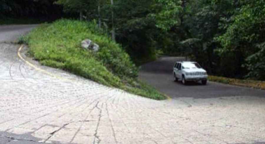
The road to the summit is paved, with some concrete parts. It’s called Carretera Maracay (Via Choroni or Carretera Local 6). The road was built by the Venezuelan dictator Juan Vicente Gómez in 1920. In 1970 the local government started the work to pave the road, and finished 20 years later, being completed by 1990.
How long is La Cumbre Choroni?
The narrow winding mountain road is 50 kilometres (32 miles) long, running south-north from Maracay, the capital and most important city of the state of Aragua, to Puerto Colombia, a popular beach located in Aragua and one of Venezuela's best Caribbean beaches.
How challenging is the road through La Cumbre Choroni?
The route is dangerous (cracks, gaps, obstacles without signs). Expect frequent floods and landslides. This narrow windy road goes over the cloud forest mountains of the Henri Pittier National Park before descending to the sea. The road is very narrow and full of hairpin bends - at some points bigger cars have to stop and reverse a few yards in order to negotiate the bends in two manouvers. The alternative - taxis - is little better as drivers race into blind bends with little concern for oncoming traffic.
Pic: http://minci.gob.ve/2016/05/inician-este-miercoles-rehabilitacion-integral-de-carretera-de-choroni/