How to drive the 20% ramps to Cerro Ávila in Caracas?
Cerro Ávila is a high mountain peak at an elevation of 2.156m (7,073ft) above sea level, located in the Capital District of Venezuela. The average gradient is 14.61%.
Where is Cerro Ávila?
The peak is located in the northern part of the country, high in the Coastal Range mountains, within the Waraira Repano National Park.
What’s at the summit of Cerro Ávila?
The summit hosts the Humboldt Hotel, a 19-story tower inaugurated on December 29th, 1956 with a 360-view stretching to the horizon. There is a cable car from Caracas to the top. It provides great views of Caracas and the Caribbean Sea.
Is the road to Cerro Ávila paved?
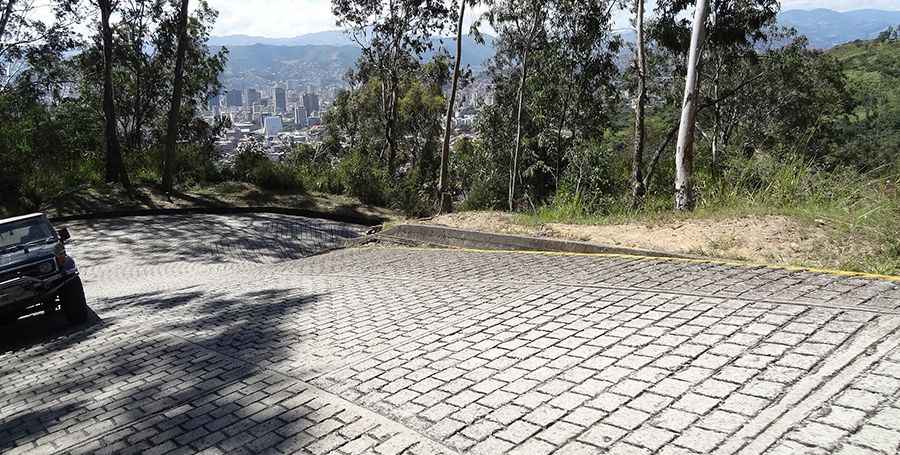
The road to the summit is fully paved with cobblestones. It is narrow and has very steep slopes with sharp turns. Due to its steepness, a 4x4 vehicle is required.
How long is the road to Cerro Ávila?
Starting from Avenida Boyacá in Caracas, the road is 8.0 km long. Over this distance the elevation gain is 1169 meters. The average gradient is 14.61%.
Is the road to Cerro Ávila worth the drive?
The drive provides great views. It’s a very busy road on weekends.
Road suggested by: jorge manuel gómez sánchez
Pic: lin6500