Road from San Francisco de Mosca to Antapirca: Driving the 23 Hairpins in Pasco
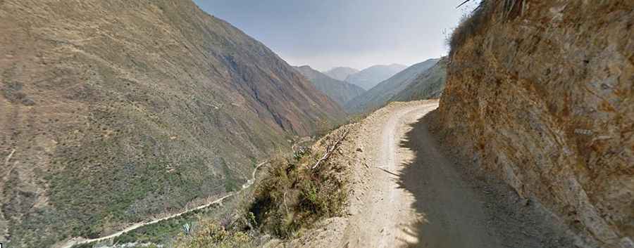
The road connecting San Francisco de Mosca and Antapirca is a high-altitude mountain route reaching an elevation of 3,570 meters (11,712 ft) above sea level on the border of Pasco and Huánuco departments in central Peru. Carved into the steep Andean slopes, the unpaved track features 23 sharp hairpin turns along its climb.
| Road facts: San Francisco de Mosca to Antapirca | |
|---|---|
| Location | Pasco / Huánuco (Peru) |
| Max Elevation | 3,570 m (11,712 ft) |
| Length | 19 km (11.8 miles) |
| Hairpin Switchbacks | 23 turns |
| Surface | Unpaved clay, gravel, and dirt track |
| Vehicle Requirement | High-clearance 4WD required in rainy season |
Where is the road from San Francisco de Mosca to Antapirca located?
The road runs north-south through the central highlands of Peru, linking the settlement of San Francisco de Mosca (Huánuco) with Antapirca (Pasco). The 19-kilometer route climbs out of the river valleys to cross high mountain ridges at 3,570 meters.
Is the road to Antapirca paved?
No. The entire 19-kilometer stretch is unpaved, consisting of packed dirt, local clay soil, and loose gravel. The single-lane road width forces oncoming vehicles to use wide turnouts to pass each other on steep ramps.
What hazards exist on the 23 hairpins to Antapirca?
The main physical hazards are unshielded cliff edges without safety barriers, single-lane bottlenecks, and active slope erosion along the 23 hairpin turns. During the wet season (December to March), rainfall dissolves the clay surface into deep mud ruts, requiring high-clearance 4WD vehicles to maintain traction on steep inclines.
How long is the road from San Francisco de Mosca to Antapirca?
The mountain track spans 19 kilometers (11.8 miles) between the two settlements. Negotiating the continuous switchbacks, narrow rock cuts, and steep gravel climbs takes over an hour of driving time.