Carretera PA-100: Driving the High Andean Track to Cerro de Pasco
The Carretera PA-100 is a high-altitude mountain highway located in the Pasco Province of central Peru. The unpaved route runs through the high Andean plateau, connecting the regional hub of Cerro de Pasco at the Route 3N junction with Route 18 near the western valleys.
| Road facts: Carretera PA-100 | |
|---|---|
| Location | Pasco Province, Central Peru |
| Max Elevation | 4,543 m (14,904 ft) |
| Length | 56.5 km (35.1 miles) |
| Surface | Unpaved / Gravel & Dirt |
What is the route profile of the PA-100 road?
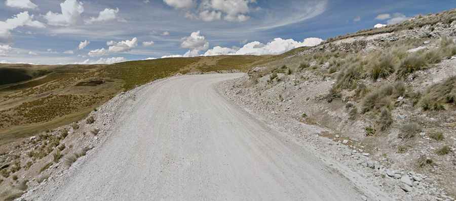
The road is 56.5 km (35.1 miles) long, linking the high mining basin of Cerro de Pasco with the lower junctions of Route 18. The alignment maintains an elevation profile that sits entirely above 4,000 meters sea level, climbing across open plains and mountain folds until topping out at its highest pass summit at 4,543 meters altitude.
What is the road surface of the PA-100?
The entire 56.5-kilometer route is unpaved, consisting of a single-lane track made of loose gravel, crushed stones, and a dirt base. The road layout features 18 sharp hairpin switchbacks cut into the bare mountain slopes. The open edges have narrow gravel shoulders flanked by steep drops, completely lacking concrete barriers, safety walls, or traffic guardrails.
How does weather affect driving conditions on the PA-100?
Rainfall alters the dirt surface, creating muddy ruts and reducing tire traction on the unpaved mountain switchbacks. Due to the high altitude, precipitation can switch to sudden snowfall or hail, covering the gravel base under slippery ice sheets. Low cloud layers and alpine fog frequently settle over the 4,543-meter summit, decreasing horizontal visibility to a few meters.
What are the mechanical demands on the PA-100 road?
Vehicles require a four-wheel-drive system and high ground clearance to clear the stony ridges and maintain traction through the 18 unpaved hairpins. At altitudes exceeding 4,000 meters, internal combustion engines lose power due to the thin air, requiring drivers to stay in low gears during the climbs. The long downward slopes demand continuous engine braking to prevent brake fluid expansion and pad fading. The 56.5 km route lacks roadside service stations or fuel terminals between the main junctions.