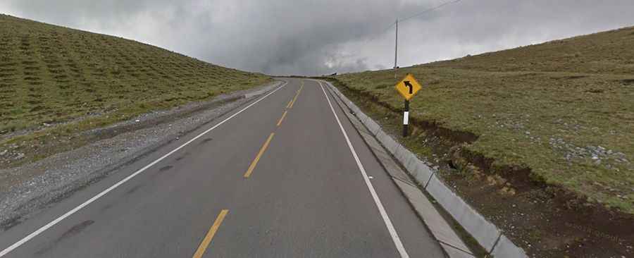
Driving the endless curves of Abra Sotacocha in the Peruvian Andes
Abra Sotacocha is a high-altitude test of concentration in the south-central Andes of Peru. Reaching an elevation of 4,261m (13,979ft) above sea level, this mountain pass in the Ayacucho region is defined by its unrelenting geometry. On this road, the concept of a "straight line" doesn't exist; the entire 67km journey is a continuous sequence of turns that demands constant work on the steering wheel and absolute focus on the shifting mountain conditions.
| Road facts: Abra Sotacocha | |
|---|---|
| Location | Ayacucho Region, Peru (Road 3S) |
| Max Elevation | 4,261m (13,979ft) |
| Length | 67 km (41.6 miles) |
| Terrain | High-altitude asphalt with extreme curvature |
How is the drive above 4,000 meters at Abra Sotacocha?
The transit through Abra Sotacocha, part of the Longitudinal de la Sierra Sur (Road 3S), is a grueling experience for both the driver and the engine. The road stays consistently above 4,000 meters for about 60km. At this altitude, the lack of oxygen significantly reduces engine performance, meaning you have to manage your gears carefully to maintain momentum through the constant climbing sections. While the surface is asphalted, the real challenge here is the endurance required to drive at this elevation for such a sustained period without a break in the concentration.
Why are the curves of Abra Sotacocha so technical?
It is impossible to provide a count of the turns and hairpins on the way through Abra Sotacocha because the road is essentially one single, endless curve. From the moment you begin the ascent until you clear the pass, the steering wheel is never centered. This creates a massive physical toll on the tires and the braking system, especially during the descent where the weight of the vehicle is constantly shifting laterally. Navigating these hundreds of bends requires a disciplined pace; overshooting a single apex can put you directly into the path of oncoming trucks or against the steep Andean rock walls that line the inner edge of the asphalt.
Is visibility a problem on the road to Abra Sotacocha?
The Abra Sotacocha is notorious for its heavy mist and sudden weather shifts. It is common for the road to be completely engulfed in clouds, reducing visibility to just a few meters. In these conditions, the thin guardrails become your only visual reference point. Driving this pass in low visibility turns a technical route into a dangerous trap, as the curves follow no predictable pattern. The lack of shoulder space in many areas means there is nowhere to pull over safely if the fog becomes too dense to drive, forcing you to push through at a crawl.
Where can you stop at the summit of Abra Sotacocha?
Near the highest point of Abra Sotacocha, there is a small parking lot that serves as a lookout. While the views across the Andean peaks are expansive, the real value of this stop is as a recovery point for the driver. After kilometers of non-stop steering and fighting the thin air, the descent towards Andahuaylas requires fresh focus. The road remains technical until the very end, proving that even with an asphalted surface, the Andes never stop testing the mechanical limits of the vehicle and the mental stamina of the person behind the wheel.