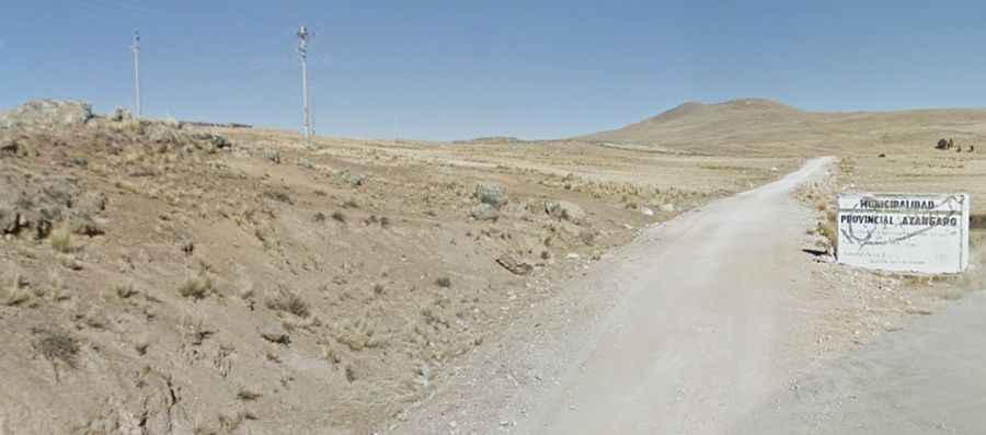
Laguna Quequerane: Driving the high-altitude tracks of Puno
Laguna Quequerane, also known as Laguna Quequerana, is a remote high-mountain lake situated in the Puno region of Peru. Reaching an elevation of 4,034m (13,234ft) above sea level in the Lampa Province, the road to the lake is a raw Andean track that crosses the vastness of the Altiplano. This is a high-consequence driving environment where the thin air and the unpaved surface define a journey far removed from the standard tourist circuits near Lake Titicaca.
| Road facts: Laguna Quequerane | |
|---|---|
| Location | Pucará District, Lampa (Puno, Peru) |
| Max Elevation | 4,034m (13,234ft) |
| Length | 13.4 km (8.3 miles) |
| Surface | Totally unpaved / Gravel |
How challenging is the climb from Pucará to Laguna Quequerane?
The journey to the lake begins in the town of Pucará, located northwest of Lake Titicaca. The track covers 13.4 kilometers of ascending terrain through the high Andean plateau. The ferro of this route is the inconsistency of the surface; the road is totally unpaved, consisting of a mix of hard-packed dirt and loose gravel that can turn into a muddy trap after a typical Altiplano storm. While the gradients are not extreme, a high-clearance 4x4 is highly recommended to manage the deep ruts and the occasional washouts caused by seasonal rains that reshape the track every year.
Why is the 4,000m elevation a factor on the Quequerane road?
At an elevation of 4,034 meters, the lack of oxygen is the primary mechanical and physiological hurdle. For the vehicle, this means a significant loss of horsepower, forcing the engine to work much harder to maintain momentum on the climbs. For the driver, the altitude demands constant hydration and focus, as the road is narrow and lacks any form of safety barriers. Navigating the slow, technical sections of the Pucará-Quequerane track in thin air requires a disciplined pace to avoid overheating the engine, especially when driving against the strong, cold winds that sweep across the Puno region.
What are the hazards of the remote Puno mountain tracks?
The road to Laguna Quequerane is characterized by its isolation. Beyond the town of Pucará, infrastructure is non-existent, and the track often narrows to a single lane as it approaches the lake. The weather in this part of Peru can shift in minutes; a sudden hailstorm can reduce visibility to zero and make the gravel surface extremely slick. Because this is a high-altitude desert environment, the temperature drops rapidly as you climb. Self-sufficiency is mandatory; you must carry recovery gear and spare tires, as a breakdown at 4,034 meters means waiting in extreme conditions for help that may be hours away.
What mechanical preparation is needed for the Altiplano drive?
Driving through the Lampa Province toward Laguna Quequerane is a journey that tests the technical integrity of your vehicle suspension. The corrugated surface of the unpaved track can vibrate bolts loose and punish standard shocks. Before leaving Pucará, checking your tire pressure and cooling system is vital. On the return descent, using engine braking is the only way to safely manage the vehicle weight on the unpaved slopes without putting unnecessary stress on the brakes. Reaching the shores of the lake is a raw experience of Andean off-roading, where the silence of the high peaks and the technical condition of your car are your only companions.