Driving the paved road to La Raya Pass in the Andes
Abra la Raya is a high mountain pass at an elevation of 4.352m (14,278ft) above sea level located on the boundary between Puno and Cusco regions in Peru.
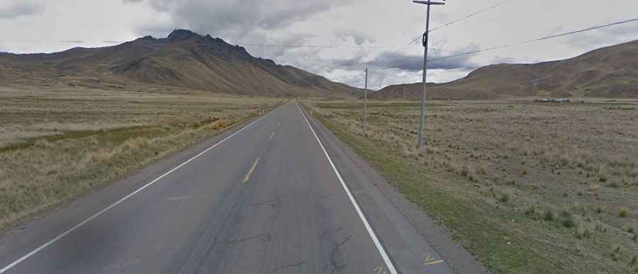
Is La Raya Pass in Peru paved?
Tucked away in the southern part of the country, the road to the summit, also known as Apu Chimboya, is totally paved. It’s called Carretera 3S. Nicknamed as "Ruta del Sol" (Route of the Sun),
How long is La Raya Pass in the Andes?
The pass is 107km (66 miles) long running from Sicuani, the capital of Canchis Province in Cusco Region to Ayaviri or Ayawiri, the capital of the province Melgar in the region Puno.
Is La Raya Pass in Peru open?
Set high in La Raya mountain range of the Andes, the pass is typically open all year round but short term closures are common in winter due to dangerous weather conditions. At this elevation it’s the highest point on the road. December and January are typically the rainiest months.
Is La Raya Pass in Peru worth it?
Embarking on a journey from the town of Cusco to Lake Titicaca, you'll navigate through La Raya Pass. This remote landscape is a tapestry of hills, peaks, and freshwater pools. Reaching the summit unveils panoramic views, while the local bazaar entices with Andean vendors selling local crafts and souvenirs, most of which are crafted from alpaca wool. From this point, the snow-capped Chimboya of the Andes mountain range emerges into view. Bear in mind, the high altitude may make you feel sluggish. Even those acclimated to the Andean region can find the thin air challenging. The idea of jogging can be swiftly dismissed as taking one step at a time is the prudent way to go. Rushing may result in headaches, dizziness or breathlessness. So, take it slow and enjoy the beauty of La Raya Pass.