Driving the paved AN-110 road to Laguna de Querococha
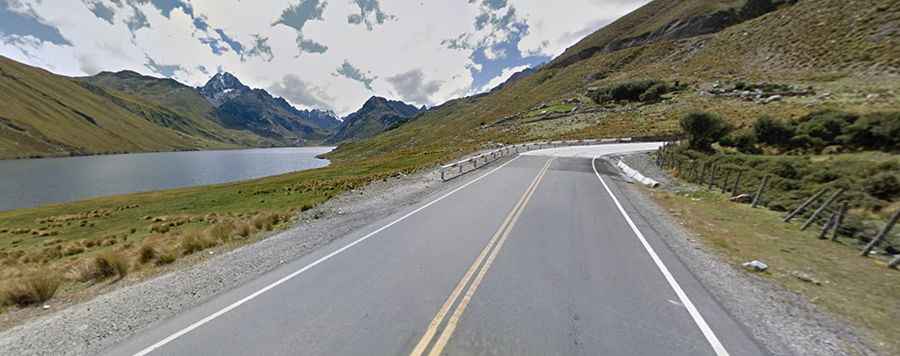
Laguna de Querococha is a high-altitude glacial lake located in the Ancash Region of northern Peru. Situated within the Huascarán National Park in the Cordillera Blanca range, the lake sits along the paved AN-110 mountain highway at an elevation of 3,980 meters (13,060 ft) above sea level.
| Road facts: Laguna de Querococha | |
|---|---|
| Location | Huascarán National Park, Ancash (Peru) |
| Elevation | 3,980 m (13,060 ft) |
| Road Name | Ruta AN-110 |
| Length | 37 km (23 miles) |
| Surface | Paved (Asphalt) |
Where is the Laguna de Querococha road located?
The mountain highway runs through the southern sector of the Huascarán National Park, crosscutting the high valley floor before scaling the steep mountain walls of the Cordillera Blanca. The route links the lower valley areas with the high alpine passes, completely exposed to sudden high-altitude weather transitions and rockfalls from the flanking granite massifs.
What are the asphalt and driving conditions on the AN-110?
The Ruta AN-110 is fully paved with a smooth asphalt surface but follows a highly winding alignment with a continuous uphill grade. The lane is narrow and flanked directly by deep concrete drainage ditches without side shoulders. The alignment features 15 tight hairpin turns used regularly by heavy freight trucks and regional tourist buses, which restricts overtaking options along the entire ascent.
How long is the road section to Laguna de Querococha?
The paved segment covers a distance of 37 kilometers (23 miles), running from west to east starting at the town of Catac and climbing toward the Kahuish Tunnel. At an elevation of 3,980 meters, low atmospheric pressure reduces the power output of internal combustion engines by approximately 35%, requiring sustained low-gear operation to maintain vehicle momentum up the mountain switchbacks.
What are the main topography hazards on the AN-110 descent?
The return descent from the lake toward Catac involves a steep down-grade across the 15 mountain hairpins. The narrow asphalt lanes lack lateral steel guardrails or runoff safety zones along the outer mountain drops. The route passes directly through high-altitude slopes where heavy fog layers and low-visibility conditions frequently settle over the tarmac during the rainy season.