Driving the high altitude road 670 to Abra Achallaque
Abra Achallaque is a high-altitude mountain pass located on the regional boundary between Cusco and Arequipa in southern Peru. Situated in the high puna plateau, this unpaved mountain sector of the Carretera 670 climbs the bare Andean ridges to reach a maximum elevation of 4,962 meters (16,279 ft) above sea level.
| Road facts: Abra Achallaque | |
|---|---|
| Location | Cusco - Arequipa border (Peru) |
| Elevation | 4,962 m (16,279 ft) |
| Road Name | Carretera 670 |
| Length | 44 km (27.3 miles) |
| Surface | Unpaved (Gravel, dirt, loose stone) |
Where is the Abra Achallaque pass located?
The mountain pass marks the geographic divide between the Cusco and Arequipa departments. The unpaved lane crosses an isolated high-altitude plateau devoid of urban centers or roadside infrastructure. The route stands completely remote from major paved highways, leaving any vehicle transit dependent on full mechanical self-sufficiency along the high mountain ridge lines.
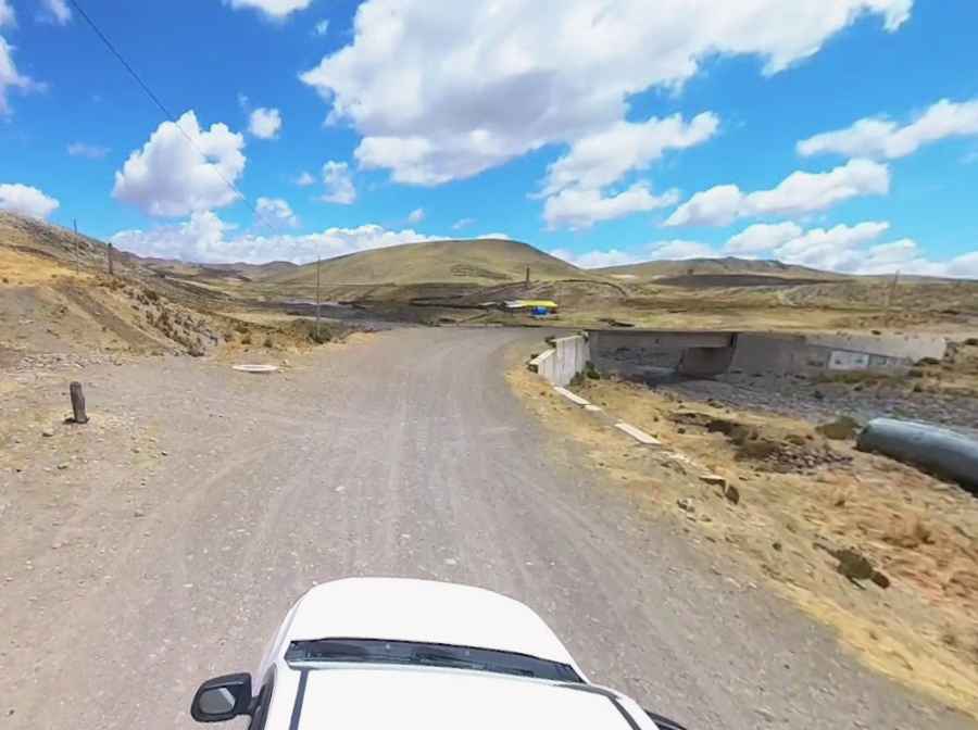
Is the Carretera 670 road unpaved?
The Carretera 670 consists entirely of an unpaved track bed made of loose gravel, dirt, and sharp volcanic stones. The state of the lane depends directly on local weather shifts. Heavy Andean rainfall and sudden snowfalls turn the soil into a thick mud layer or cause track washouts near the small intermediate bridges and drainage pipes, requiring high-clearance four-wheel-drive vehicles to cross the rocky steps near the 4,962-meter summit.
How long is the road through Abra Achallaque?
The unpaved mountain route runs for a distance of 44 kilometers (27.3 miles), following a north-south alignment to connect the settlement of Callanca with the mining zone of Caylloma. At an elevation near 5,000 meters, low atmospheric pressure reduces internal combustion engine power by approximately 50%, forcing sustained low-gear operation to overcome the steep dirt inclines and mountain ramps.
What are the main weather and terrain hazards on the route?
The high-altitude track is exposed to sudden winter snowstorms and freezing temperatures that coat the loose volcanic gravel. The 44-kilometer pass lacks concrete walls, steel guardrails, or safety markers along the edge of the downward slopes. The entire mountain segment between Callanca and Caylloma is completely devoid of civilian fuel stations, commercial workshops, or cellular mobile coverage.