How to drive the paved road to Abra Lliullita in the Andes?
Abra Lliullita is a high mountain pass at an elevation of 4,645m (15,239ft) above sea level, located in the heart of Apurímac Department in Peru.
Where is Abra Lliullita?
The pass, also known as Abra Llullita, is located in the Grau Province, in the southern part of the country. Near the summit, there’s a lagoon known as Laguna de Lliullita, ideal for fishing, trekking, and wildlife watching.
| Road facts: Abra Lliullita | |
|---|---|
| Elevation | 4,645m (15,239ft) |
| Route | Carretera 3SF |
| Distance | 135 km (83 miles) |
| Surface | Paved |
Why is there a road to Abra Lliullita?
The road through the pass was, historically, part of an important trade route between Chuquibambilla and Abancay, used by mule drivers transporting goods. This path lost its importance after a modern road was built but is still partially used today.
Is the road to Abra Lliullita paved?
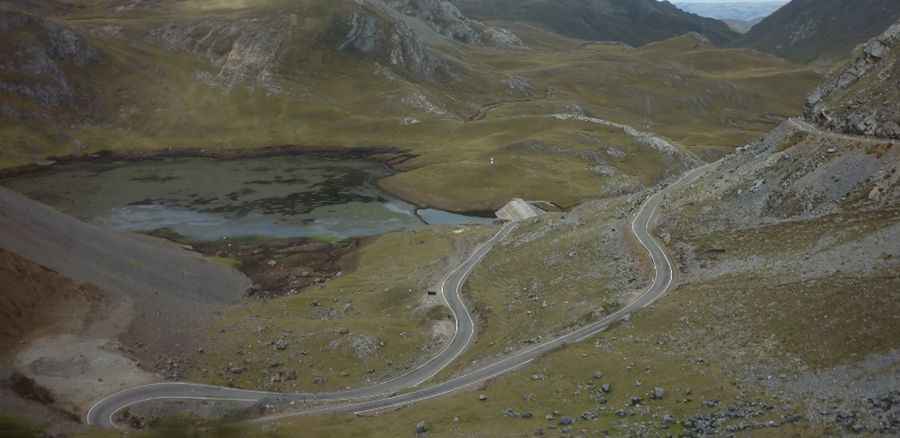
The road through the summit is now fully paved, yet pretty defiant, with countless turns (many of them hairpin turns) and steep parts. It’s called Carretera 3SF. Better avoid it if you’re prone to car sickness. It is pretty much constant uphill for 45km from Vilcabamba, but the road surface is good, there’s almost no traffic, and it’s never steep.
How long is the road to Abra Lliullita?
Set high in Peru's Southern Sierra of the Andes, the road through the summit is 135km (83 miles) long, running south–north from Vilcabamba to Abancay.
Pic: Fernando Espinoza